
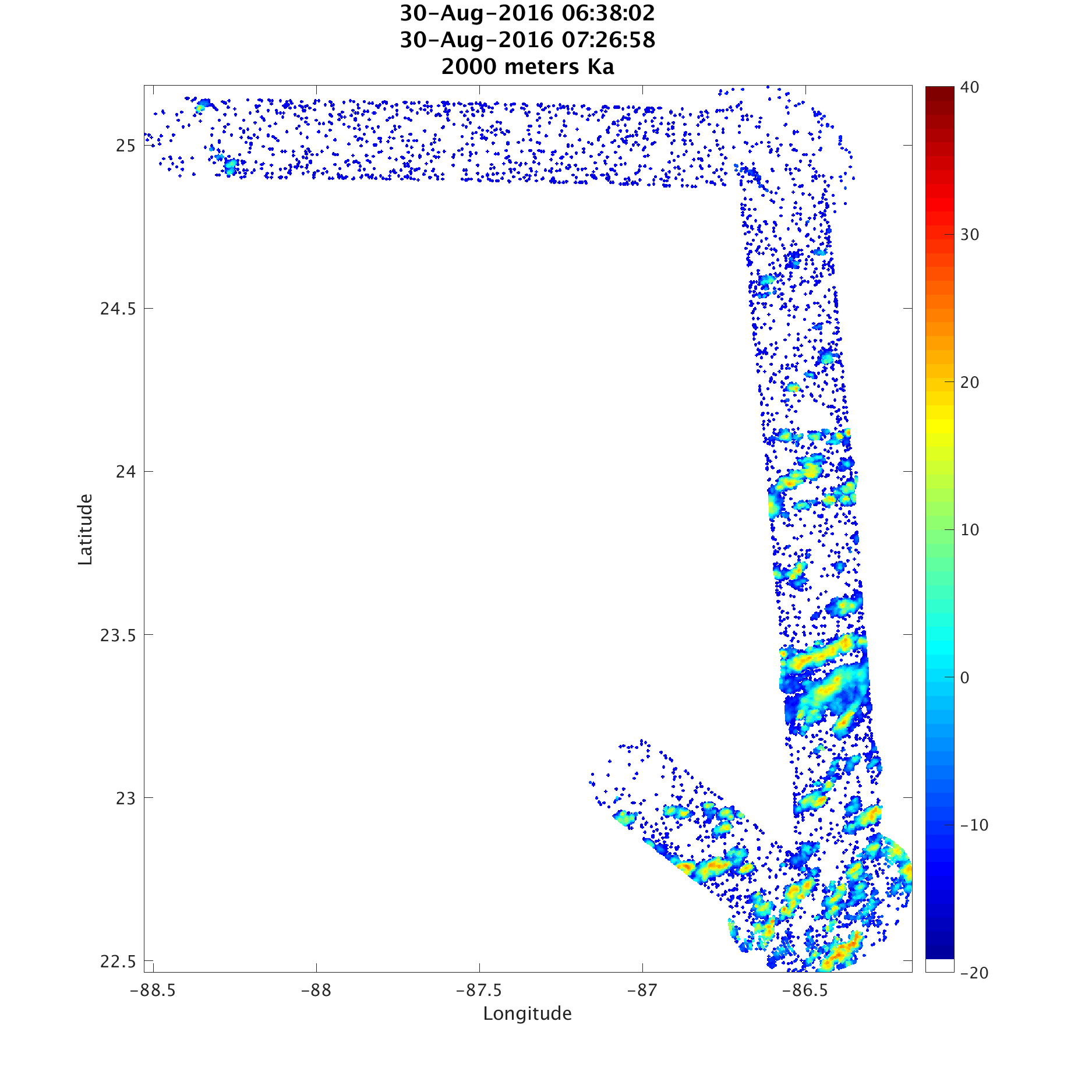
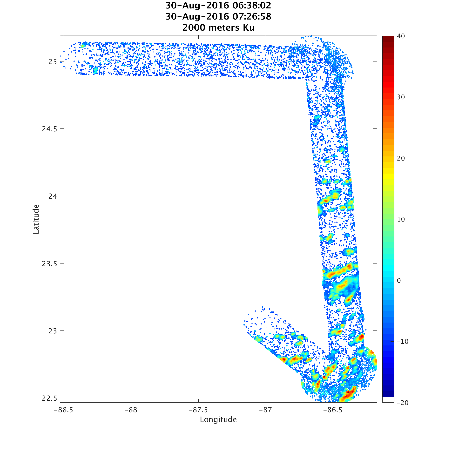
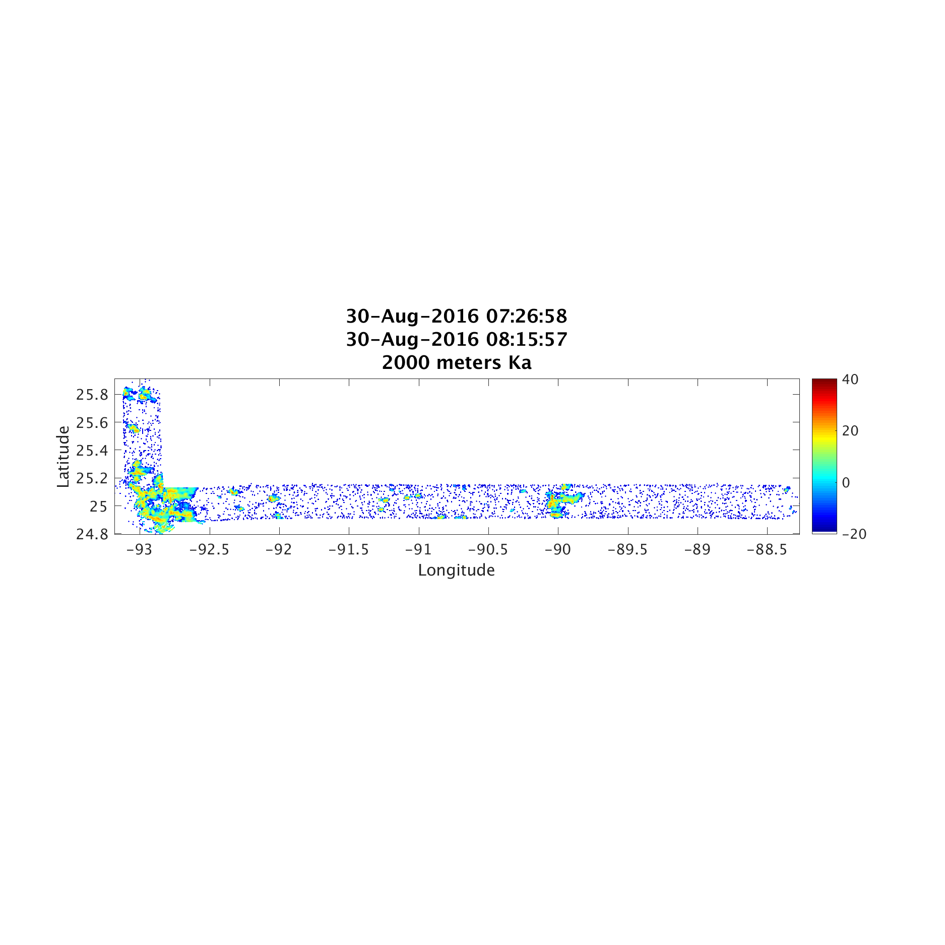
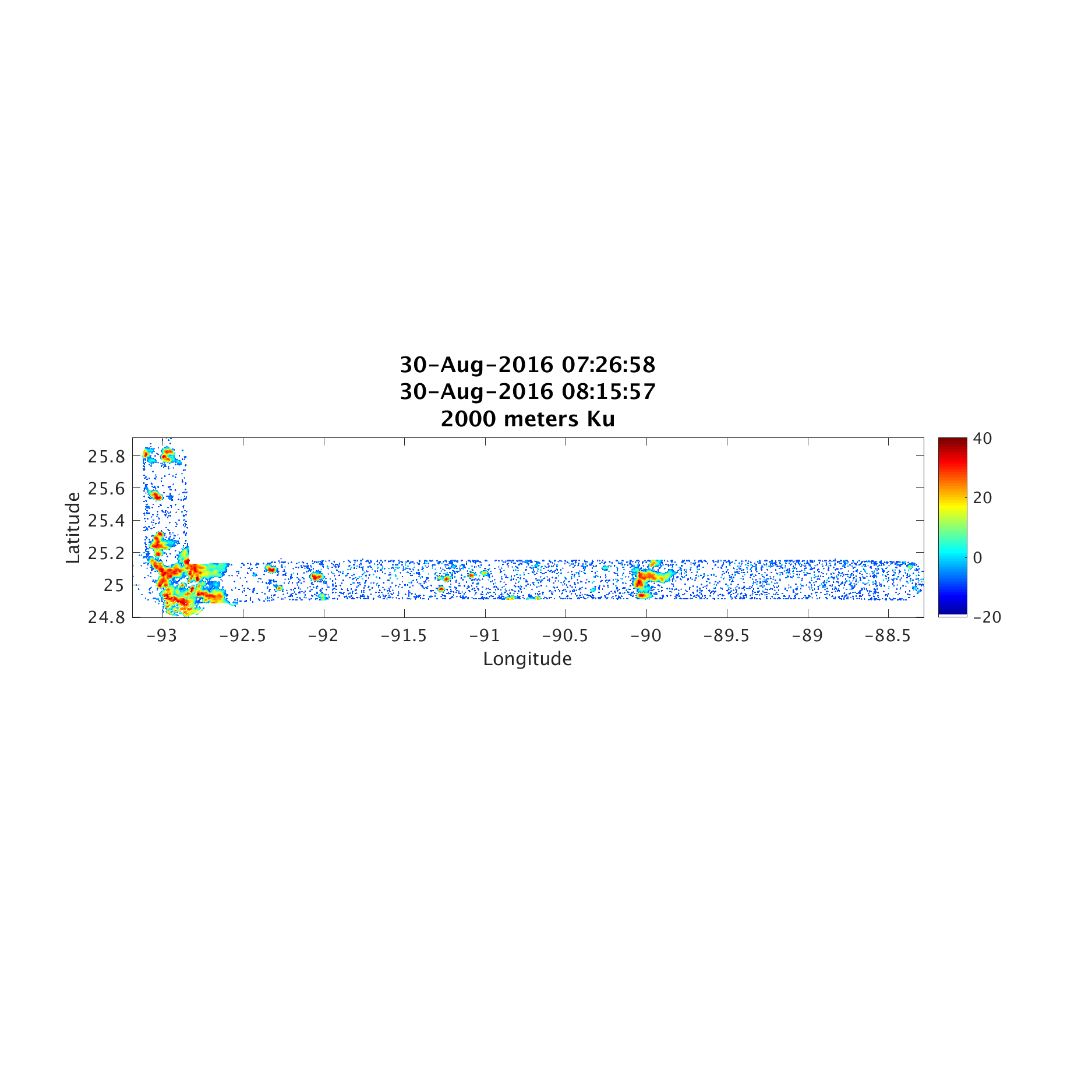
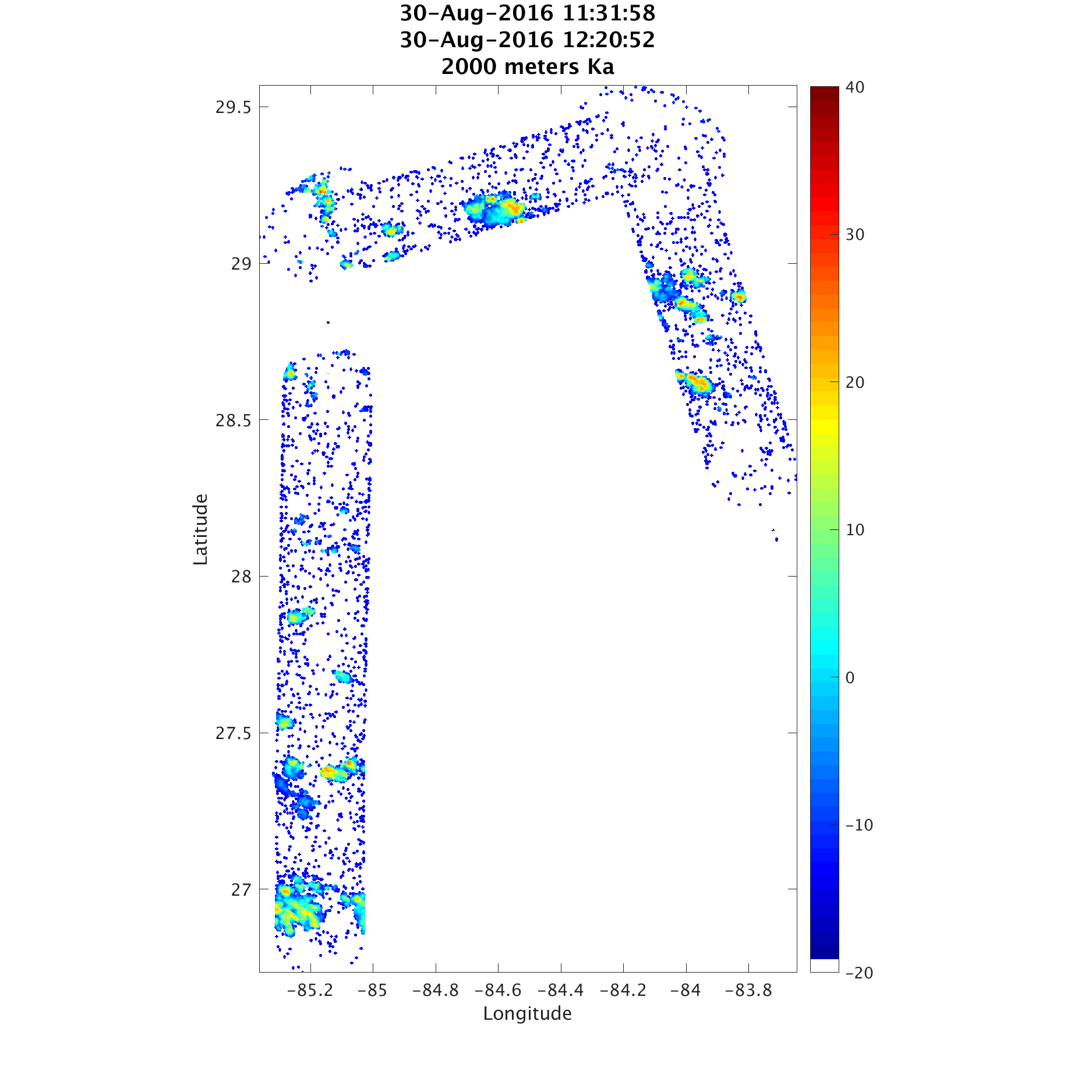
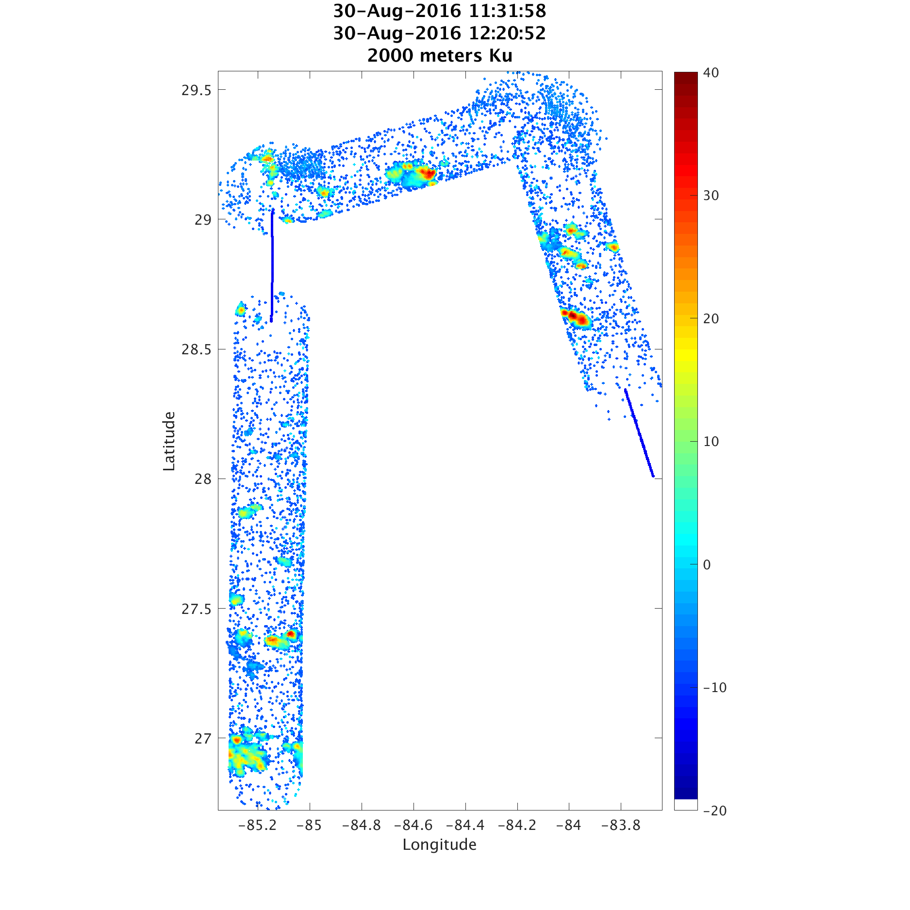
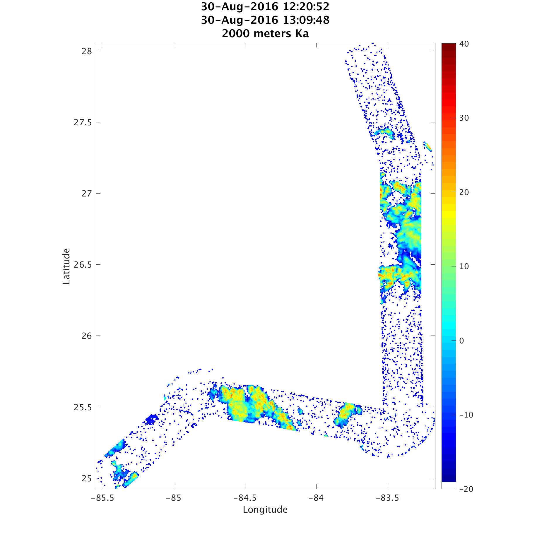
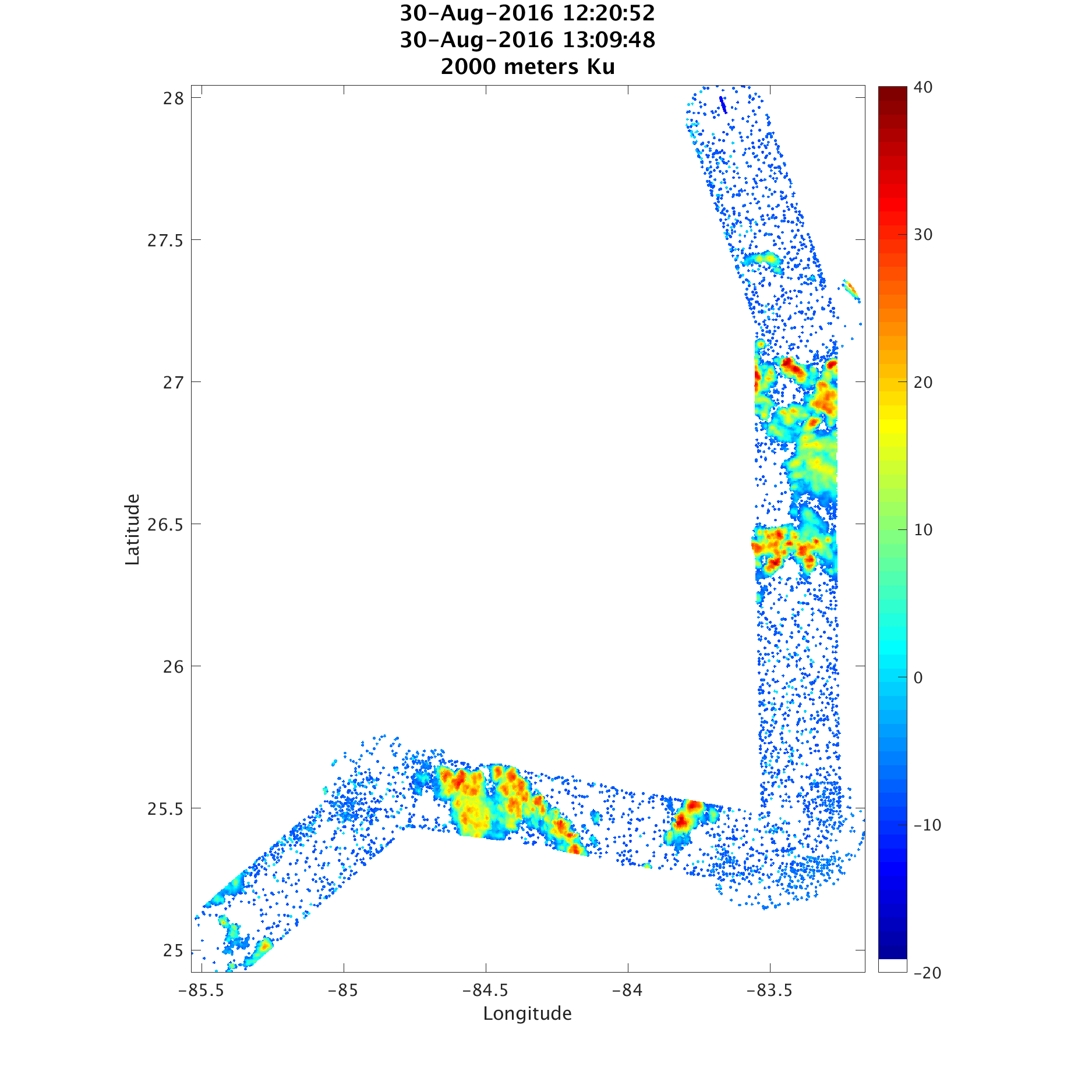
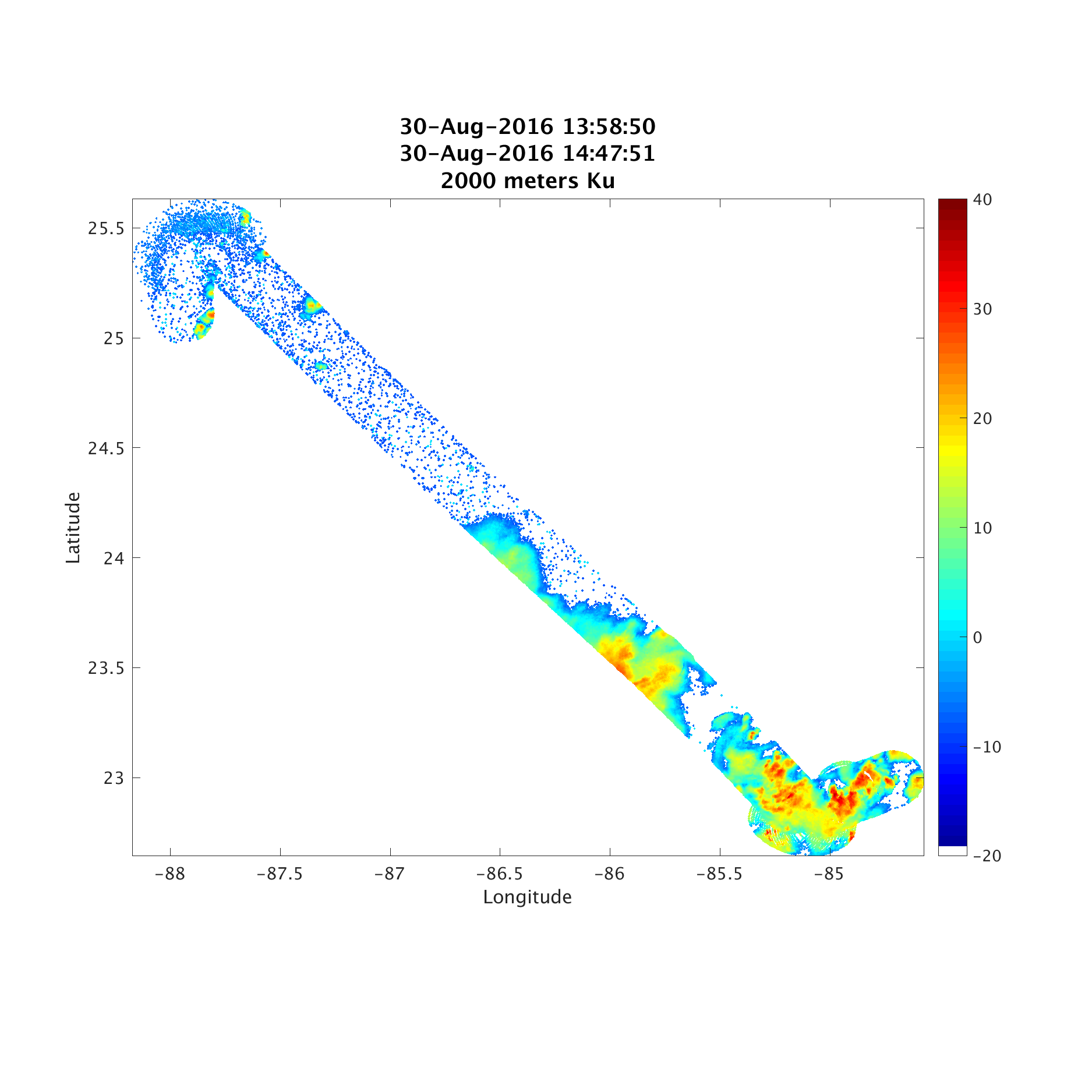
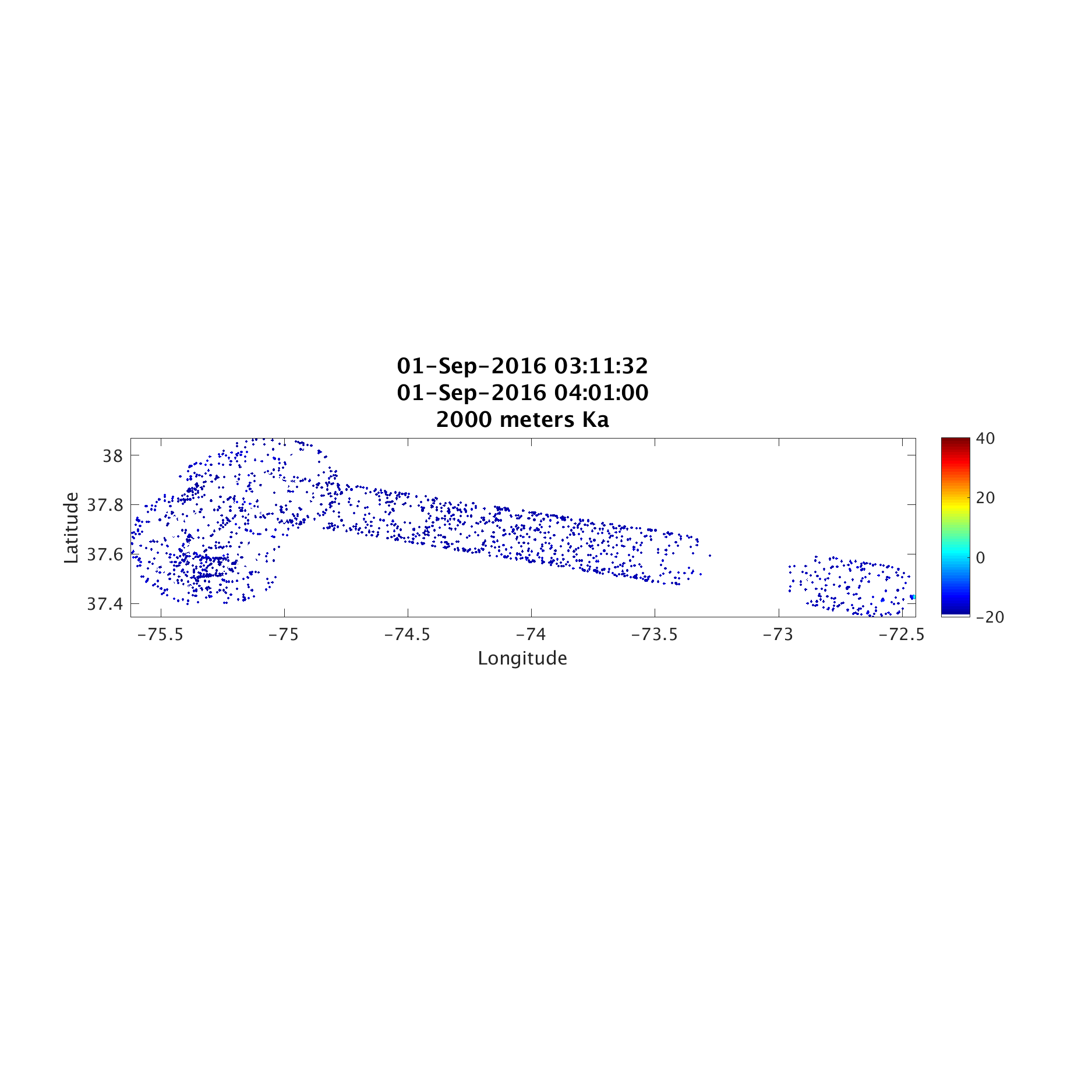
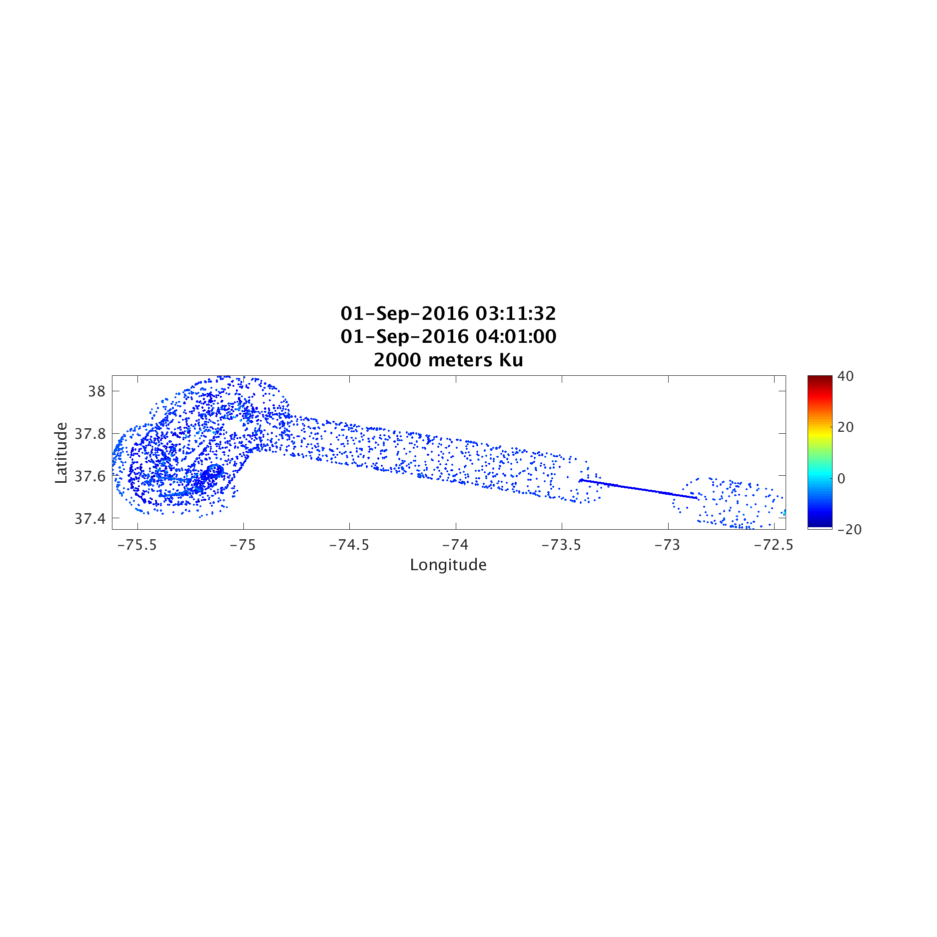
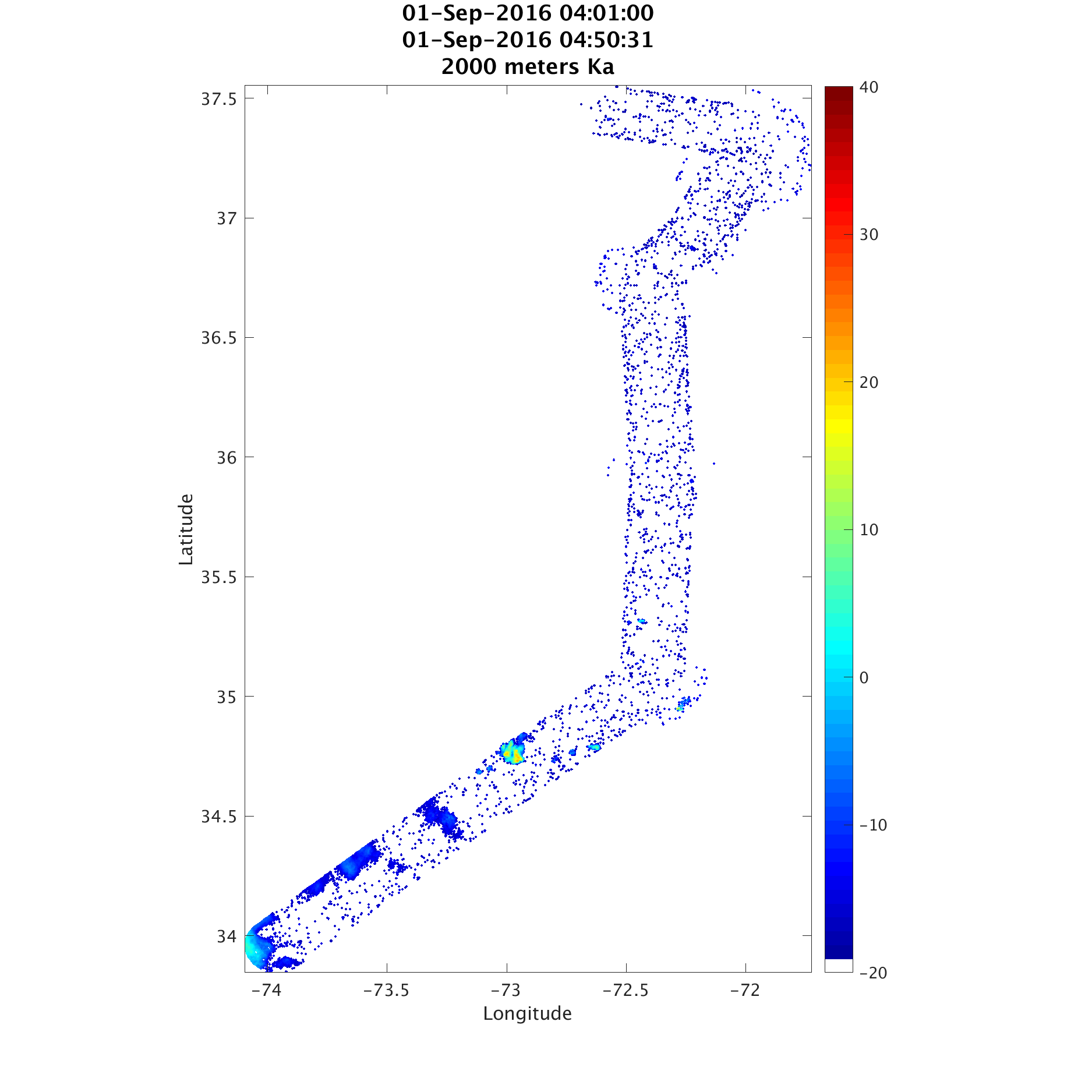
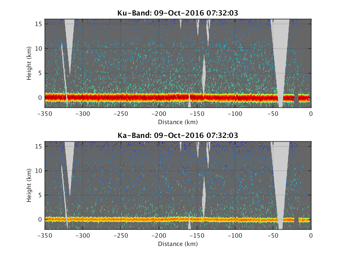
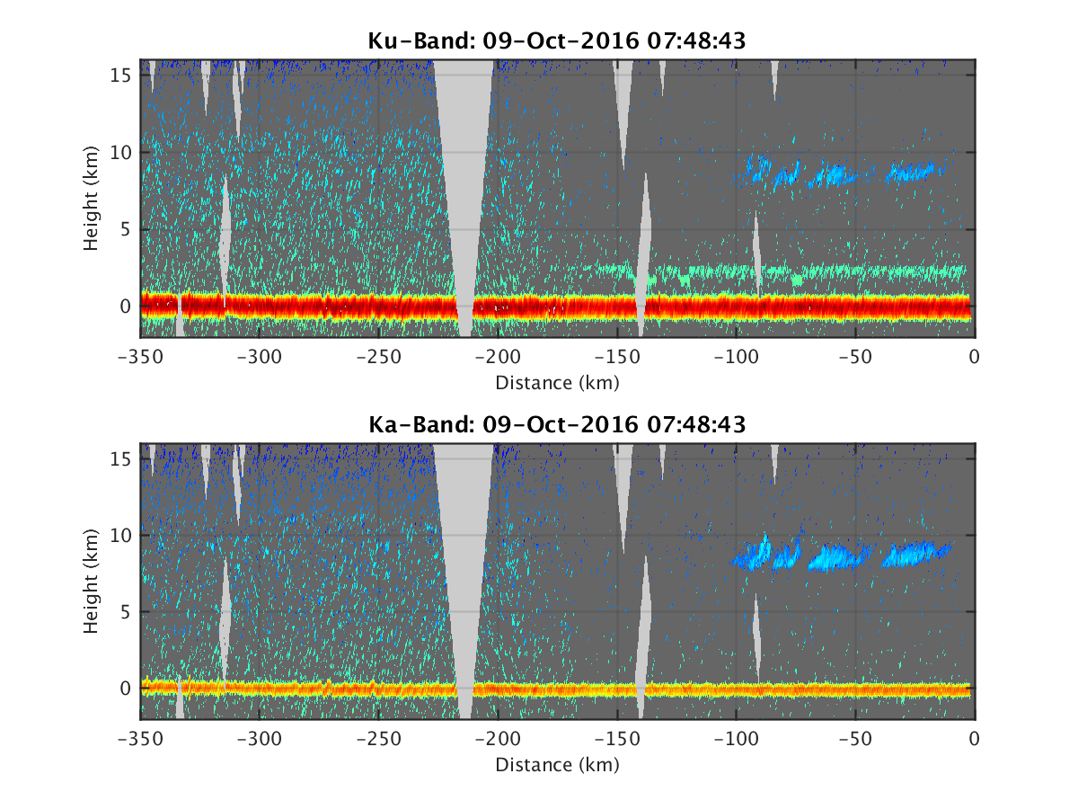
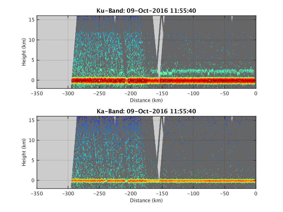
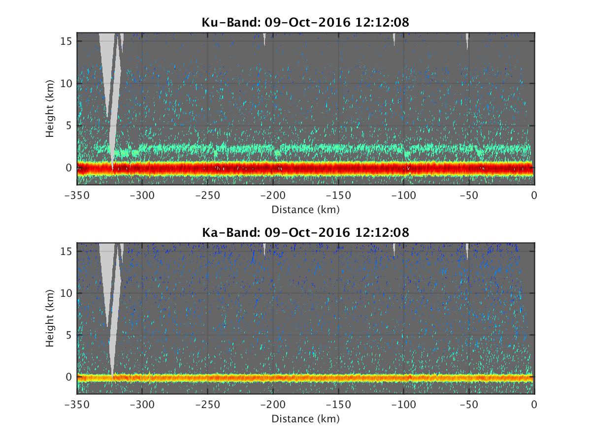
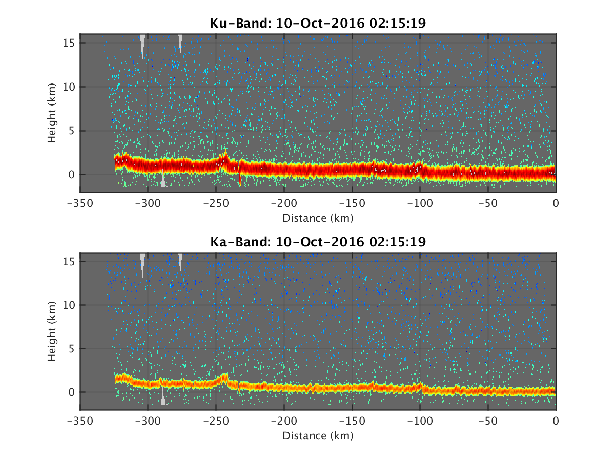
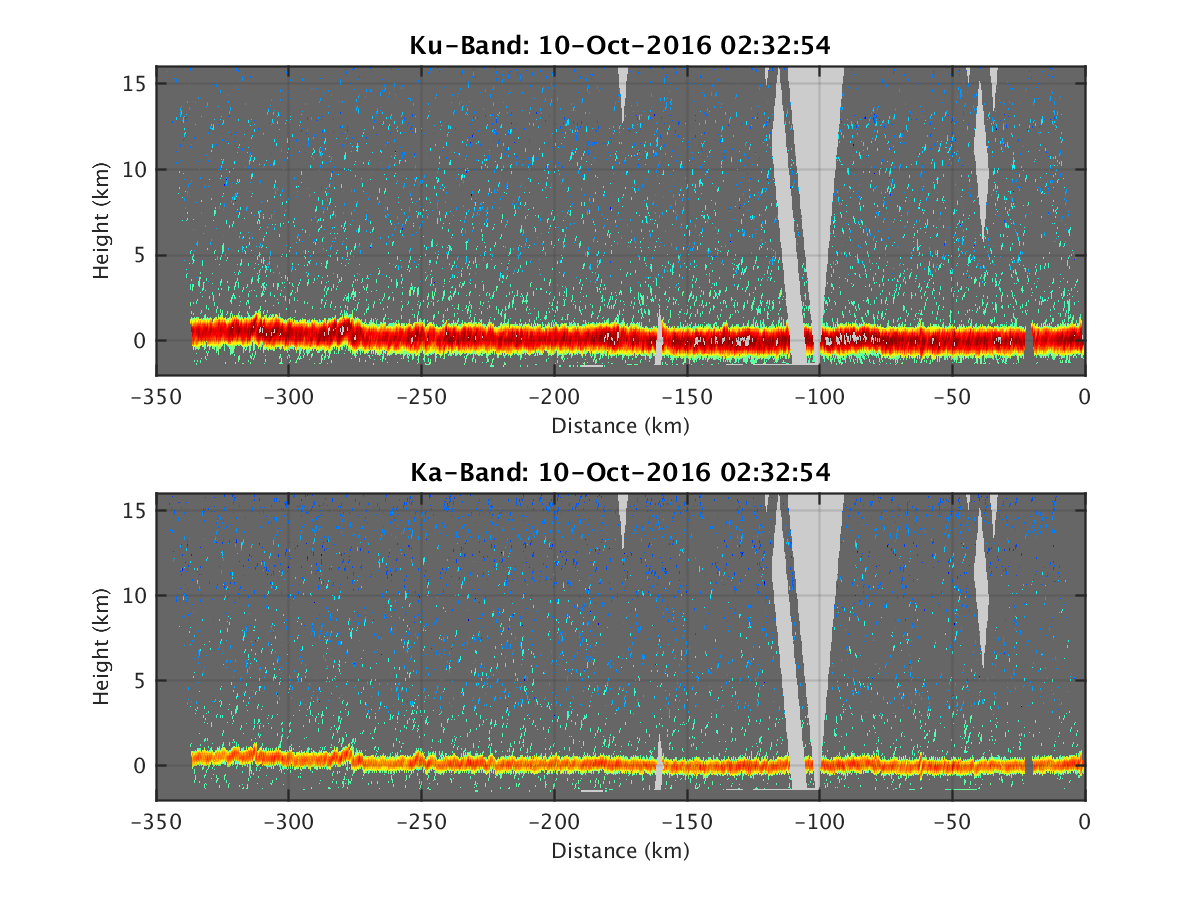
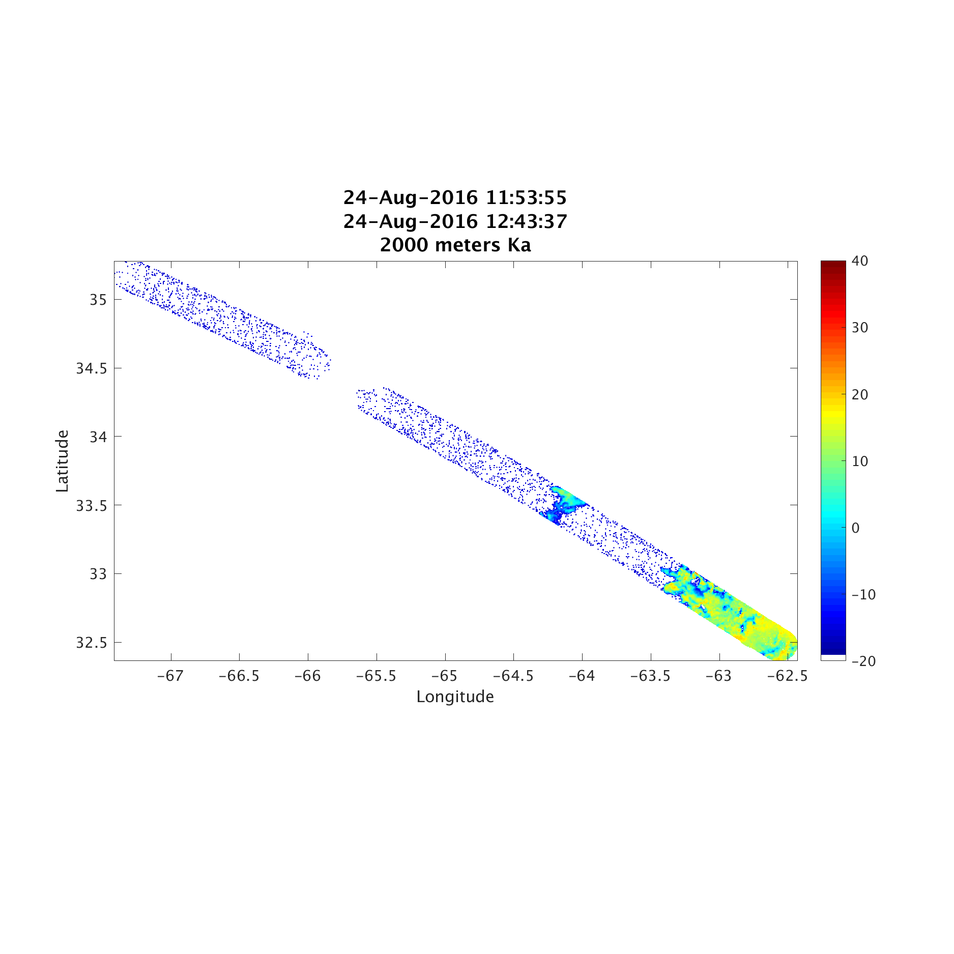
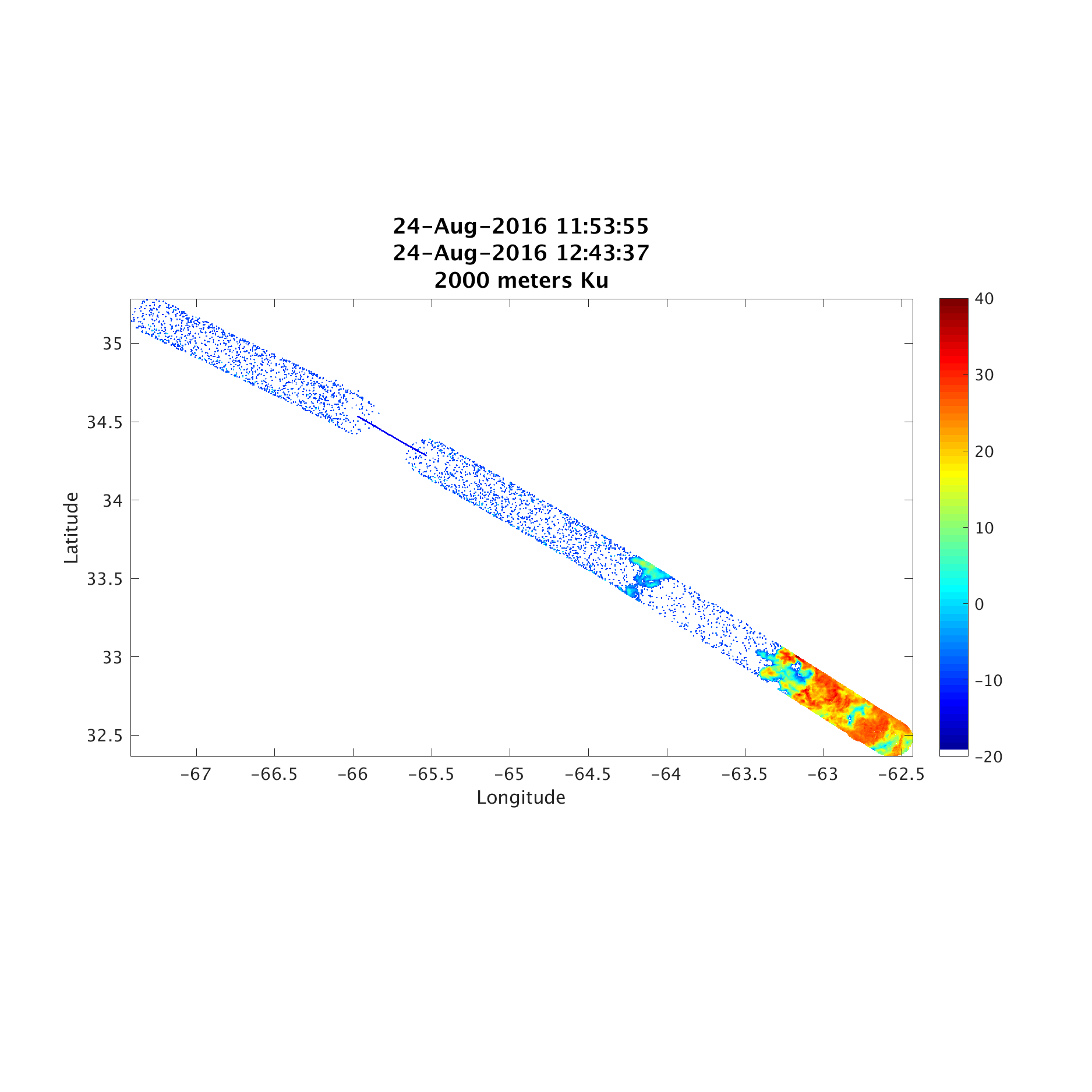
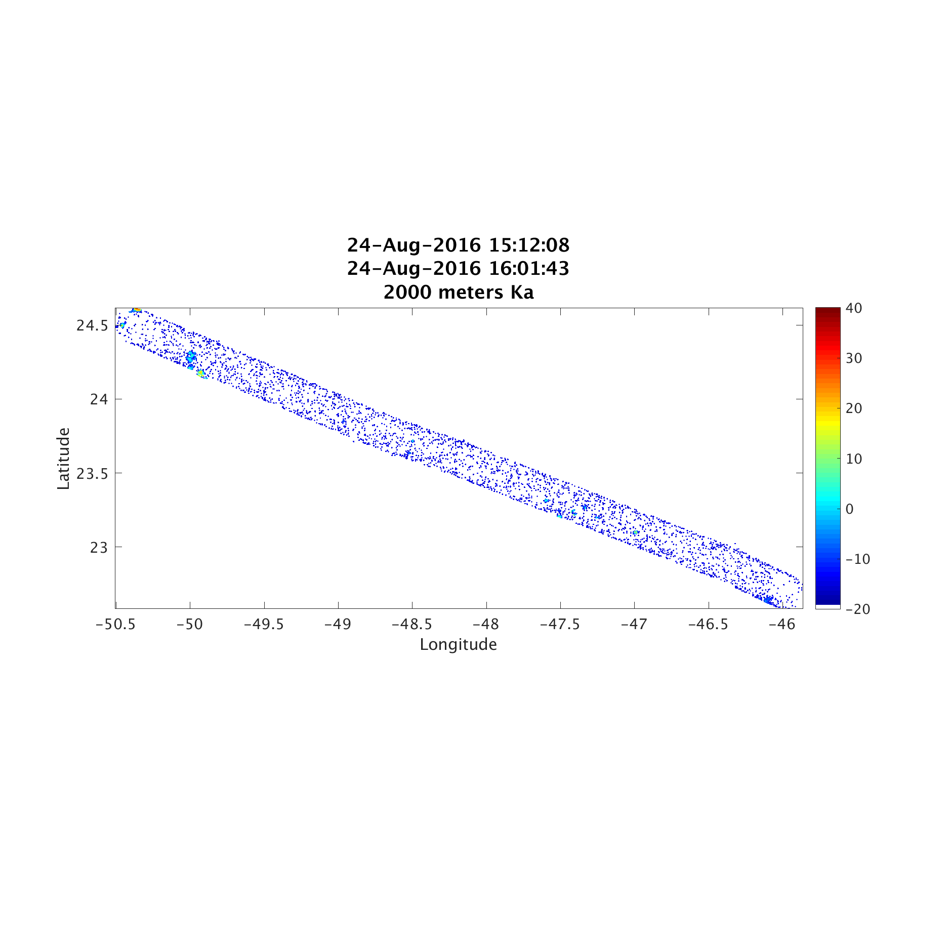
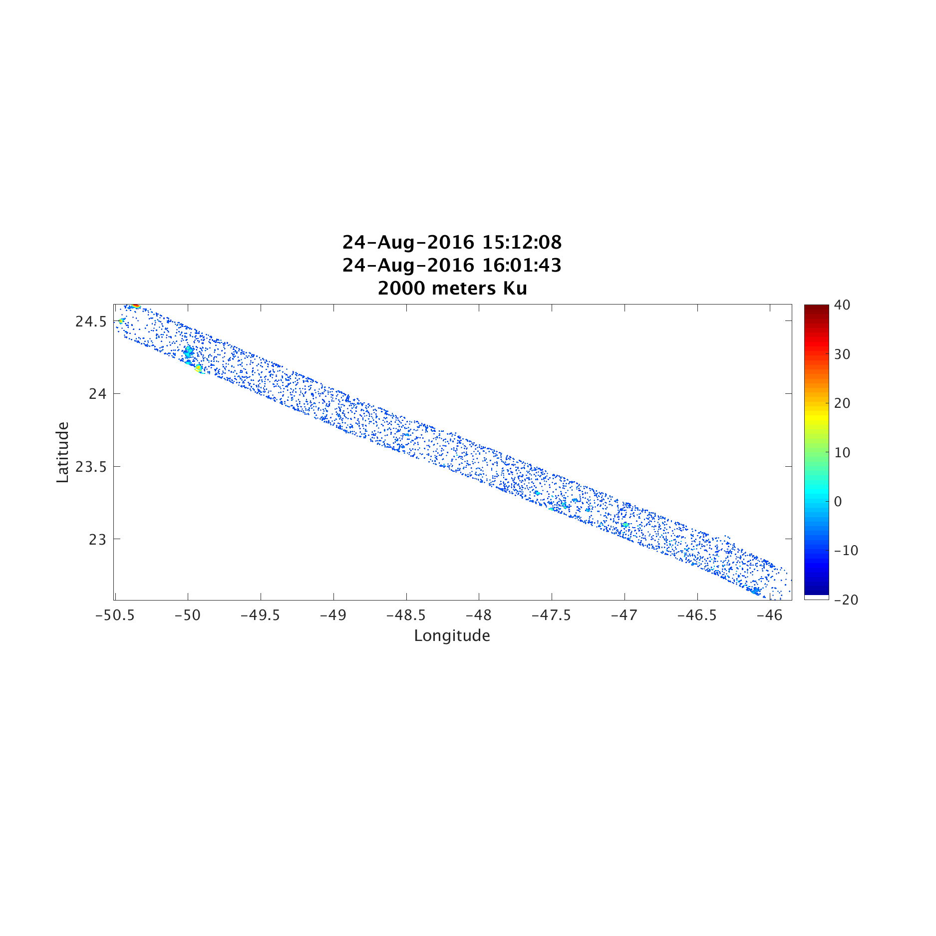
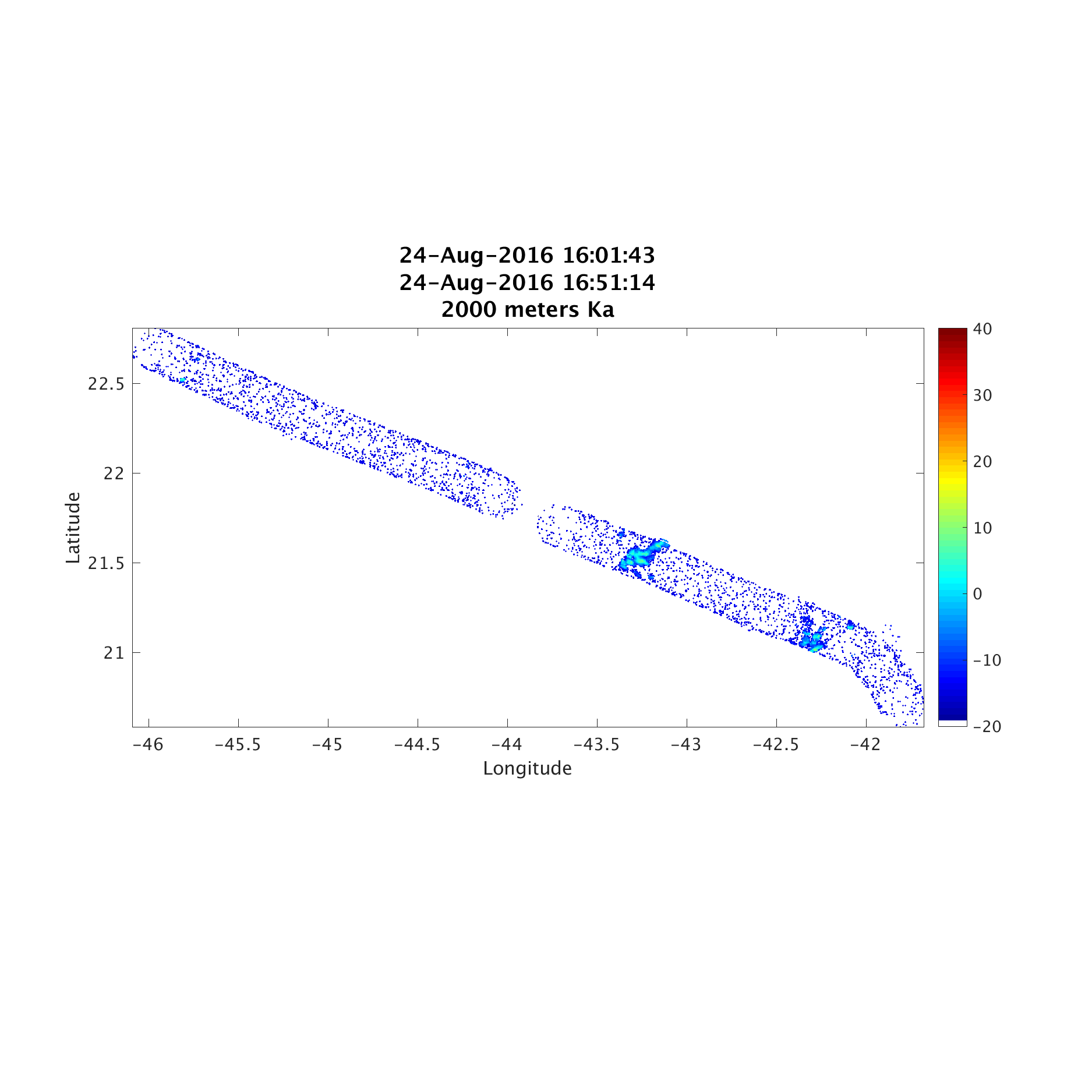
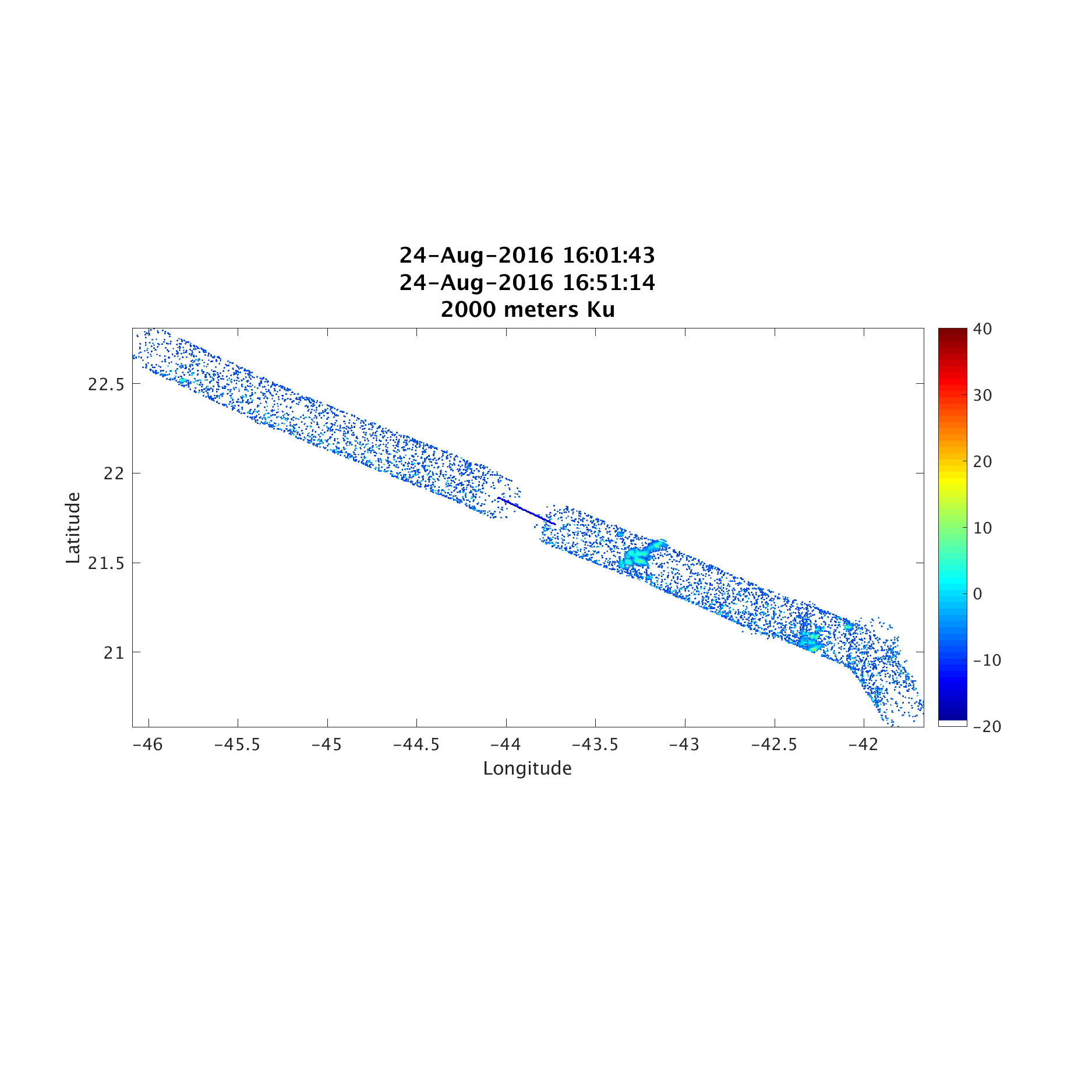
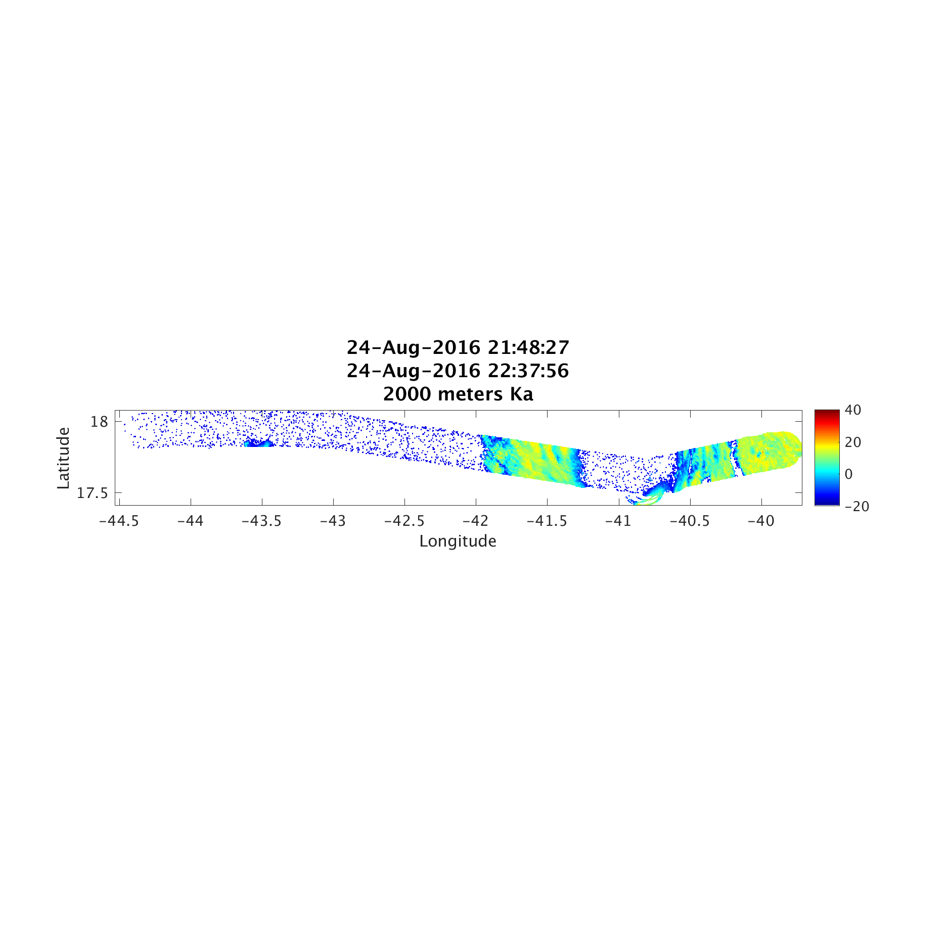
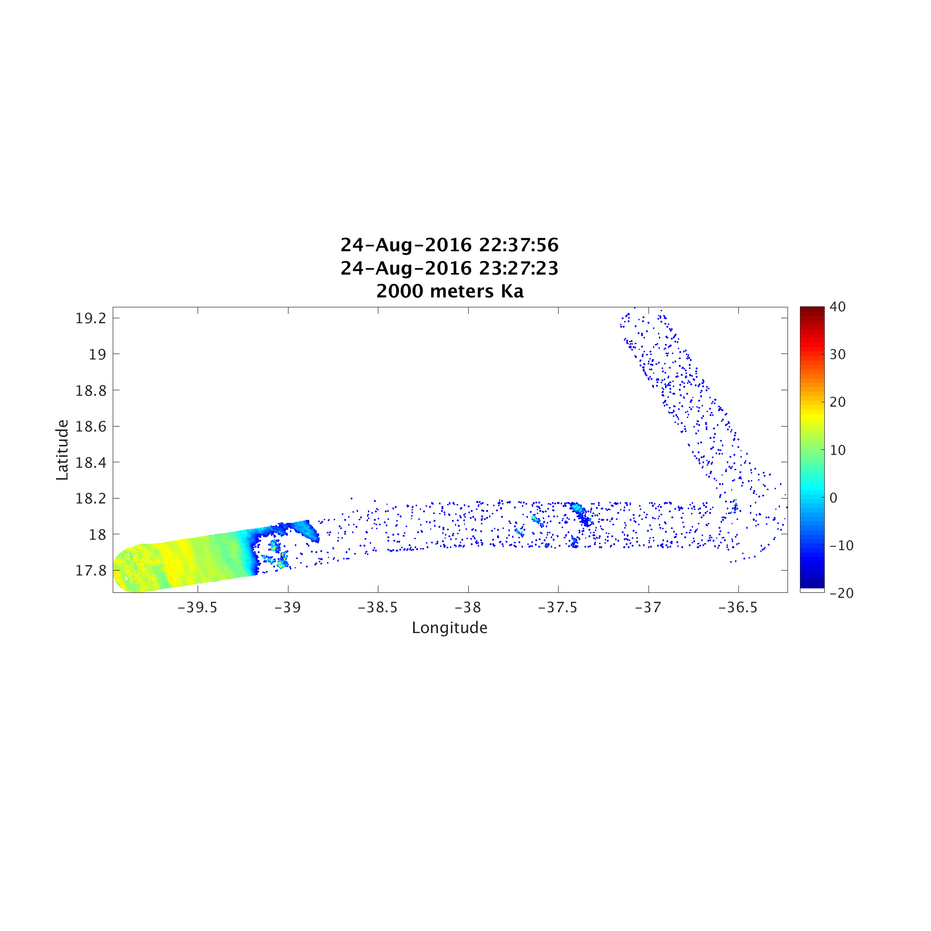
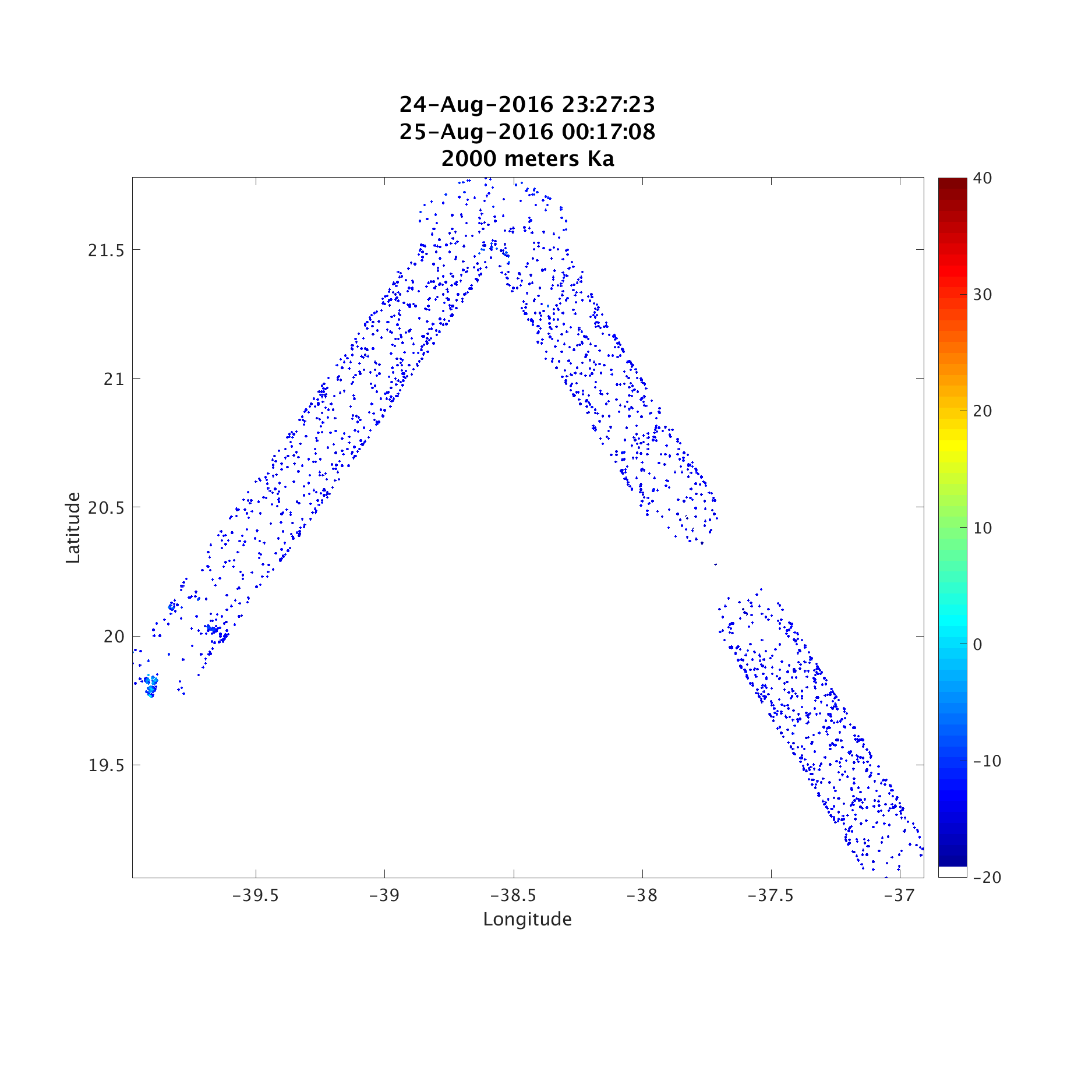
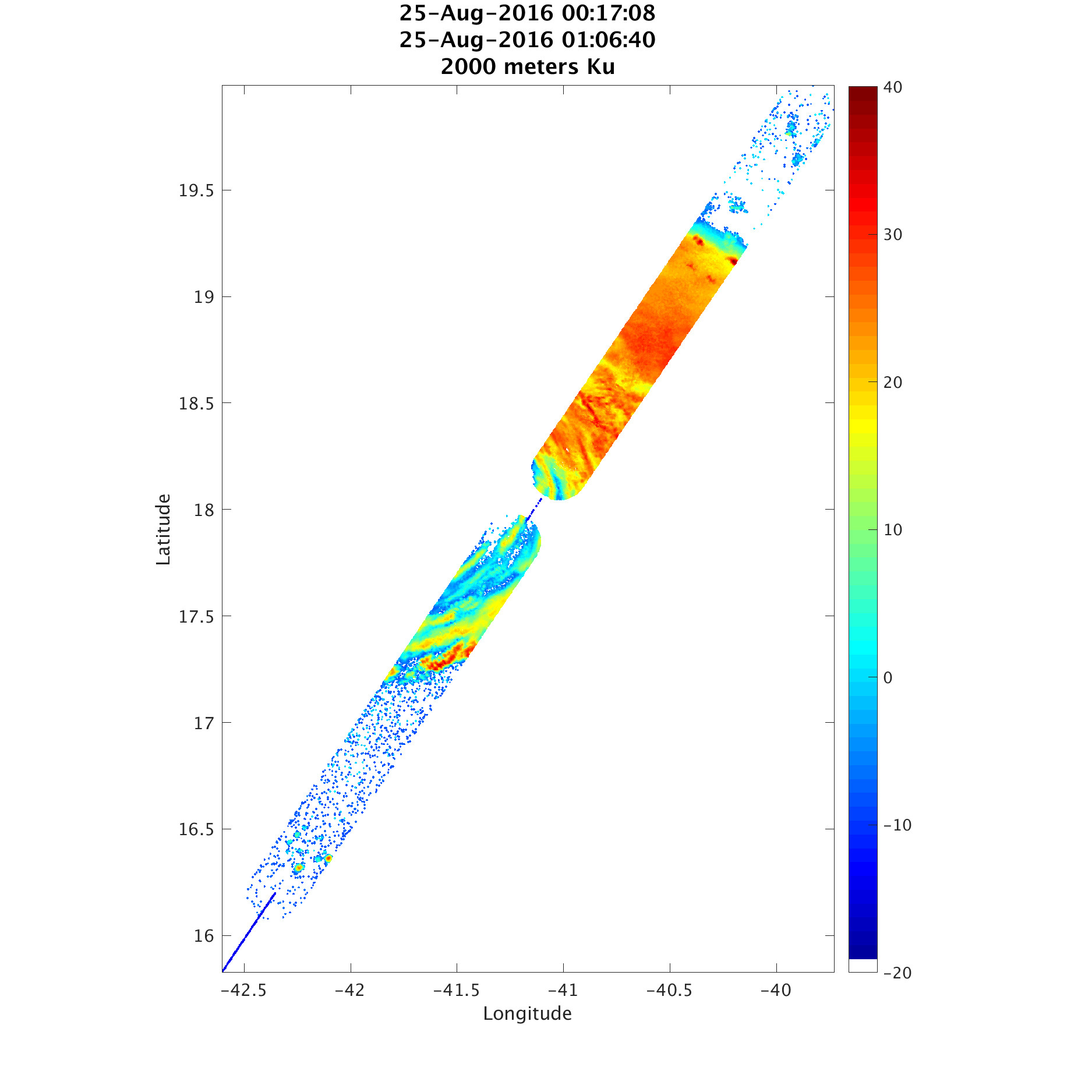
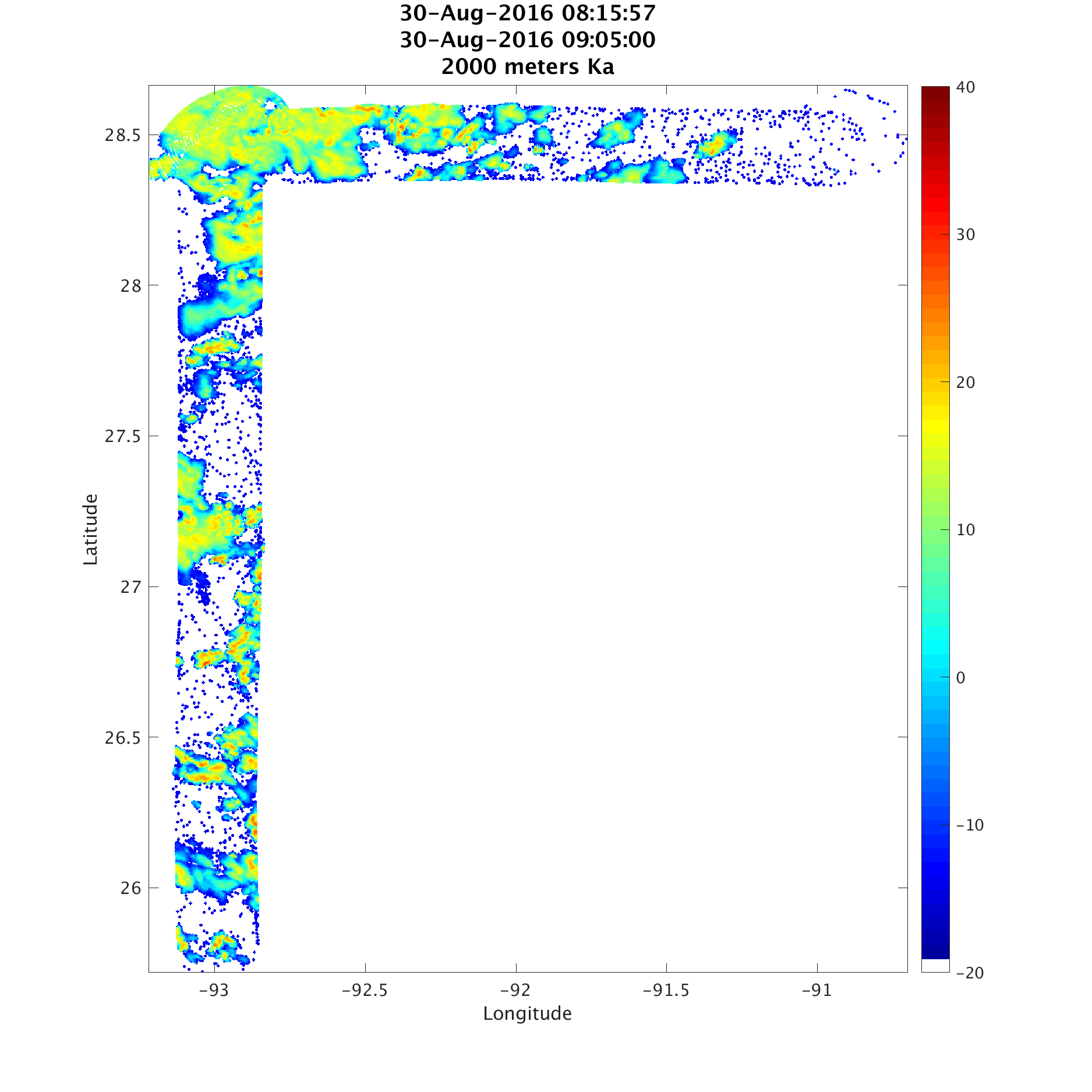
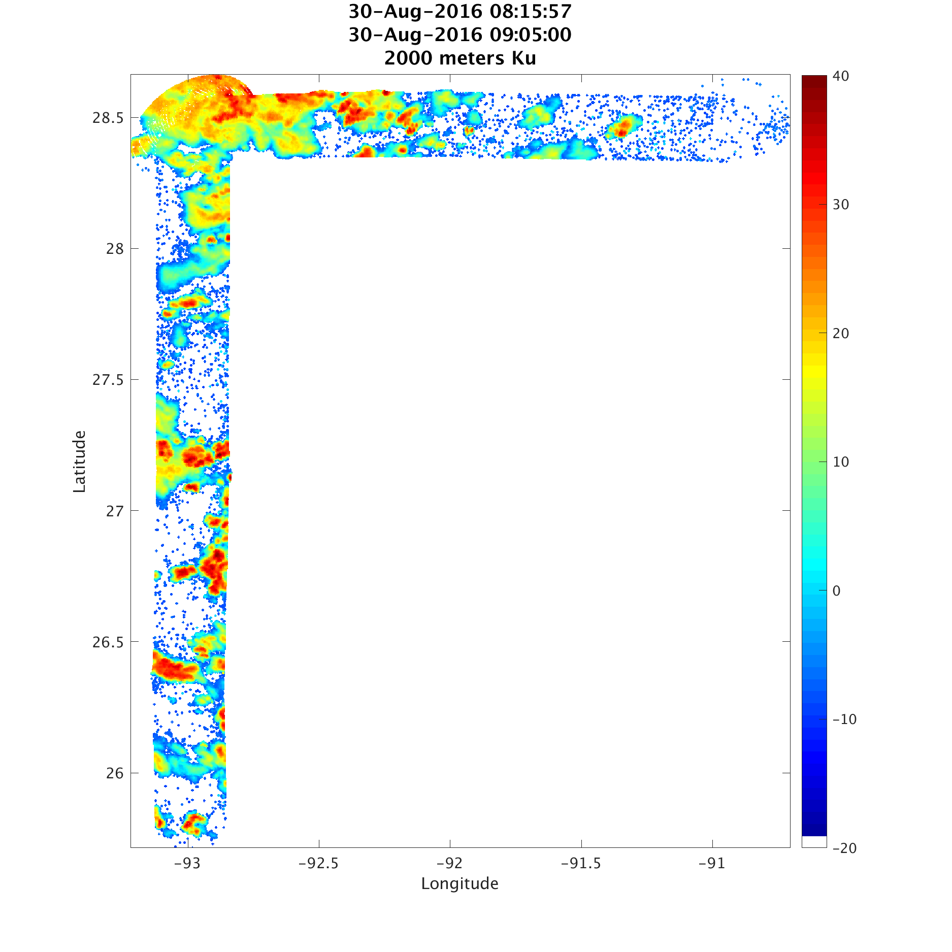
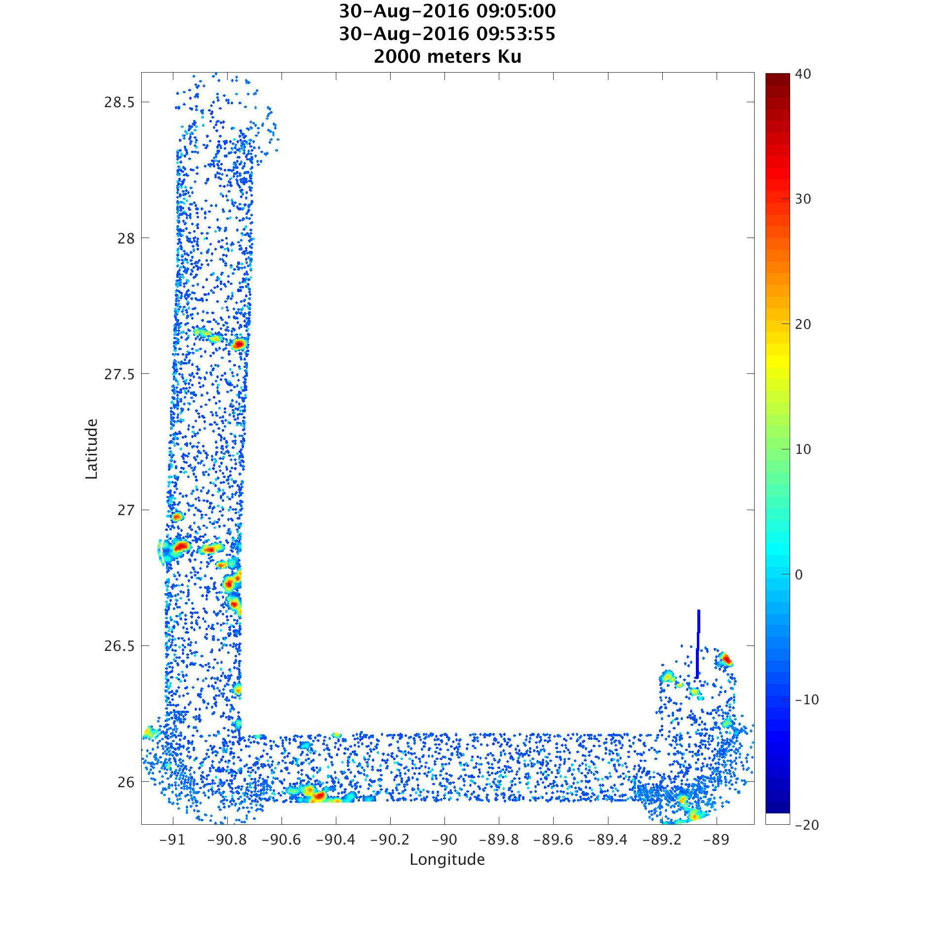
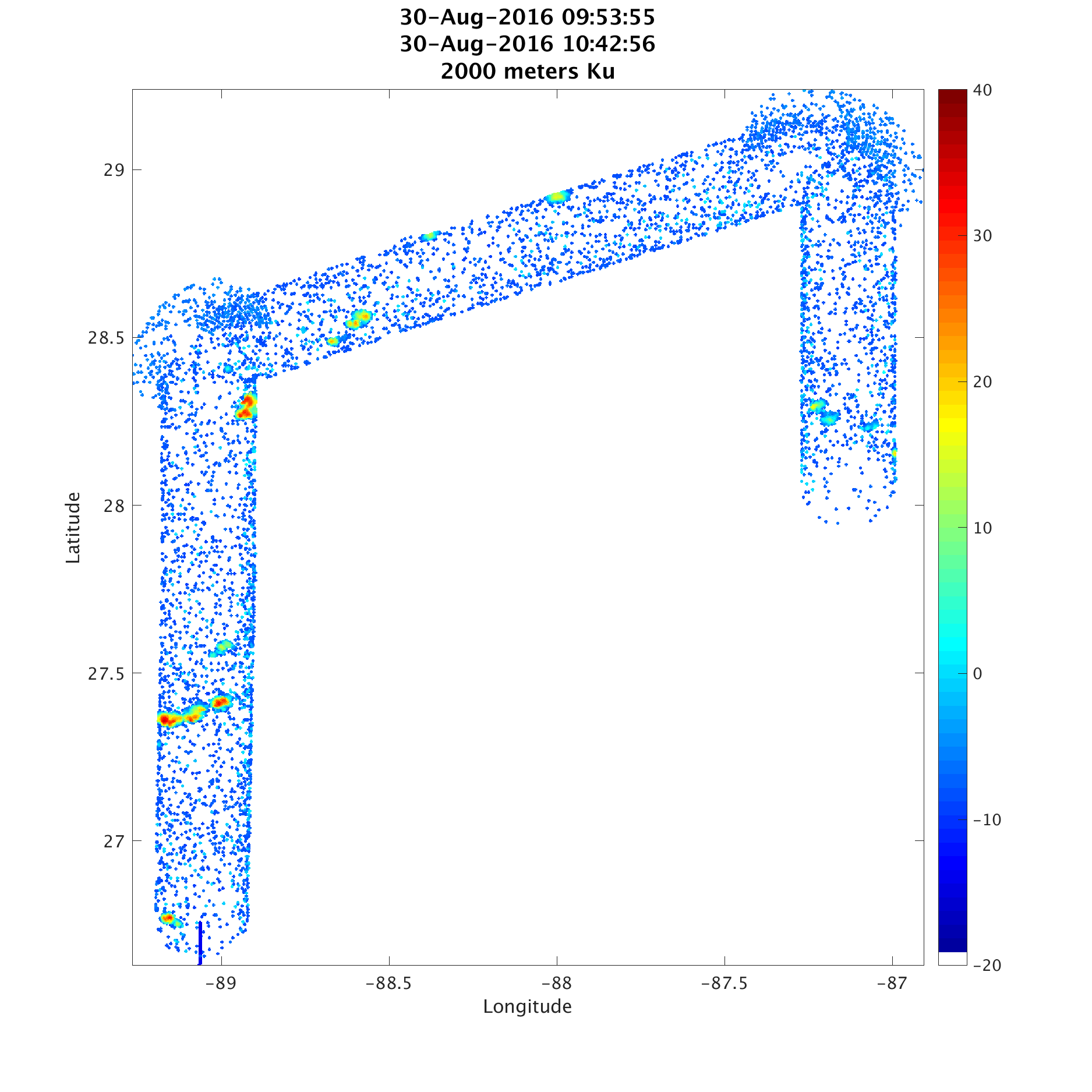
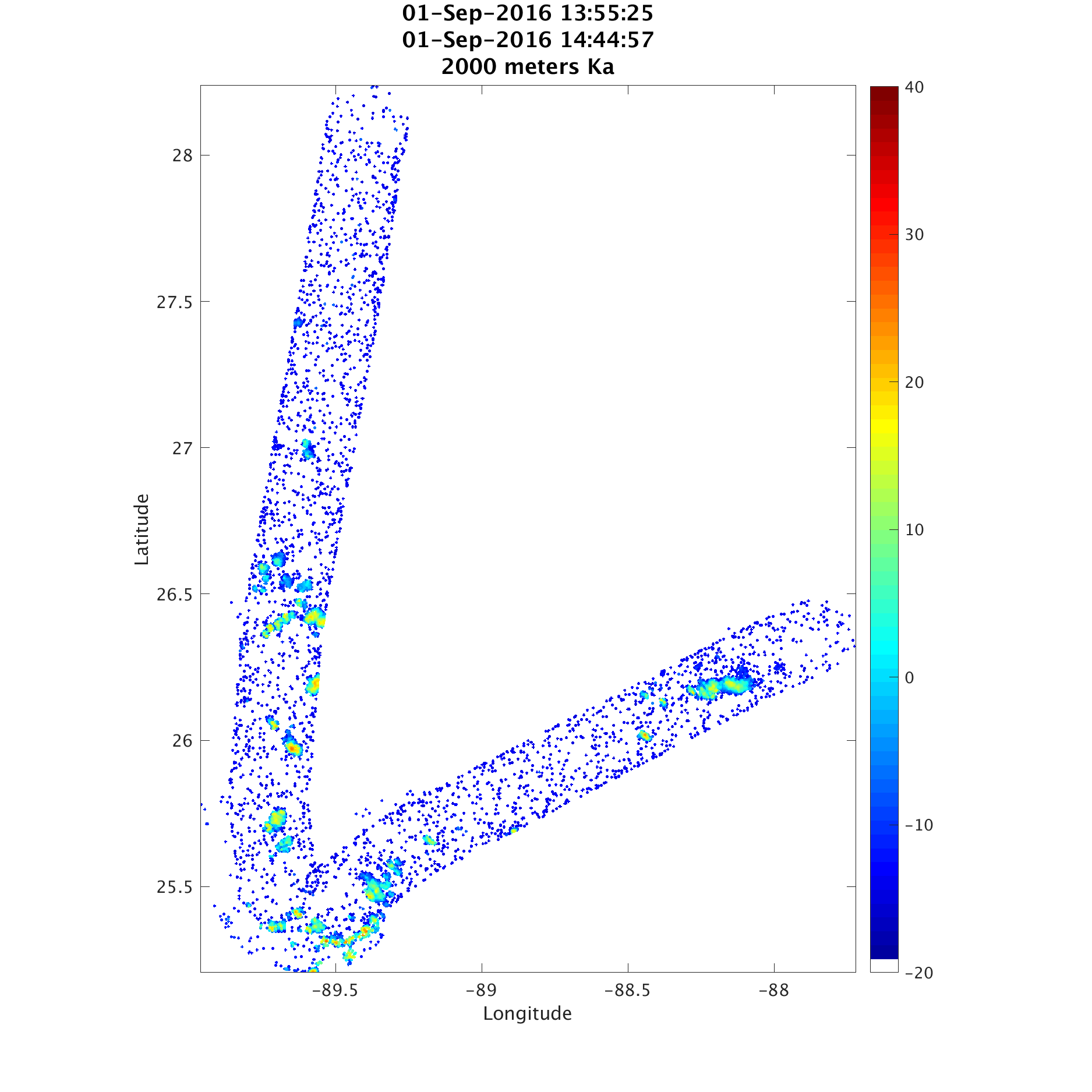
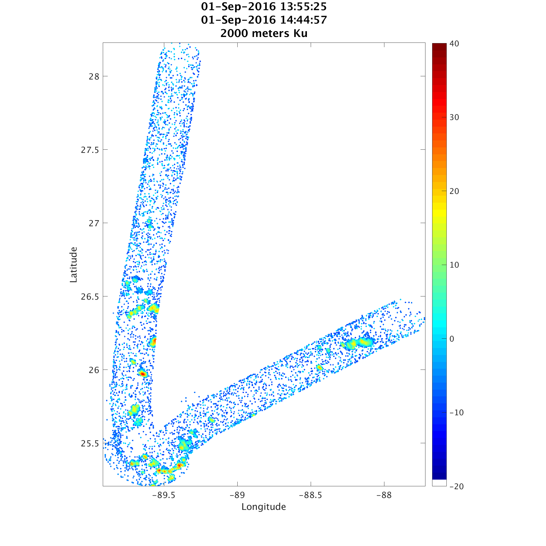
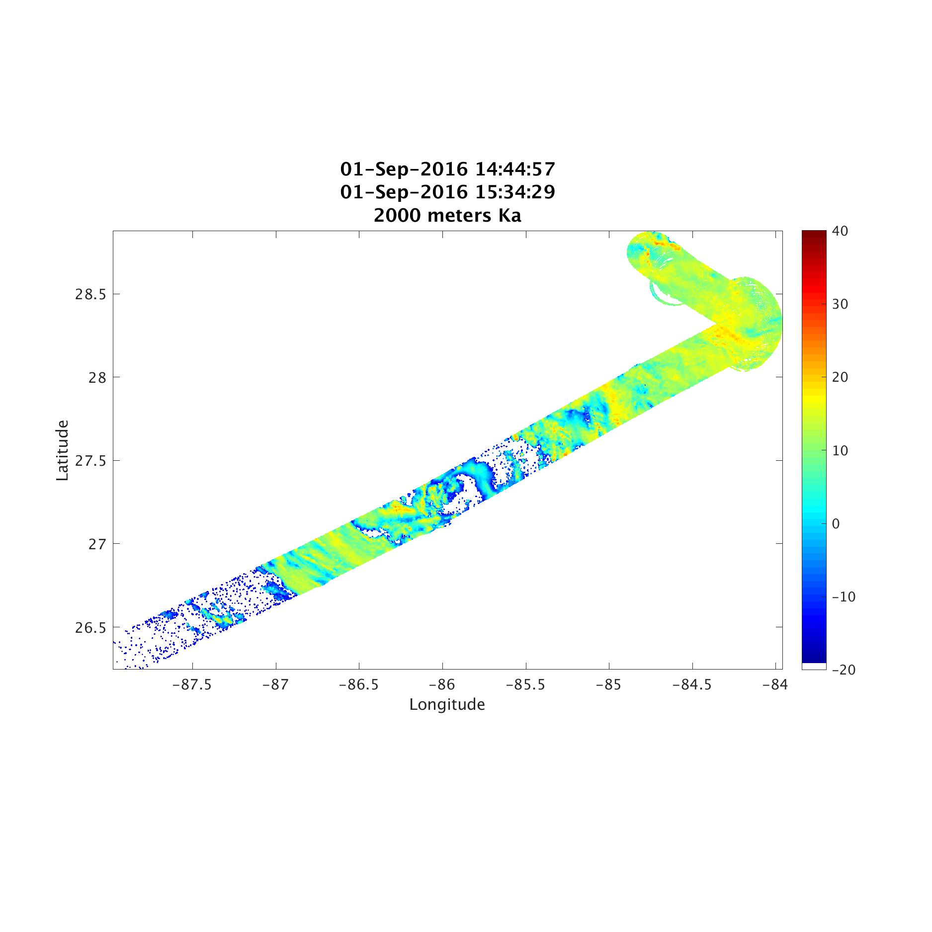
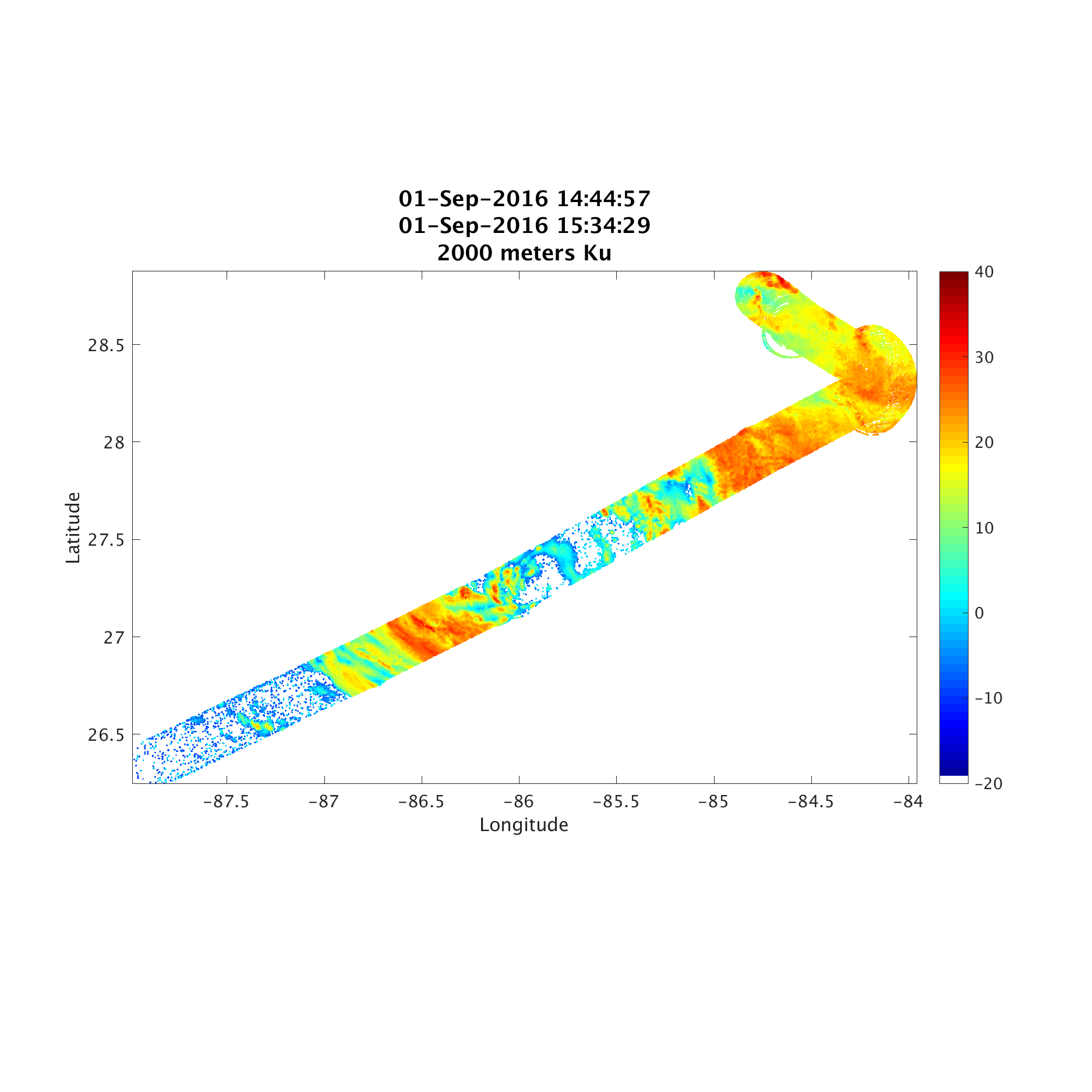
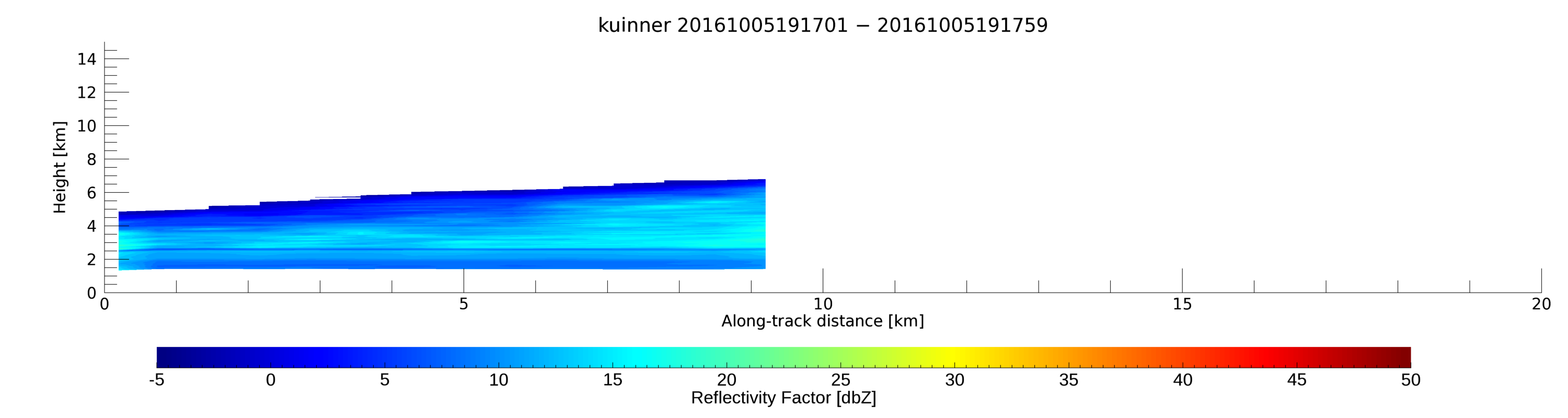
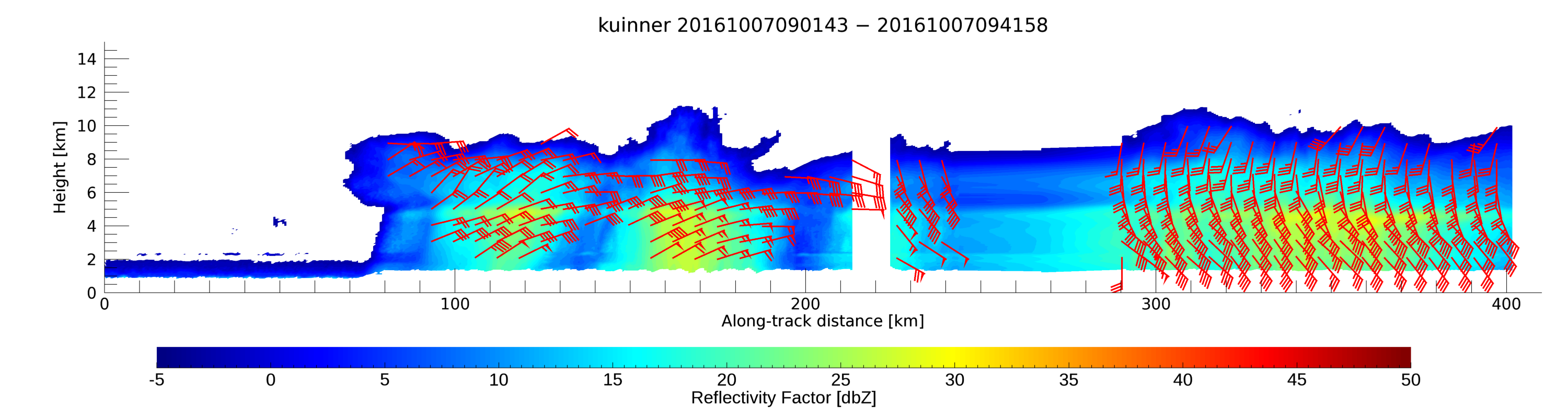
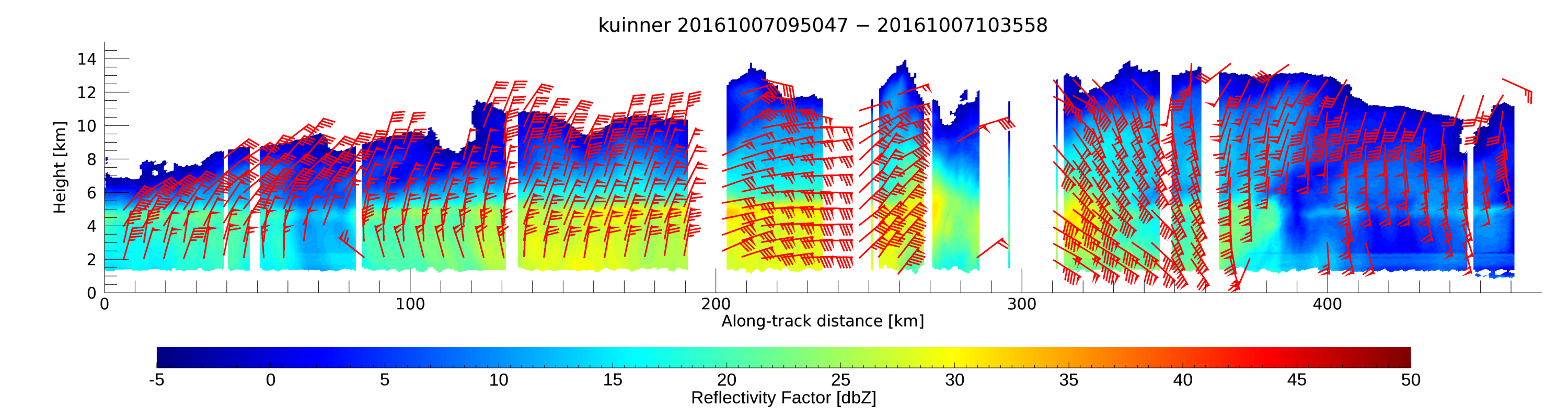
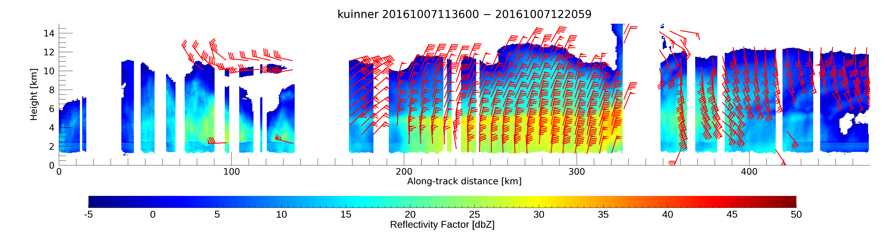
SHOUT HRR
NOAA Sensing Hazards with Operational Unmanned Technology (SHOUT-2016)
Location: NASA Wallops Flight Facility, VA | Coordinates: 37°56′21.6°N 75°27′6°W
![]()
- HIWRAP was flown during Gaston (2 flights), Hermine (1 flight), Erika (1 flight), and Matthew (3 flights).
- Time period: 8/24/2016 - 10/10/2016
- Global Hawk was based at both NASA AFRC and NASA WFF.
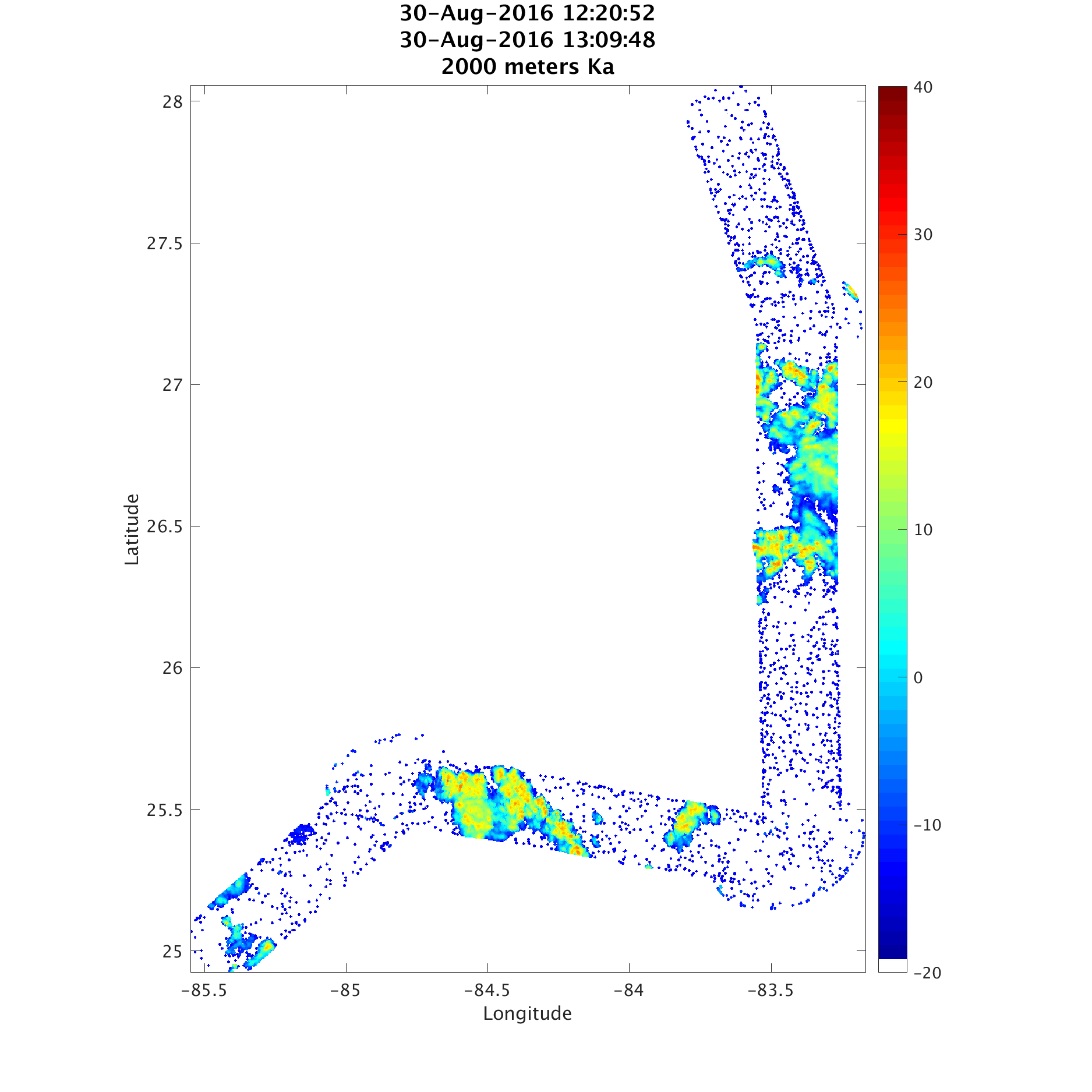
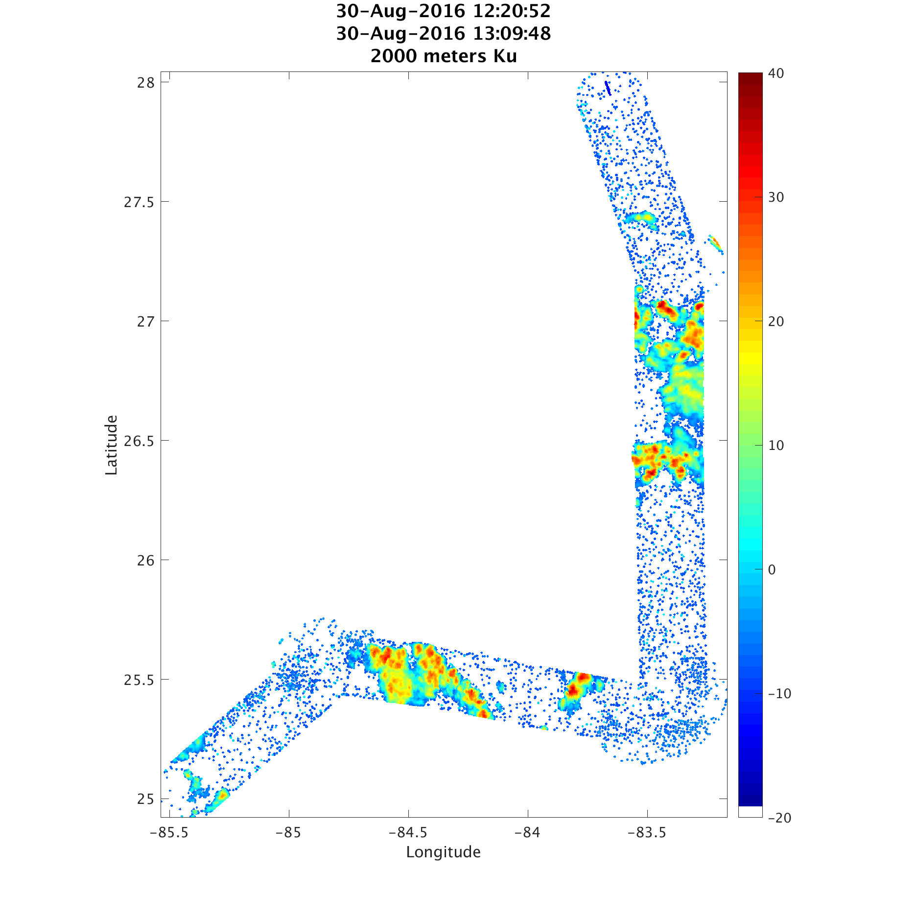
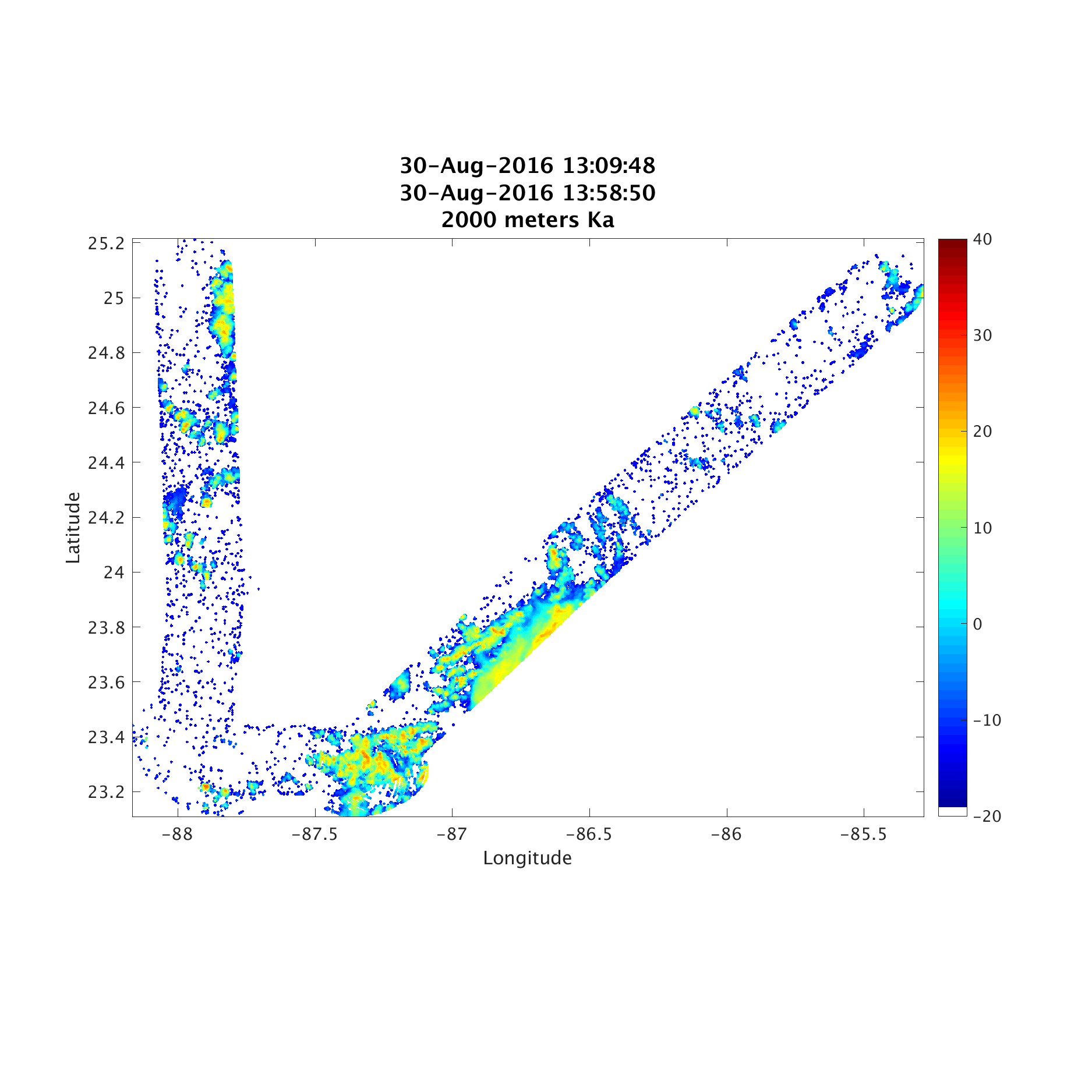
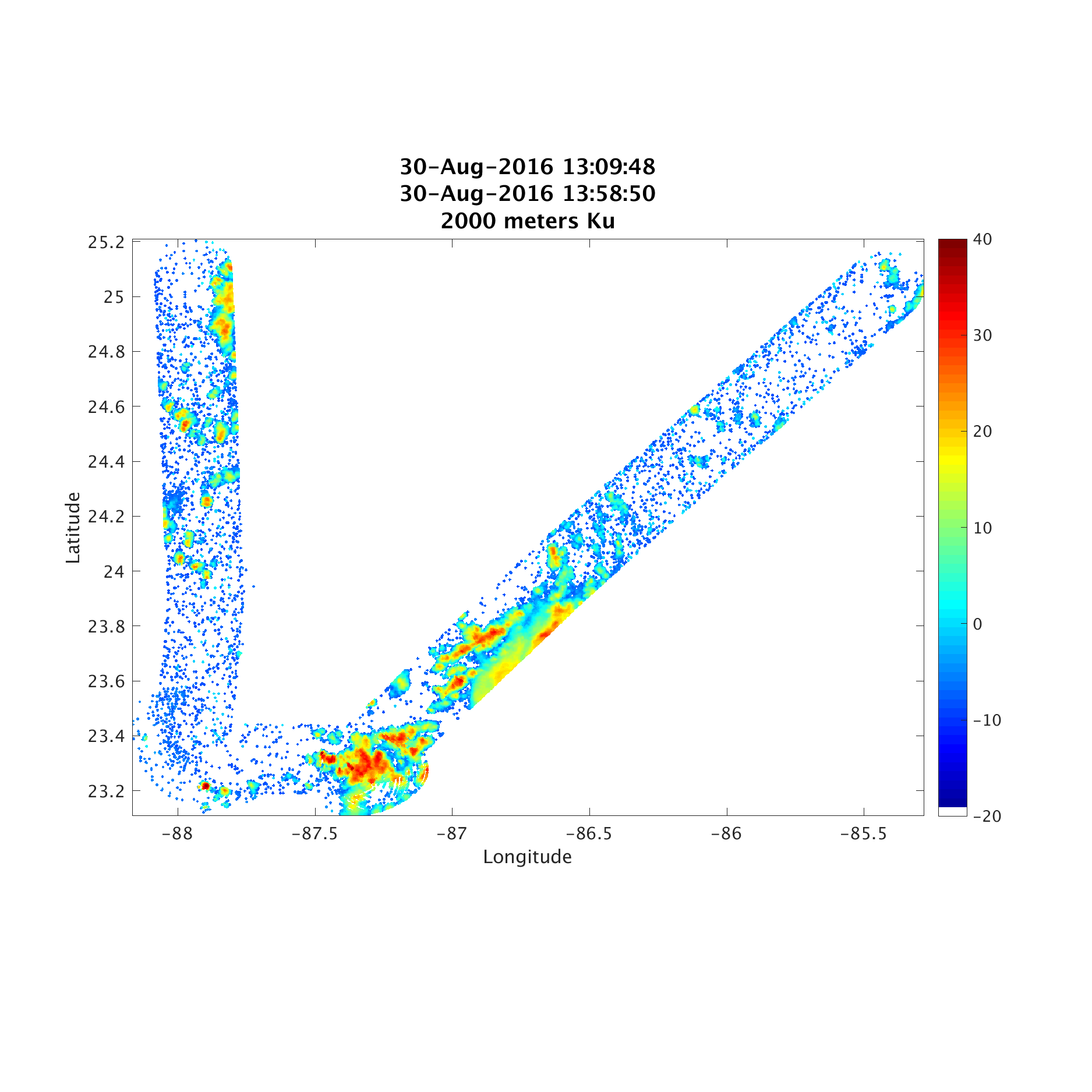
NOTE: This is not an offical data site. Any use of data from this site should acknowledge the High-Altitude Radar Group (HAR) at Goddard Space Flight Center. It is always advisable to check with HAR whether the latest version of data is posted.
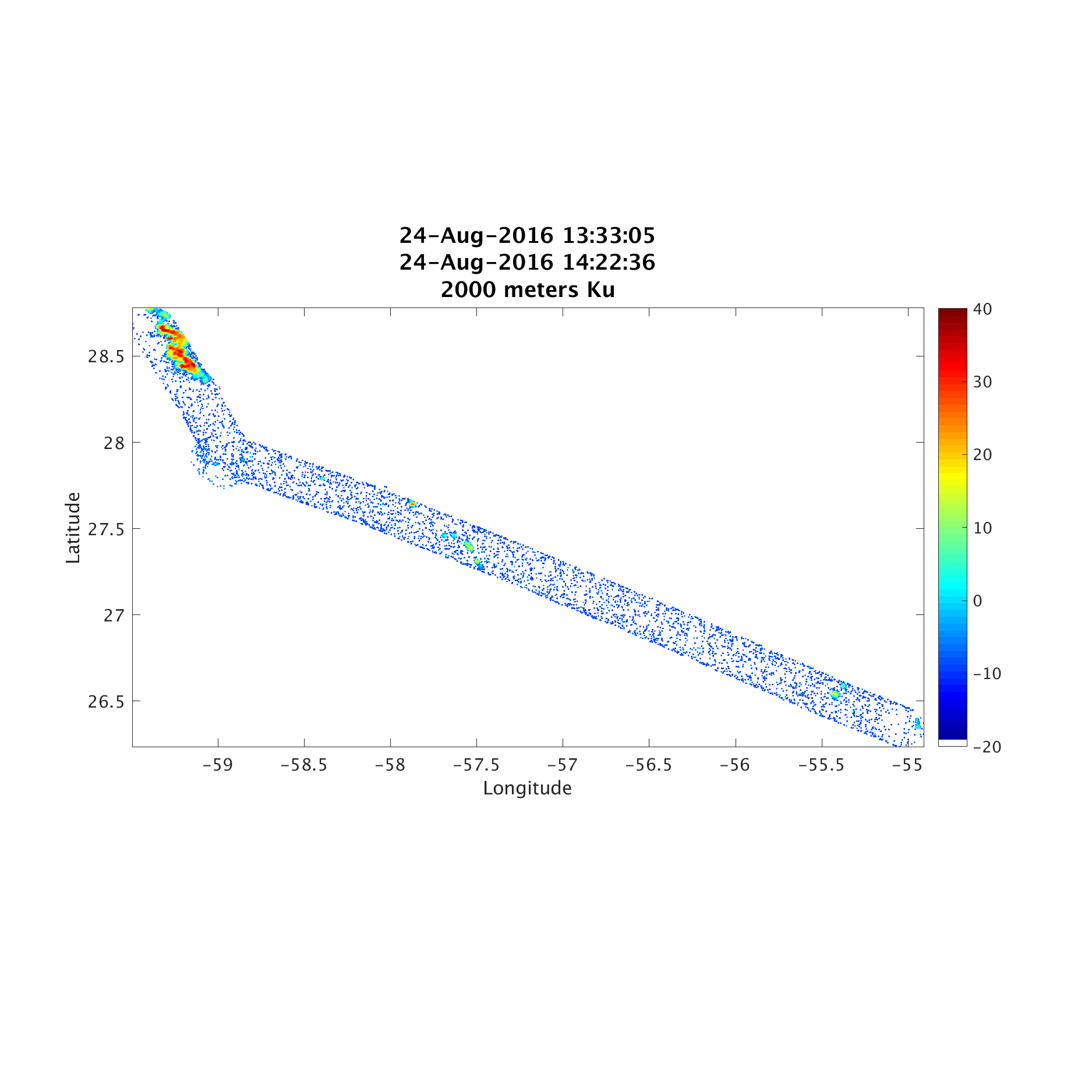
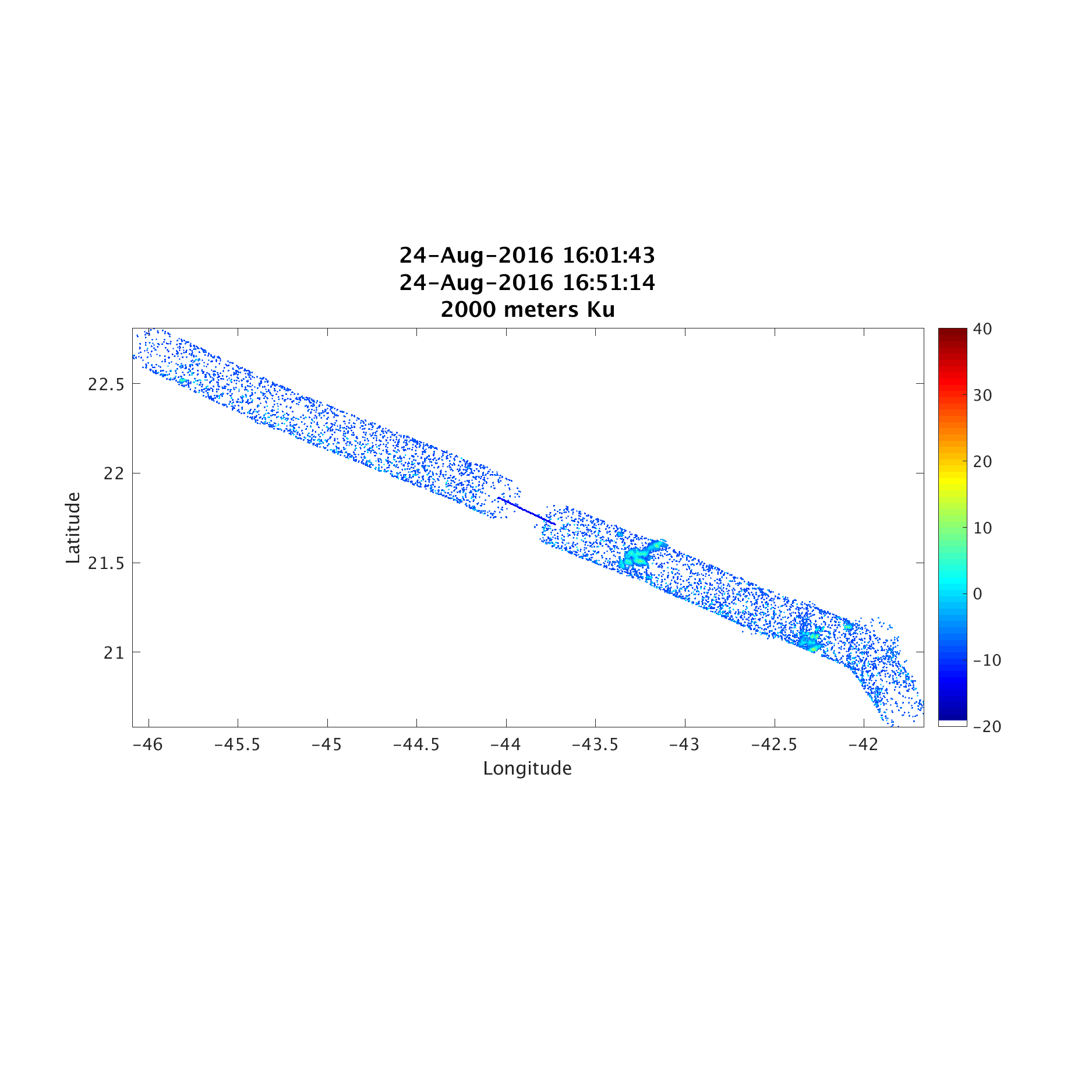
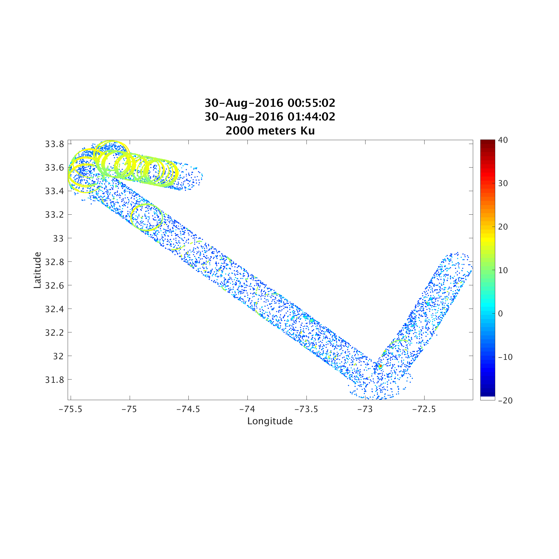
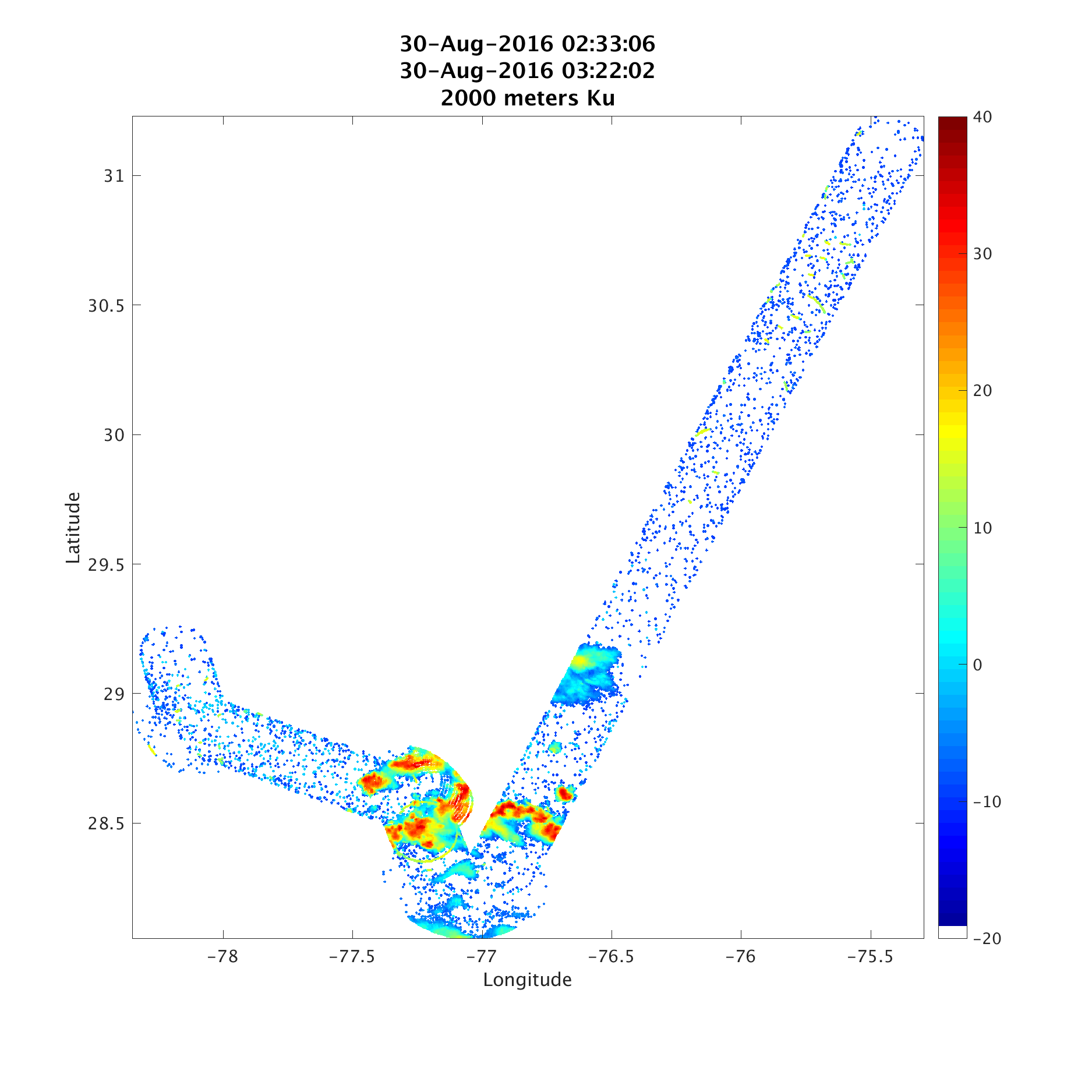
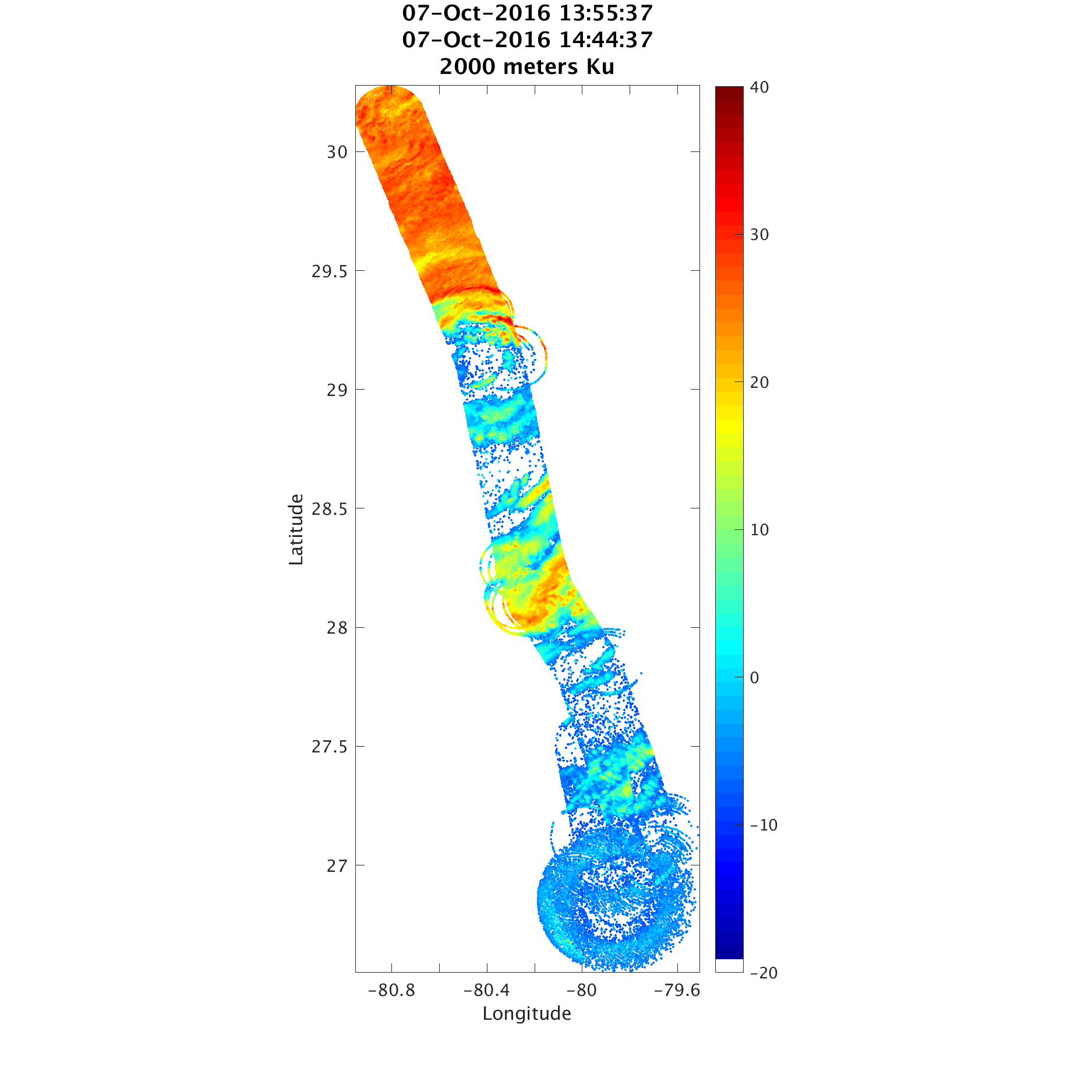
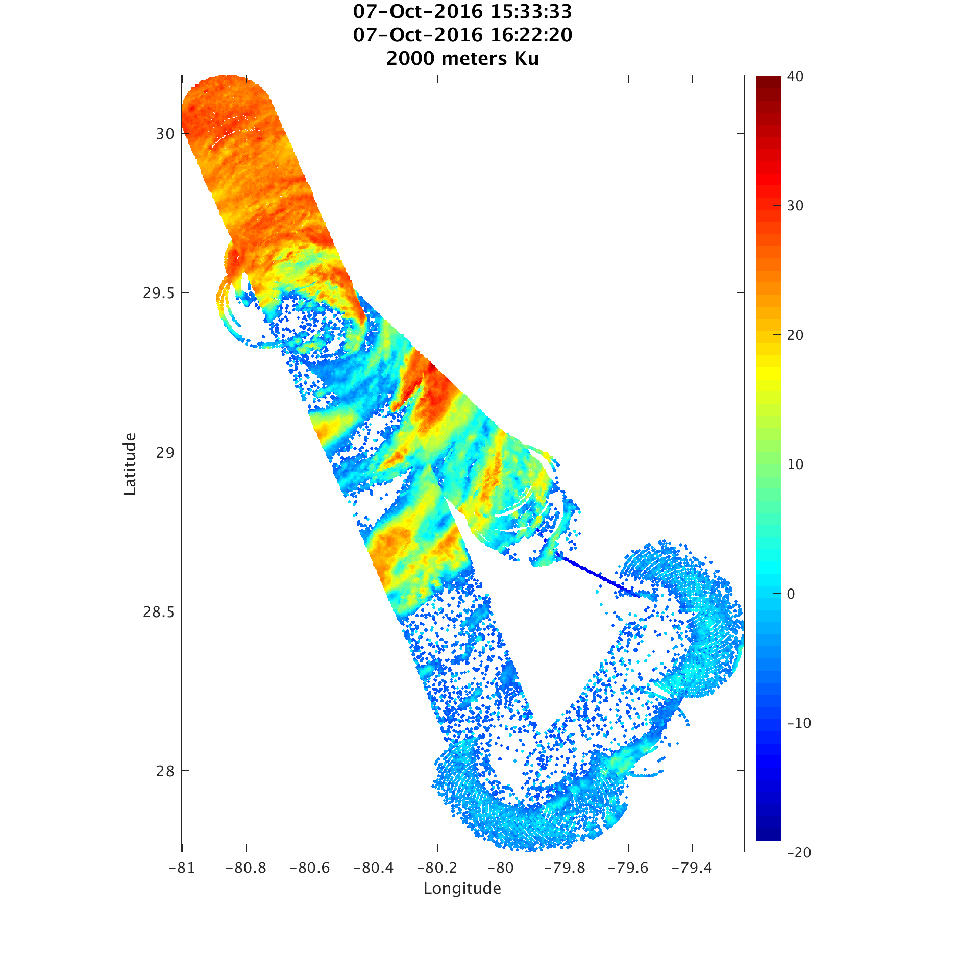
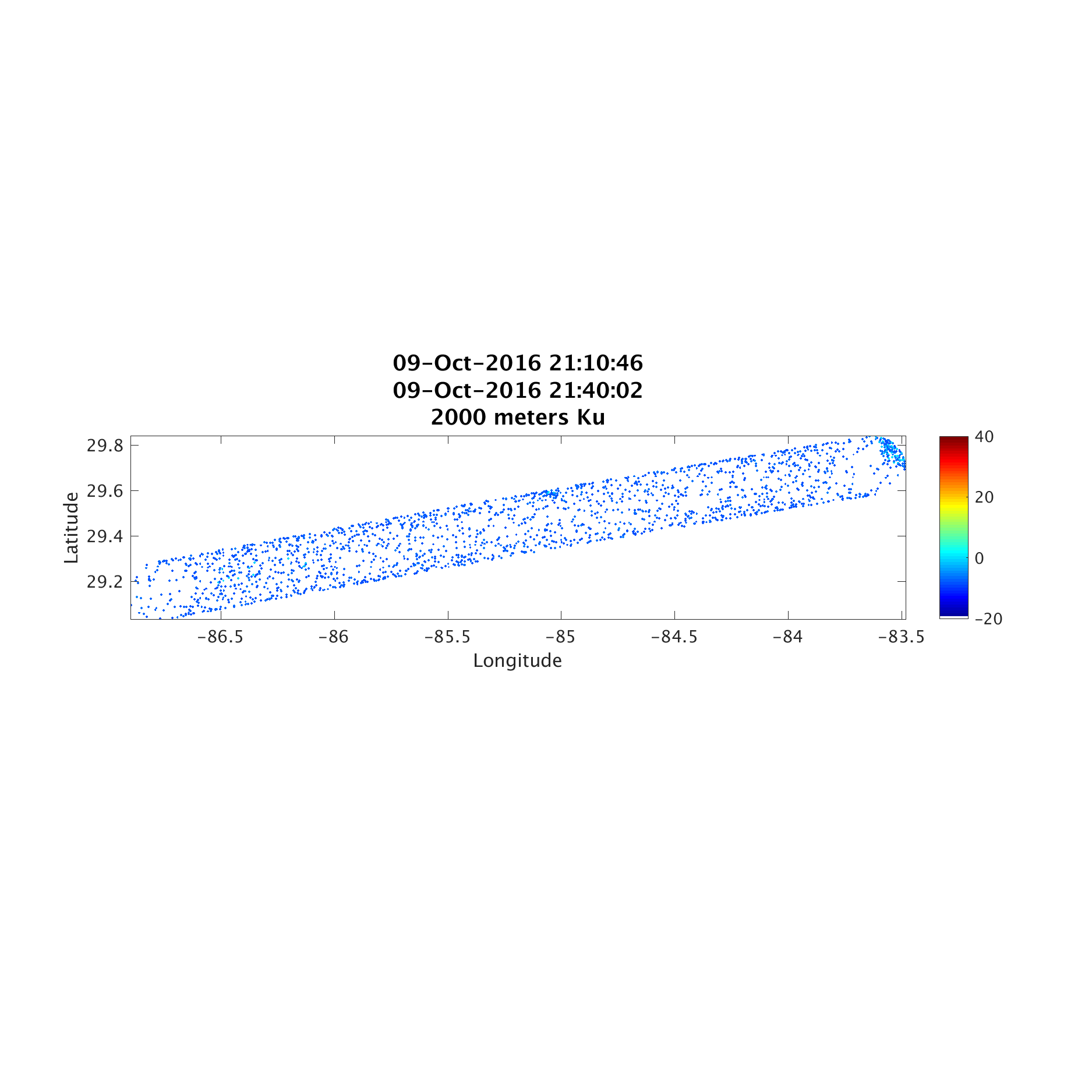
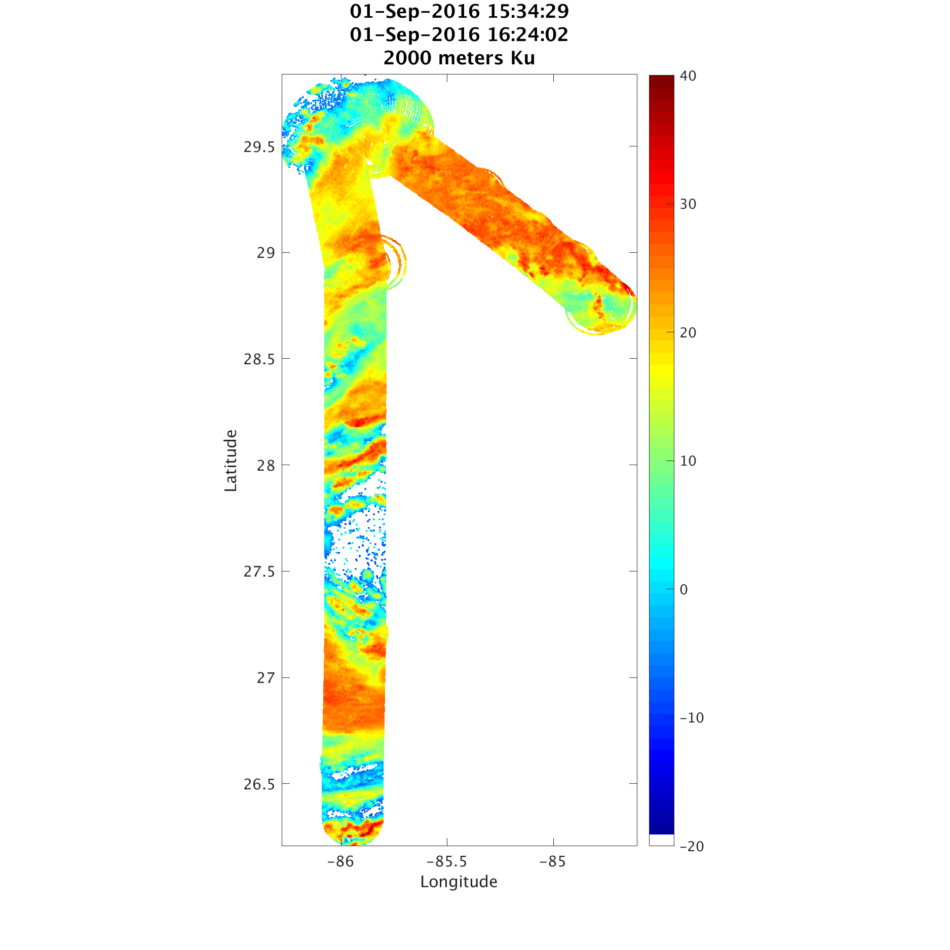
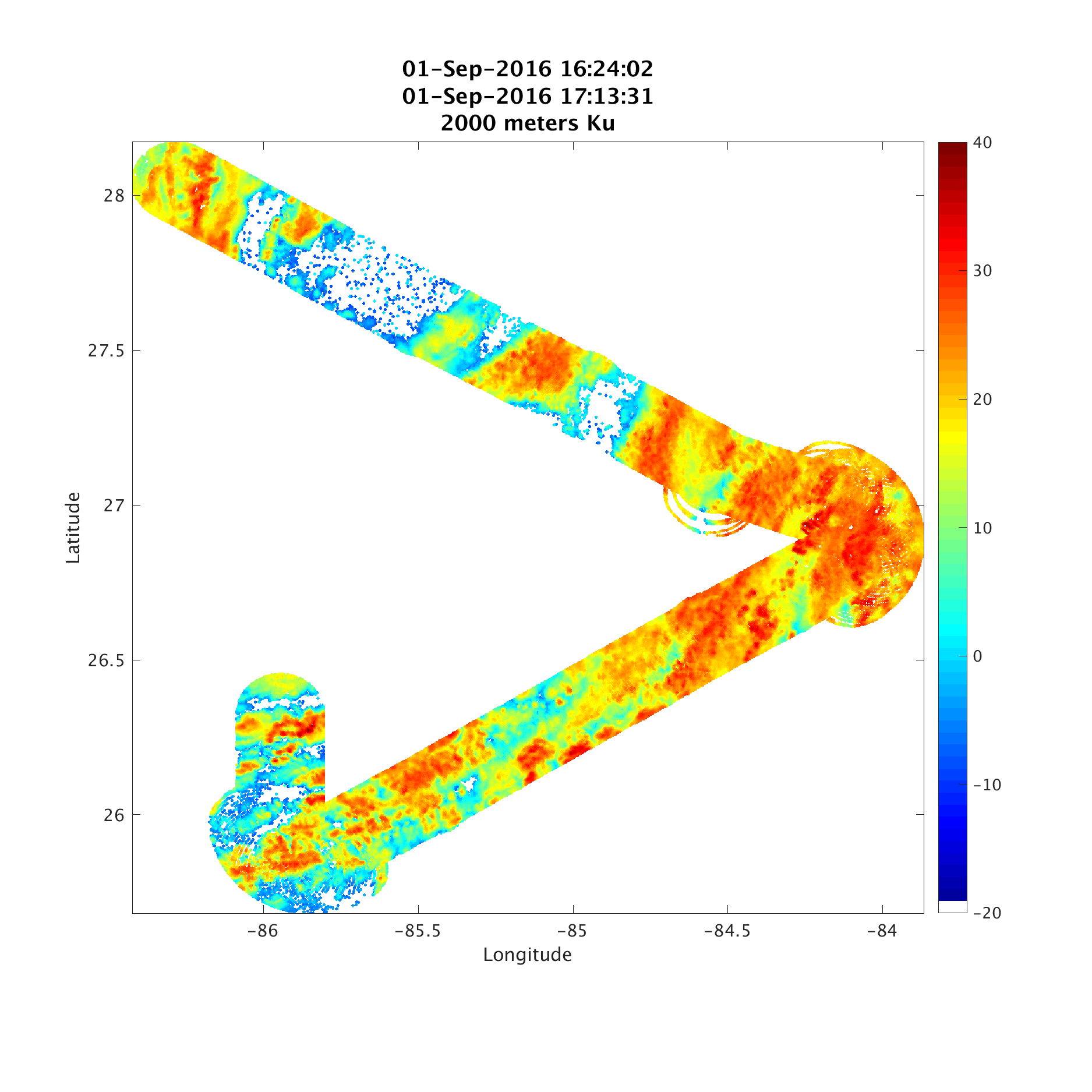
QLOOK_HIWRAP_OUTER_KU_HORIZ


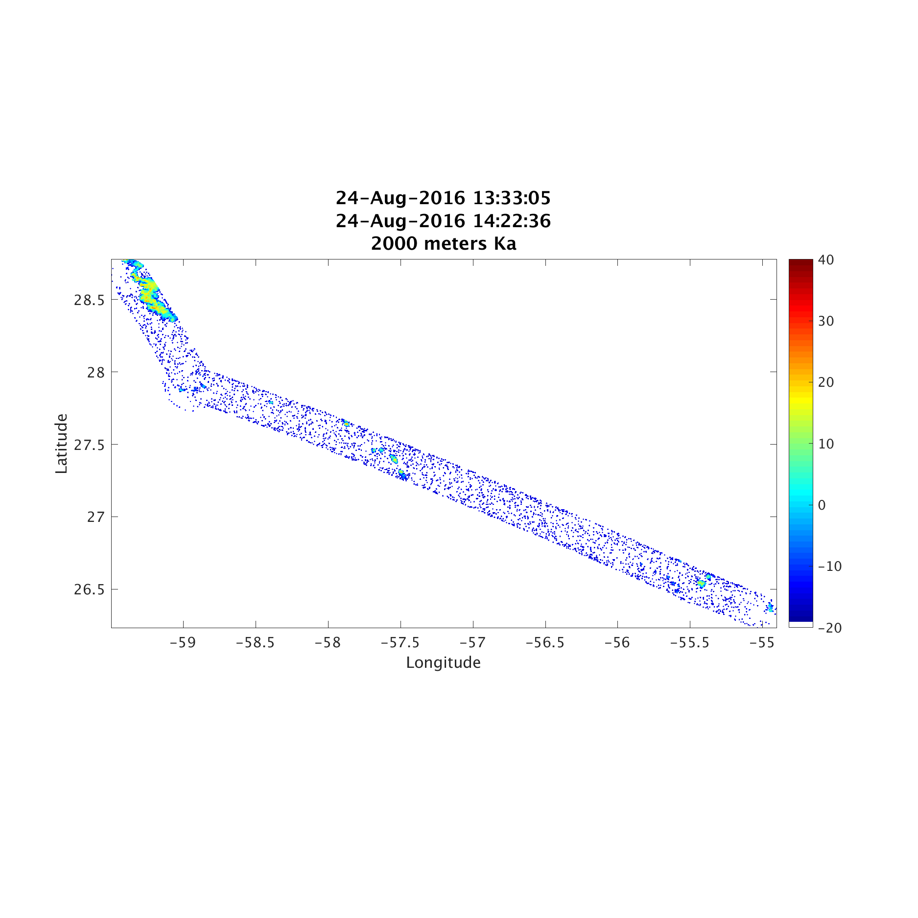
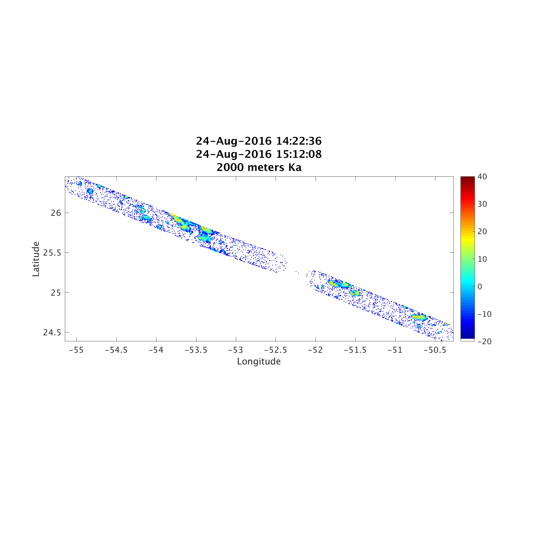


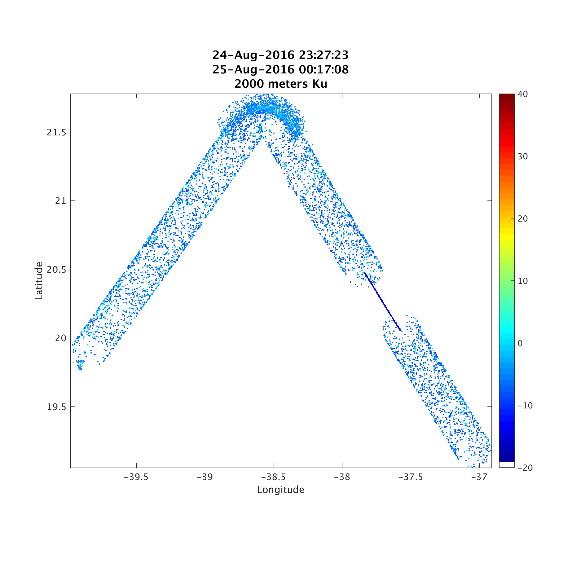
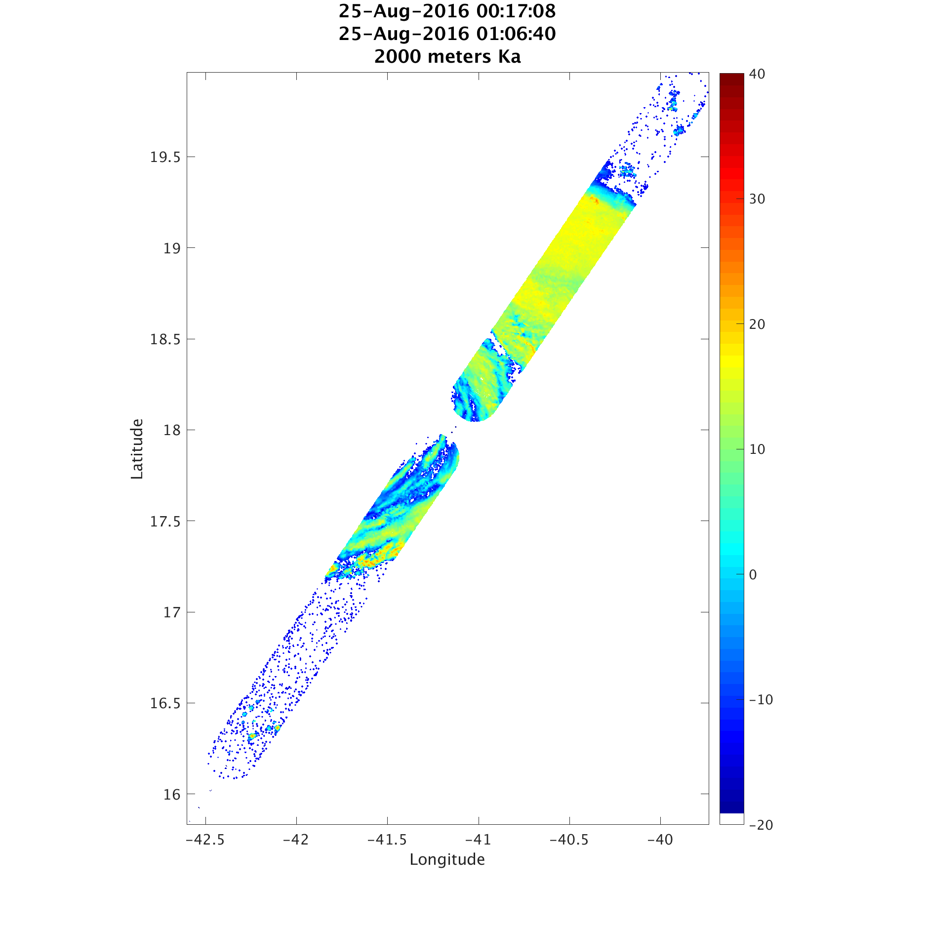

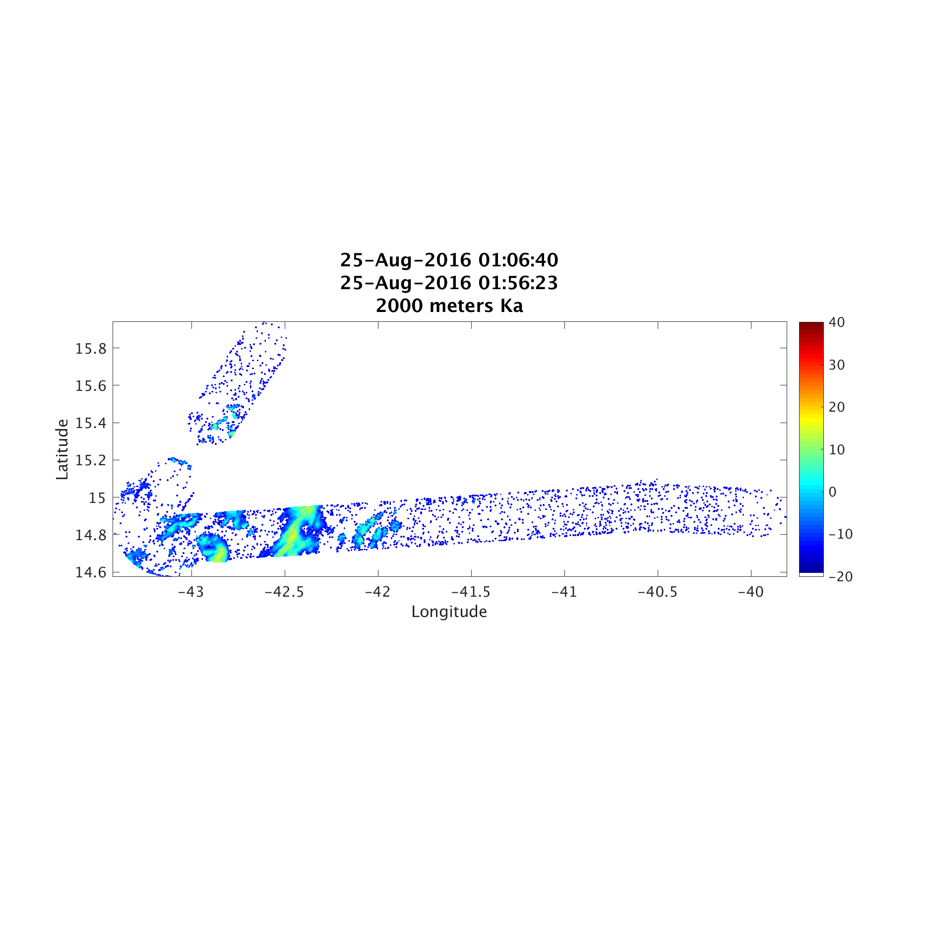

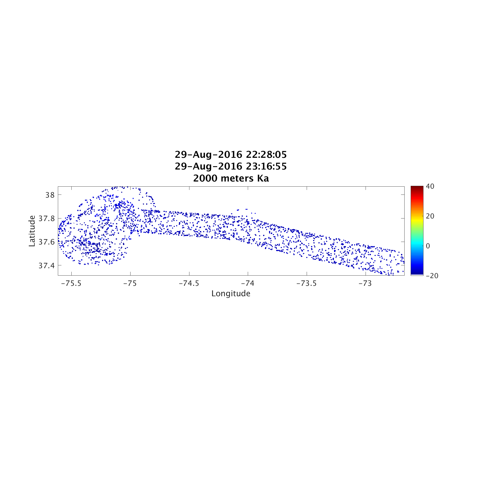


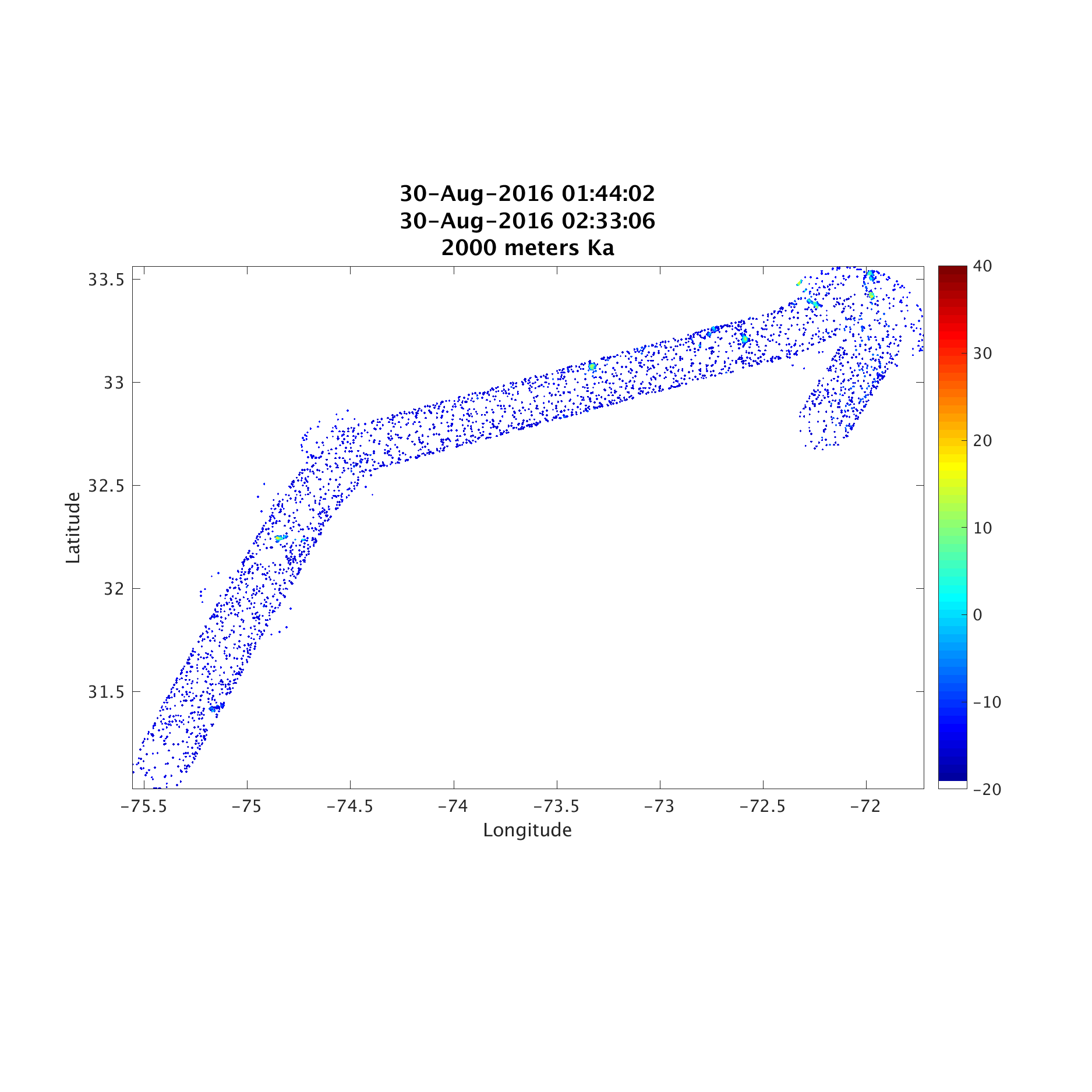

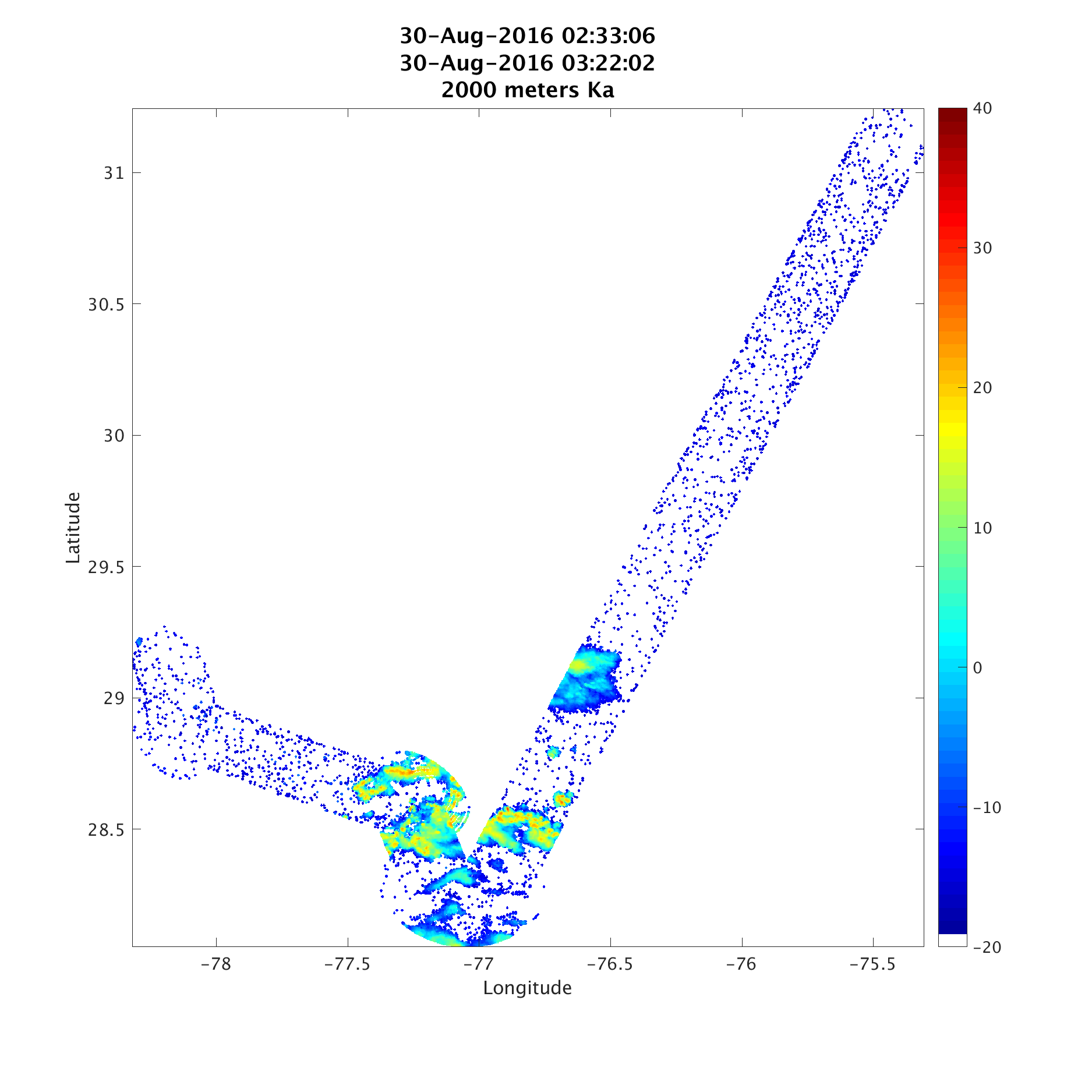


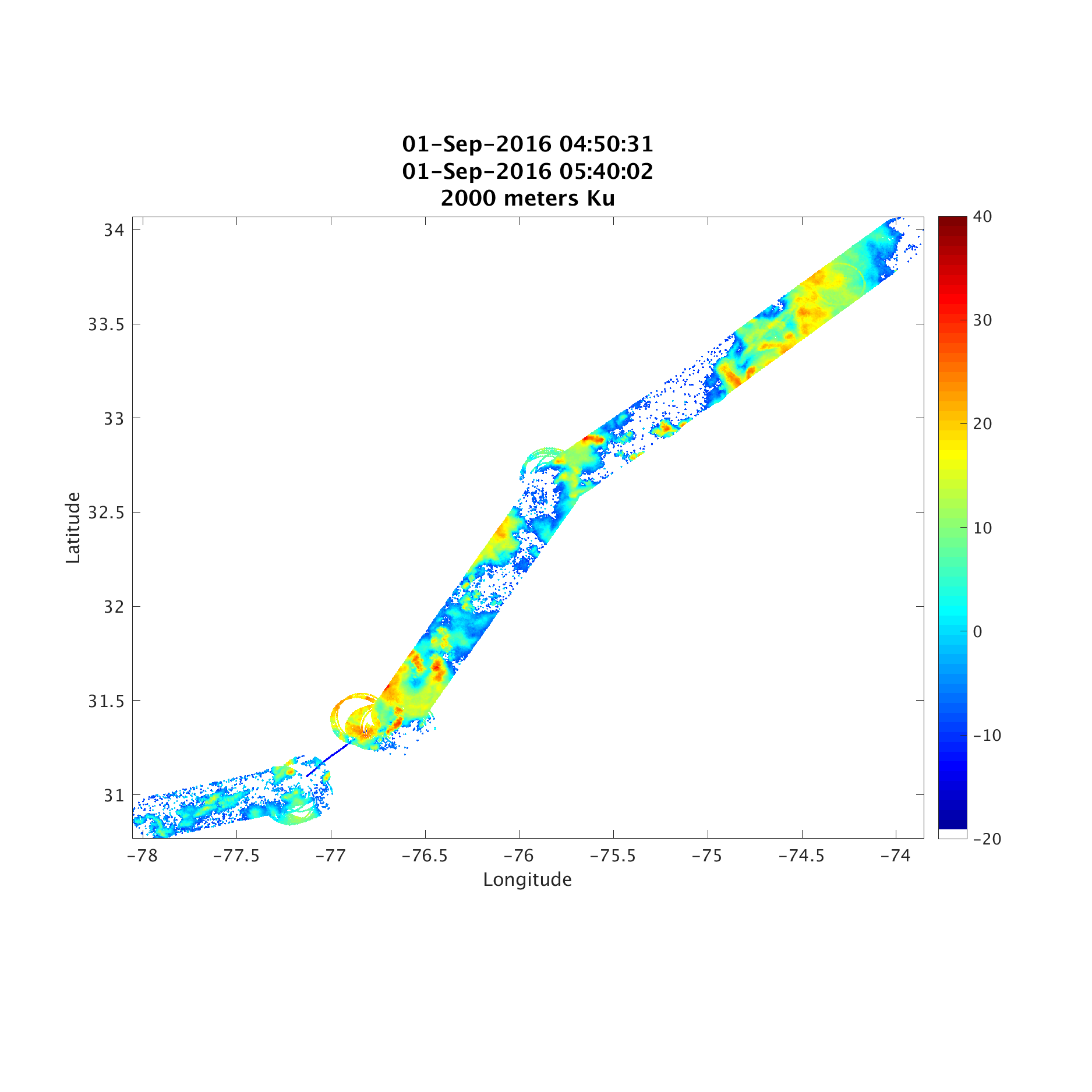


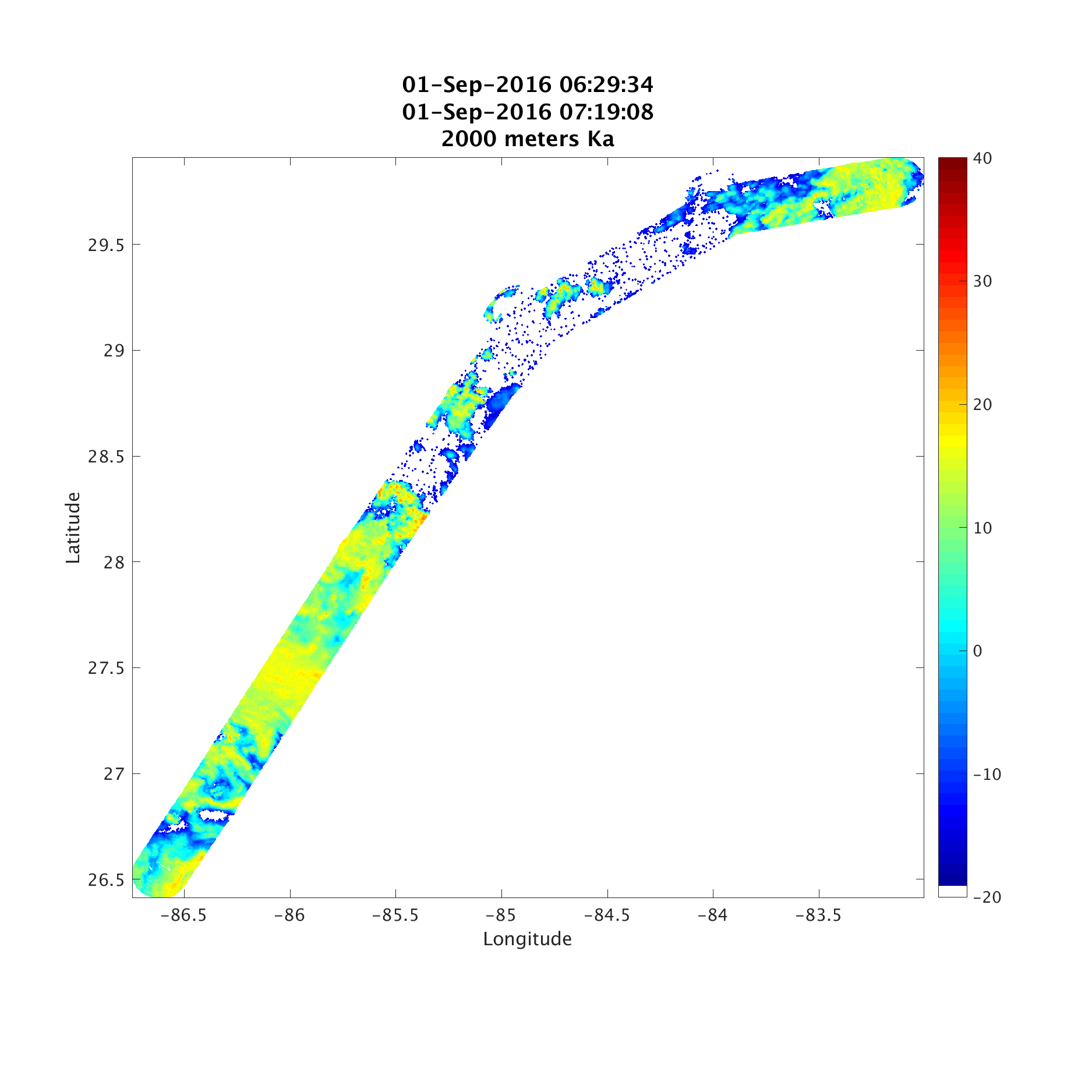

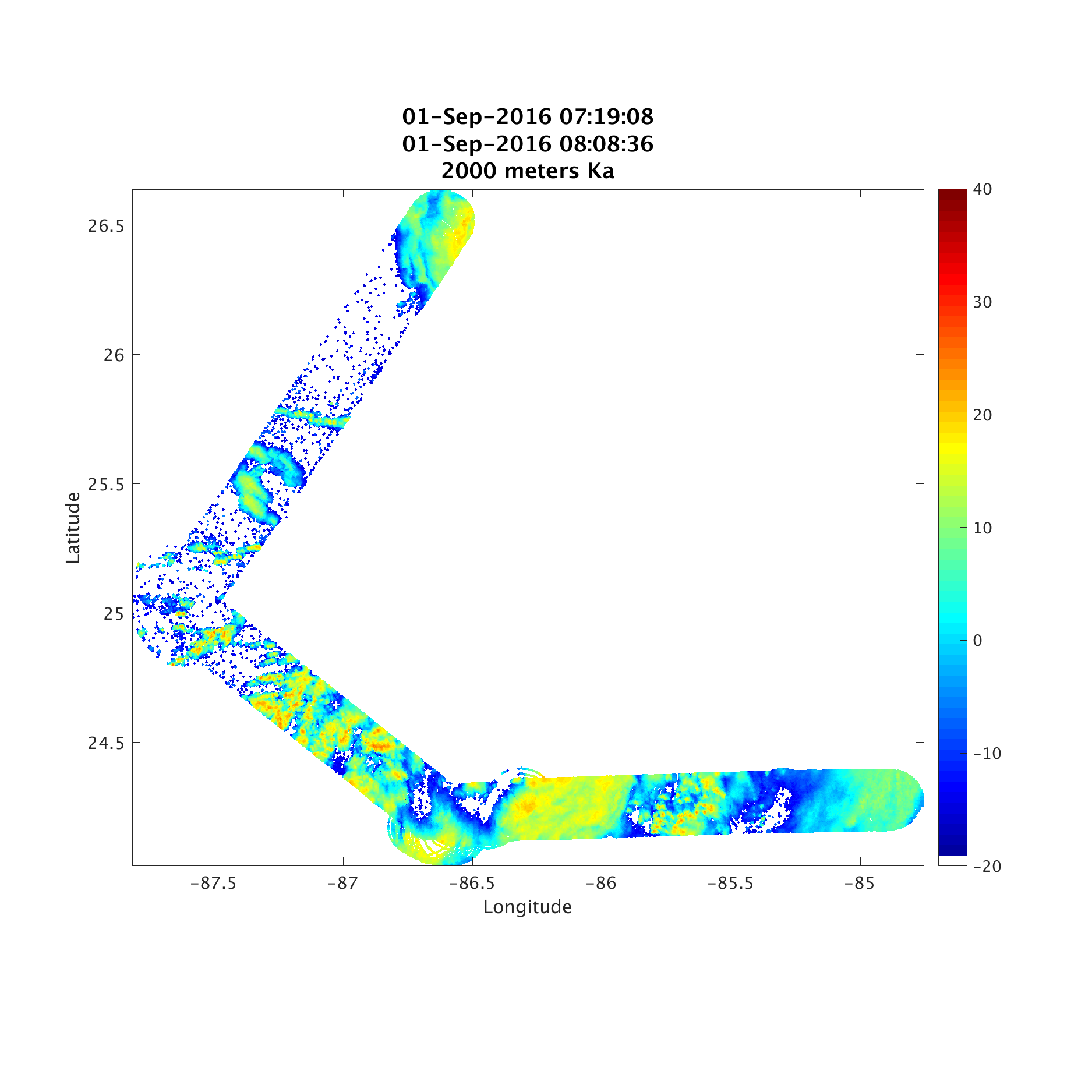

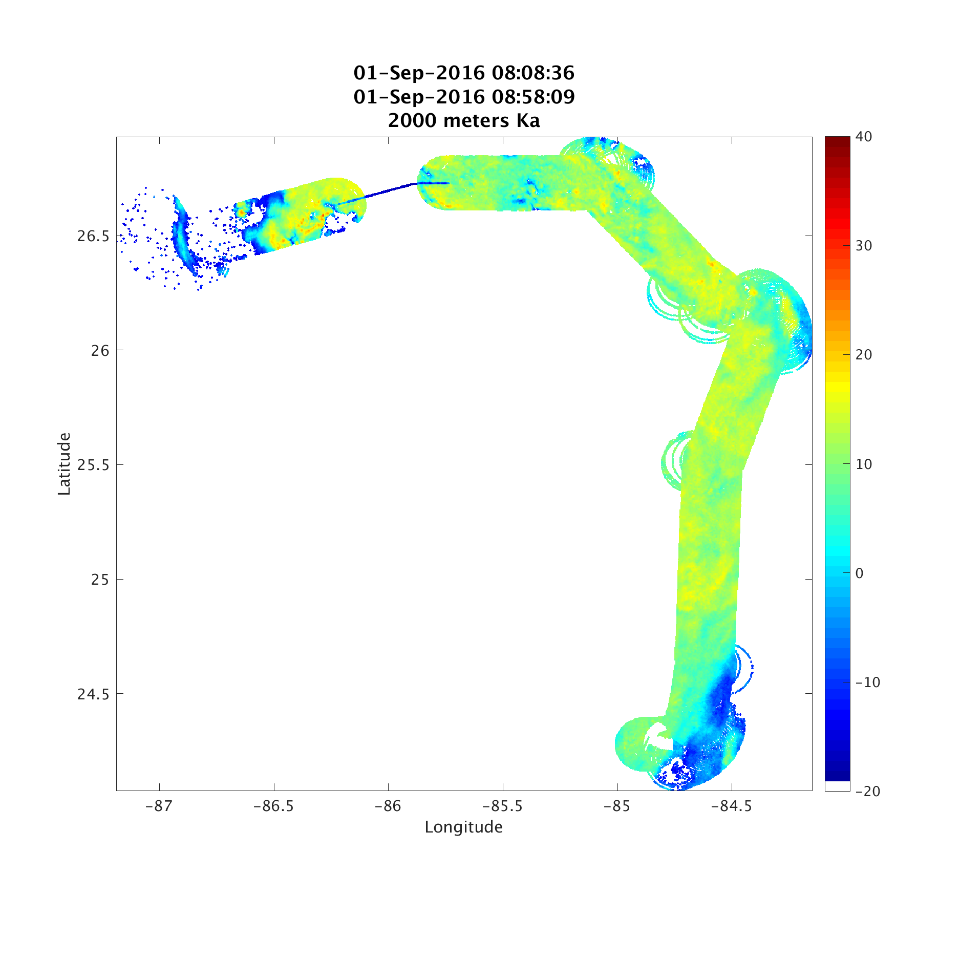


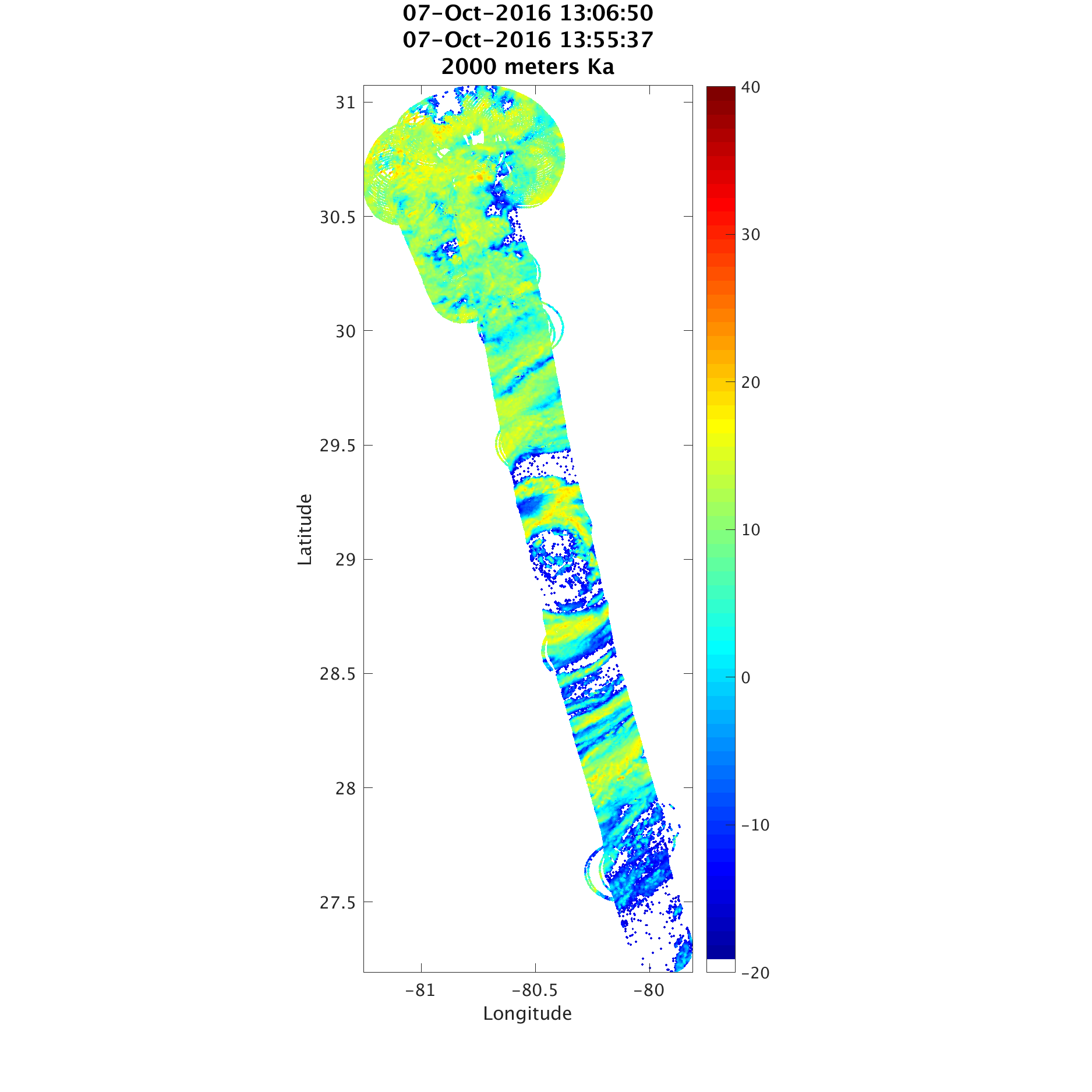


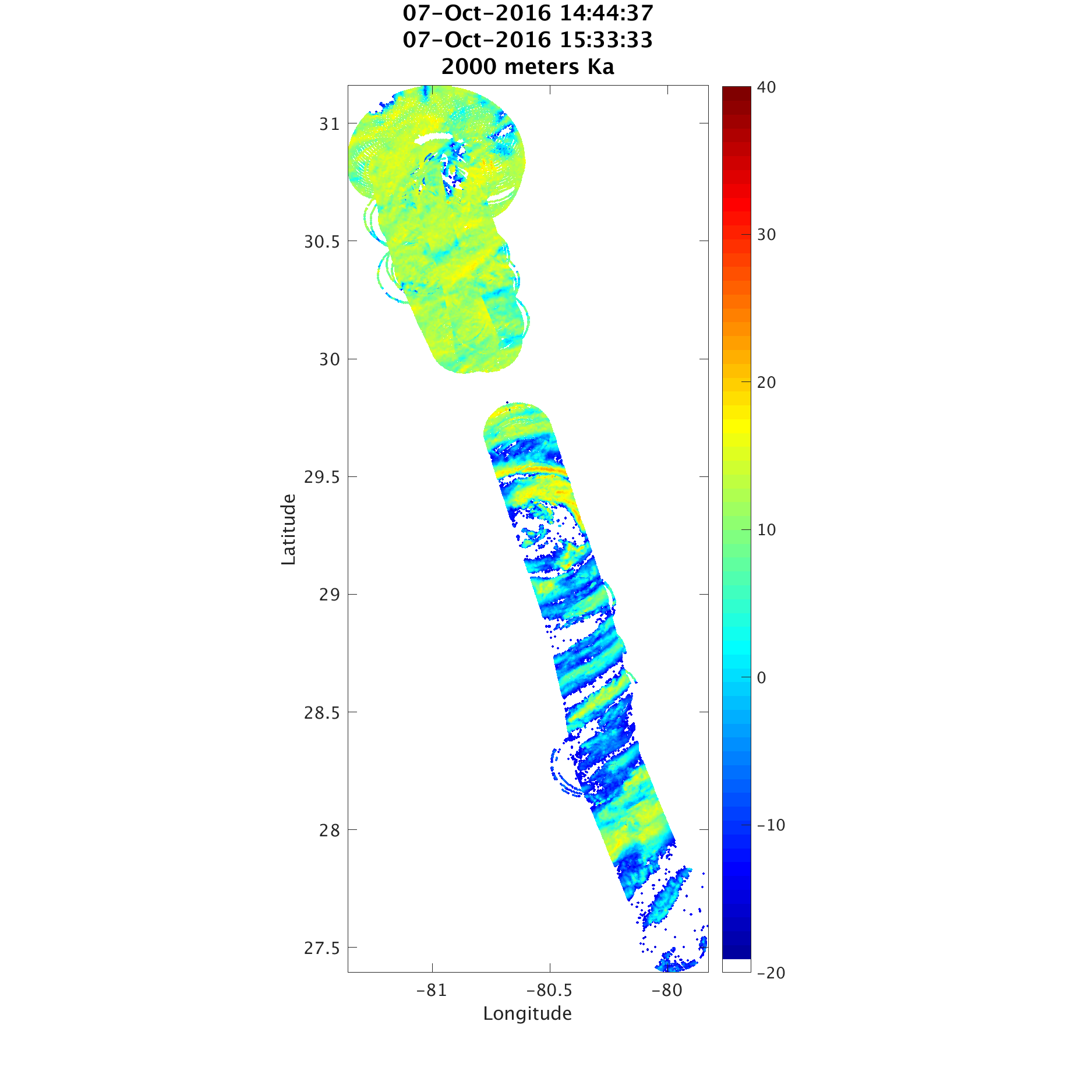


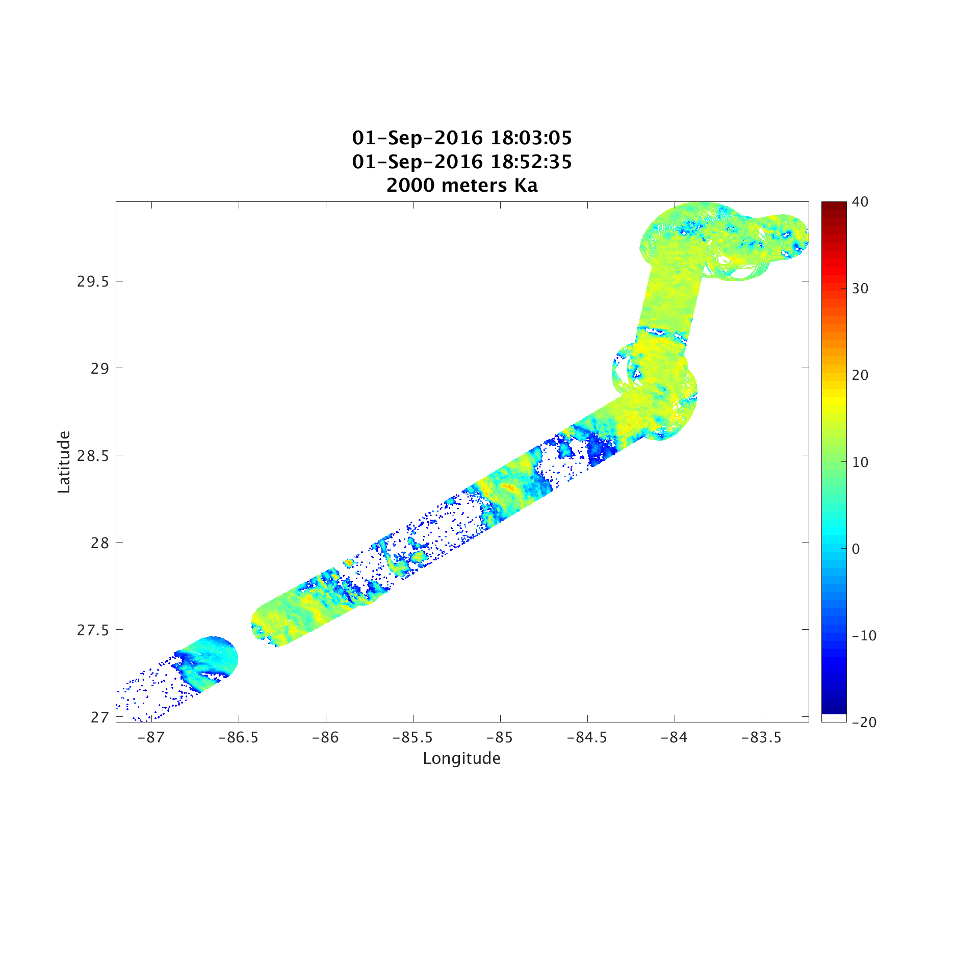
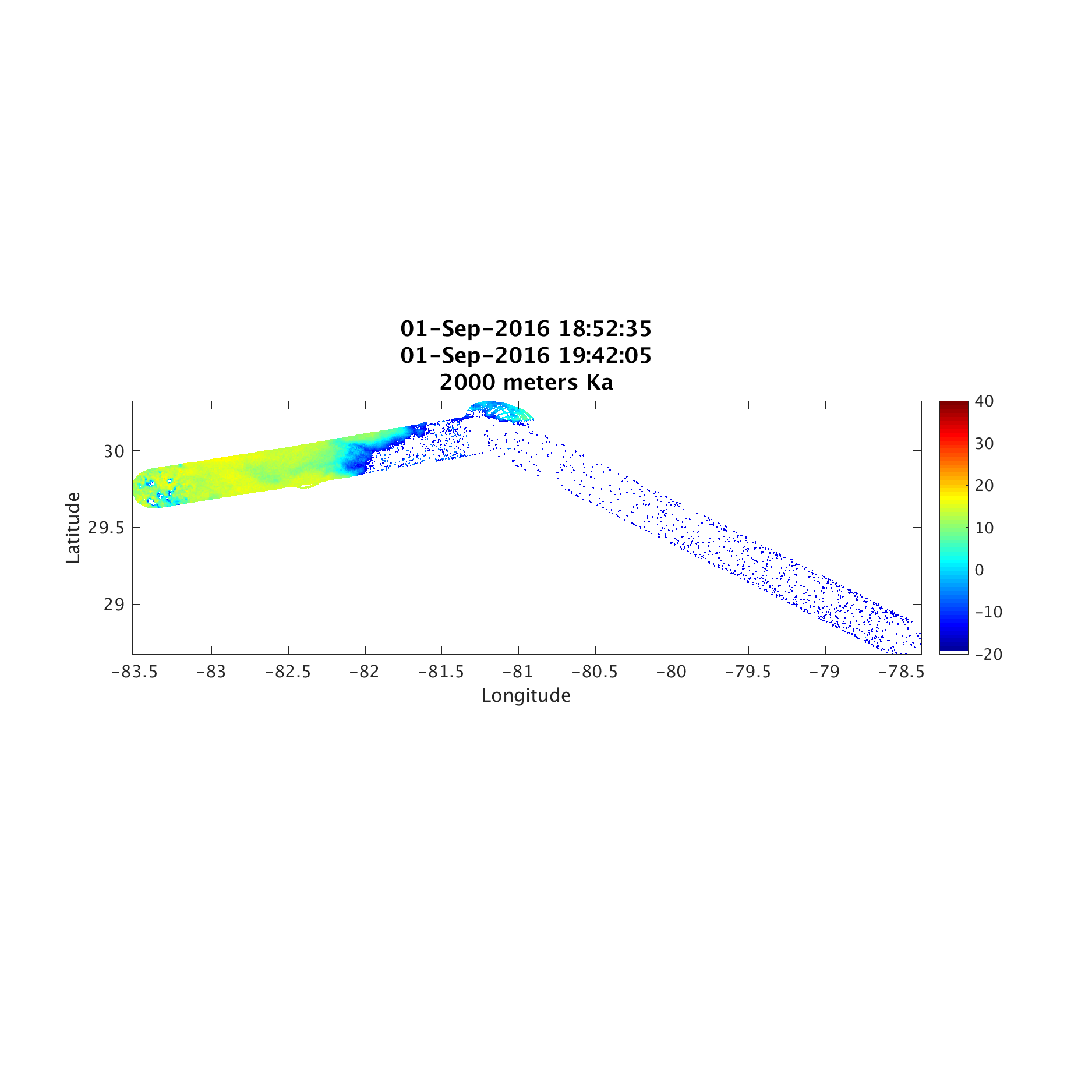
QLOOK_HIWRAP_REALTIME_KA


QLOOK_HIWRAP_OUTER_HORIZ


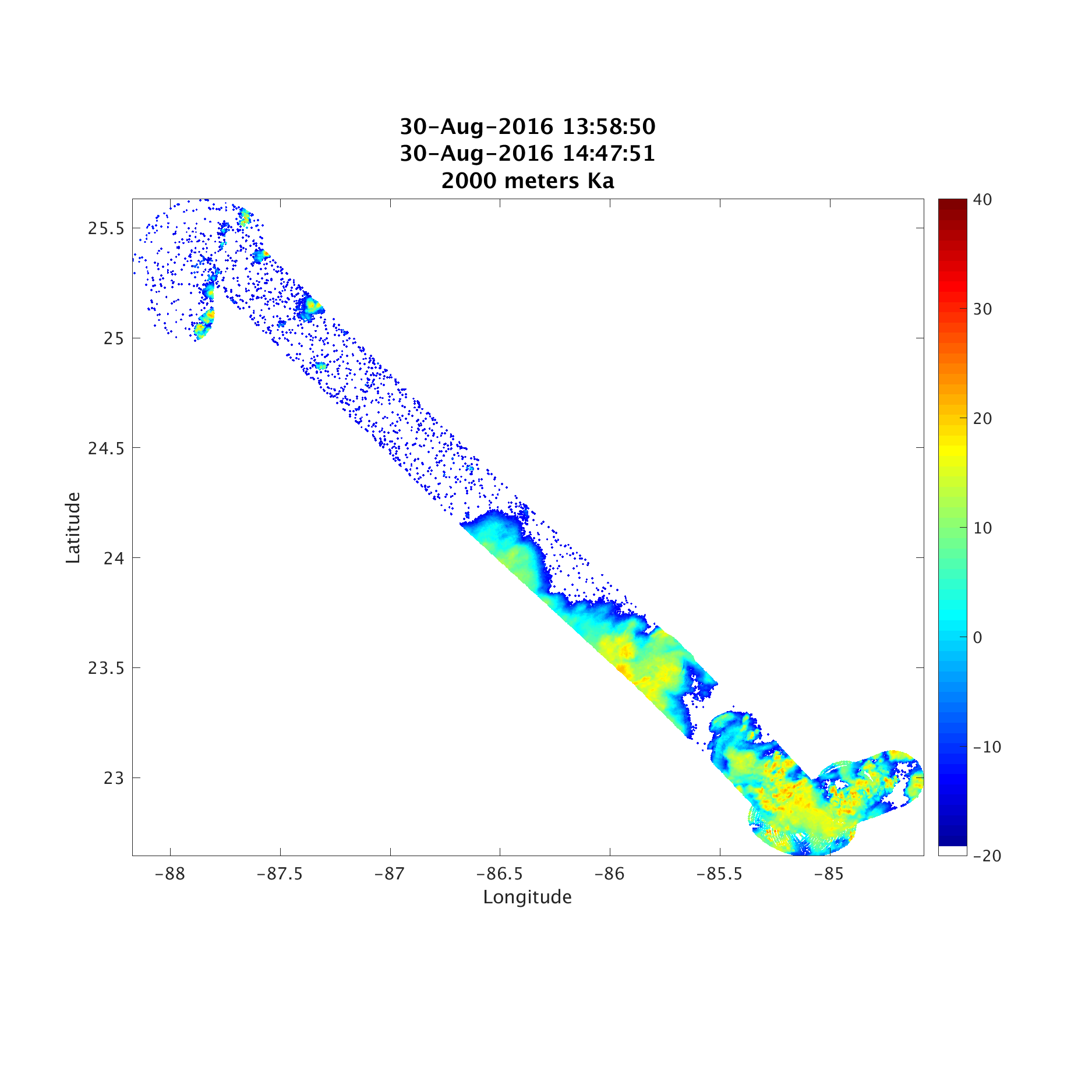


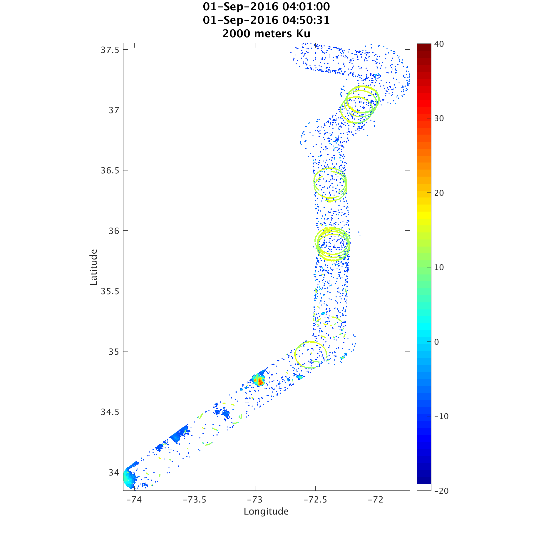
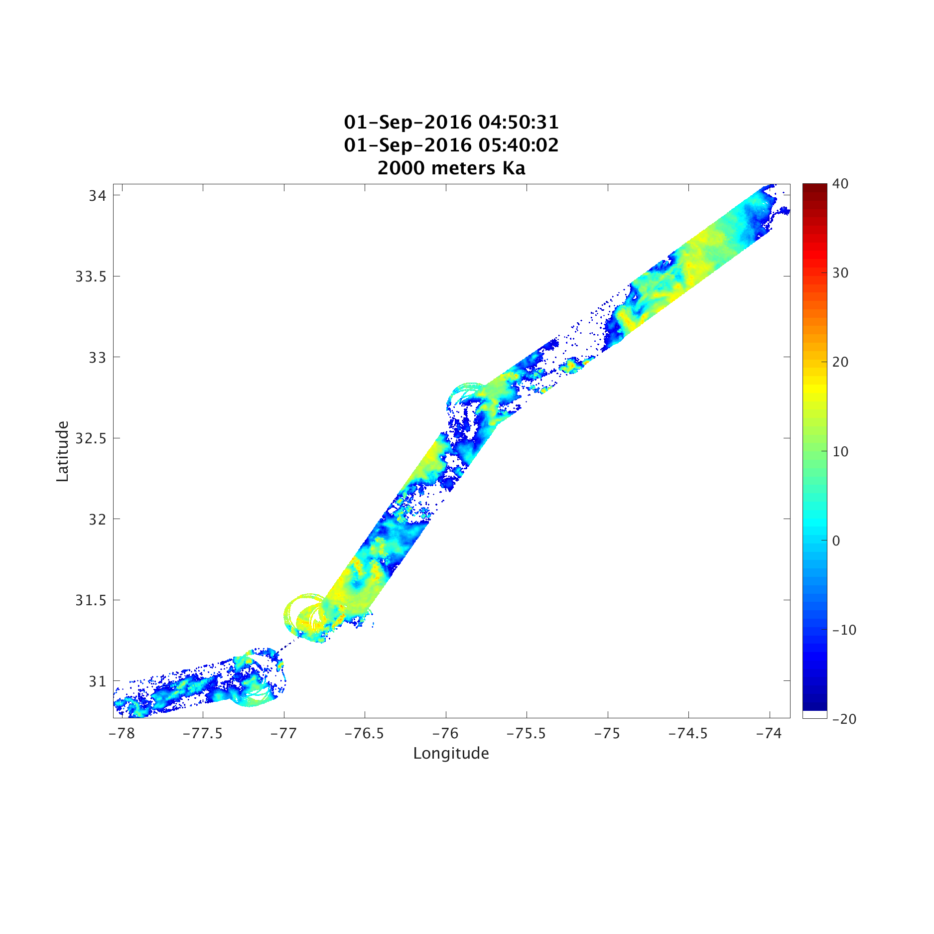

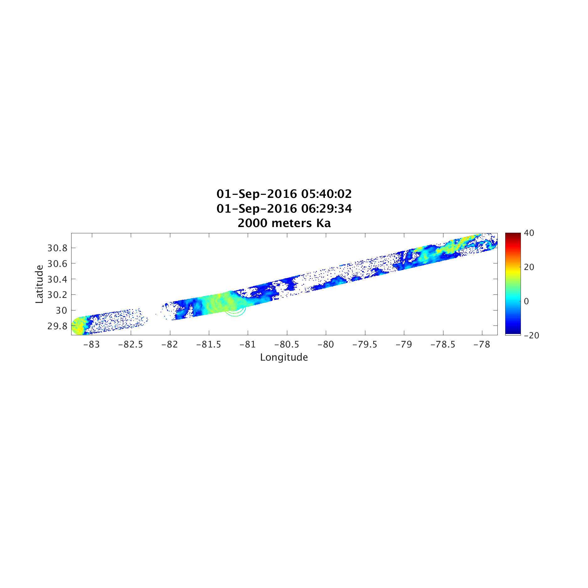


QLOOK_HIWRAP_PROCESSED_NADIR


QLOOK_HIWRAP_VAD_KU_INNER


HIWRAP_KML
- HIWRAP-Ku-9000m.kmz
- HIWRAP-Ka-10000m-FULL.kmz
- HIWRAP-Ka-10000m.kmz
- HIWRAP-Ku-FULL-10000m.kmz
- HIWRAP-Ka-2000m-FULL.kmz
- HIWRAP-Ka-2000m.kmz
- HIWRAP-Ku-FULL-3000m.kmz
- HIWRAP-Ka-3000m-FULL.kmz
- HIWRAP-Ka-3000m.kmz
- HIWRAP-Ku-FULL-2000m.kmz
- HIWRAP-Ka-4000m-FULL.kmz
- HIWRAP-Ka-4000m.kmz
- HIWRAP-Ku-FULL-4000m.kmz
- HIWRAP-Ka-5000m-FULL.kmz
- HIWRAP-Ka-5000m.kmz
- HIWRAP-Ku-FULL-5000m.kmz
- HIWRAP-Ka-6000m-FULL.kmz
- HIWRAP-Ka-6000m.kmz
- HIWRAP-Ku-FULL-6000m.kmz
- HIWRAP-Ka-7000m-FULL.kmz
- HIWRAP-Ka-7000m.kmz
- HIWRAP-Ku-FULL-7000m.kmz
- HIWRAP-Ka-8000m-FULL.kmz
- HIWRAP-Ka-8000m.kmz
- HIWRAP-Ka-9000m-FULL.kmz
- HIWRAP-Ka-9000m.kmz
- HIWRAP-Ka-FULL-10000m.kmz
- HIWRAP-Ka-FULL-2000m.kmz
- HIWRAP-Ka-FULL-3000m.kmz
- HIWRAP-Ka-FULL-4000m.kmz
- HIWRAP-Ka-FULL-5000m.kmz
- HIWRAP-Ka-FULL-6000m.kmz
- HIWRAP-Ka-FULL-7000m.kmz
- HIWRAP-Ka-FULL-8000m.kmz
- HIWRAP-Ka-FULL-9000m.kmz
- HIWRAP-Ku-10000m-FULL.kmz
- HIWRAP-Ku-10000m.kmz
- HIWRAP-Ku-2000m-FULL.kmz
- HIWRAP-Ku-2000m.kmz
- HIWRAP-Ku-3000m-FULL.kmz
- HIWRAP-Ku-3000m.kmz
- HIWRAP-Ku-4000m-FULL.kmz
- HIWRAP-Ku-4000m.kmz
- HIWRAP-Ku-5000m-FULL.kmz
- HIWRAP-Ku-5000m.kmz
- HIWRAP-Ku-6000m-FULL.kmz
- HIWRAP-Ku-6000m.kmz
- HIWRAP-Ku-7000m-FULL.kmz
- HIWRAP-Ku-7000m.kmz
- HIWRAP-Ku-8000m-FULL.kmz
- HIWRAP-Ku-8000m.kmz
- HIWRAP-Ku-9000m-FULL.kmz
- HIWRAP-Ku-FULL-8000m.kmz
- HIWRAP-Ku-FULL-9000m.kmz
- HIWRAP_RealTimeVerticalPlot.kmz
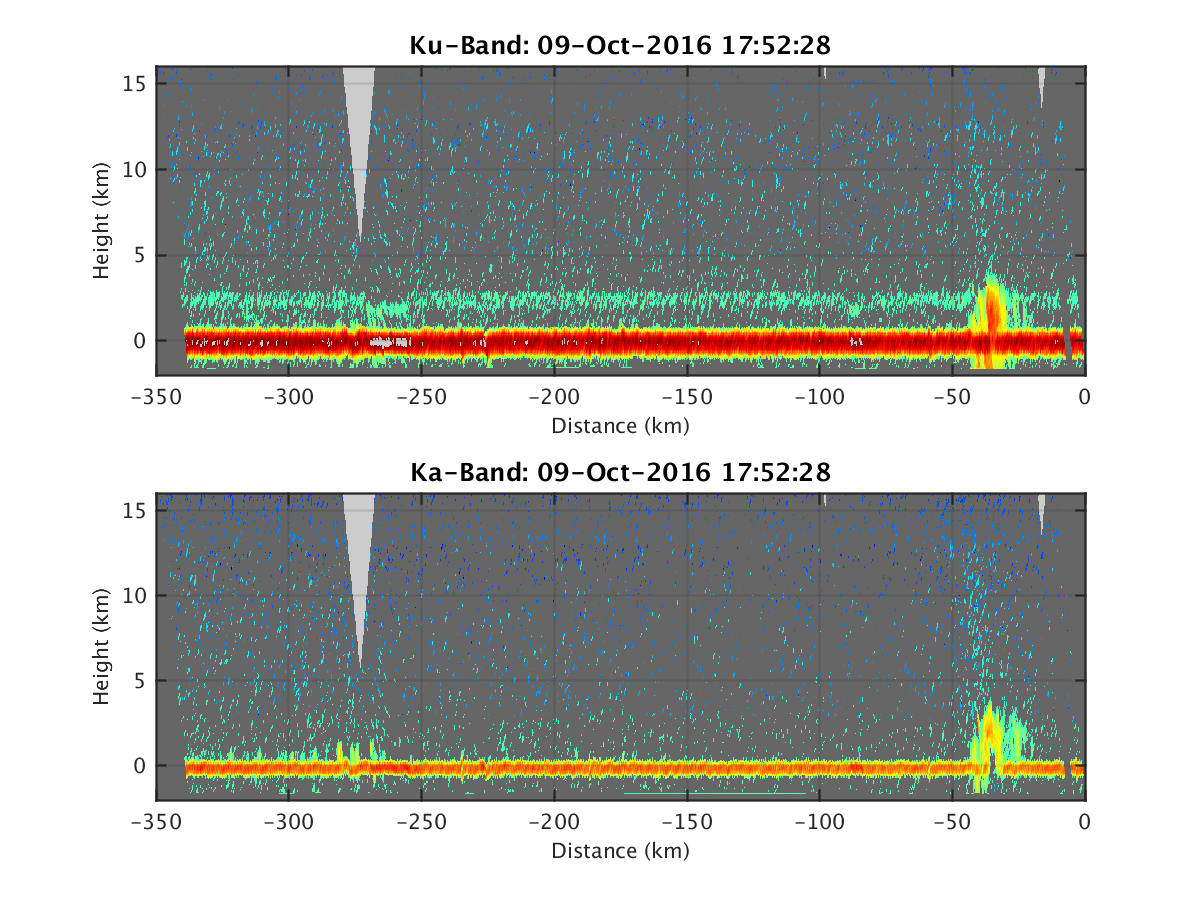
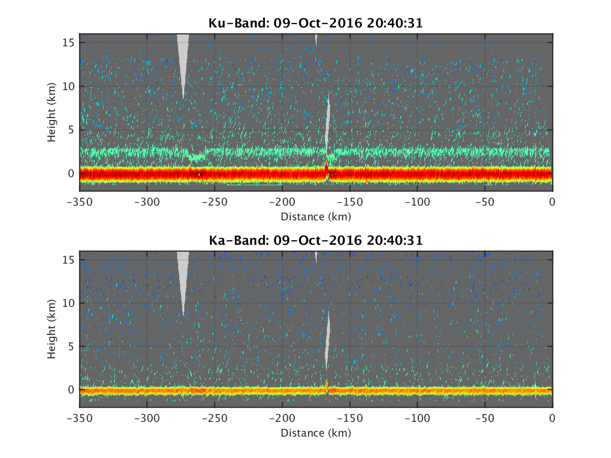
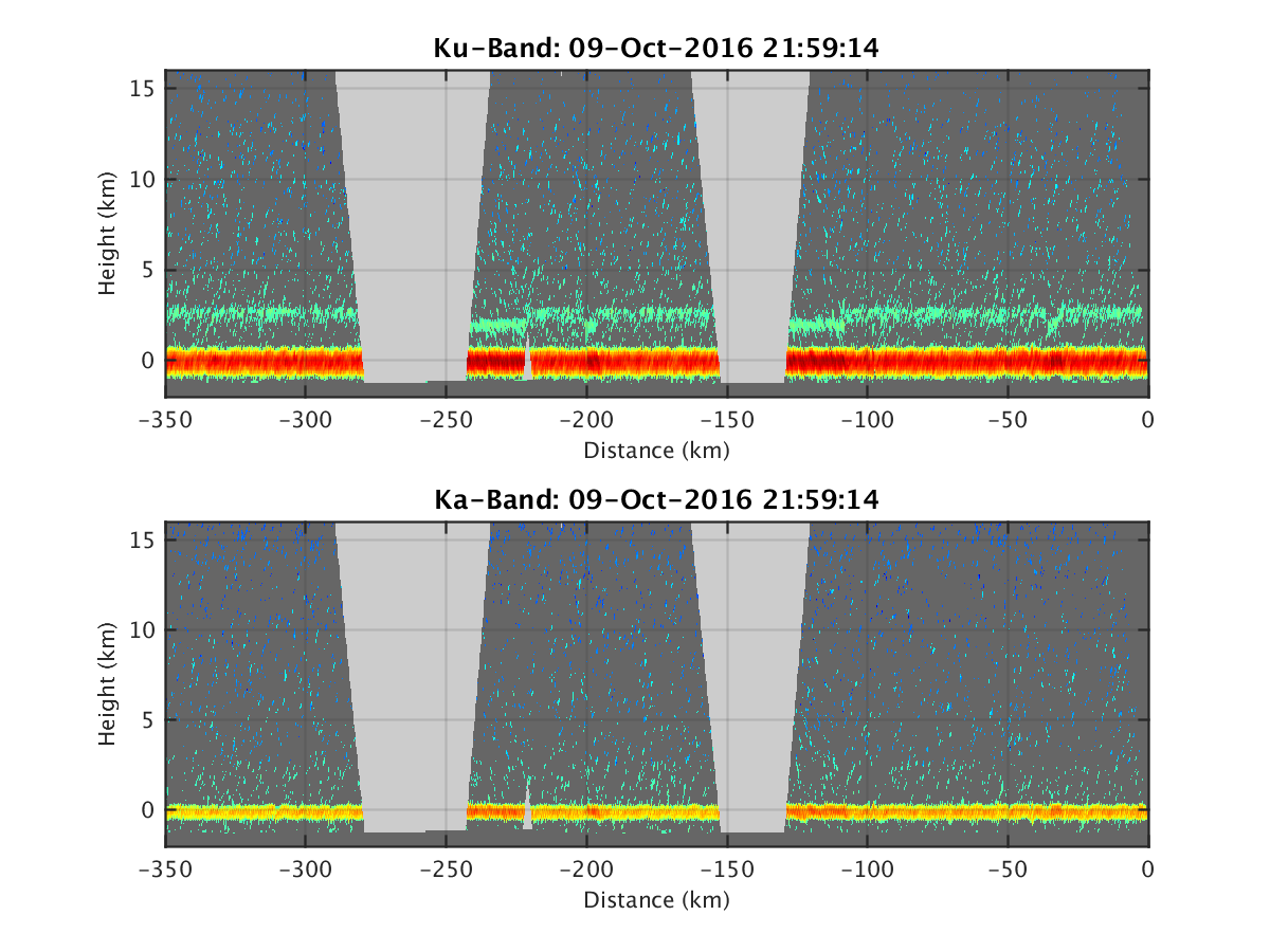
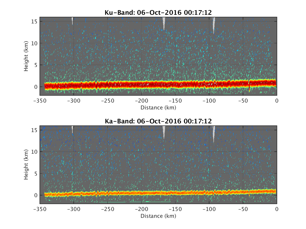
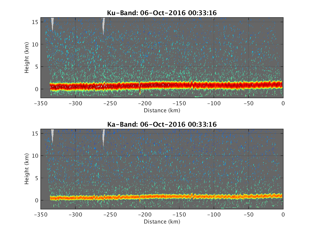
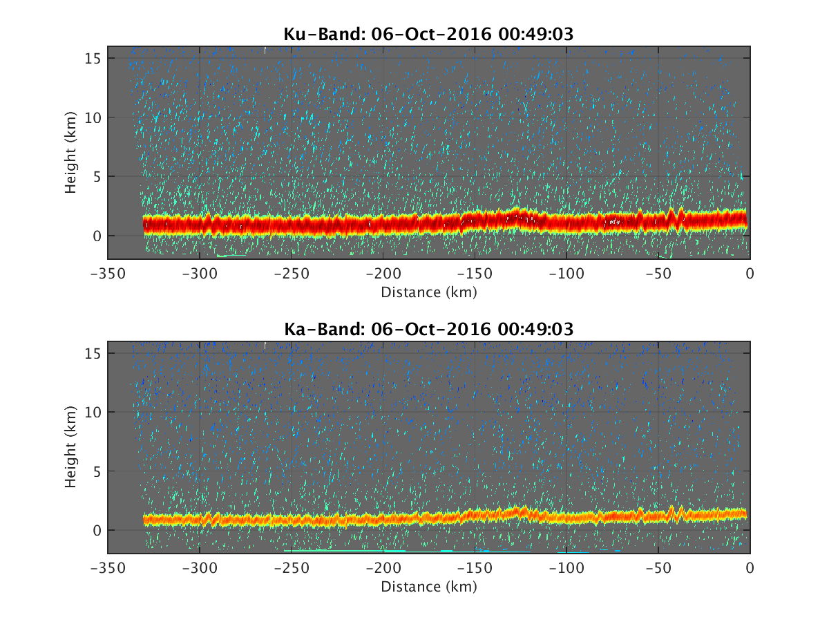
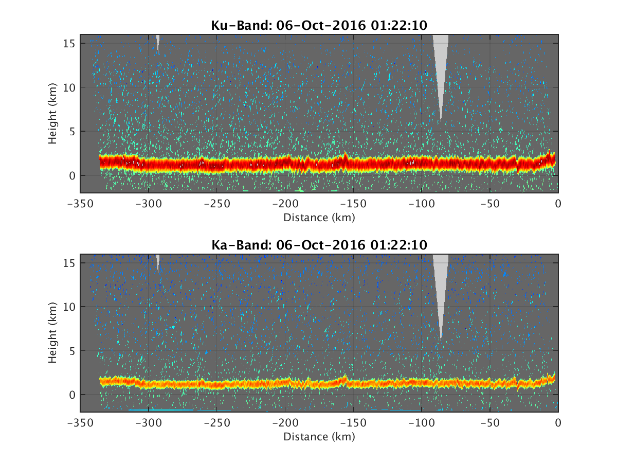
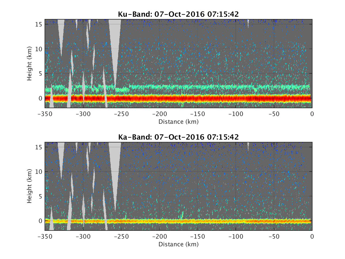
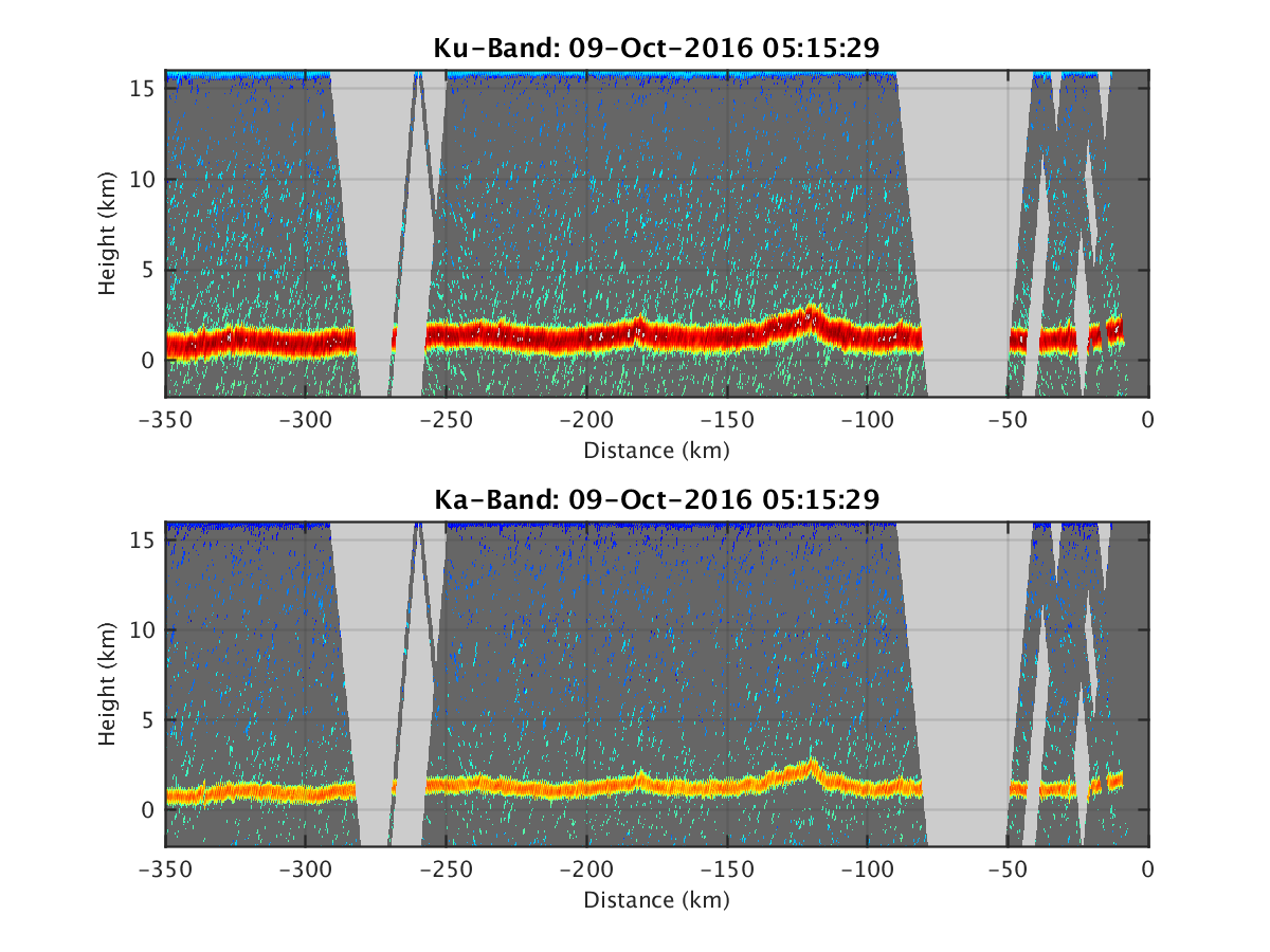
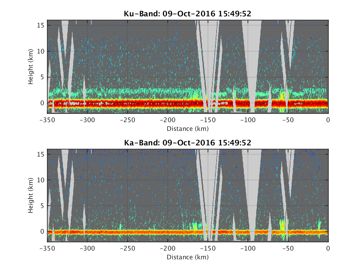
- HIWRAP_RealTimeVerticalPlot.png
- HIWRAP_RealTimeVerticalPlot_20161006T001712.png
- HIWRAP_RealTimeVerticalPlot_20161006T003316.png
- HIWRAP_RealTimeVerticalPlot_20161006T004903.png
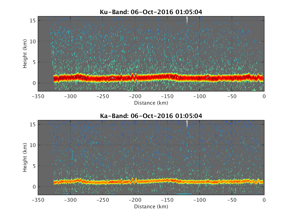
- HIWRAP_RealTimeVerticalPlot_20161006T010504.png
- HIWRAP_RealTimeVerticalPlot_20161006T012210.png
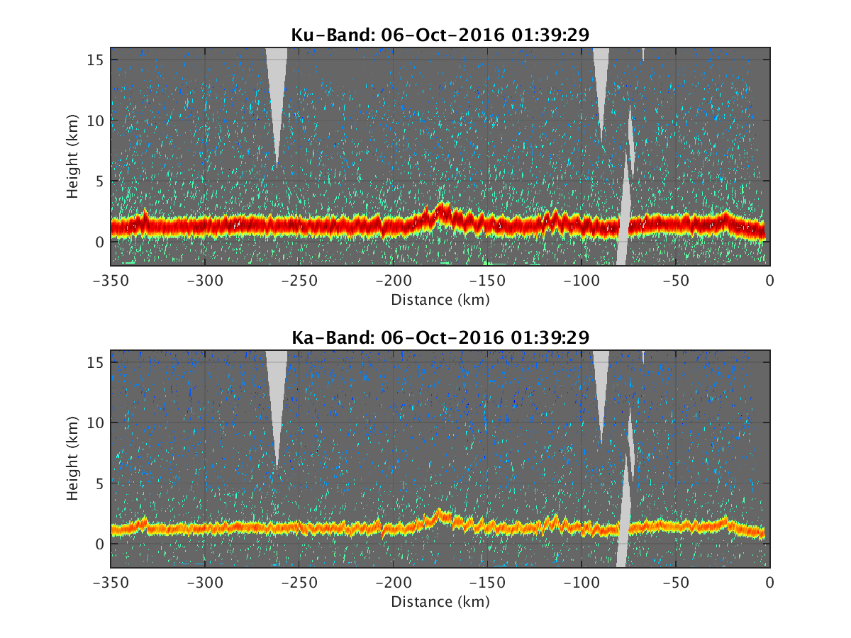
- HIWRAP_RealTimeVerticalPlot_20161006T013929.png
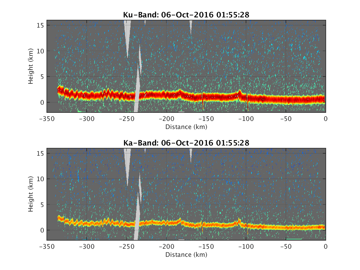
- HIWRAP_RealTimeVerticalPlot_20161006T015528.png
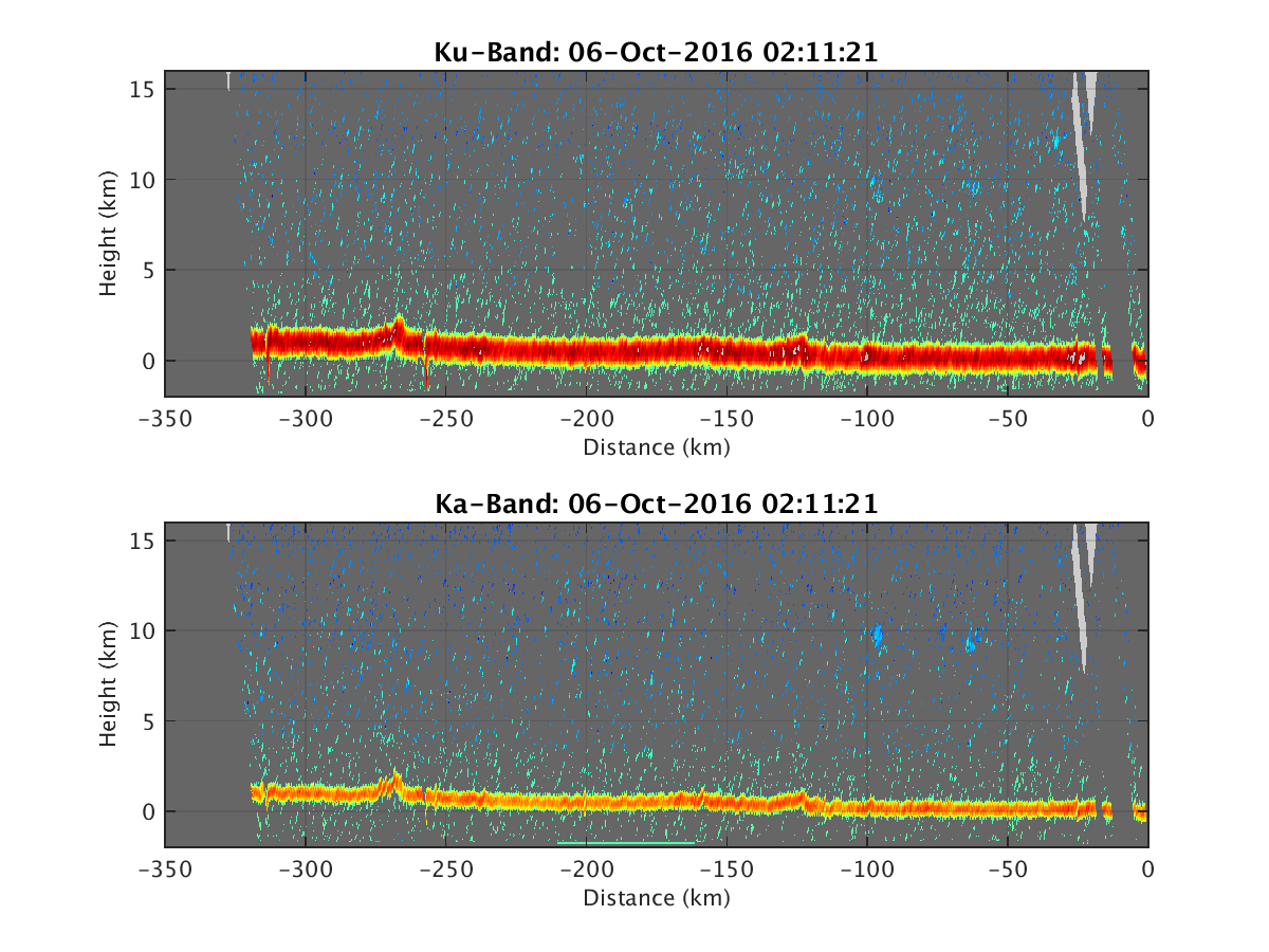
- HIWRAP_RealTimeVerticalPlot_20161006T021121.png
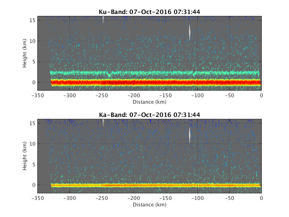
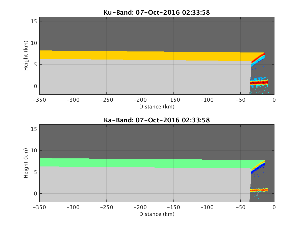
- HIWRAP_RealTimeVerticalPlot_20161007T023358.png
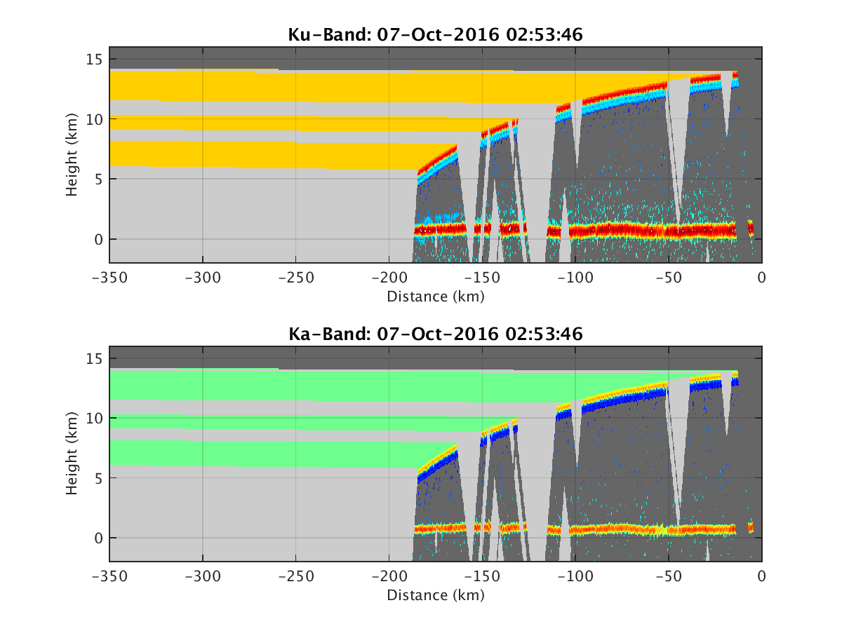
- HIWRAP_RealTimeVerticalPlot_20161007T025346.png
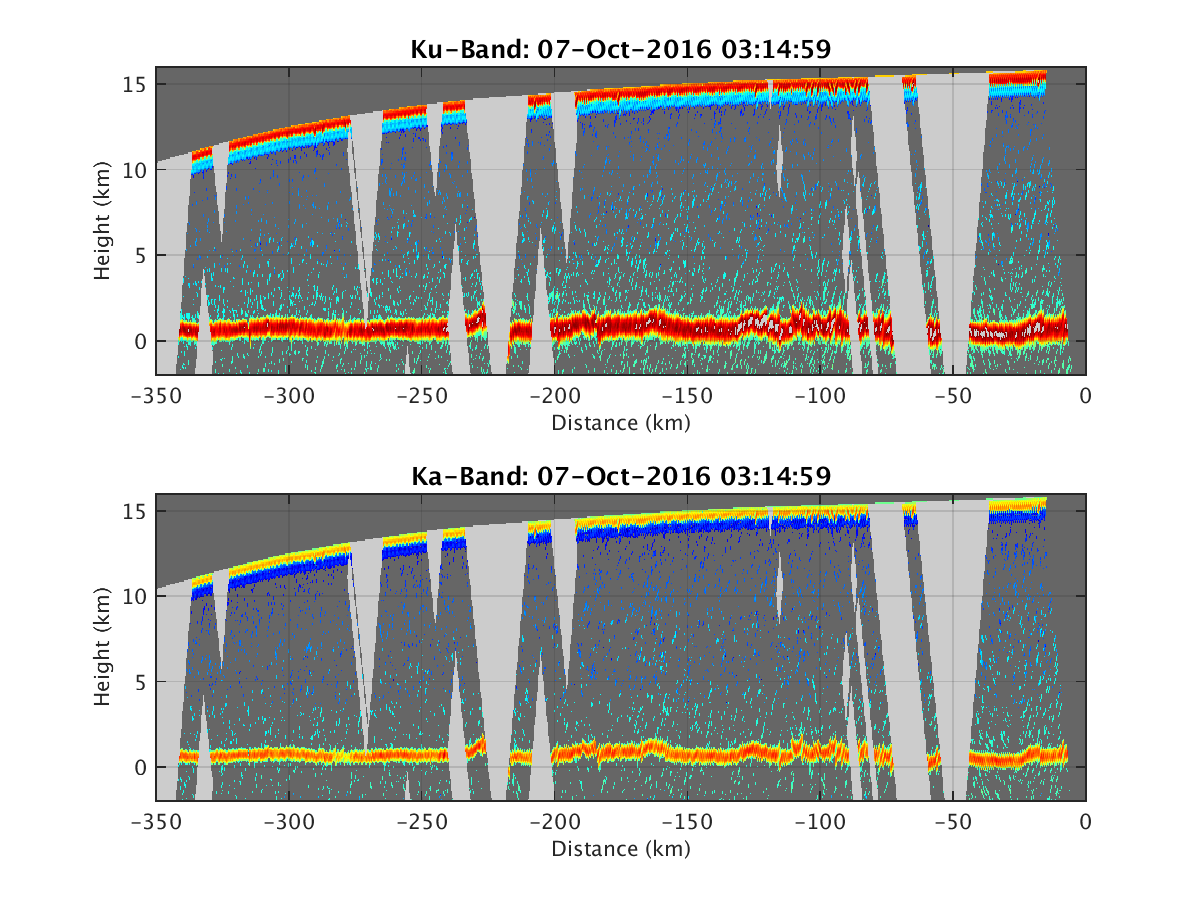
- HIWRAP_RealTimeVerticalPlot_20161007T031459.png
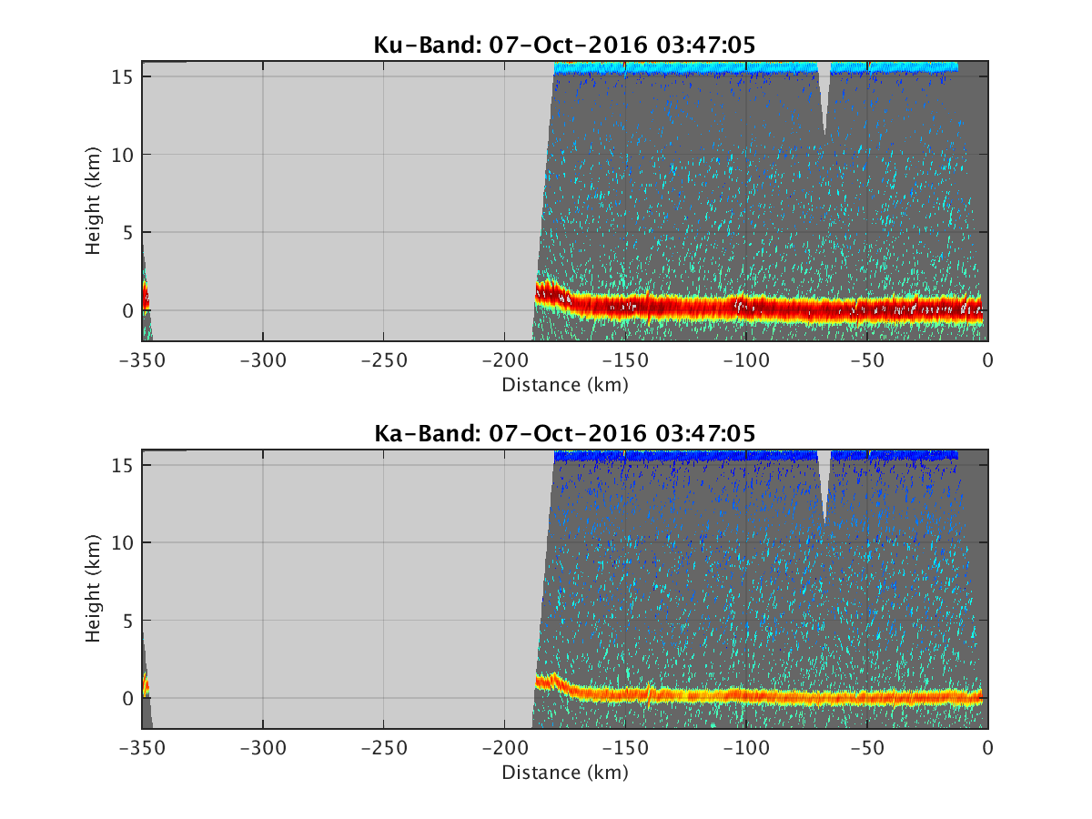
- HIWRAP_RealTimeVerticalPlot_20161007T034705.png
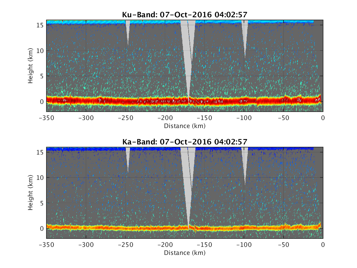
- HIWRAP_RealTimeVerticalPlot_20161007T040257.png
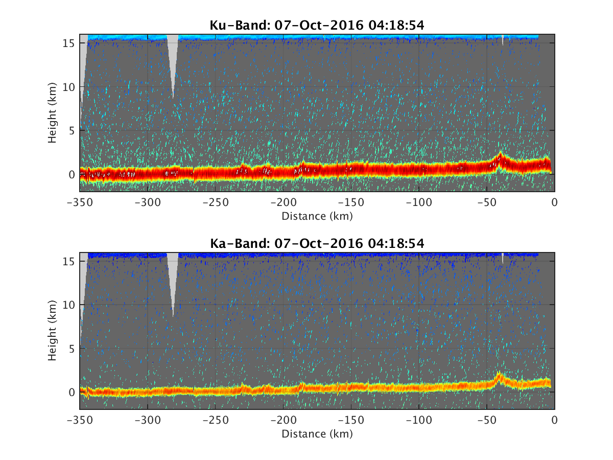
- HIWRAP_RealTimeVerticalPlot_20161007T041854.png
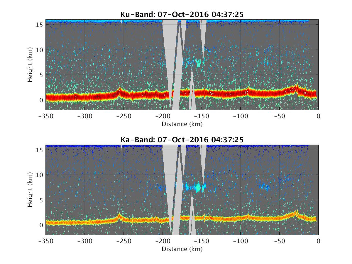
- HIWRAP_RealTimeVerticalPlot_20161007T043725.png
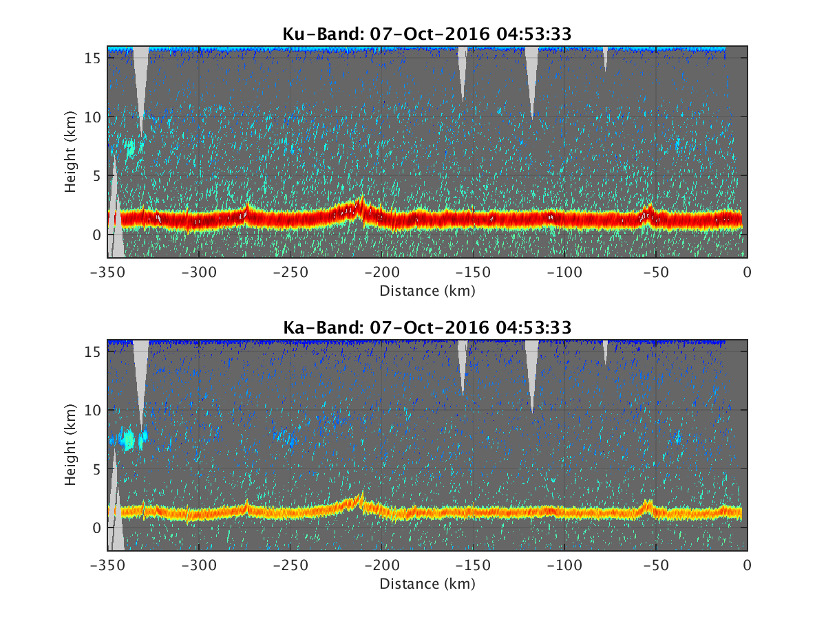
- HIWRAP_RealTimeVerticalPlot_20161007T045333.png
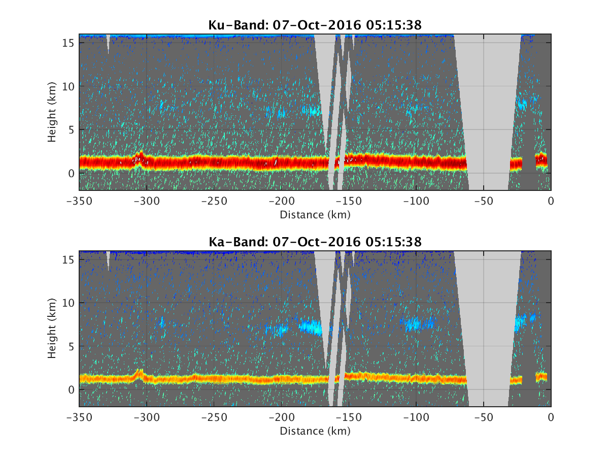
- HIWRAP_RealTimeVerticalPlot_20161007T051538.png
- HIWRAP_RealTimeVerticalPlot_20161007T053133.png
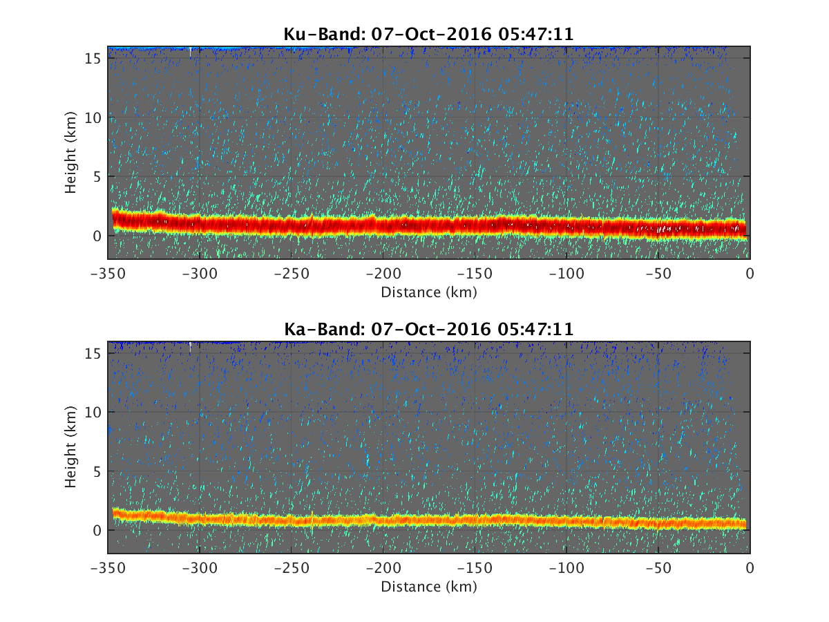
- HIWRAP_RealTimeVerticalPlot_20161007T054711.png
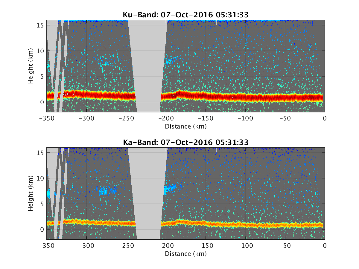
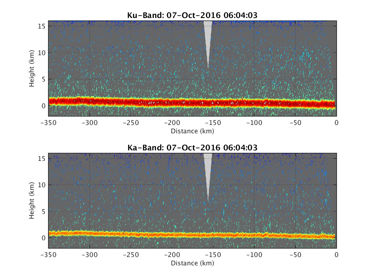
- HIWRAP_RealTimeVerticalPlot_20161007T060403.png
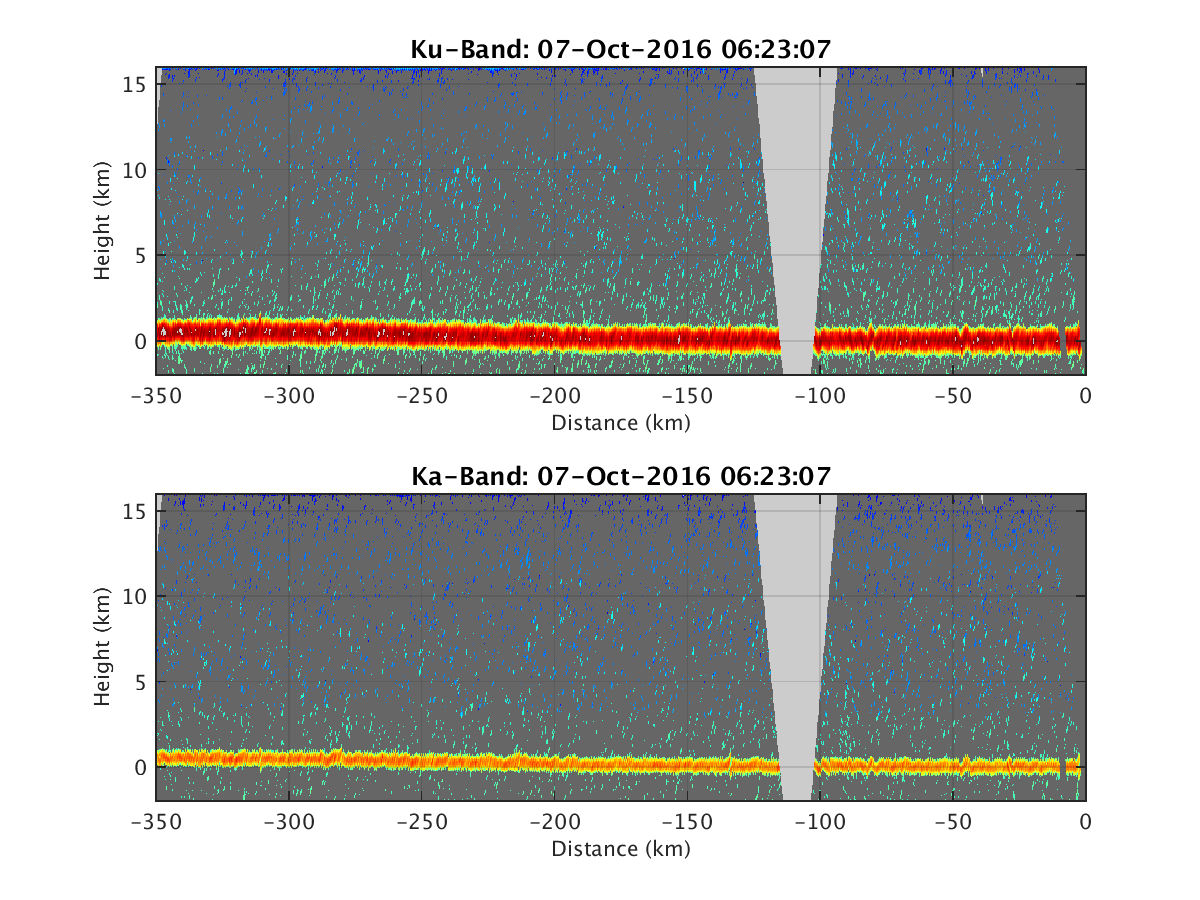
- HIWRAP_RealTimeVerticalPlot_20161007T062307.png
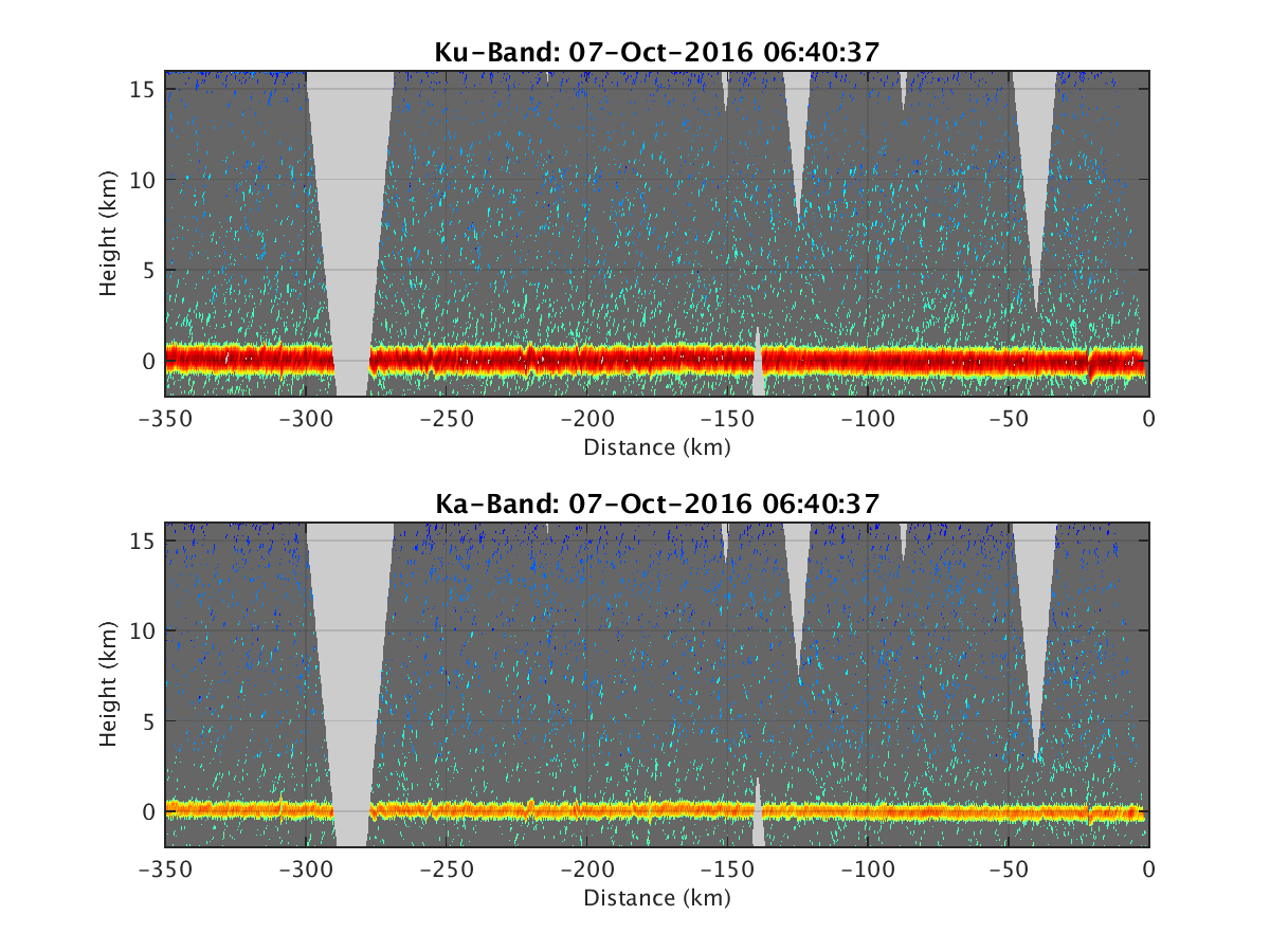
- HIWRAP_RealTimeVerticalPlot_20161007T064037.png
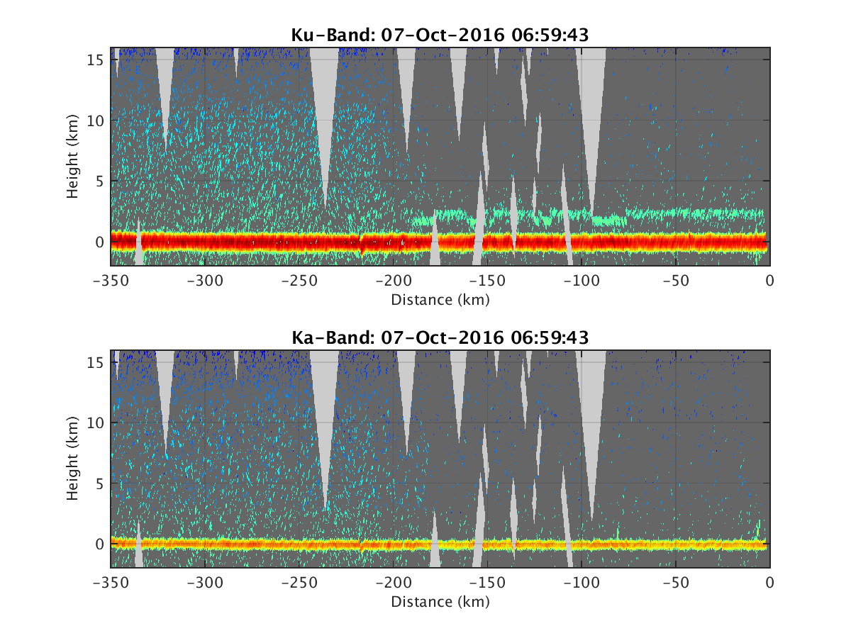
- HIWRAP_RealTimeVerticalPlot_20161007T065943.png
- HIWRAP_RealTimeVerticalPlot_20161007T071542.png
- HIWRAP_RealTimeVerticalPlot_20161007T073144.png
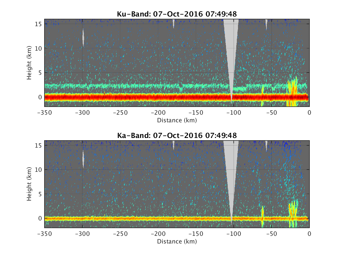
- HIWRAP_RealTimeVerticalPlot_20161007T074948.png
- HIWRAP_RealTimeVerticalPlot_20161007T080744.png
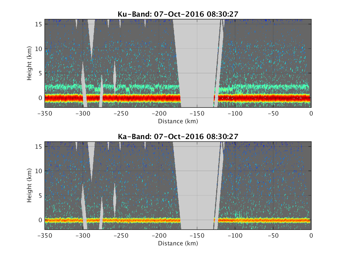
- HIWRAP_RealTimeVerticalPlot_20161007T083027.png
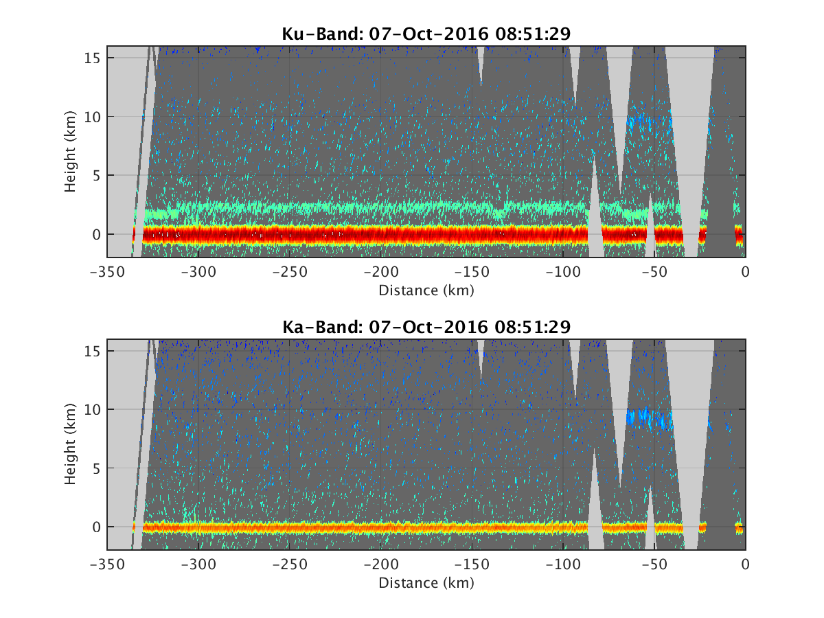
- HIWRAP_RealTimeVerticalPlot_20161007T085129.png
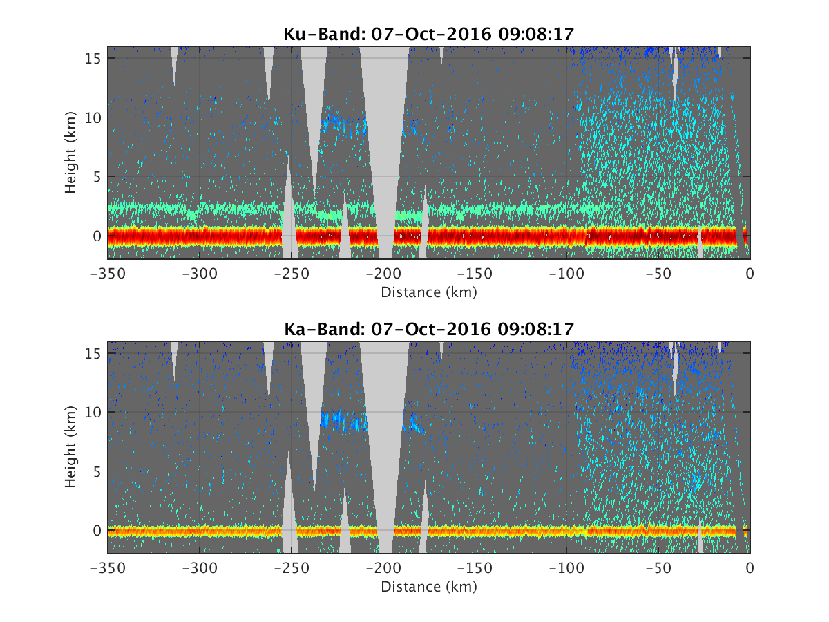
- HIWRAP_RealTimeVerticalPlot_20161007T090817.png
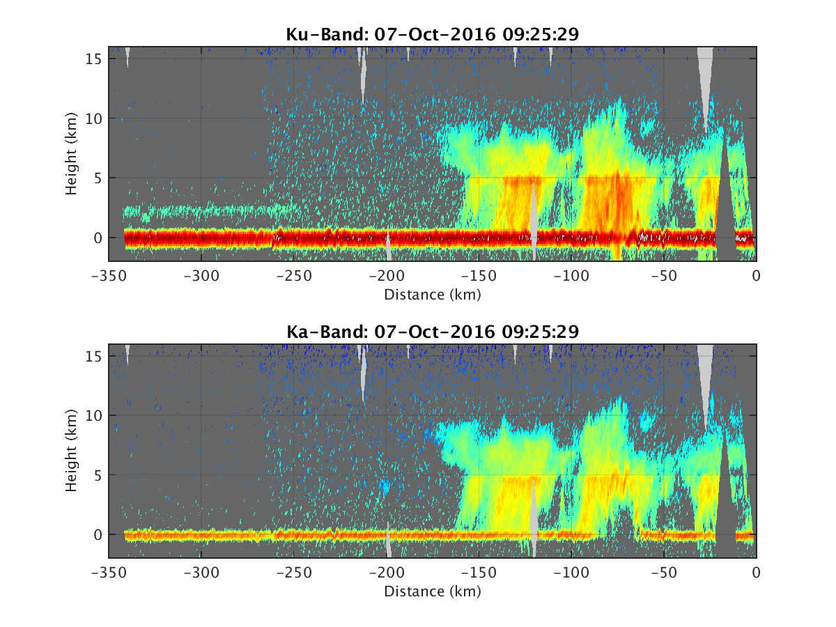
- HIWRAP_RealTimeVerticalPlot_20161007T092529.png
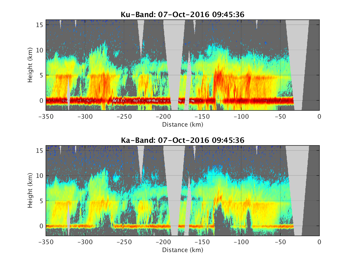
- HIWRAP_RealTimeVerticalPlot_20161007T094536.png
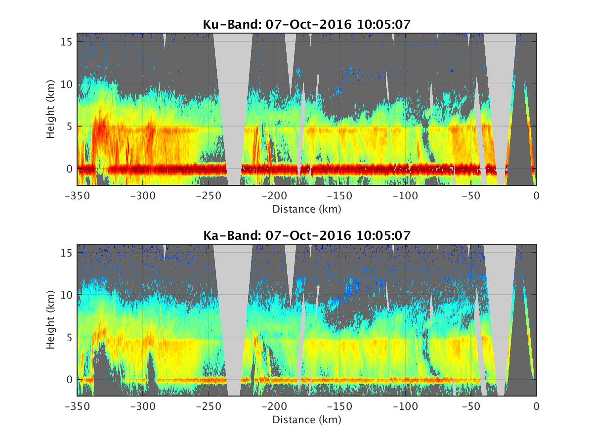
- HIWRAP_RealTimeVerticalPlot_20161007T100507.png
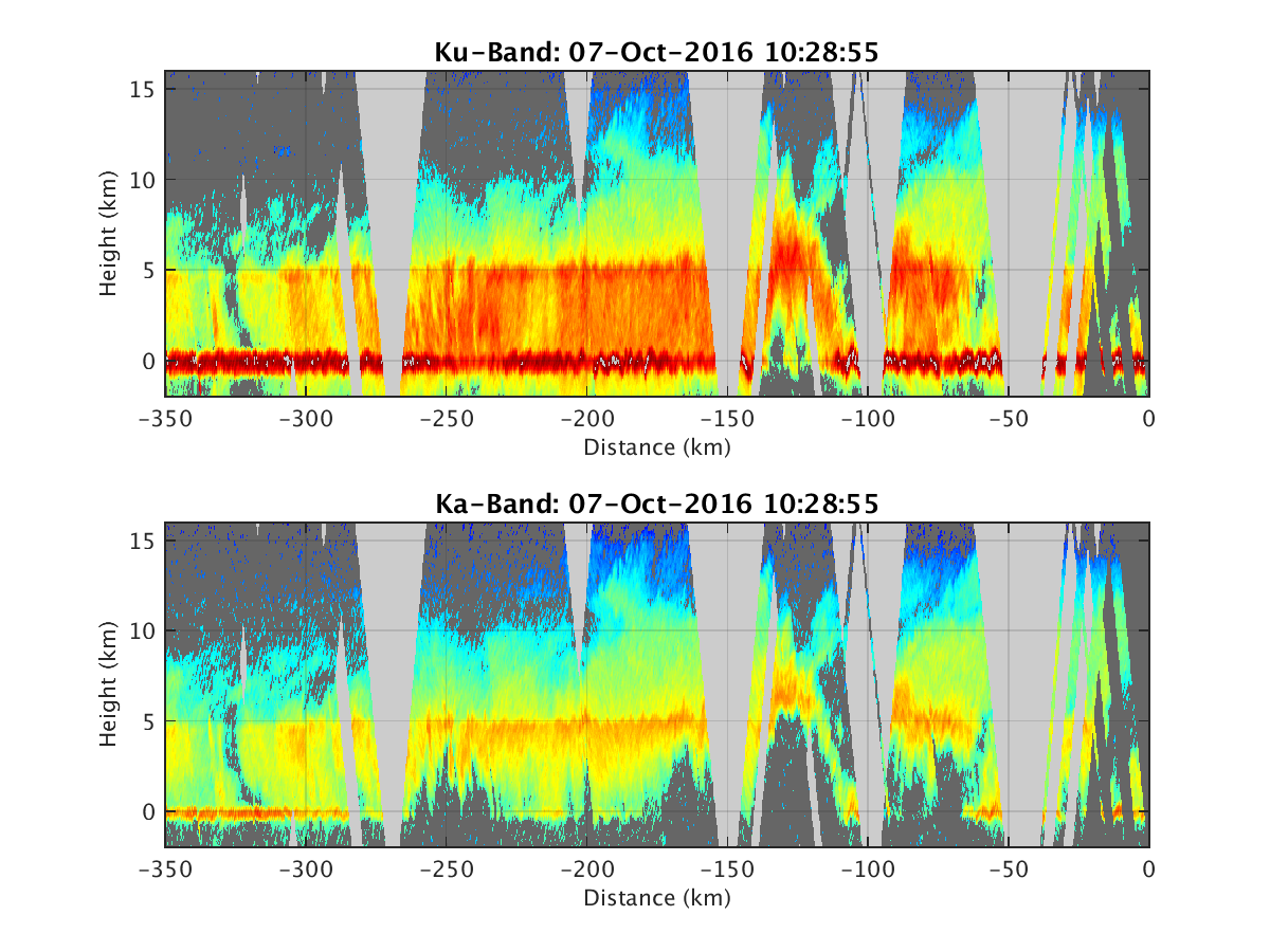
- HIWRAP_RealTimeVerticalPlot_20161007T102855.png
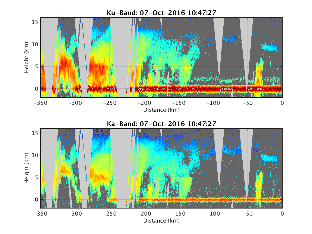
- HIWRAP_RealTimeVerticalPlot_20161007T104727.png
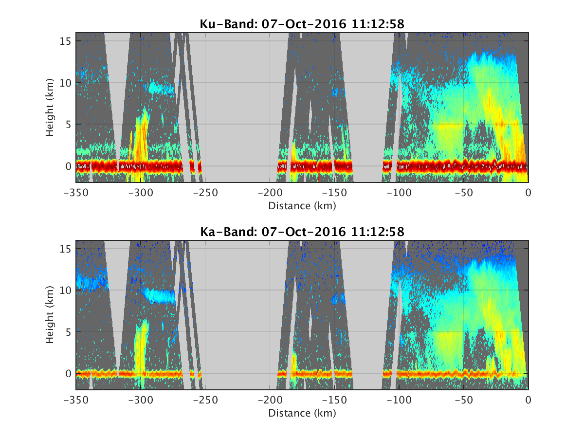
- HIWRAP_RealTimeVerticalPlot_20161007T111258.png
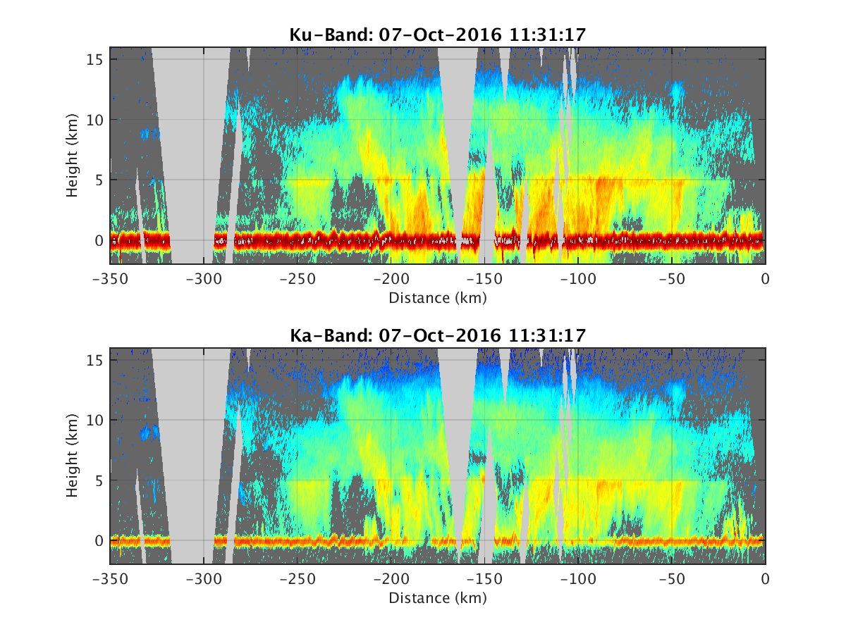
- HIWRAP_RealTimeVerticalPlot_20161007T113117.png
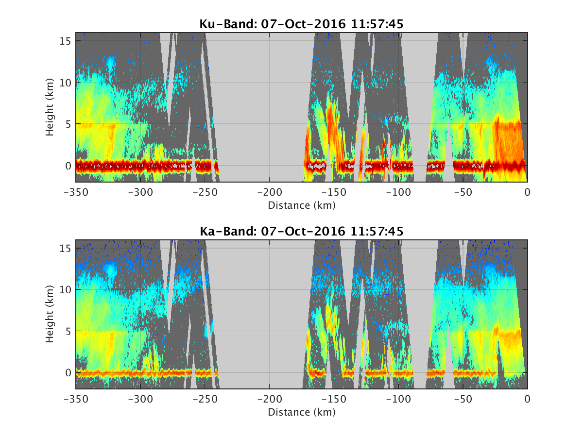
- HIWRAP_RealTimeVerticalPlot_20161007T115745.png
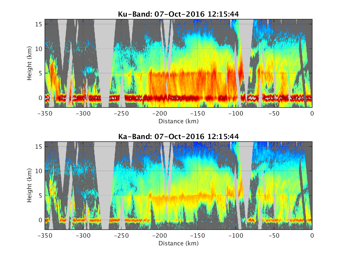
- HIWRAP_RealTimeVerticalPlot_20161007T121544.png
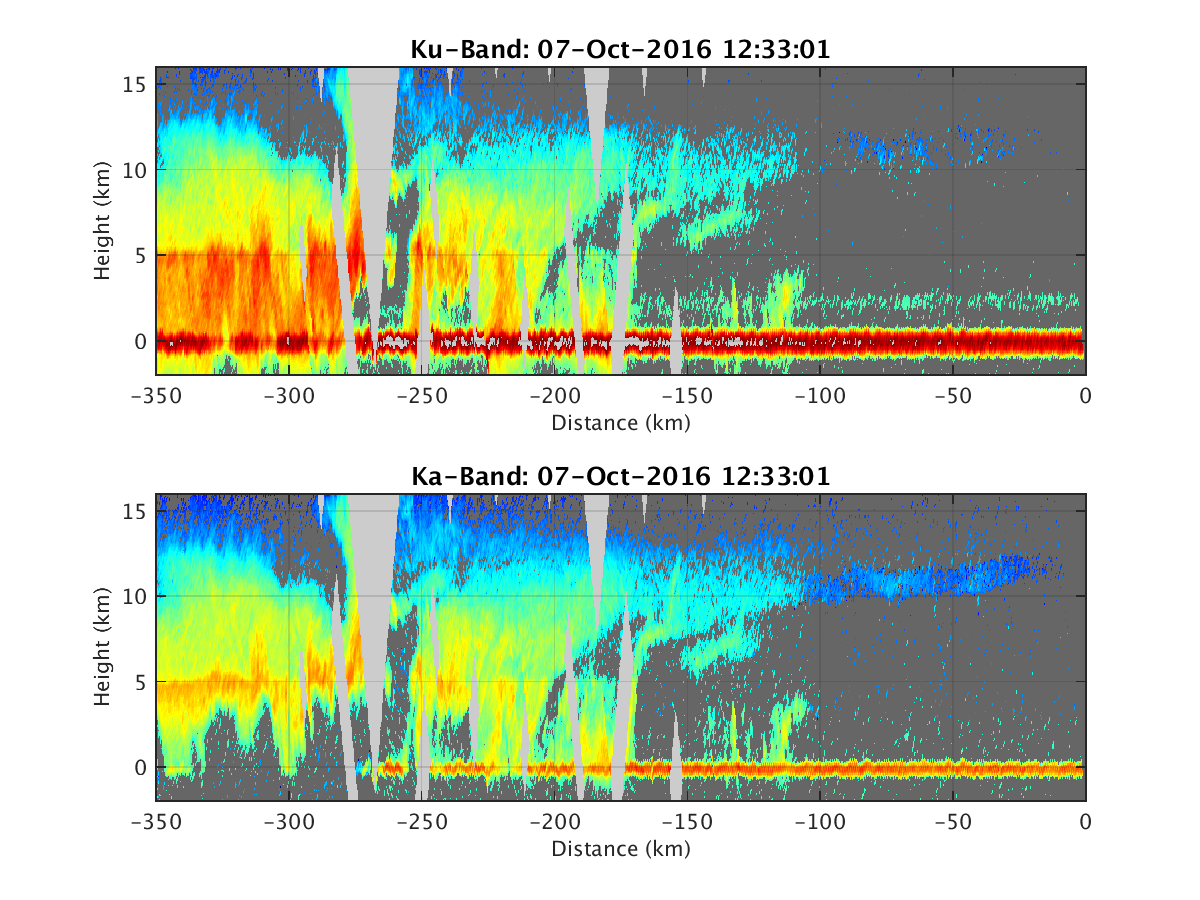
- HIWRAP_RealTimeVerticalPlot_20161007T123301.png
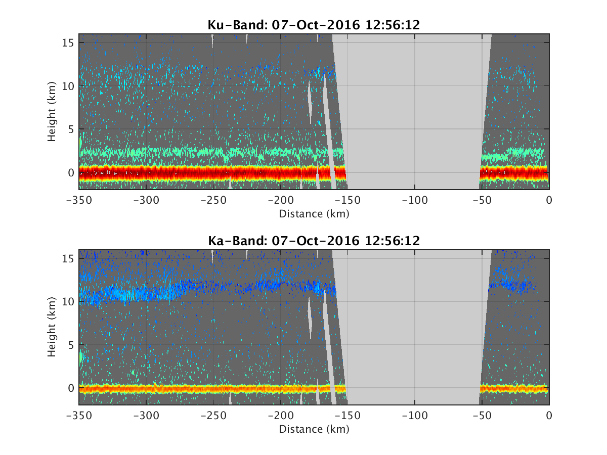
- HIWRAP_RealTimeVerticalPlot_20161007T125612.png
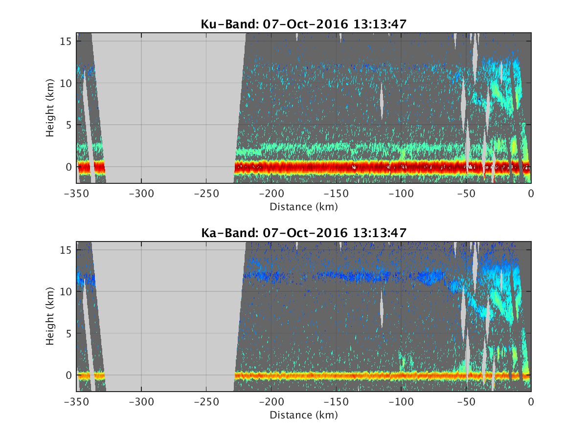
- HIWRAP_RealTimeVerticalPlot_20161007T131347.png
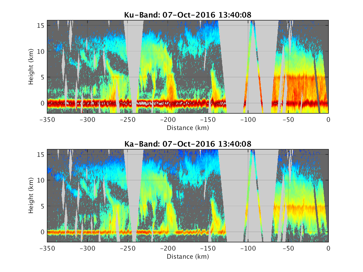
- HIWRAP_RealTimeVerticalPlot_20161007T134008.png
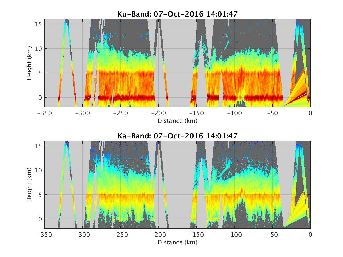
- HIWRAP_RealTimeVerticalPlot_20161007T140147.png
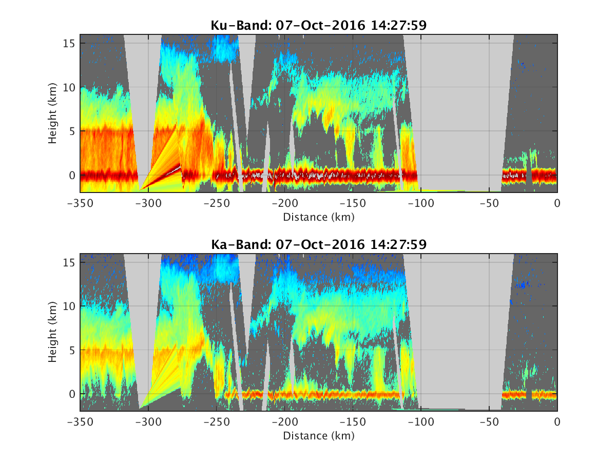
- HIWRAP_RealTimeVerticalPlot_20161007T142759.png
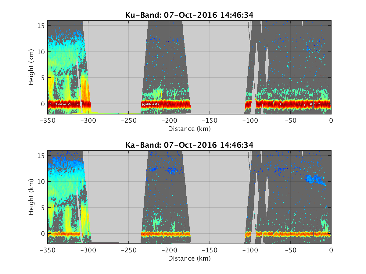
- HIWRAP_RealTimeVerticalPlot_20161007T144634.png
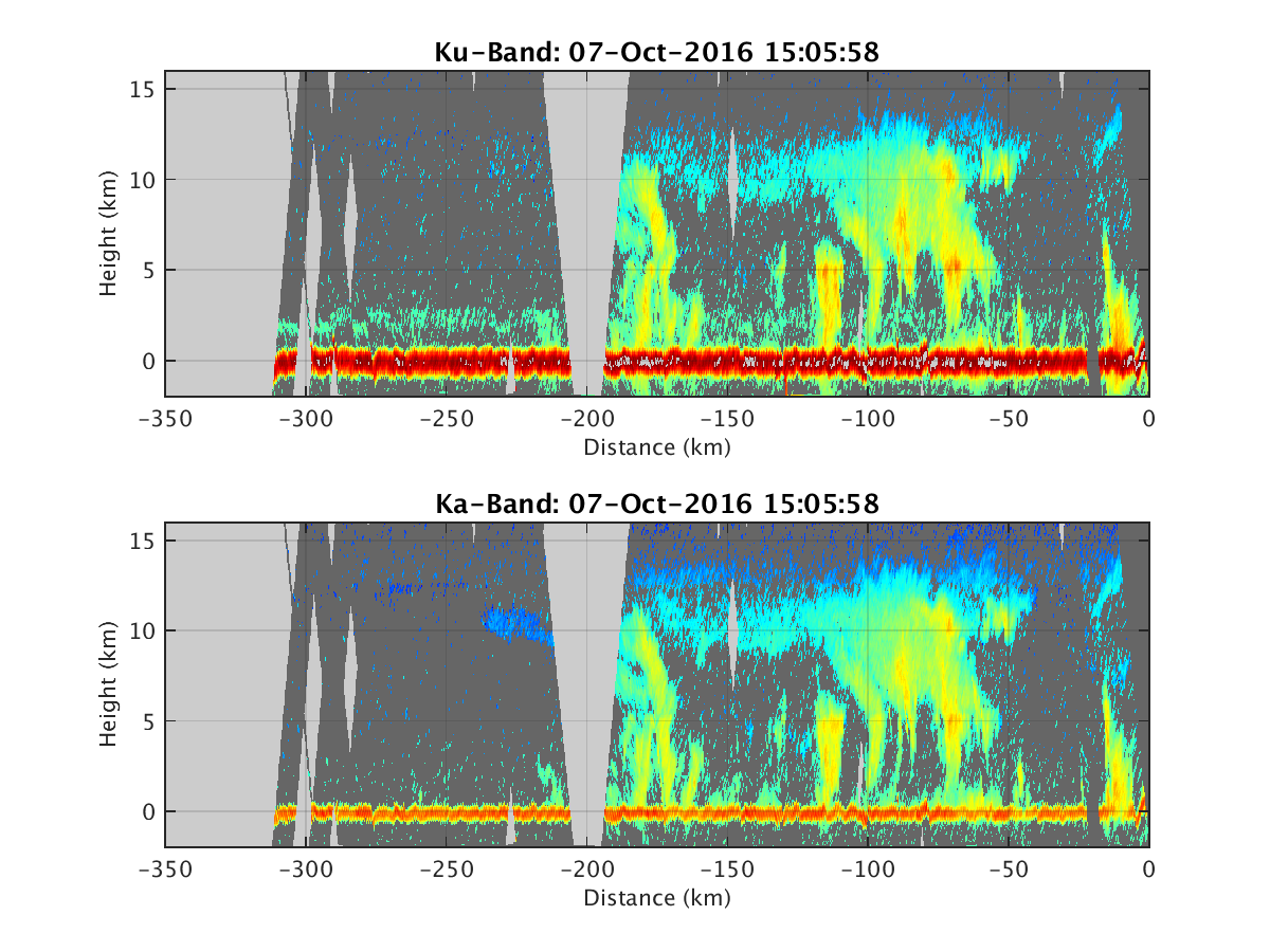
- HIWRAP_RealTimeVerticalPlot_20161007T150558.png
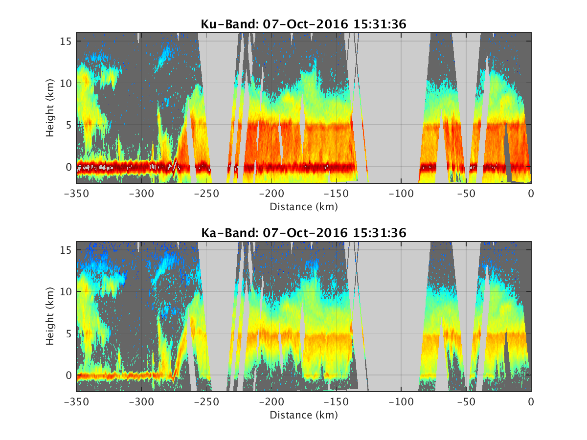
- HIWRAP_RealTimeVerticalPlot_20161007T153136.png
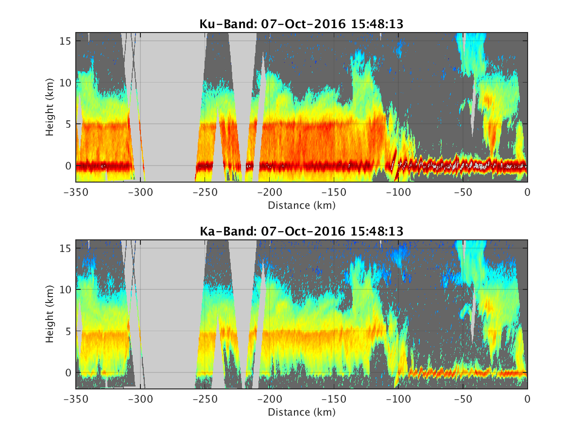
- HIWRAP_RealTimeVerticalPlot_20161007T154813.png
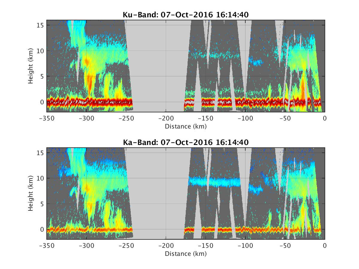
- HIWRAP_RealTimeVerticalPlot_20161007T161440.png
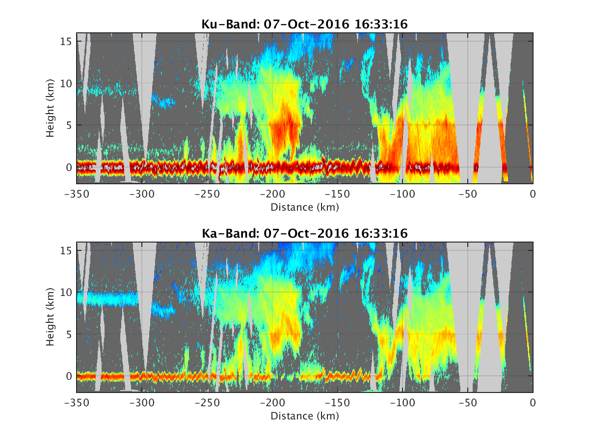
- HIWRAP_RealTimeVerticalPlot_20161007T163316.png
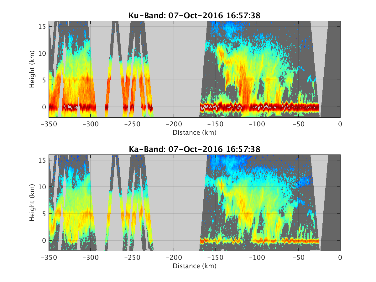
- HIWRAP_RealTimeVerticalPlot_20161007T165738.png
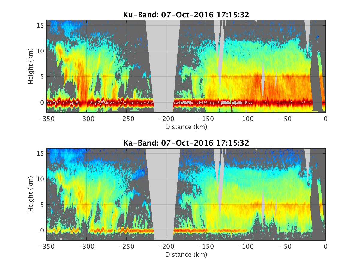
- HIWRAP_RealTimeVerticalPlot_20161007T171532.png
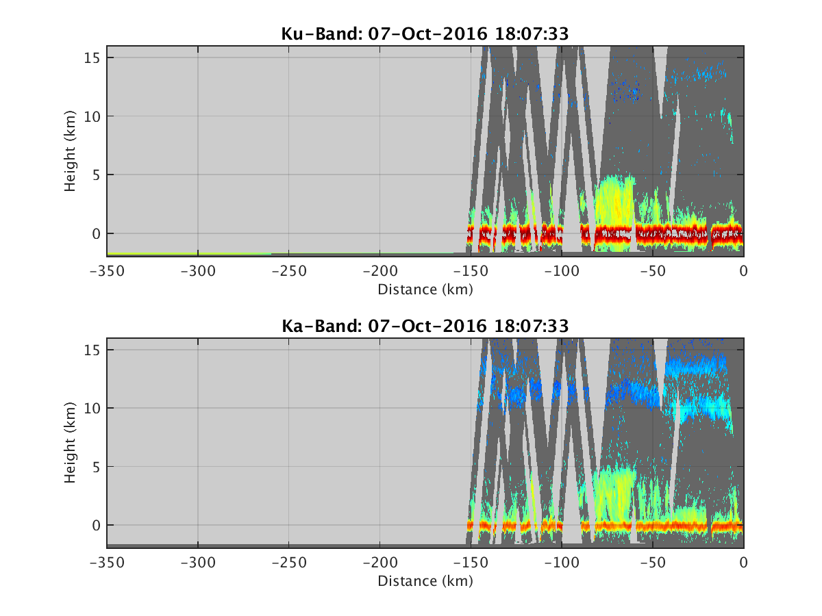
- HIWRAP_RealTimeVerticalPlot_20161007T180733.png
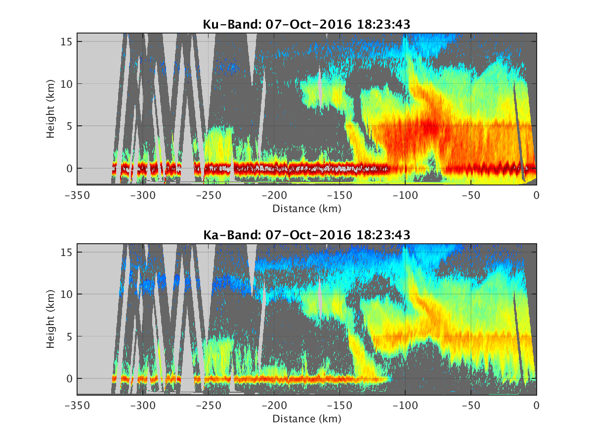
- HIWRAP_RealTimeVerticalPlot_20161007T182343.png
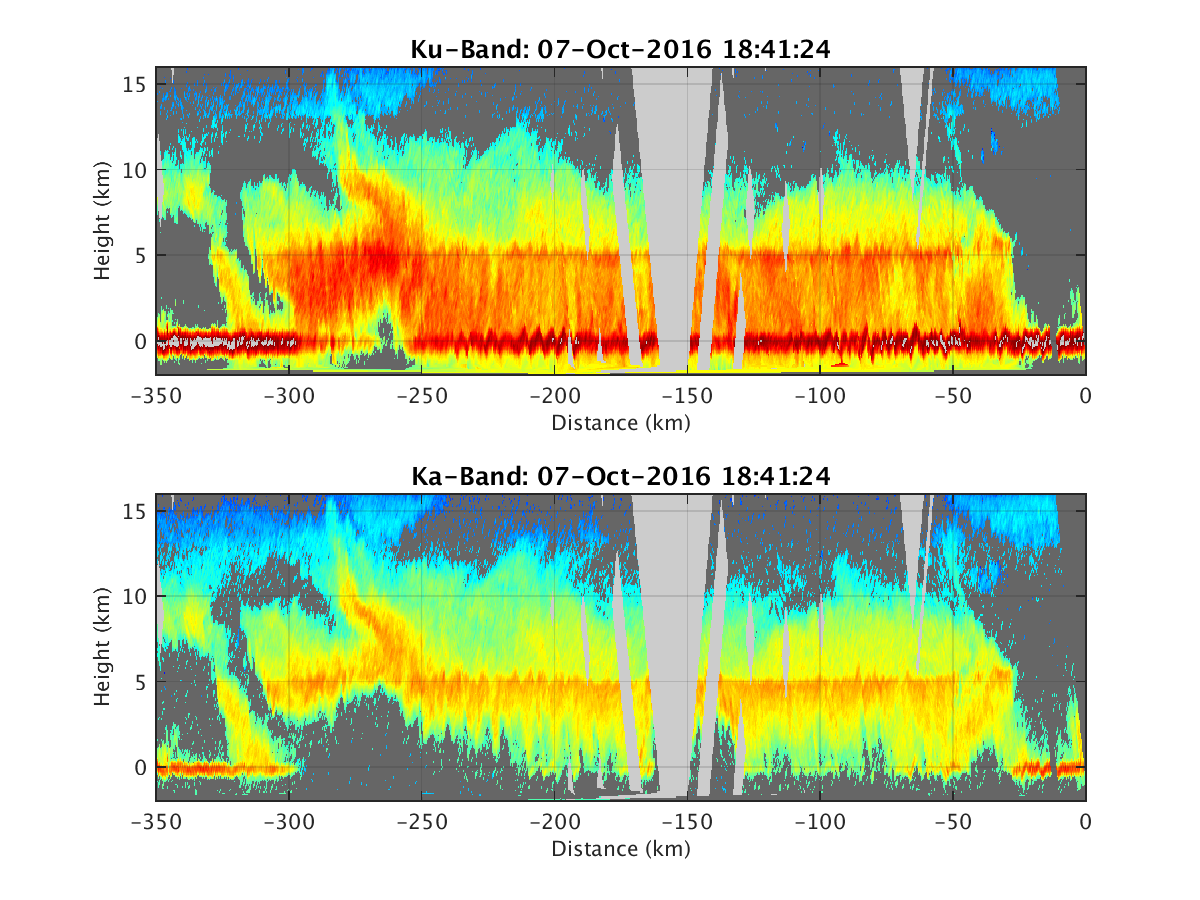
- HIWRAP_RealTimeVerticalPlot_20161007T184124.png
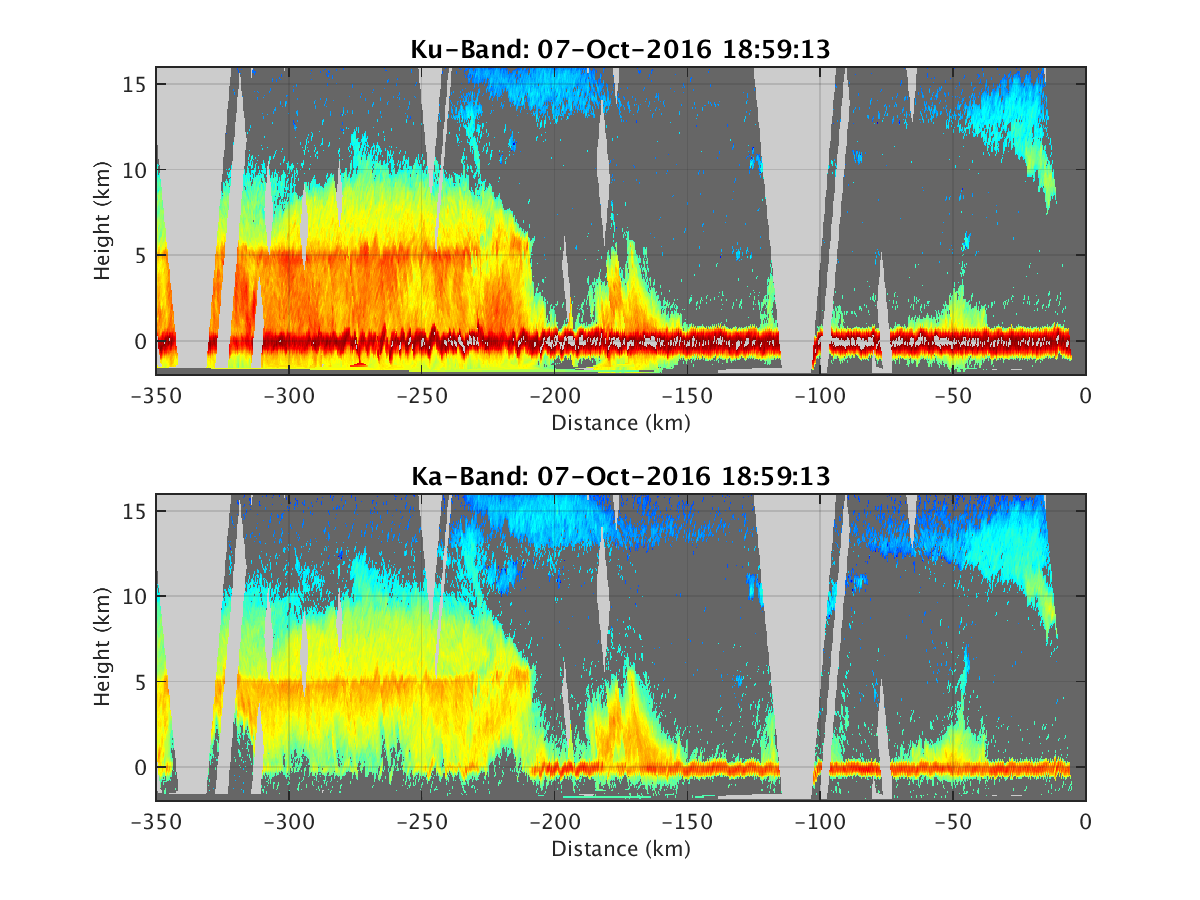
- HIWRAP_RealTimeVerticalPlot_20161007T185913.png
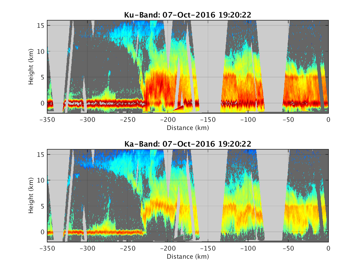
- HIWRAP_RealTimeVerticalPlot_20161007T192022.png
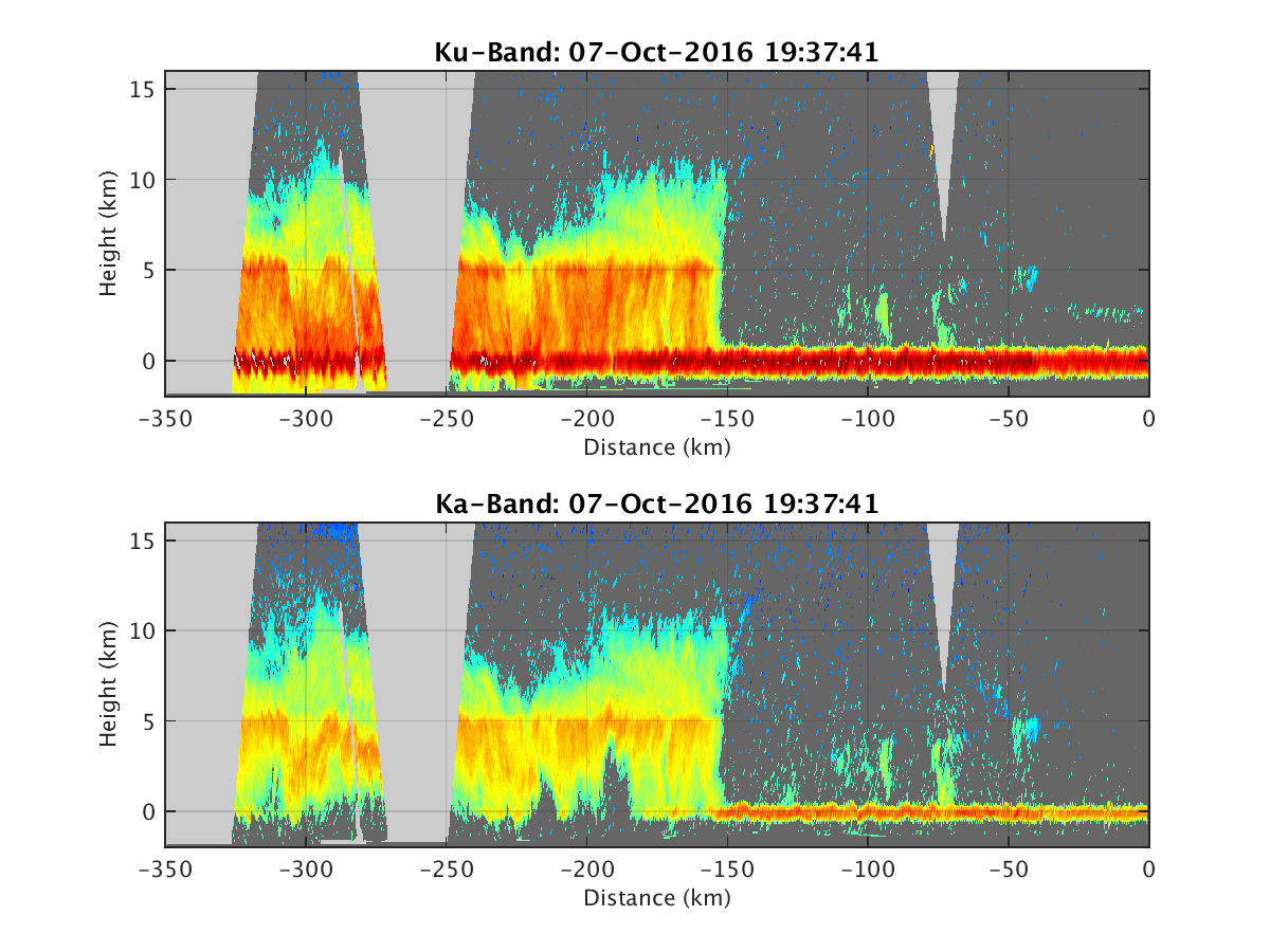
- HIWRAP_RealTimeVerticalPlot_20161007T193741.png
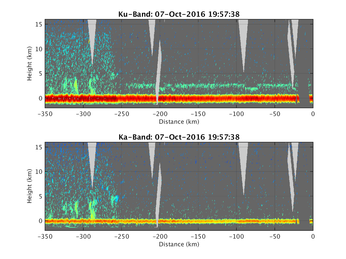
- HIWRAP_RealTimeVerticalPlot_20161007T195738.png
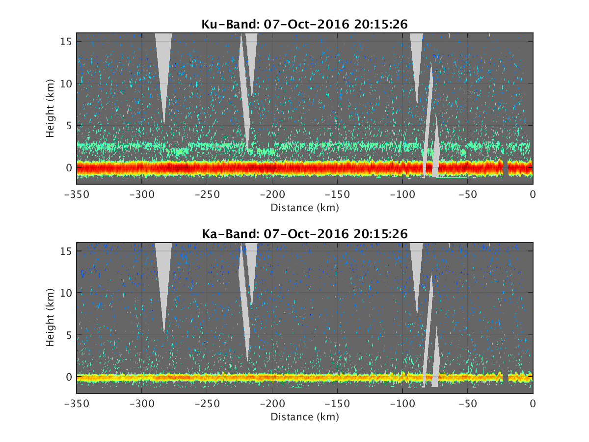
- HIWRAP_RealTimeVerticalPlot_20161007T201526.png
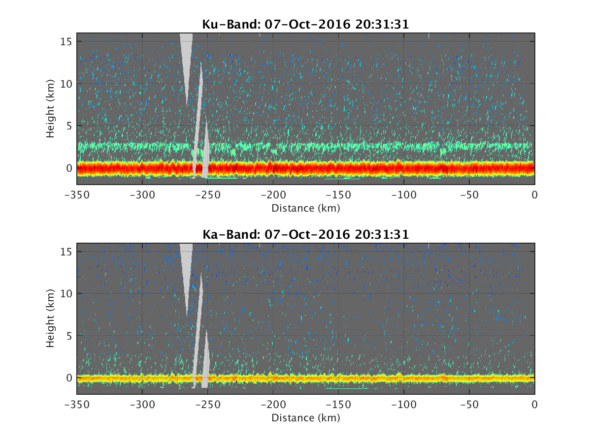
- HIWRAP_RealTimeVerticalPlot_20161007T203131.png
- HIWRAP_RealTimeVerticalPlot_20161007T204817.png
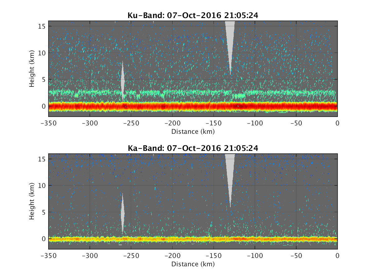
- HIWRAP_RealTimeVerticalPlot_20161007T210524.png
- HIWRAP_RealTimeVerticalPlot_20161007T212510.png
- HIWRAP_RealTimeVerticalPlot_20161007T214151.png
- HIWRAP_RealTimeVerticalPlot_20161009T040712.png
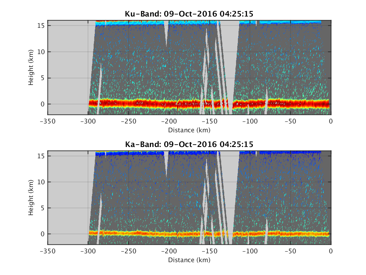
- HIWRAP_RealTimeVerticalPlot_20161009T042515.png
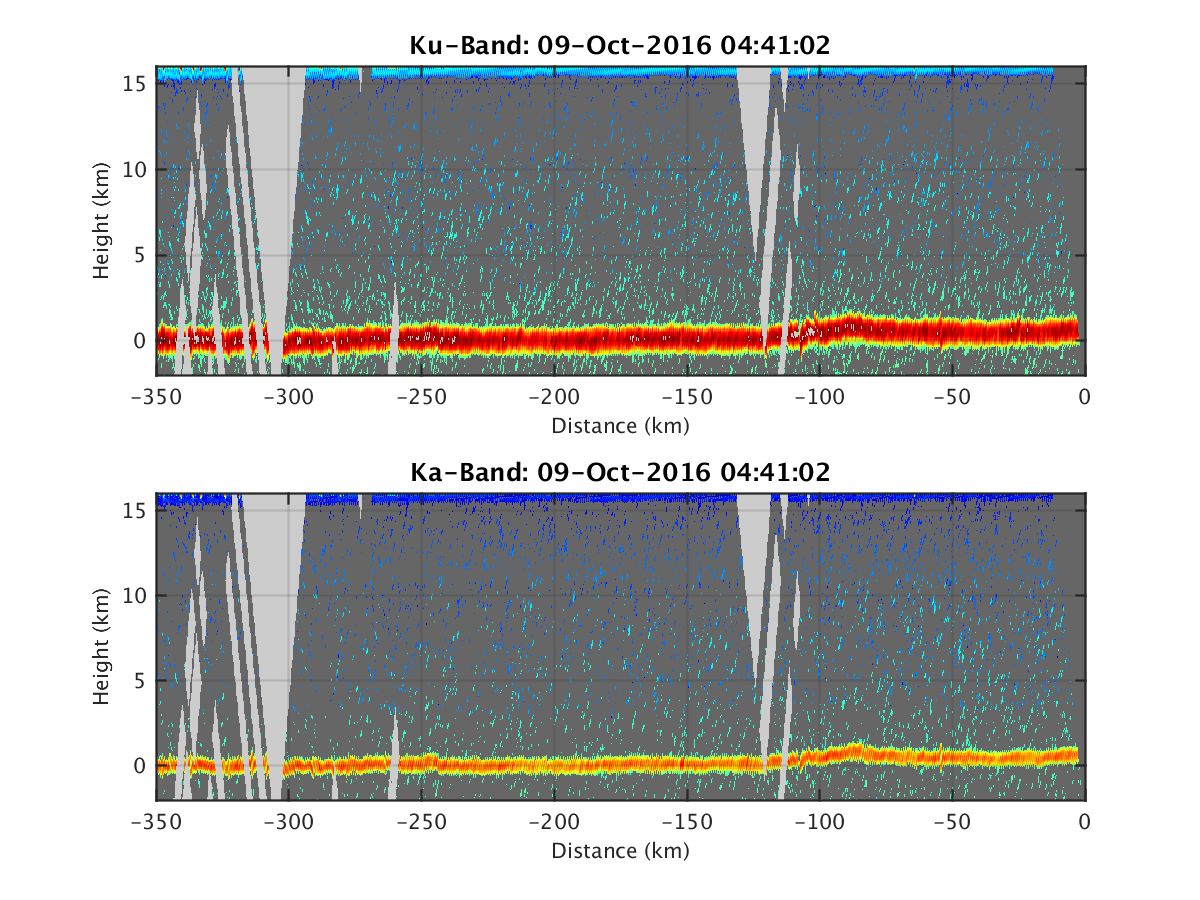
- HIWRAP_RealTimeVerticalPlot_20161009T044102.png
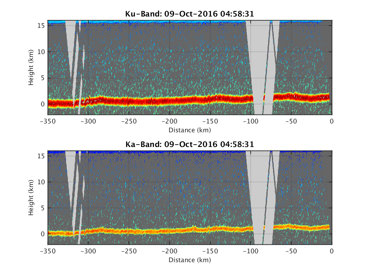
- HIWRAP_RealTimeVerticalPlot_20161009T045831.png
- HIWRAP_RealTimeVerticalPlot_20161009T051529.png
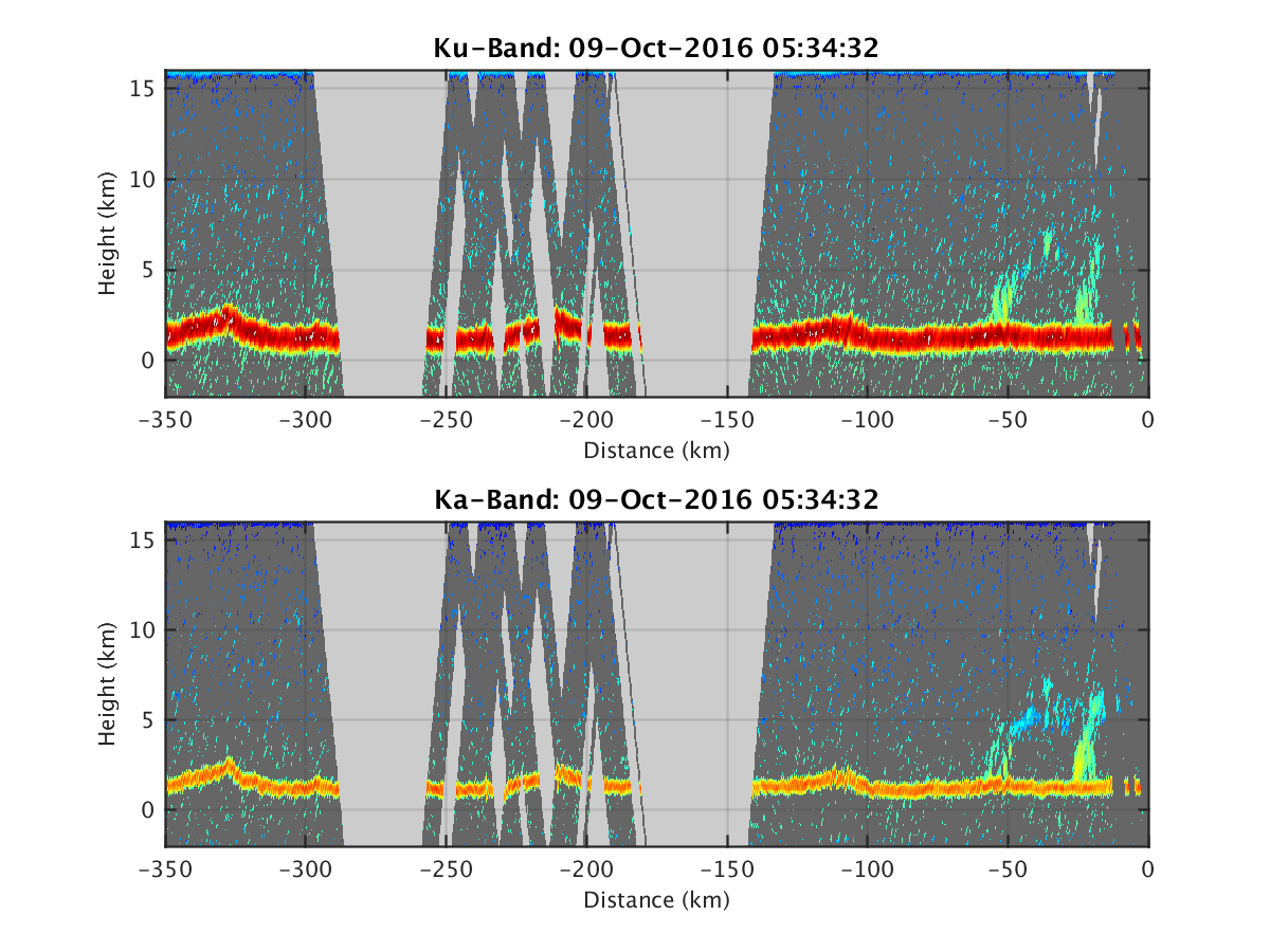
- HIWRAP_RealTimeVerticalPlot_20161009T053432.png
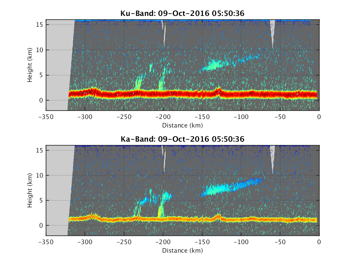
- HIWRAP_RealTimeVerticalPlot_20161009T055036.png
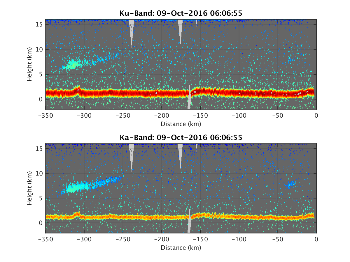
- HIWRAP_RealTimeVerticalPlot_20161009T060655.png
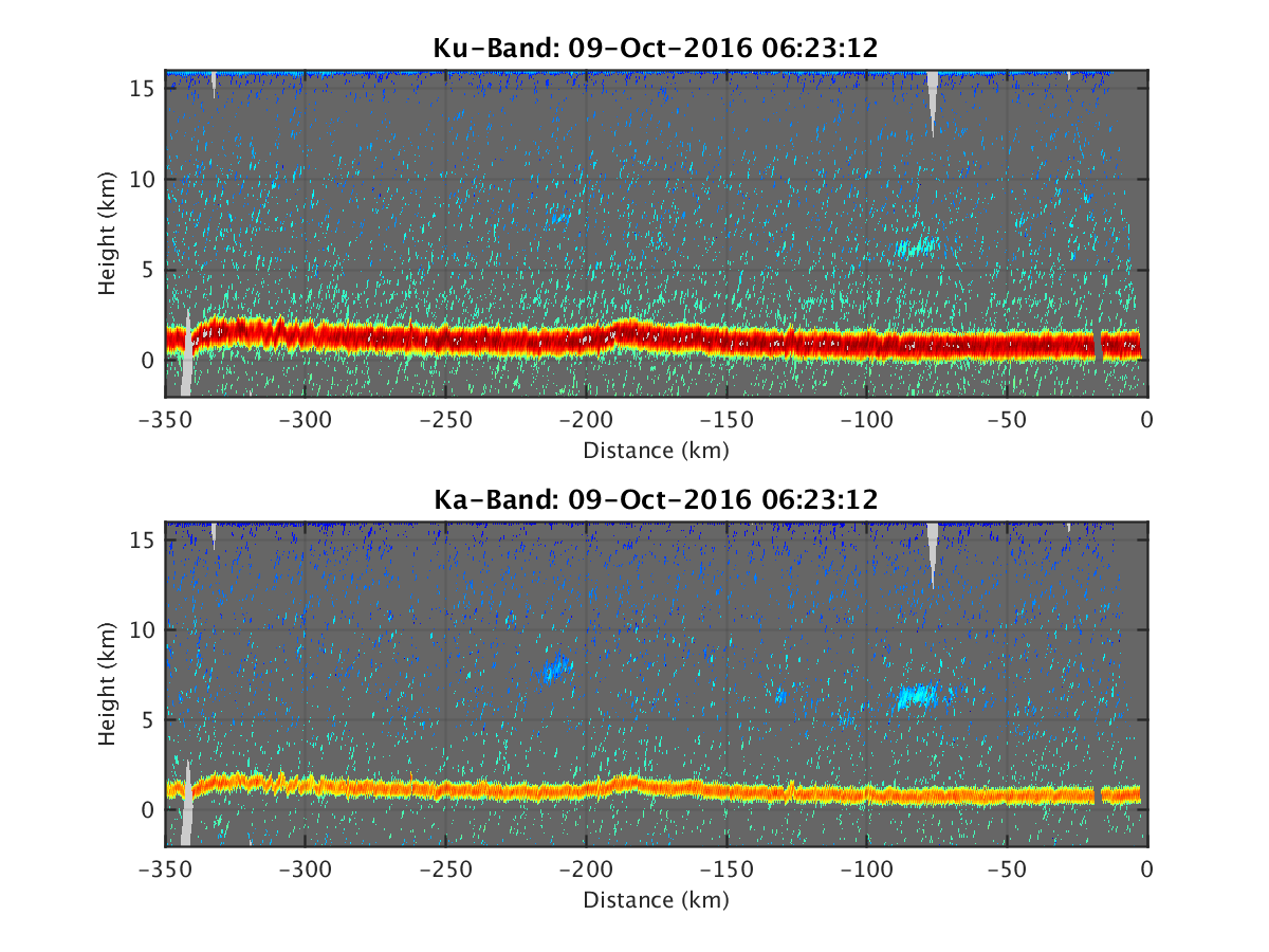
- HIWRAP_RealTimeVerticalPlot_20161009T062312.png
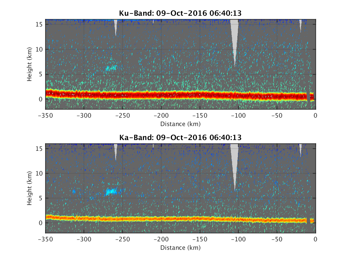
- HIWRAP_RealTimeVerticalPlot_20161009T064013.png
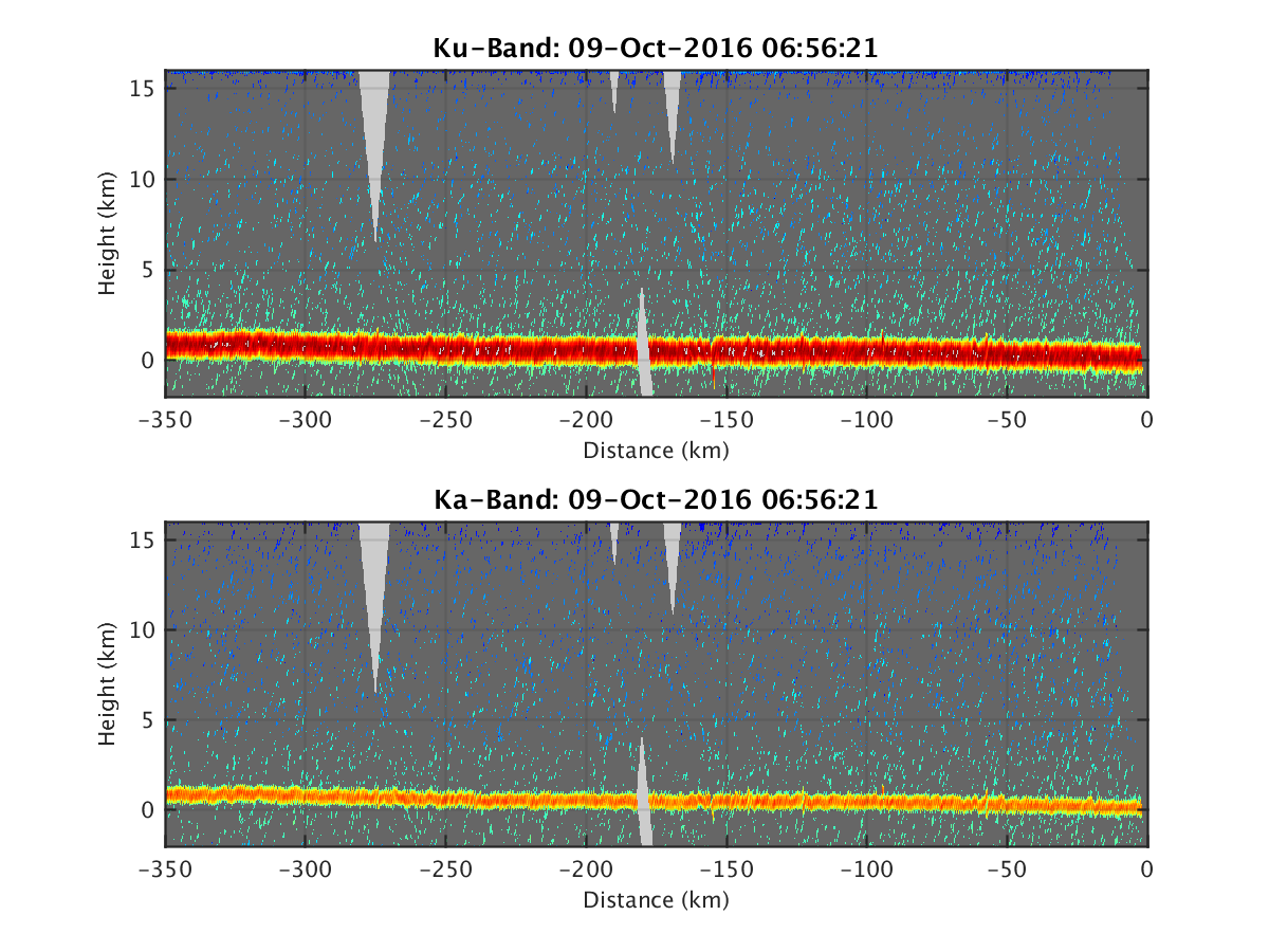
- HIWRAP_RealTimeVerticalPlot_20161009T065621.png
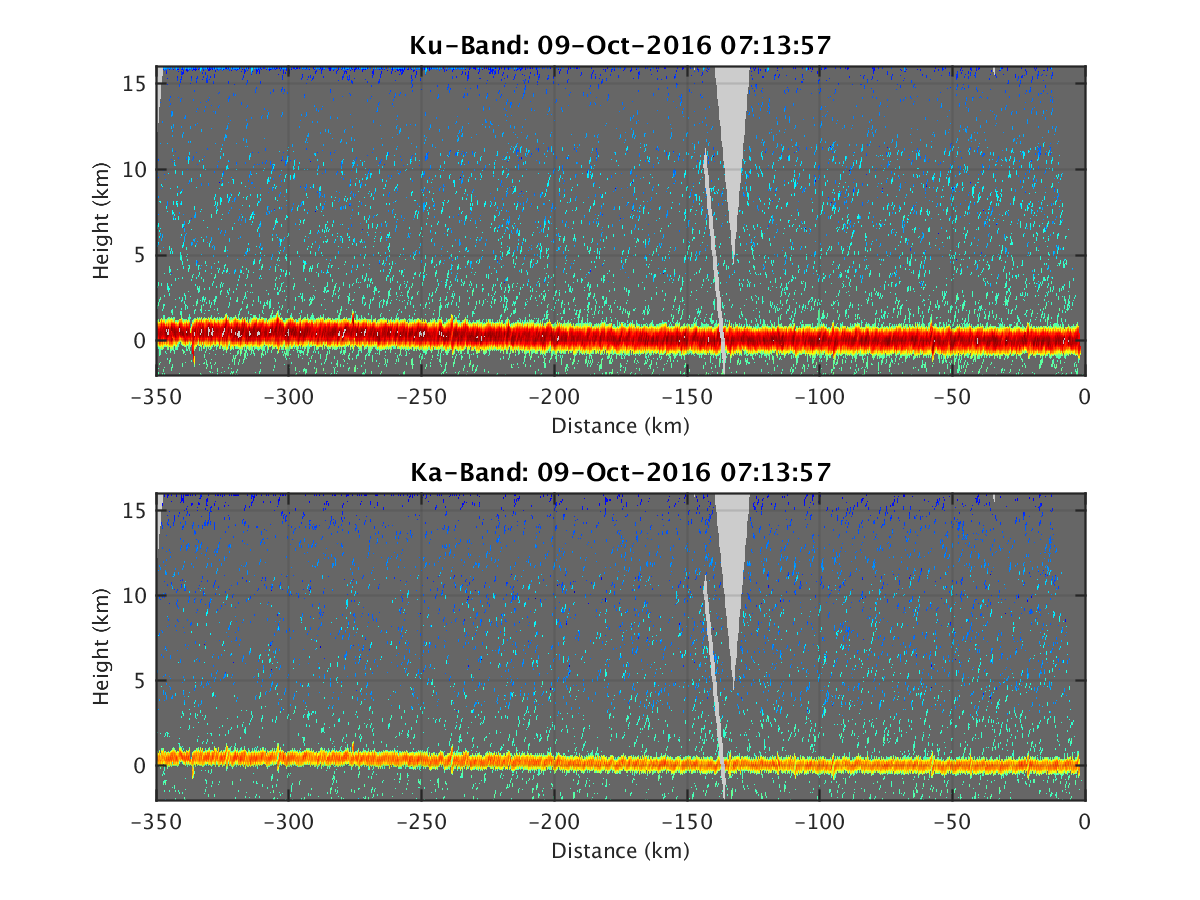
- HIWRAP_RealTimeVerticalPlot_20161009T071357.png
- HIWRAP_RealTimeVerticalPlot_20161009T073203.png
- HIWRAP_RealTimeVerticalPlot_20161009T074843.png
- HIWRAP_RealTimeVerticalPlot_20161009T115540.png
- HIWRAP_RealTimeVerticalPlot_20161009T121208.png
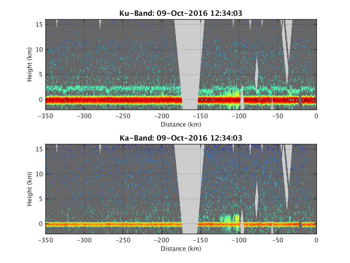
- HIWRAP_RealTimeVerticalPlot_20161009T123403.png
- HIWRAP_RealTimeVerticalPlot_20161009T125010.png
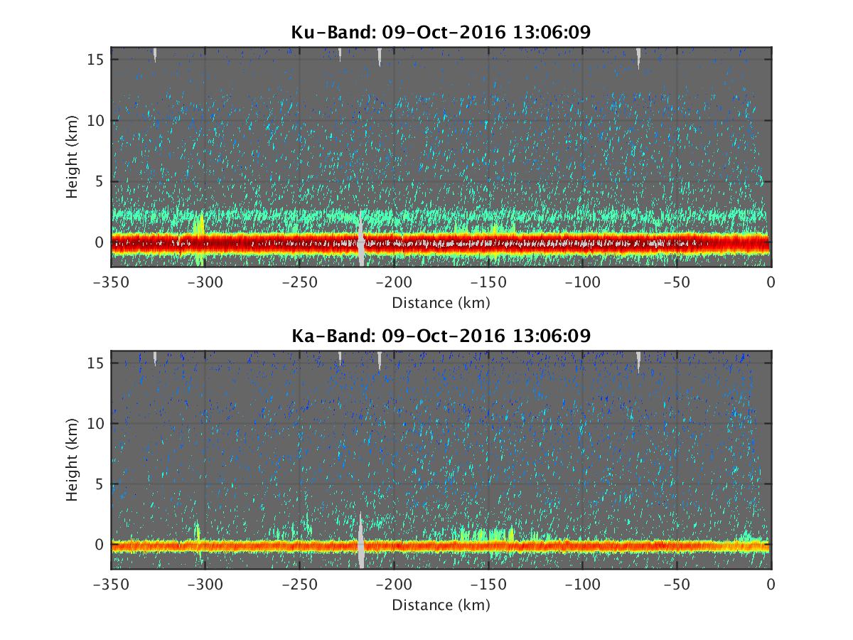
- HIWRAP_RealTimeVerticalPlot_20161009T130609.png
- HIWRAP_RealTimeVerticalPlot_20161009T132328.png
- HIWRAP_RealTimeVerticalPlot_20161009T134159.png
- HIWRAP_RealTimeVerticalPlot_20161009T140133.png
- HIWRAP_RealTimeVerticalPlot_20161009T141741.png
- HIWRAP_RealTimeVerticalPlot_20161009T143650.png
- HIWRAP_RealTimeVerticalPlot_20161009T145301.png
- HIWRAP_RealTimeVerticalPlot_20161009T151143.png
- HIWRAP_RealTimeVerticalPlot_20161009T152951.png
- HIWRAP_RealTimeVerticalPlot_20161009T154952.png
- HIWRAP_RealTimeVerticalPlot_20161009T160629.png
- HIWRAP_RealTimeVerticalPlot_20161009T162246.png
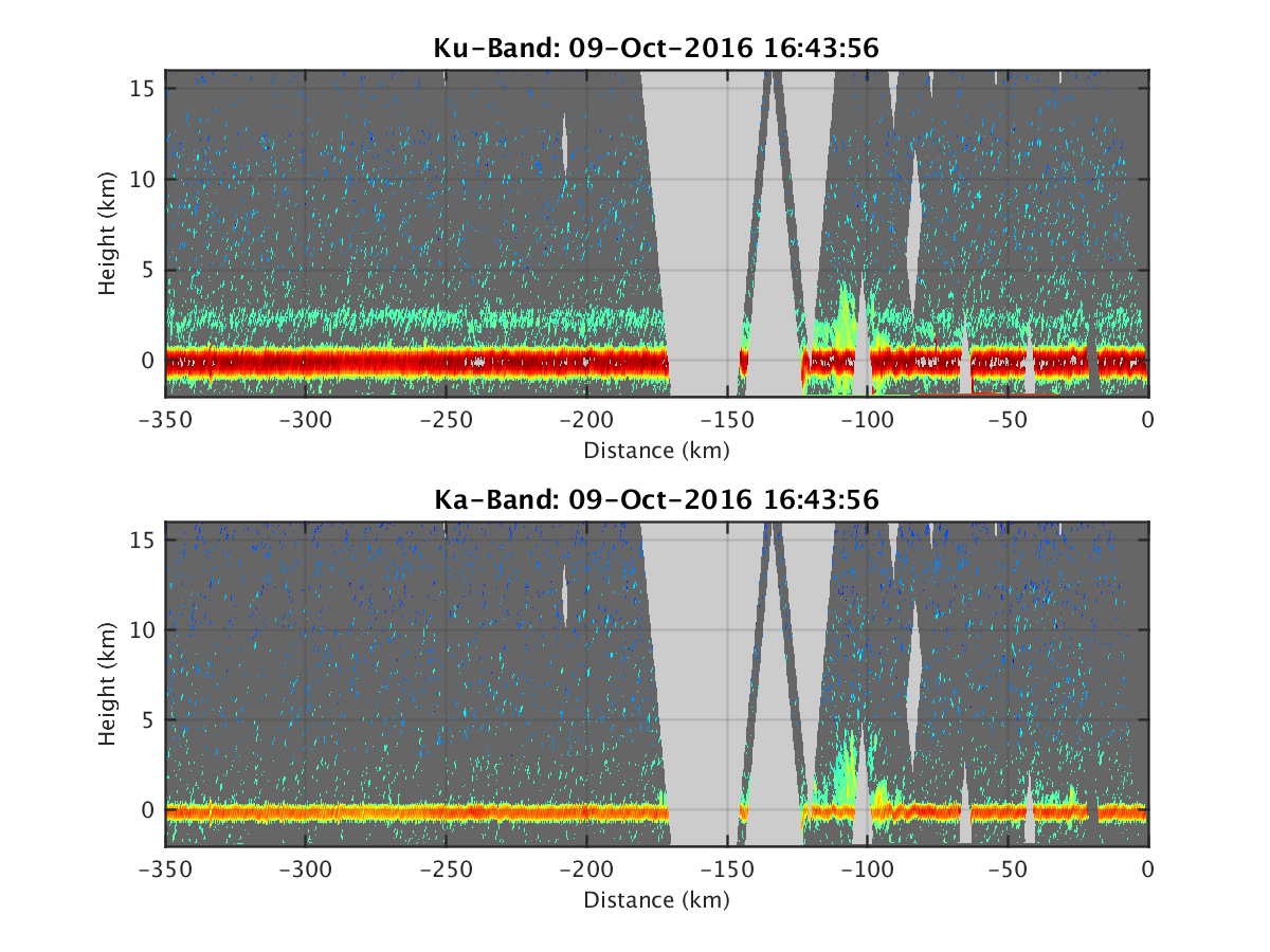
- HIWRAP_RealTimeVerticalPlot_20161009T164356.png
- HIWRAP_RealTimeVerticalPlot_20161009T170239.png
- HIWRAP_RealTimeVerticalPlot_20161009T171840.png
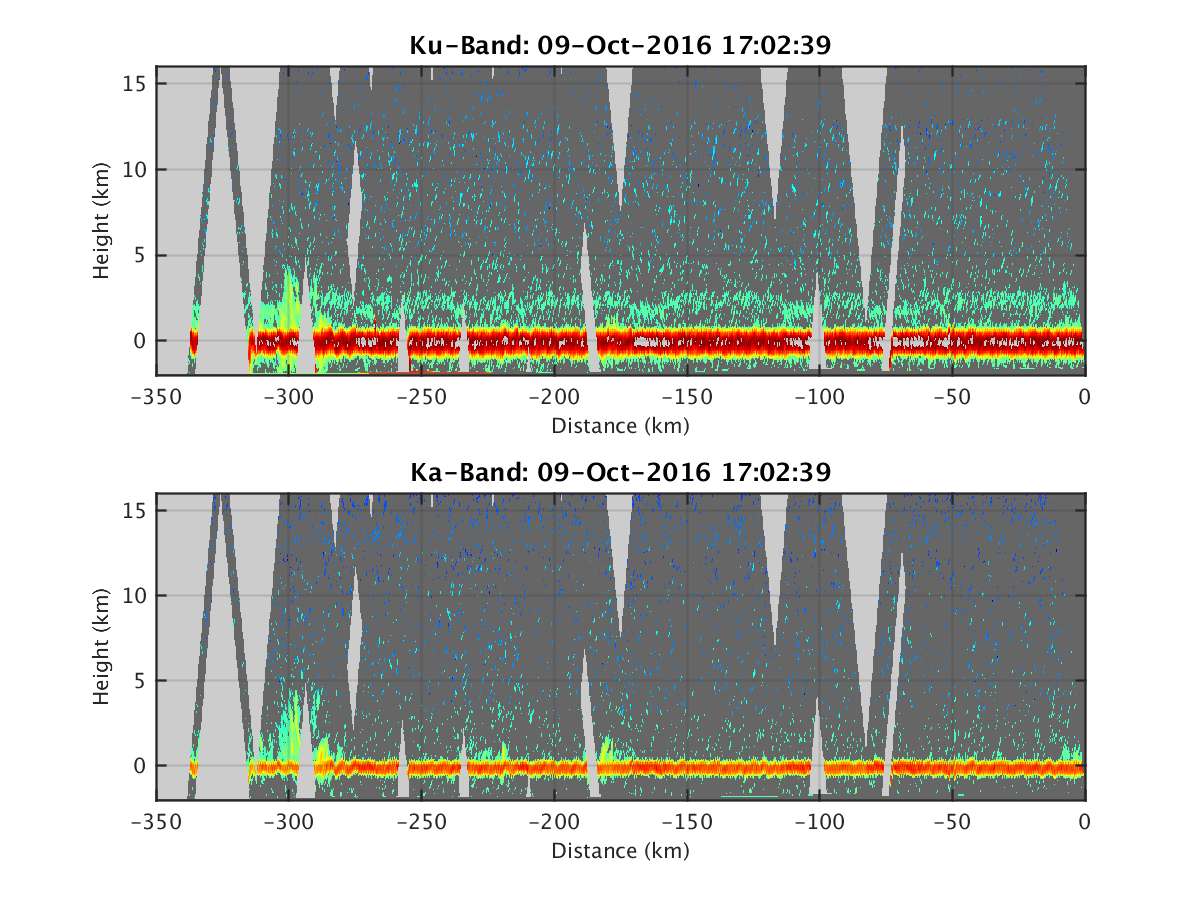
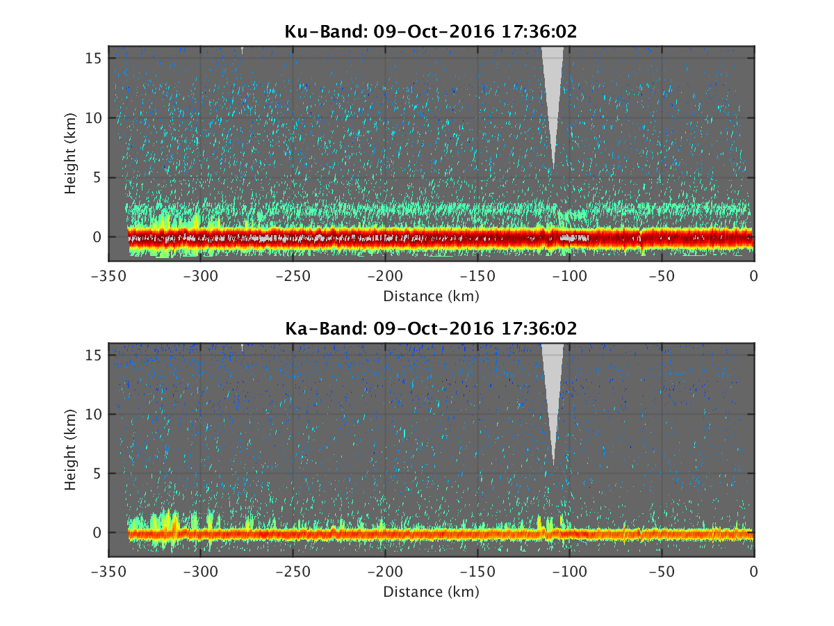
- HIWRAP_RealTimeVerticalPlot_20161009T173602.png
- HIWRAP_RealTimeVerticalPlot_20161009T175228.png
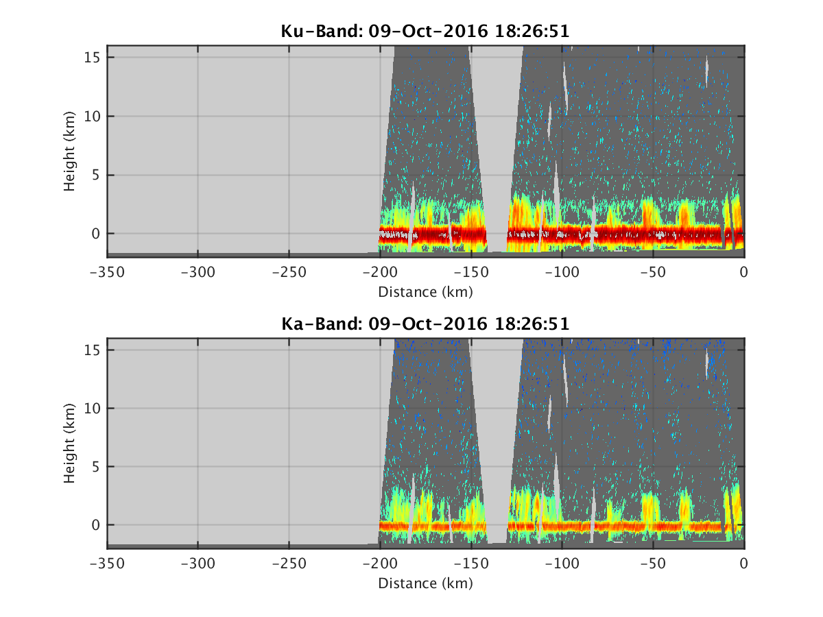
- HIWRAP_RealTimeVerticalPlot_20161009T182651.png
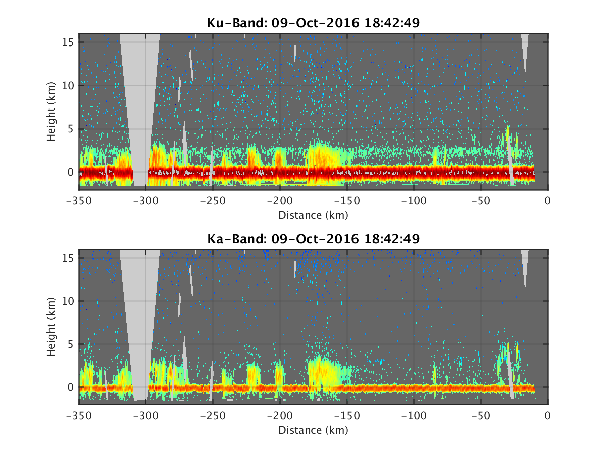
- HIWRAP_RealTimeVerticalPlot_20161009T184249.png
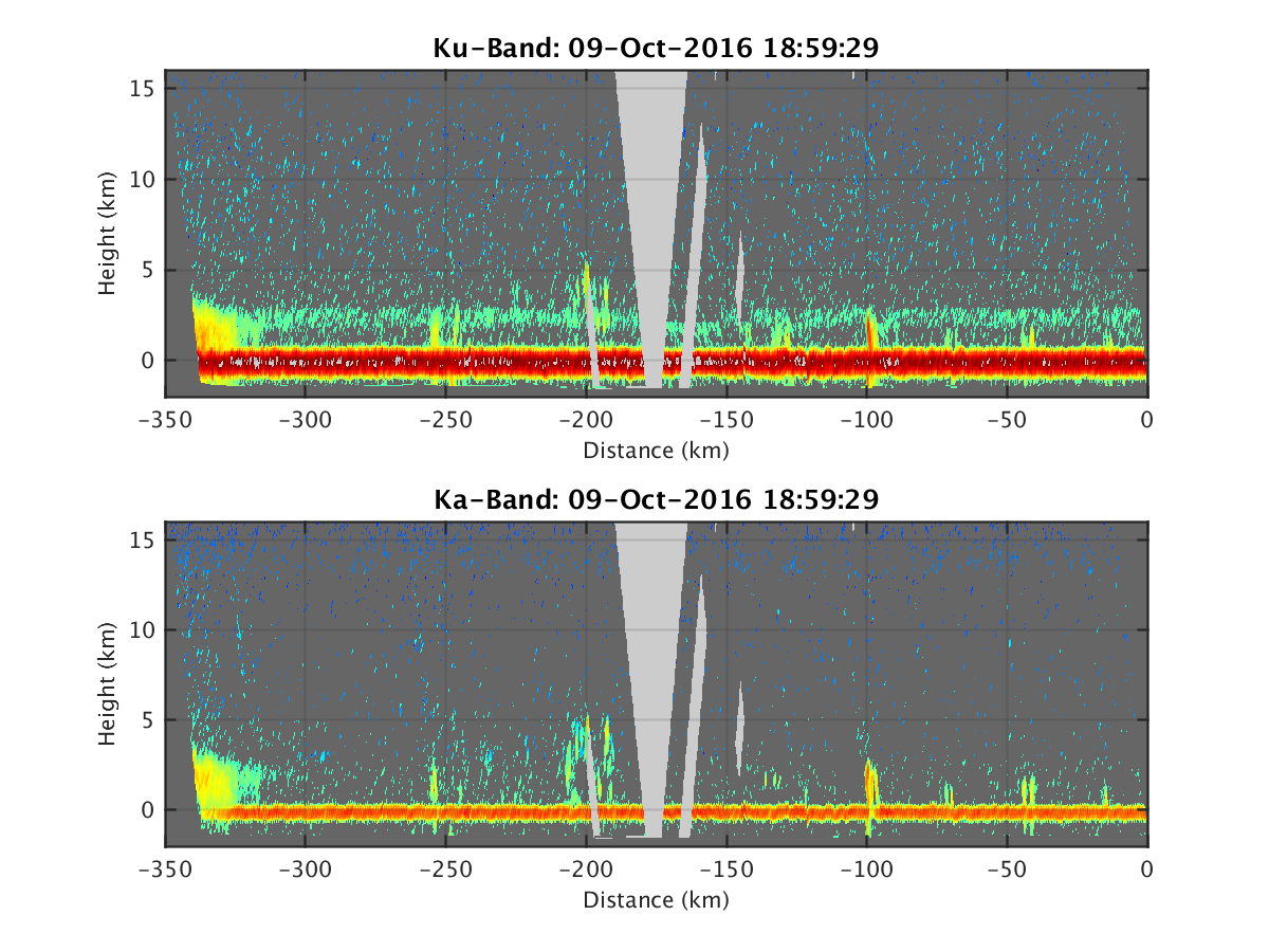
- HIWRAP_RealTimeVerticalPlot_20161009T185929.png
- HIWRAP_RealTimeVerticalPlot_20161009T191543.png
- HIWRAP_RealTimeVerticalPlot_20161009T193310.png
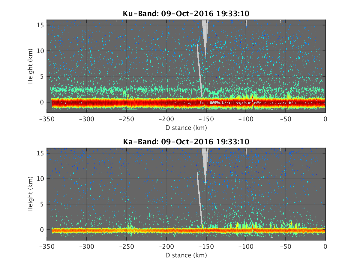
- HIWRAP_RealTimeVerticalPlot_20161009T194951.png
- HIWRAP_RealTimeVerticalPlot_20161009T200735.png
- HIWRAP_RealTimeVerticalPlot_20161009T202424.png
- HIWRAP_RealTimeVerticalPlot_20161009T204031.png
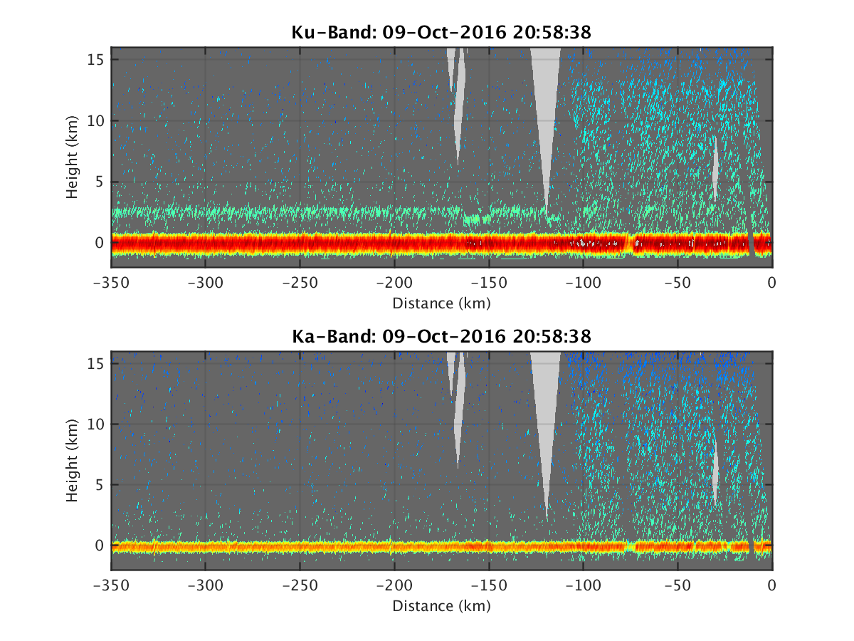
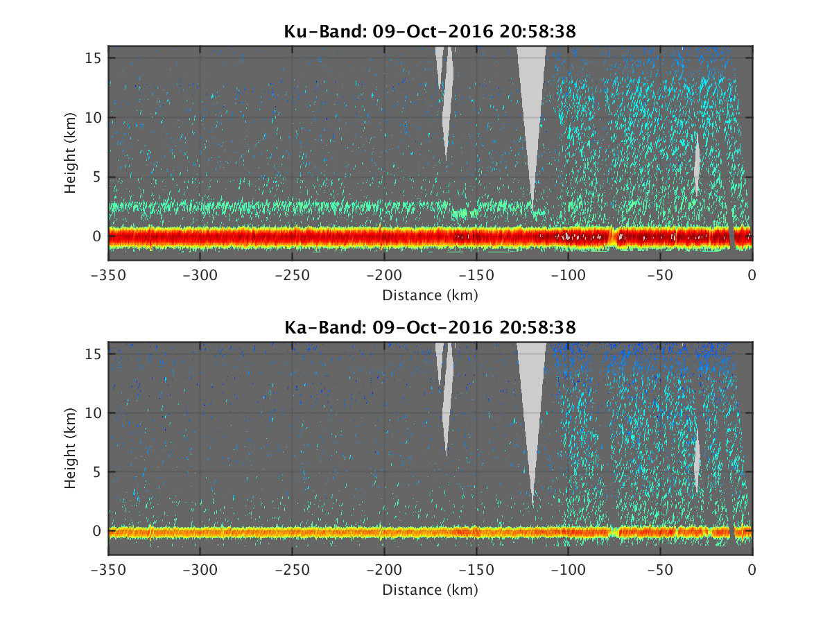
- HIWRAP_RealTimeVerticalPlot_20161009T205838.png
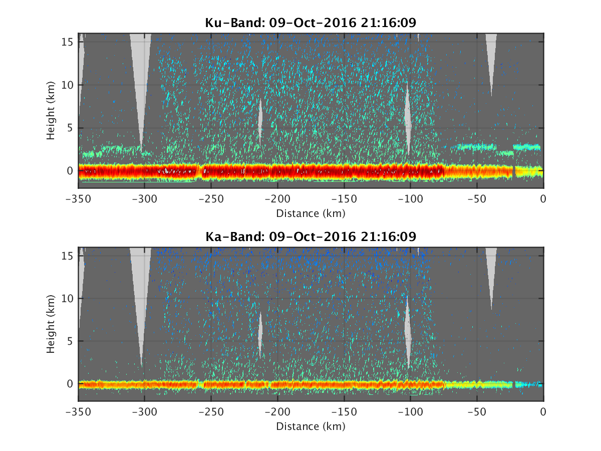
- HIWRAP_RealTimeVerticalPlot_20161009T211609.png
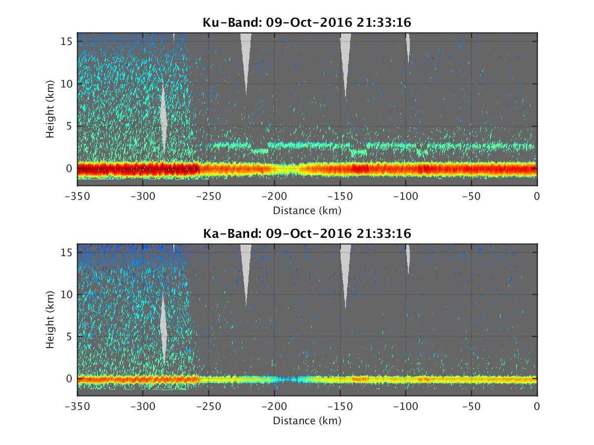
- HIWRAP_RealTimeVerticalPlot_20161009T213316.png
- HIWRAP_RealTimeVerticalPlot_20161009T215914.png
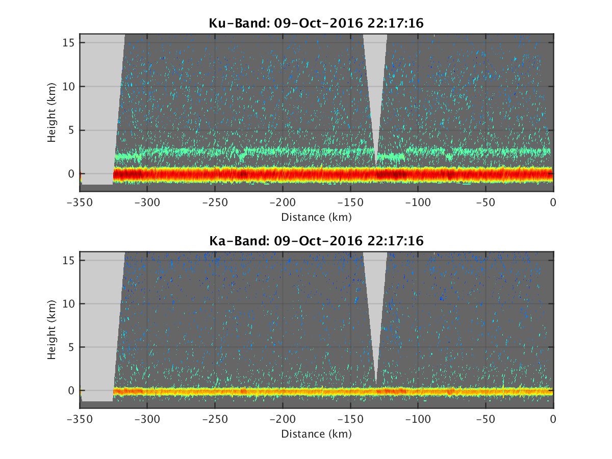
- HIWRAP_RealTimeVerticalPlot_20161009T221716.png
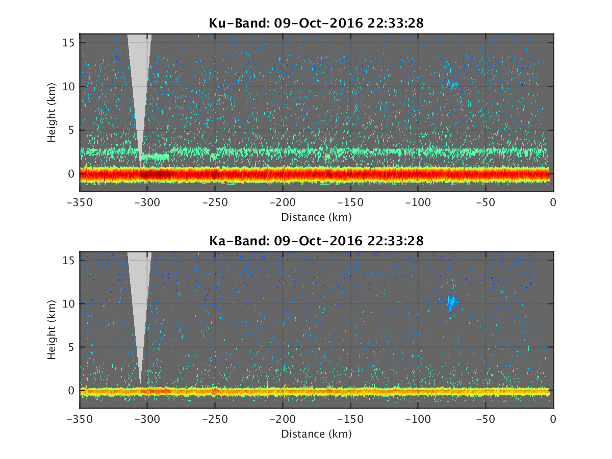
- HIWRAP_RealTimeVerticalPlot_20161009T223328.png
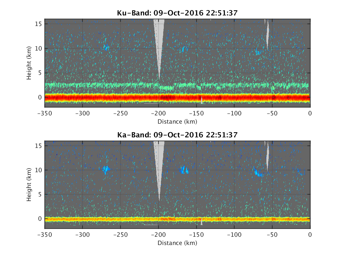
- HIWRAP_RealTimeVerticalPlot_20161009T225137.png
- HIWRAP_RealTimeVerticalPlot_20161009T231556.png
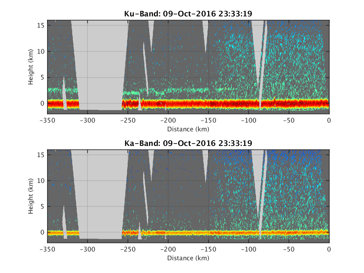
- HIWRAP_RealTimeVerticalPlot_20161009T233319.png
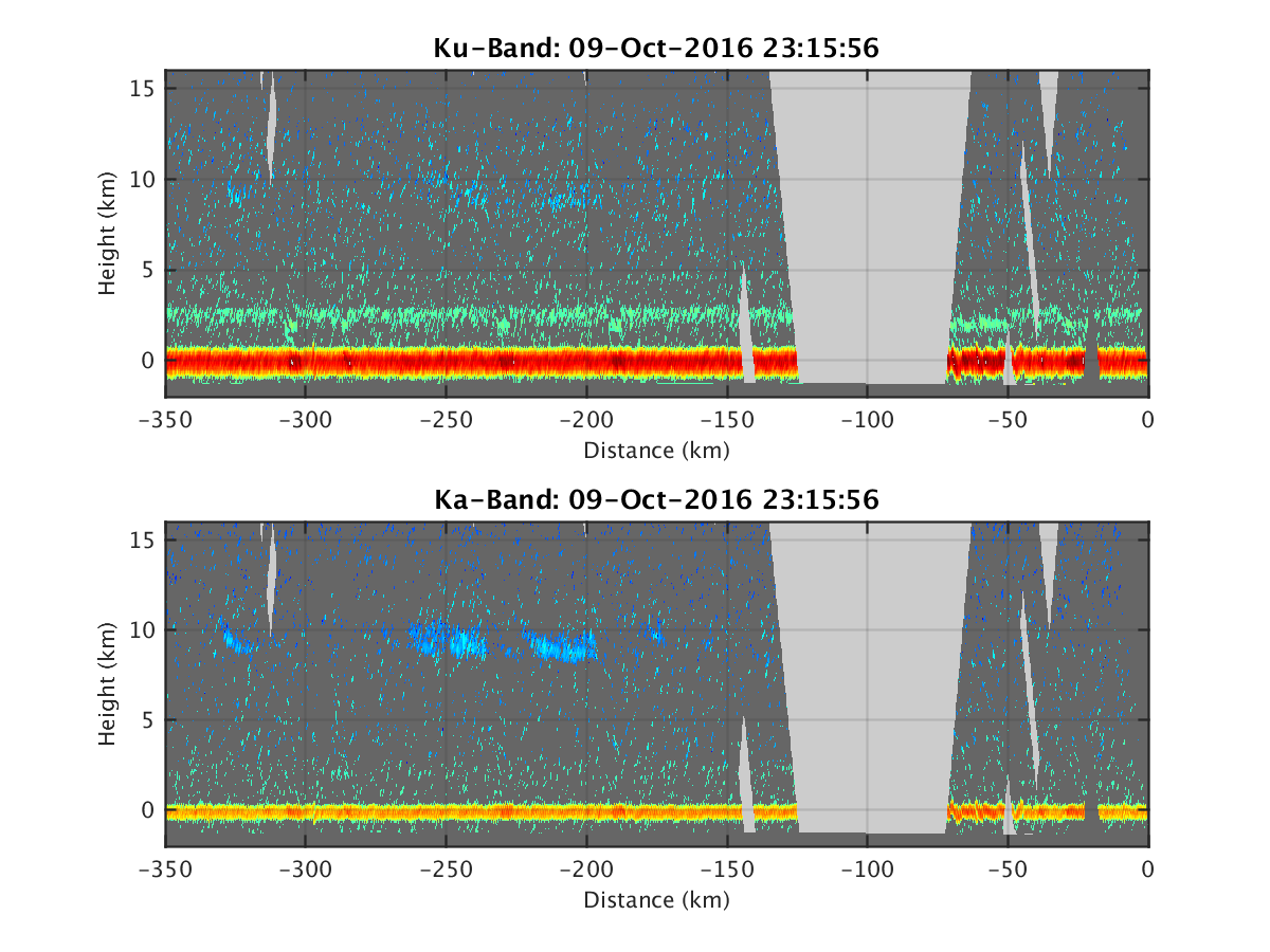
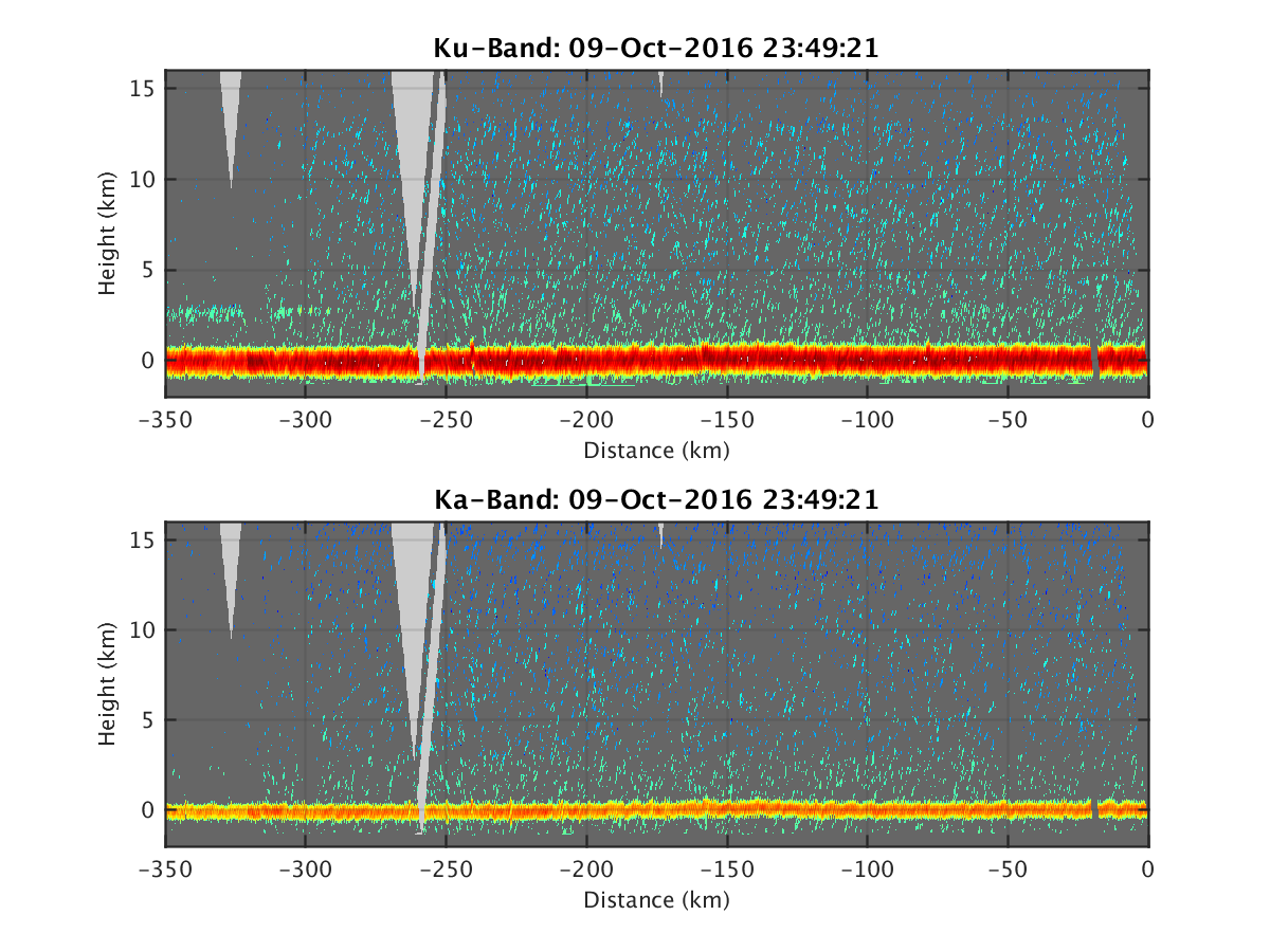
- HIWRAP_RealTimeVerticalPlot_20161009T234921.png
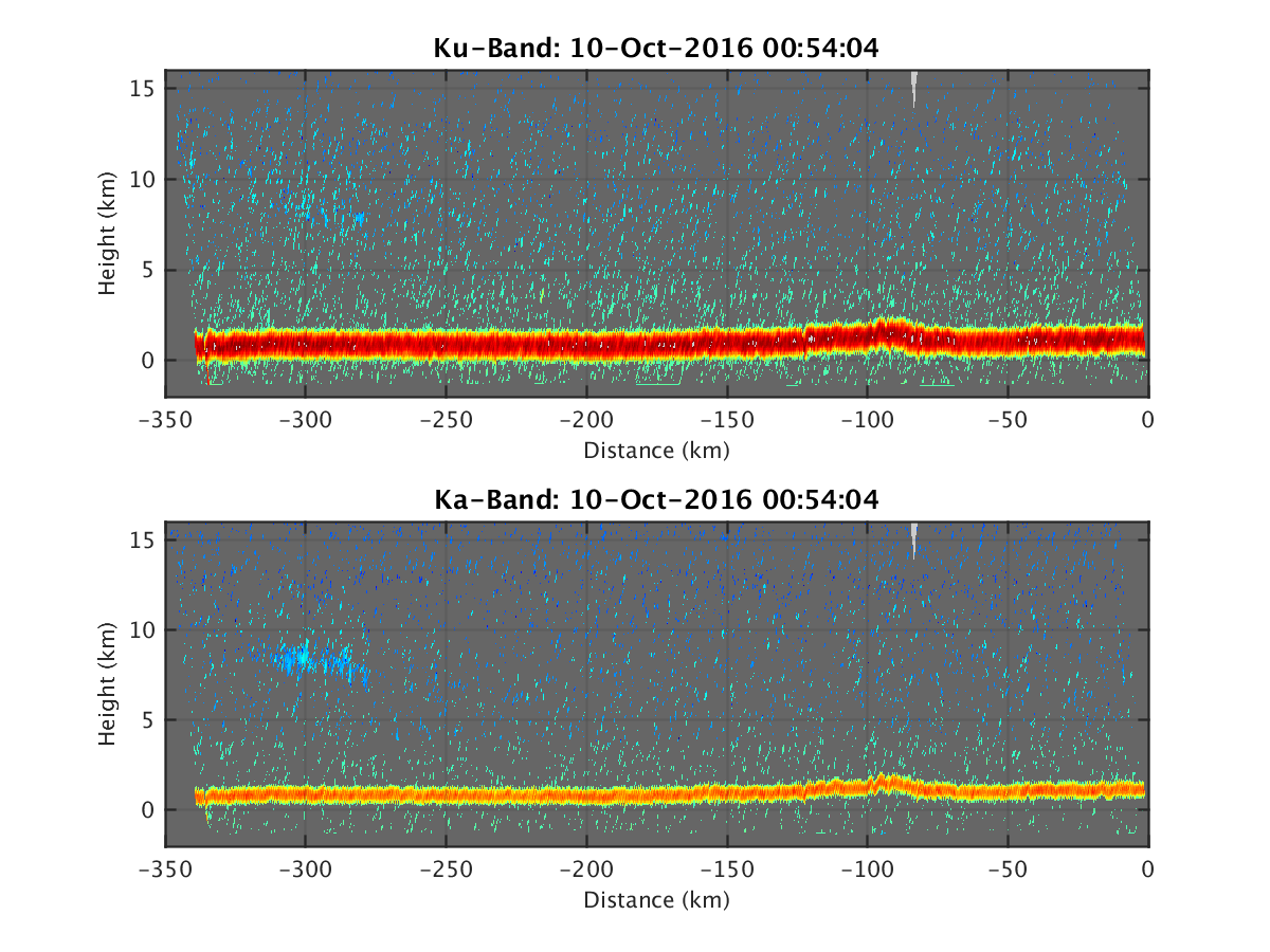
- HIWRAP_RealTimeVerticalPlot_20161010T000520.png
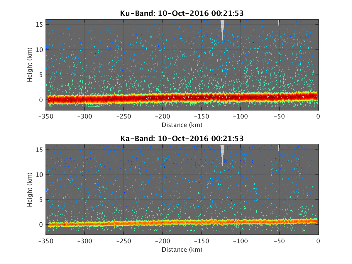
- HIWRAP_RealTimeVerticalPlot_20161010T002153.png
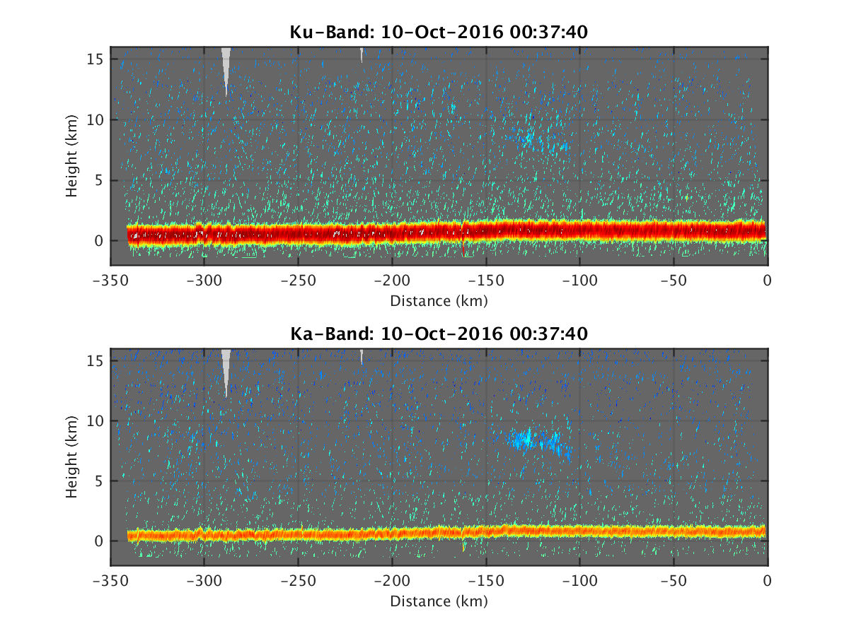
- HIWRAP_RealTimeVerticalPlot_20161010T003740.png
- HIWRAP_RealTimeVerticalPlot_20161010T005404.png
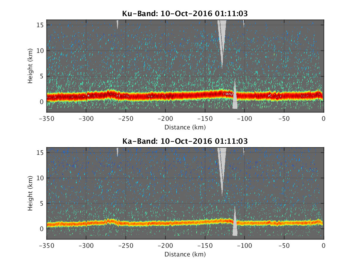
- HIWRAP_RealTimeVerticalPlot_20161010T011103.png
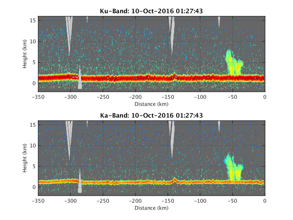
- HIWRAP_RealTimeVerticalPlot_20161010T012743.png
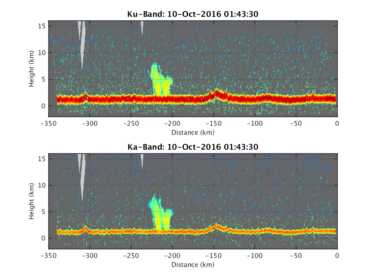
- HIWRAP_RealTimeVerticalPlot_20161010T014330.png
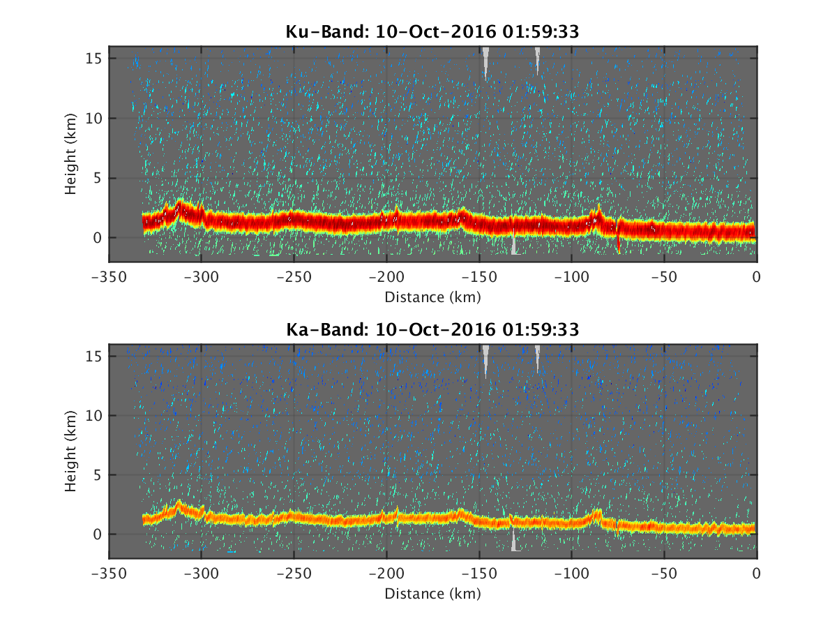
- HIWRAP_RealTimeVerticalPlot_20161010T015933.png
- HIWRAP_RealTimeVerticalPlot_20161010T021519.png
- HIWRAP_RealTimeVerticalPlot_20161010T023254.png
- HIWRAPrt10132-2016-02-12-16-42-22.bin.HIWRAP-Ka-10000m.kmz
- HIWRAPrt10132-2016-02-12-16-42-22.bin.HIWRAP-Ka-2000m.kmz
- HIWRAPrt10132-2016-02-12-16-42-22.bin.HIWRAP-Ka-3000m.kmz
- HIWRAPrt10132-2016-02-12-16-42-22.bin.HIWRAP-Ka-4000m.kmz
- HIWRAPrt10132-2016-02-12-16-42-22.bin.HIWRAP-Ka-5000m.kmz
- HIWRAPrt10132-2016-02-12-16-42-22.bin.HIWRAP-Ka-6000m.kmz
- HIWRAPrt10132-2016-02-12-16-42-22.bin.HIWRAP-Ka-7000m.kmz
- HIWRAPrt10132-2016-02-12-16-42-22.bin.HIWRAP-Ka-8000m.kmz
- HIWRAPrt10132-2016-02-12-16-42-22.bin.HIWRAP-Ka-9000m.kmz
- HIWRAPrt10132-2016-02-12-16-42-22.bin.HIWRAP-Ku-10000m.kmz
- HIWRAPrt10132-2016-02-12-16-42-22.bin.HIWRAP-Ku-2000m.kmz
- HIWRAPrt10132-2016-02-12-16-42-22.bin.HIWRAP-Ku-3000m.kmz
- HIWRAPrt10132-2016-02-12-16-42-22.bin.HIWRAP-Ku-4000m.kmz
- HIWRAPrt10132-2016-02-12-16-42-22.bin.HIWRAP-Ku-5000m.kmz
- HIWRAPrt10132-2016-02-12-16-42-22.bin.HIWRAP-Ku-6000m.kmz
- HIWRAPrt10132-2016-02-12-16-42-22.bin.HIWRAP-Ku-7000m.kmz
- HIWRAPrt10132-2016-02-12-16-42-22.bin.HIWRAP-Ku-8000m.kmz
- HIWRAPrt10132-2016-02-12-16-42-22.bin.HIWRAP-Ku-9000m.kmz
- HIWRAPrt10132-2016-02-15-15-13-28.bin.HIWRAP-Ka-10000m.kmz
- HIWRAPrt10132-2016-02-15-15-13-28.bin.HIWRAP-Ka-2000m.kmz
- HIWRAPrt10132-2016-02-15-15-13-28.bin.HIWRAP-Ka-3000m.kmz
- HIWRAPrt10132-2016-02-15-15-13-28.bin.HIWRAP-Ka-4000m.kmz
- HIWRAPrt10132-2016-02-15-15-13-28.bin.HIWRAP-Ka-5000m.kmz
- HIWRAPrt10132-2016-02-15-15-13-28.bin.HIWRAP-Ka-6000m.kmz
- HIWRAPrt10132-2016-02-15-15-13-28.bin.HIWRAP-Ka-7000m.kmz
- HIWRAPrt10132-2016-02-15-15-13-28.bin.HIWRAP-Ka-8000m.kmz
- HIWRAPrt10132-2016-02-15-15-13-28.bin.HIWRAP-Ka-9000m.kmz
- HIWRAPrt10132-2016-02-15-15-13-28.bin.HIWRAP-Ku-10000m.kmz
- HIWRAPrt10132-2016-02-15-15-13-28.bin.HIWRAP-Ku-2000m.kmz
- HIWRAPrt10132-2016-02-15-15-13-28.bin.HIWRAP-Ku-3000m.kmz
- HIWRAPrt10132-2016-02-15-15-13-28.bin.HIWRAP-Ku-4000m.kmz
- HIWRAPrt10132-2016-02-15-15-13-28.bin.HIWRAP-Ku-5000m.kmz
- HIWRAPrt10132-2016-02-15-15-13-28.bin.HIWRAP-Ku-6000m.kmz
- HIWRAPrt10132-2016-02-15-15-13-28.bin.HIWRAP-Ku-7000m.kmz
- HIWRAPrt10132-2016-02-15-15-13-28.bin.HIWRAP-Ku-8000m.kmz
- HIWRAPrt10132-2016-02-15-15-13-28.bin.HIWRAP-Ku-9000m.kmz
- HIWRAPrt10132-2016-02-21-14-40-33.bin.HIWRAP-Ka-10000m.kmz
- HIWRAPrt10132-2016-02-21-14-40-33.bin.HIWRAP-Ka-2000m.kmz
- HIWRAPrt10132-2016-02-21-14-40-33.bin.HIWRAP-Ka-3000m.kmz
- HIWRAPrt10132-2016-02-21-14-40-33.bin.HIWRAP-Ka-4000m.kmz
- HIWRAPrt10132-2016-02-21-14-40-33.bin.HIWRAP-Ka-5000m.kmz
- HIWRAPrt10132-2016-02-21-14-40-33.bin.HIWRAP-Ka-6000m.kmz
- HIWRAPrt10132-2016-02-21-14-40-33.bin.HIWRAP-Ka-7000m.kmz
- HIWRAPrt10132-2016-02-21-14-40-33.bin.HIWRAP-Ka-8000m.kmz
- HIWRAPrt10132-2016-02-21-14-40-33.bin.HIWRAP-Ka-9000m.kmz
- HIWRAPrt10132-2016-02-21-14-40-33.bin.HIWRAP-Ku-10000m.kmz
- HIWRAPrt10132-2016-02-21-14-40-33.bin.HIWRAP-Ku-2000m.kmz
- HIWRAPrt10132-2016-02-21-14-40-33.bin.HIWRAP-Ku-3000m.kmz
- HIWRAPrt10132-2016-02-21-14-40-33.bin.HIWRAP-Ku-4000m.kmz
- HIWRAPrt10132-2016-02-21-14-40-33.bin.HIWRAP-Ku-5000m.kmz
- HIWRAPrt10132-2016-02-21-14-40-33.bin.HIWRAP-Ku-6000m.kmz
- HIWRAPrt10132-2016-02-21-14-40-33.bin.HIWRAP-Ku-7000m.kmz
- HIWRAPrt10132-2016-02-21-14-40-33.bin.HIWRAP-Ku-8000m.kmz
- HIWRAPrt10132-2016-02-21-14-40-33.bin.HIWRAP-Ku-9000m.kmz
HDF5_HIWRAP
20161007
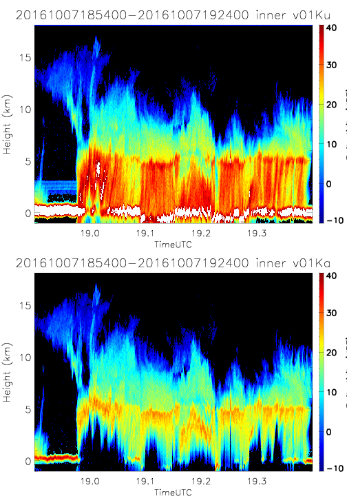
- SHOUTHRR_HIWRAP_L1B_20161007185400-20161007192400_inner_v01.h5
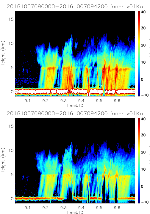
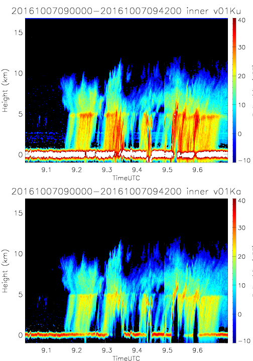
- SHOUTHRR_HIWRAP_L1B_20161007090000-20161007094200_inner_v01.h5
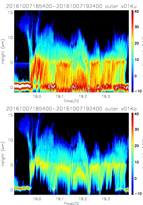
- SHOUTHRR_HIWRAP_L1B_20161007185400-20161007192400_outer_v01.h5
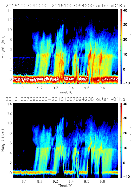
- SHOUTHRR_HIWRAP_L1B_20161007090000-20161007094200_outer_v01.h5
- SHOUTHRR_HIWRAP_L1B_20161007090000-20161007094200_outer_v02.h5
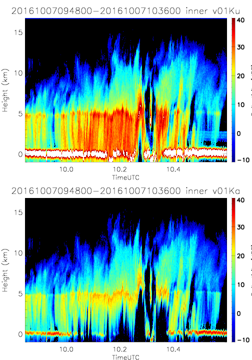
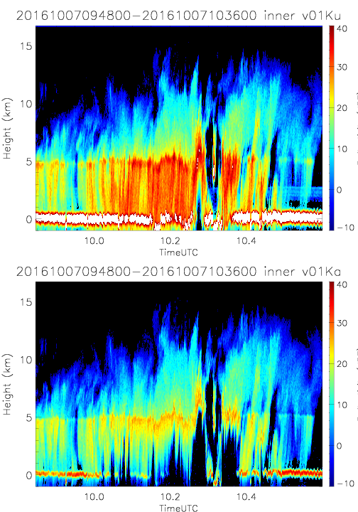
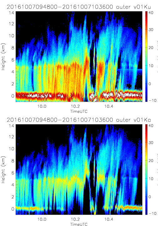
- SHOUTHRR_HIWRAP_L1B_20161007094800-20161007103600_inner_v01.h5
- SHOUTHRR_HIWRAP_L1B_20161007094800-20161007103600_inner_v02.h5
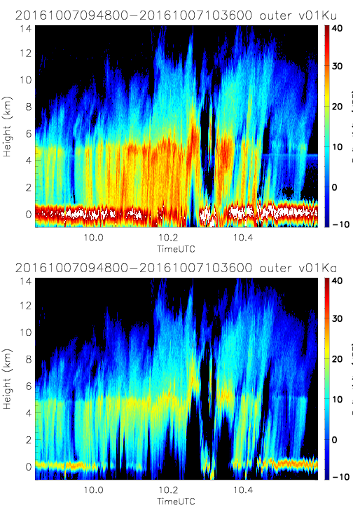
- SHOUTHRR_HIWRAP_L1B_20161007094800-20161007103600_outer_v01.h5
- SHOUTHRR_HIWRAP_L1B_20161007094800-20161007103600_outer_v02.h5
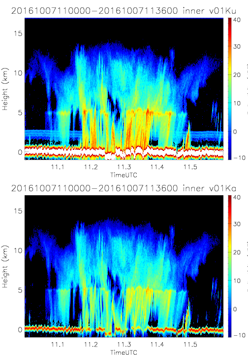
- SHOUTHRR_HIWRAP_L1B_20161007110000-20161007113600_inner_v01.h5
- SHOUTHRR_HIWRAP_L1B_20161007110000-20161007113600_inner_v02.h5
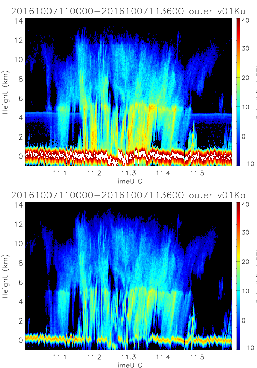
- SHOUTHRR_HIWRAP_L1B_20161007110000-20161007113600_outer_v01.h5
- SHOUTHRR_HIWRAP_L1B_20161007110000-20161007113600_outer_v02.h5
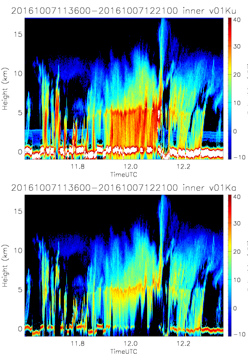
- SHOUTHRR_HIWRAP_L1B_20161007113600-20161007122100_inner_v01.h5
- SHOUTHRR_HIWRAP_L1B_20161007113600-20161007122100_inner_v02.h5
- SHOUTHRR_HIWRAP_L1B_20161007113600-20161007122100_outer_v01.h5
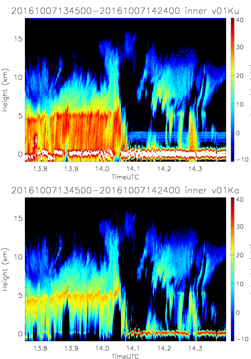
- SHOUTHRR_HIWRAP_L1B_20161007134500-20161007142400_inner_v02.h5
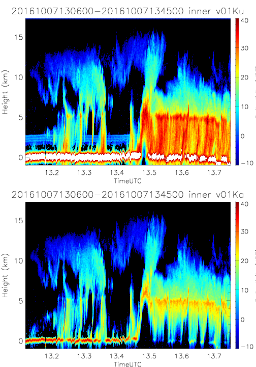
- SHOUTHRR_HIWRAP_L1B_20161007130600-20161007134500_inner_v01.h5
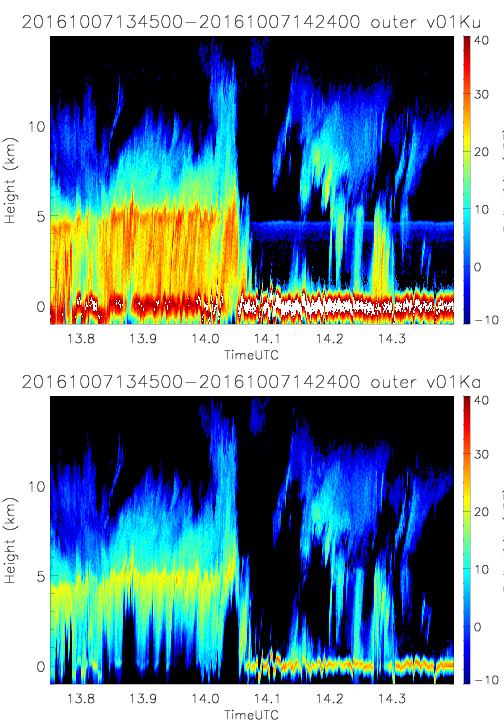
- SHOUTHRR_HIWRAP_L1B_20161007134500-20161007142400_outer_v02.h5
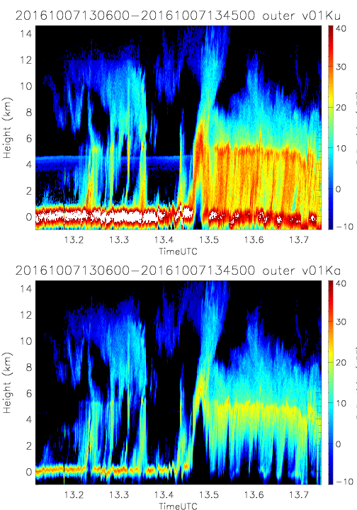
- SHOUTHRR_HIWRAP_L1B_20161007130600-20161007134500_outer_v01.h5
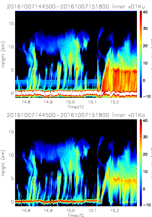
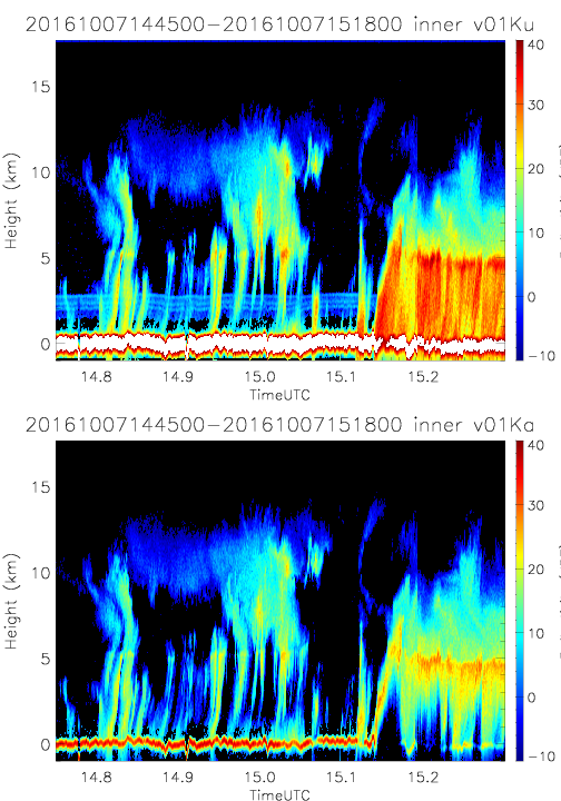
- SHOUTHRR_HIWRAP_L1B_20161007144500-20161007151800_inner_v02.h5
- SHOUTHRR_HIWRAP_L1B_20161007134500-20161007142400_inner_v01.h5
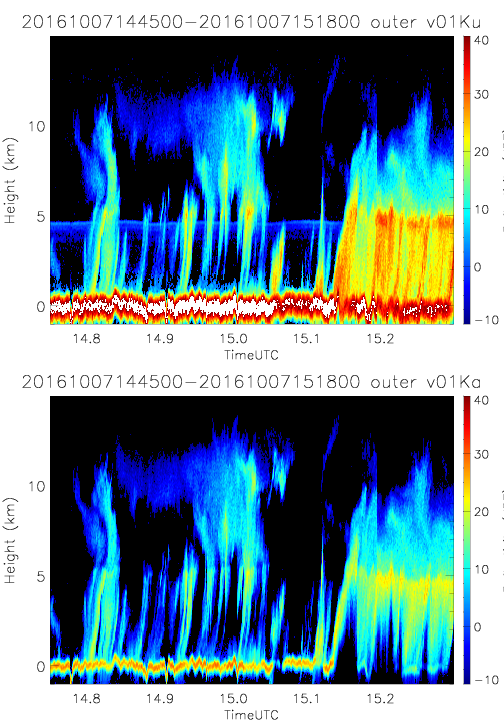
- SHOUTHRR_HIWRAP_L1B_20161007144500-20161007151800_outer_v02.h5
- SHOUTHRR_HIWRAP_L1B_20161007134500-20161007142400_outer_v01.h5
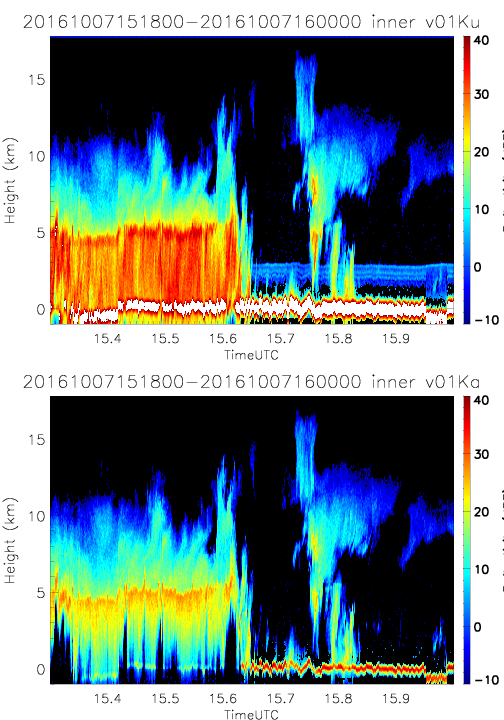
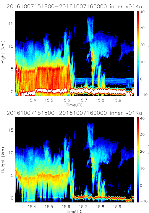
- SHOUTHRR_HIWRAP_L1B_20161007151800-20161007160000_inner_v02.h5
- SHOUTHRR_HIWRAP_L1B_20161007144500-20161007151800_inner_v01.h5
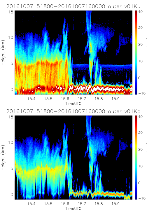
- SHOUTHRR_HIWRAP_L1B_20161007151800-20161007160000_outer_v02.h5
- SHOUTHRR_HIWRAP_L1B_20161007144500-20161007151800_outer_v01.h5
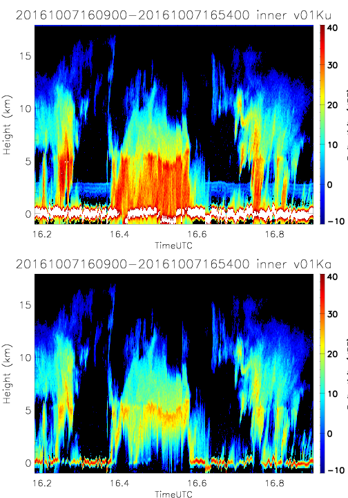
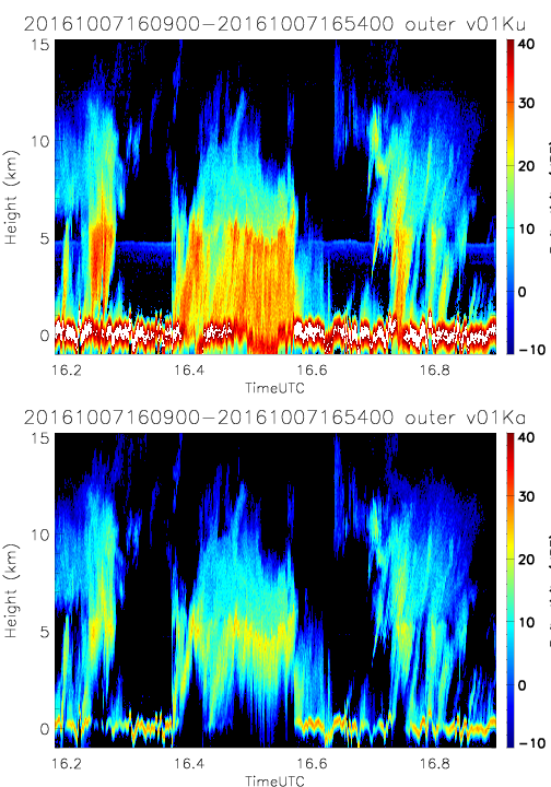
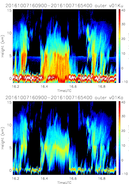
- SHOUTHRR_HIWRAP_L1B_20161007160900-20161007165400_inner_v02.h5
- SHOUTHRR_HIWRAP_L1B_20161007151800-20161007160000_inner_v01.h5
- SHOUTHRR_HIWRAP_L1B_20161007160900-20161007165400_outer_v02.h5
- SHOUTHRR_HIWRAP_L1B_20161007151800-20161007160000_outer_v01.h5
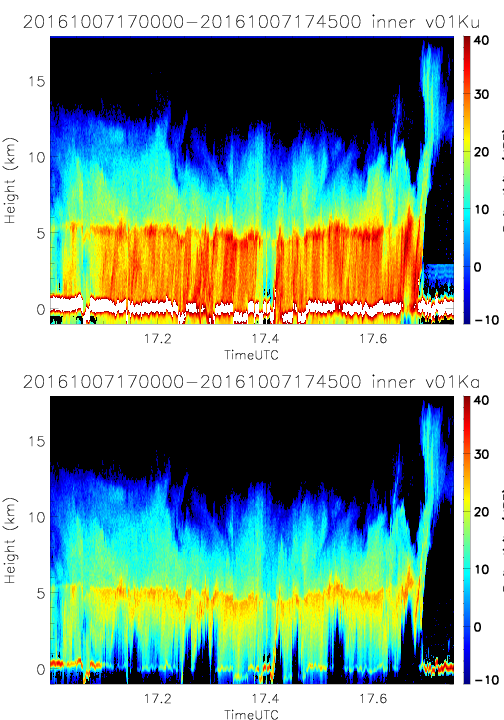
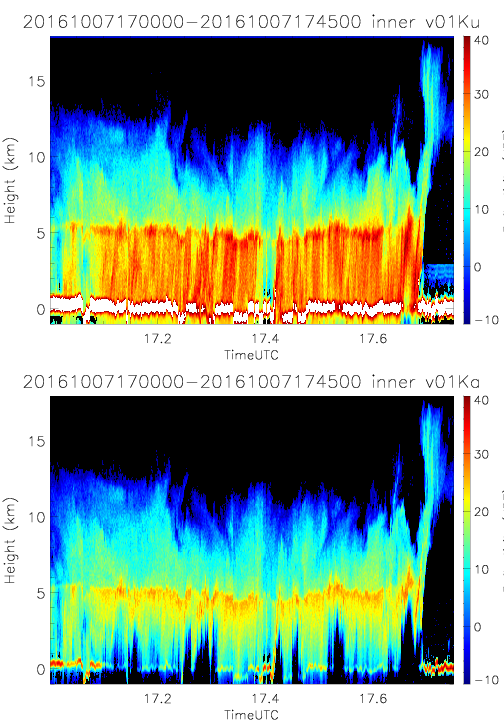
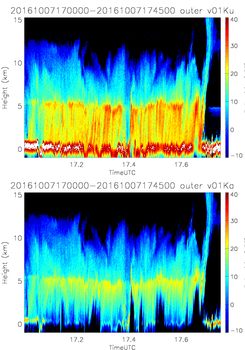
- SHOUTHRR_HIWRAP_L1B_20161007170000-20161007174500_inner_v02.h5
- SHOUTHRR_HIWRAP_L1B_20161007160900-20161007165400_inner_v01.h5
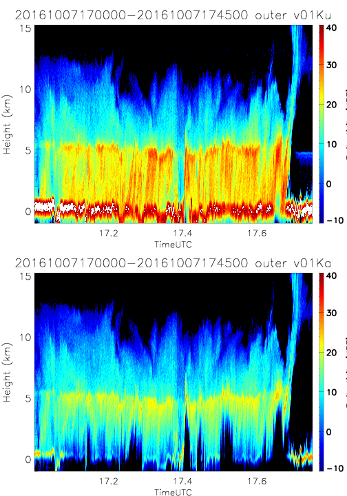
- SHOUTHRR_HIWRAP_L1B_20161007170000-20161007174500_outer_v02.h5
- SHOUTHRR_HIWRAP_L1B_20161007160900-20161007165400_outer_v01.h5
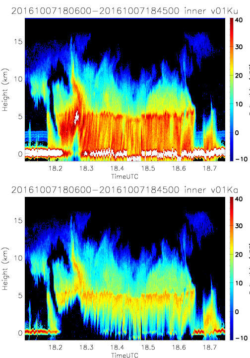
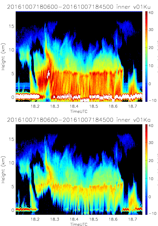
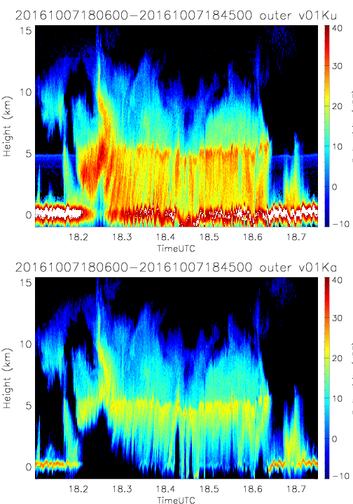
- SHOUTHRR_HIWRAP_L1B_20161007180600-20161007184500_inner_v02.h5
- SHOUTHRR_HIWRAP_L1B_20161007170000-20161007174500_inner_v01.h5
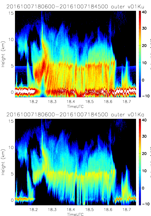
- SHOUTHRR_HIWRAP_L1B_20161007180600-20161007184500_outer_v02.h5
- SHOUTHRR_HIWRAP_L1B_20161007170000-20161007174500_outer_v01.h5
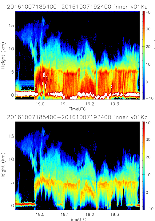
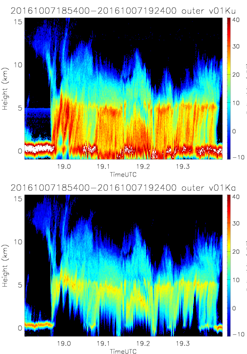
- SHOUTHRR_HIWRAP_L1B_20161007185400-20161007192400_inner_v02.h5
- SHOUTHRR_HIWRAP_L1B_20161007180600-20161007184500_inner_v01.h5
- SHOUTHRR_HIWRAP_L1B_20161007185400-20161007192400_outer_v02.h5
- SHOUTHRR_HIWRAP_L1B_20161007180600-20161007184500_outer_v01.h5
- SHOUTHRR_HIWRAP_L1B_20161007090000-20161007094200_inner_v02.h5
- SHOUTHRR_HIWRAP_L1B_20161007113600-20161007122100_outer_v02.h5
- SHOUTHRR_HIWRAP_L1B_20161007130600-20161007134500_inner_v02.h5
- SHOUTHRR_HIWRAP_L1B_20161007130600-20161007134500_outer_v02.h5
20161009
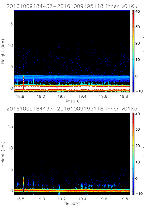
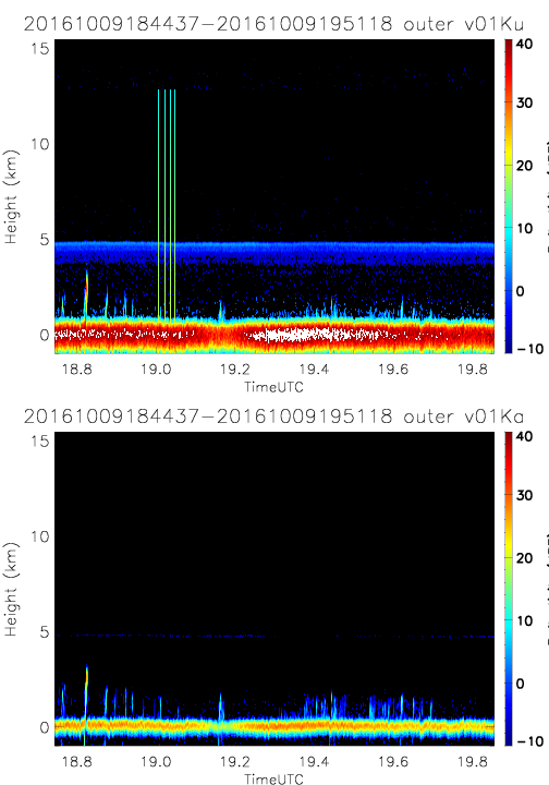
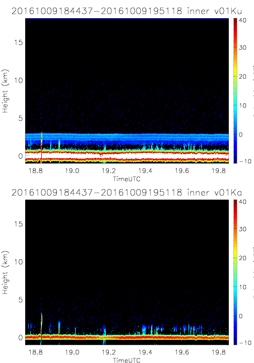
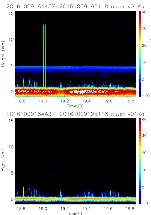
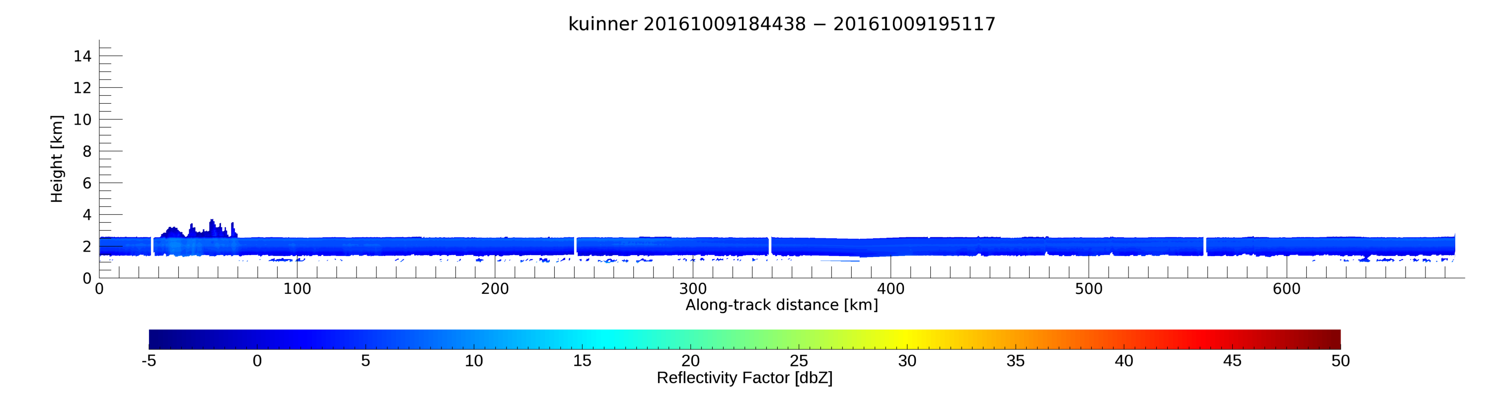
- SHOUTHRR_HIWRAP_L1B_20161009184437-20161009195118_inner_v01.h5
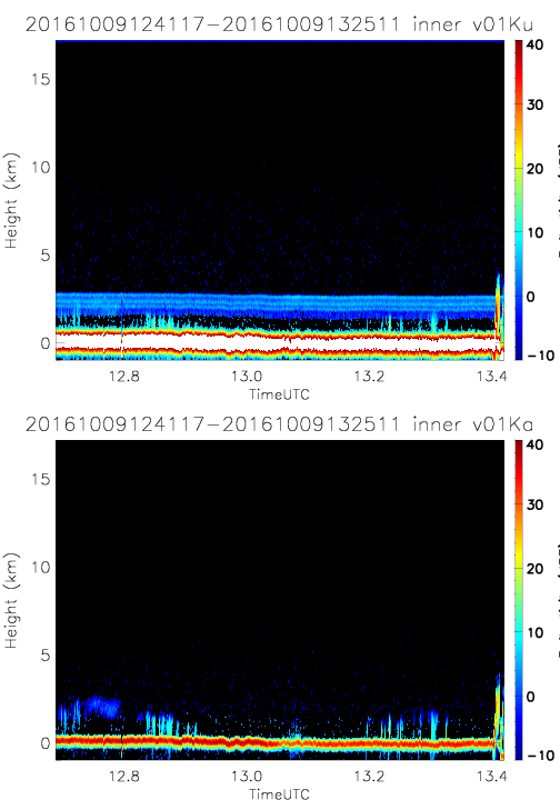
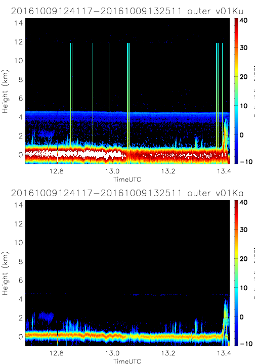
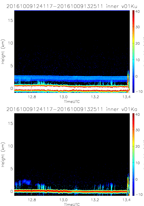
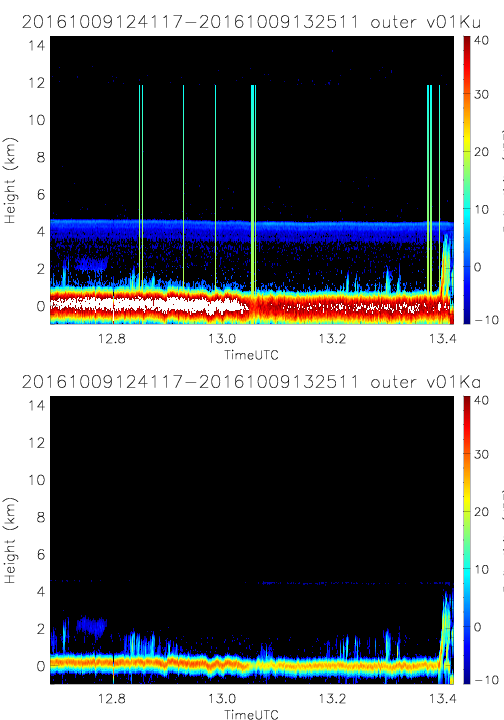
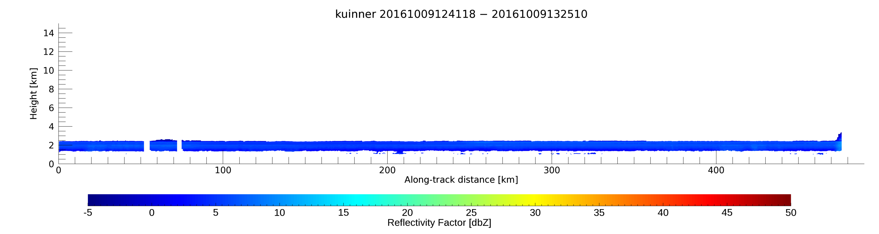
- SHOUTHRR_HIWRAP_L1B_20161009124117-20161009132511_inner_v01.h5
- SHOUTHRR_HIWRAP_L1B_20161009184437-20161009195118_outer_v01.h5
- SHOUTHRR_HIWRAP_L1B_20161009124117-20161009132511_outer_v01.h5
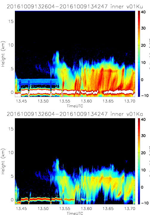
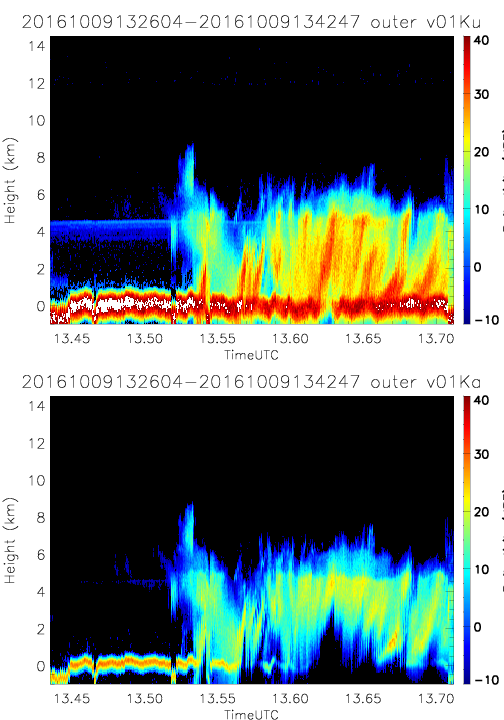
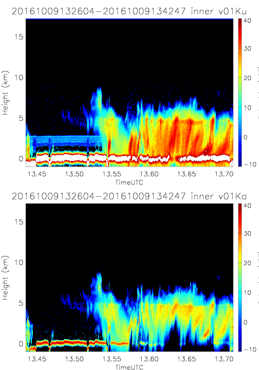
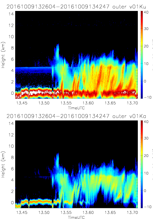
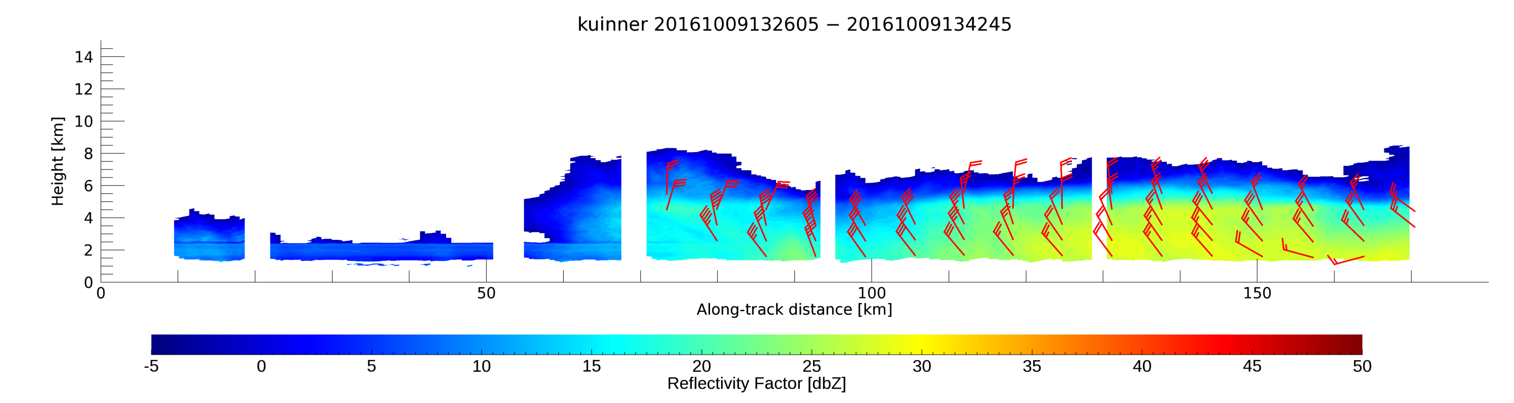
- SHOUTHRR_HIWRAP_L1B_20161009132604-20161009134247_inner_v01.h5
- SHOUTHRR_HIWRAP_L1B_20161009132604-20161009134247_outer_v01.h5
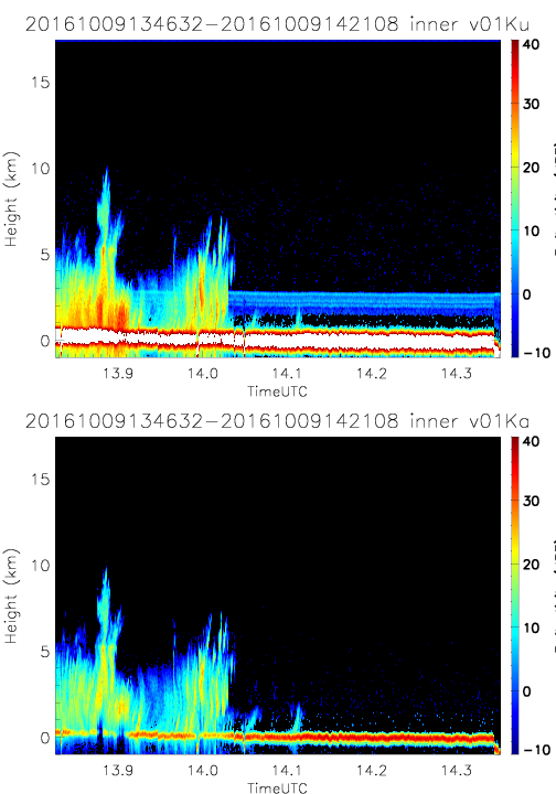
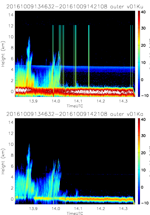
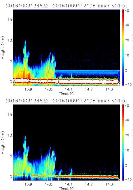
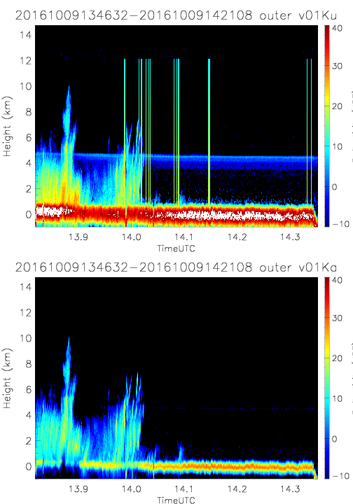
- SHOUTHRR_HIWRAP_L1B_20161009134632-20161009142108_inner_v01.h5
- SHOUTHRR_HIWRAP_L1B_20161009134632-20161009142108_outer_v01.h5
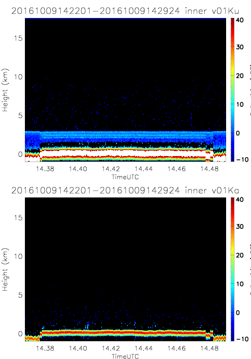
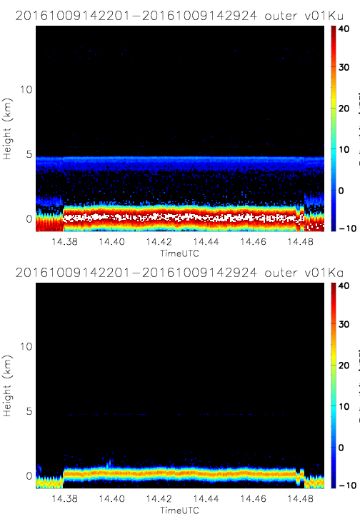
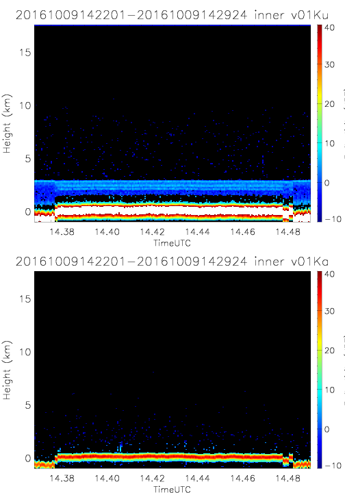
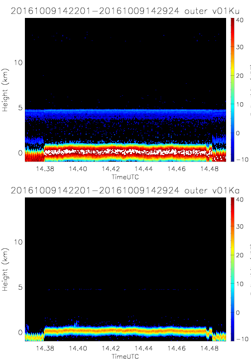
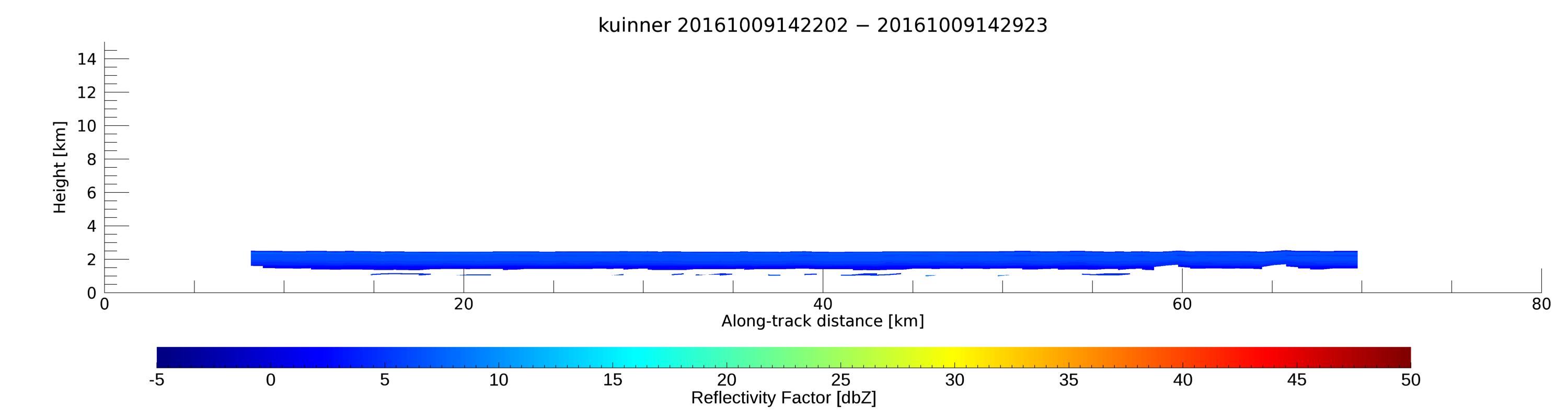
- SHOUTHRR_HIWRAP_L1B_20161009142201-20161009142924_inner_v01.h5
- SHOUTHRR_HIWRAP_L1B_20161009142201-20161009142924_outer_v01.h5
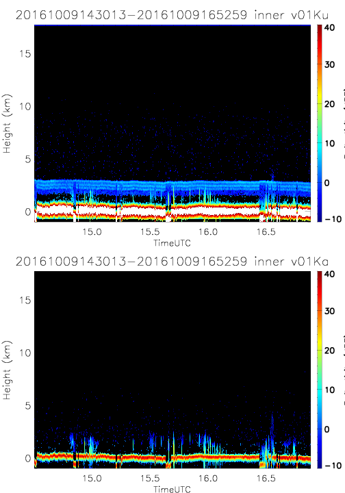
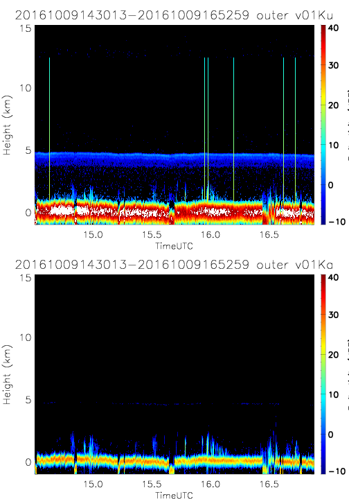
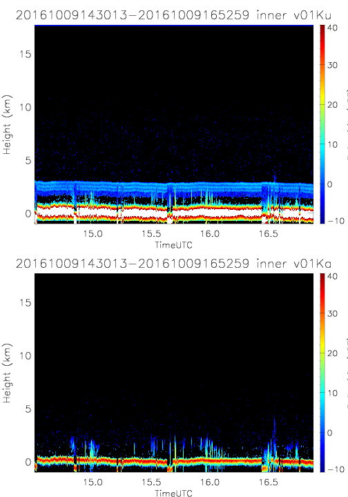
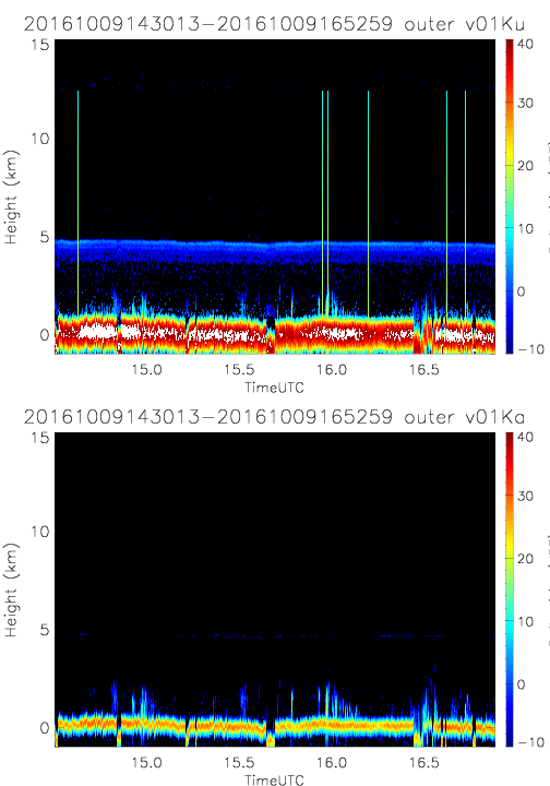
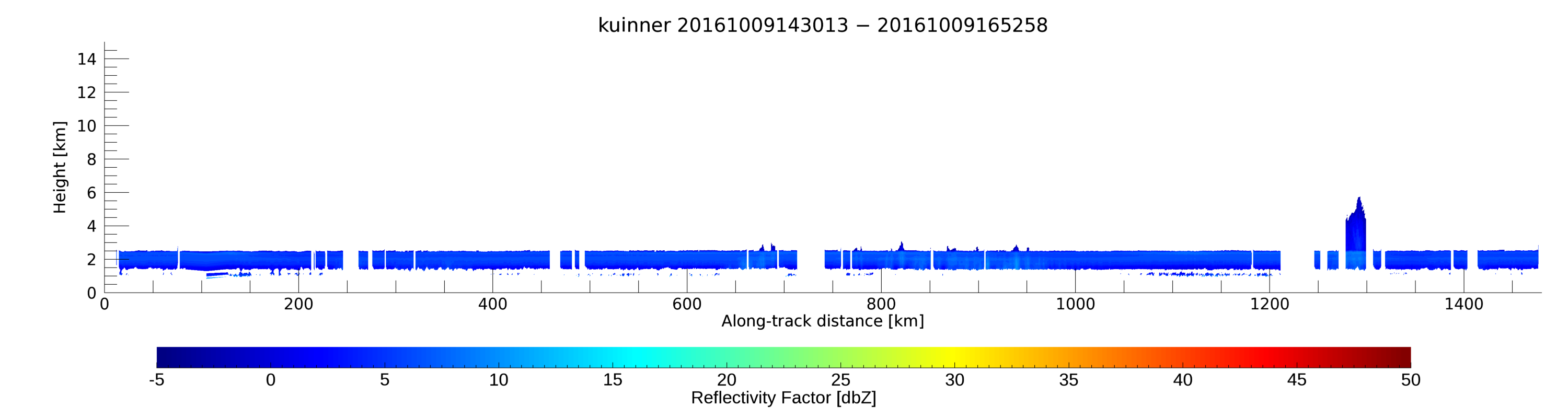
- SHOUTHRR_HIWRAP_L1B_20161009143013-20161009165259_inner_v01.h5
- SHOUTHRR_HIWRAP_L1B_20161009143013-20161009165259_outer_v01.h5
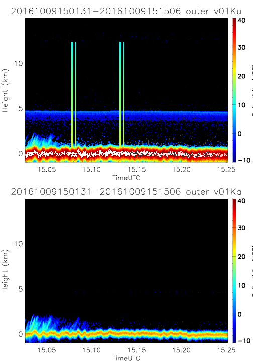
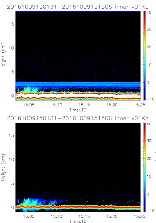
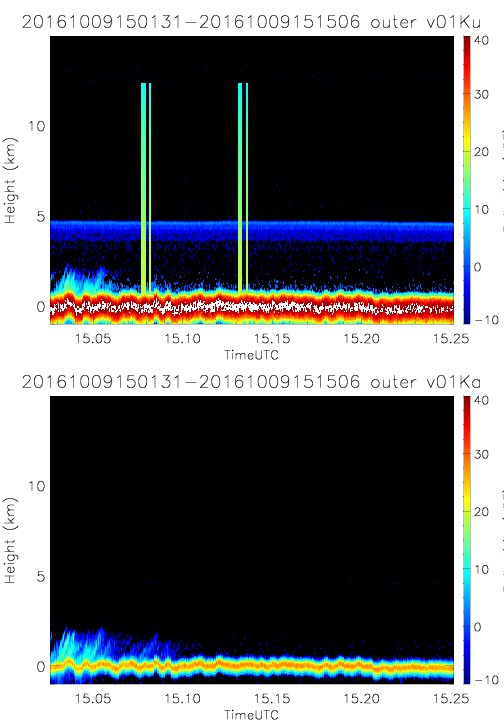
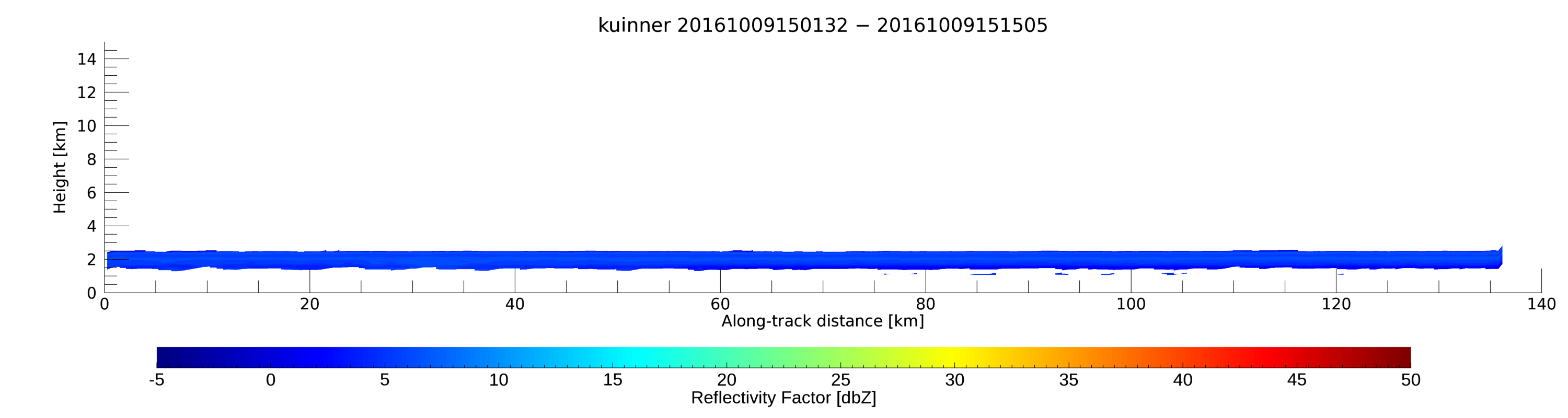
- SHOUTHRR_HIWRAP_L1B_20161009150131-20161009151506_inner_v01.h5
- SHOUTHRR_HIWRAP_L1B_20161009150131-20161009151506_outer_v01.h5
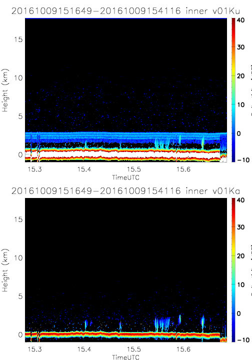
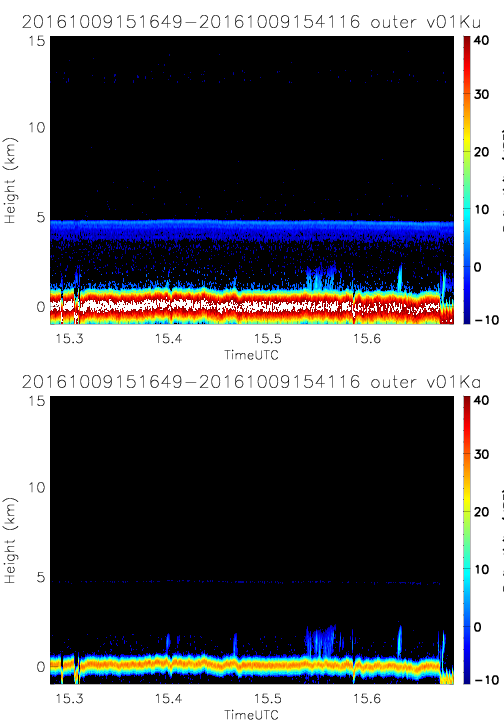
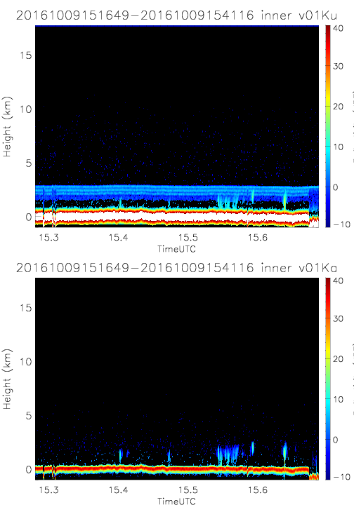
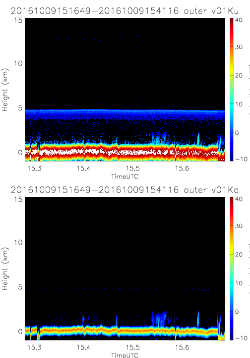
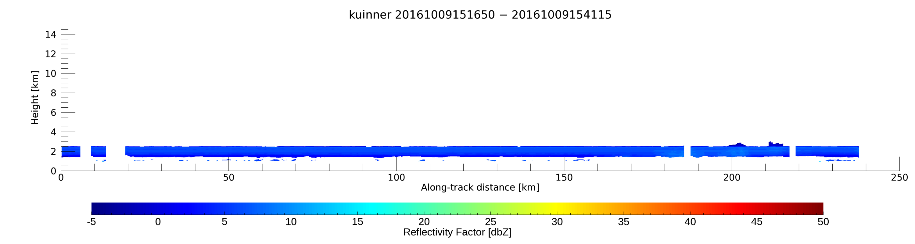
- SHOUTHRR_HIWRAP_L1B_20161009151649-20161009154116_inner_v01.h5
- SHOUTHRR_HIWRAP_L1B_20161009151649-20161009154116_outer_v01.h5
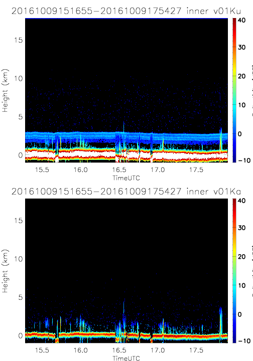
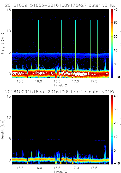
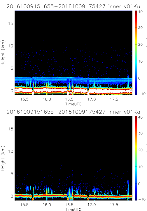
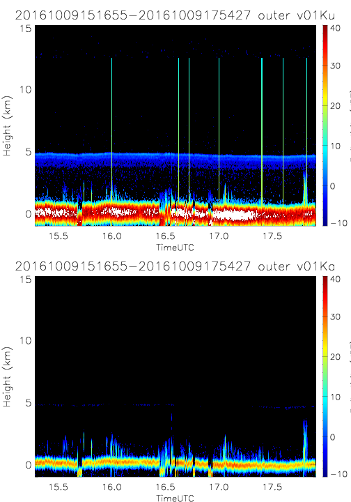
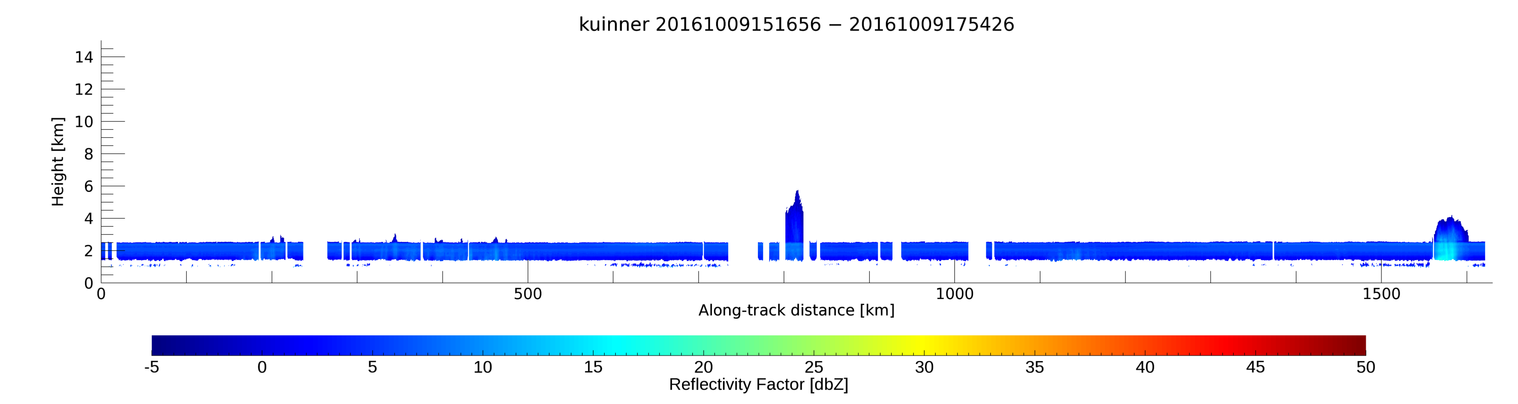
- SHOUTHRR_HIWRAP_L1B_20161009151655-20161009175427_inner_v01.h5
- SHOUTHRR_HIWRAP_L1B_20161009151655-20161009175427_outer_v01.h5
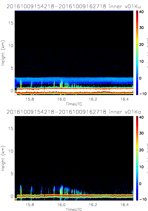
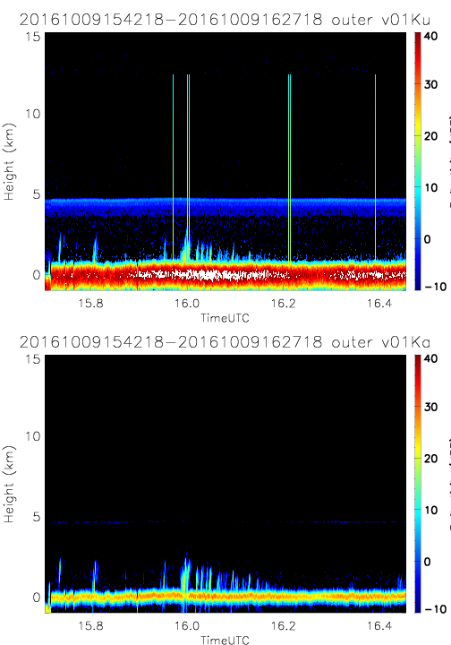
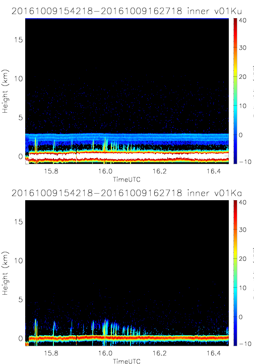
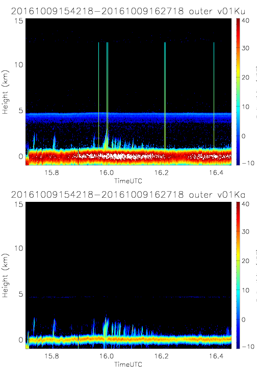
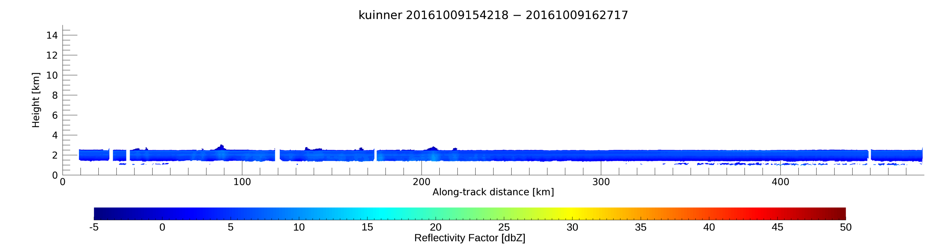
- SHOUTHRR_HIWRAP_L1B_20161009154218-20161009162718_inner_v01.h5
- SHOUTHRR_HIWRAP_L1B_20161009154218-20161009162718_outer_v01.h5
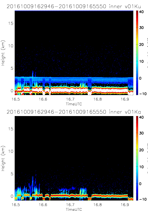
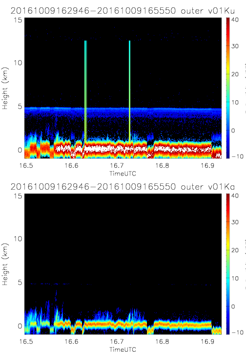
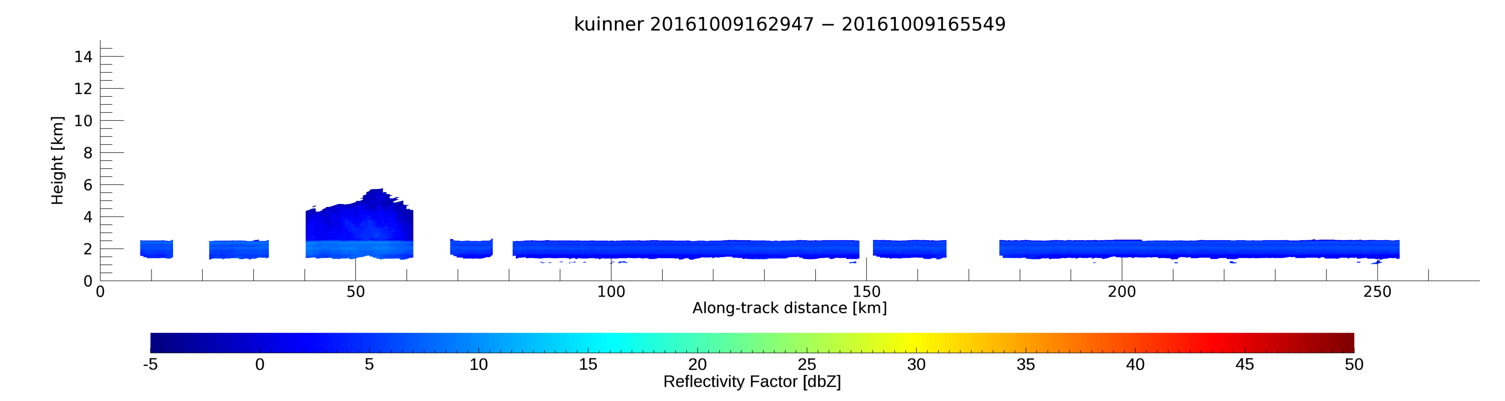
- SHOUTHRR_HIWRAP_L1B_20161009162946-20161009165550_inner_v01.h5
- SHOUTHRR_HIWRAP_L1B_20161009162946-20161009165550_outer_v01.h5
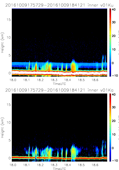
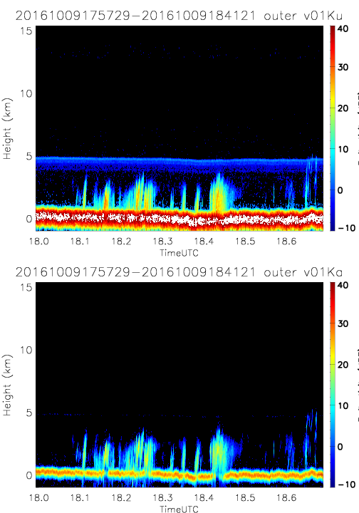
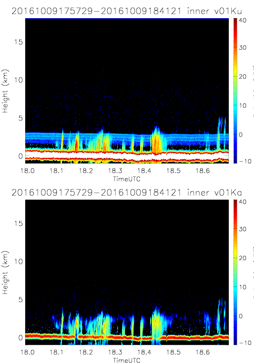
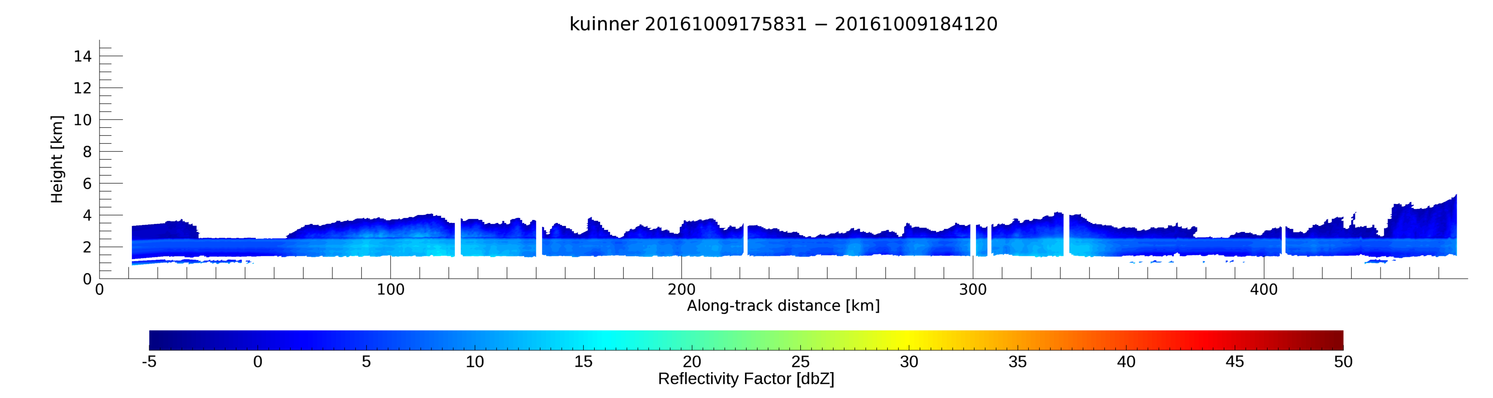
- SHOUTHRR_HIWRAP_L1B_20161009175729-20161009184121_inner_v01.h5
- SHOUTHRR_HIWRAP_L1B_20161009175729-20161009184121_outer_v01.h5
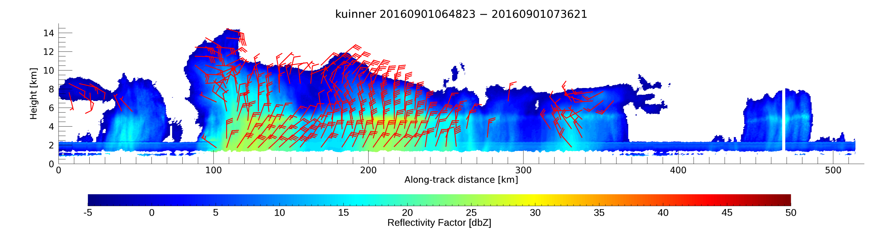
20160901
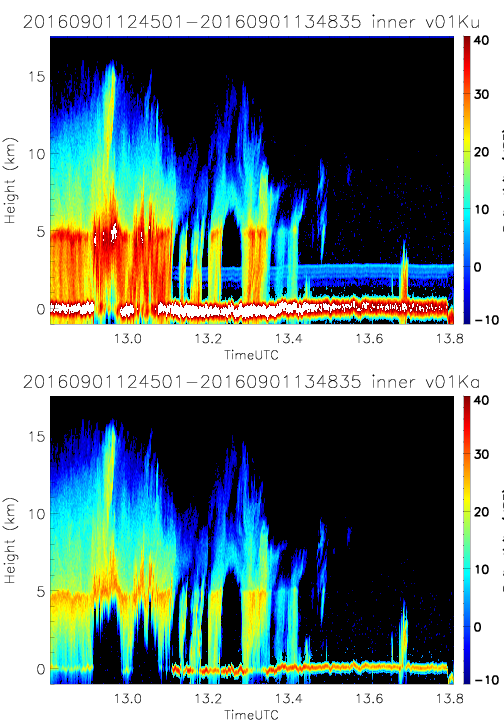
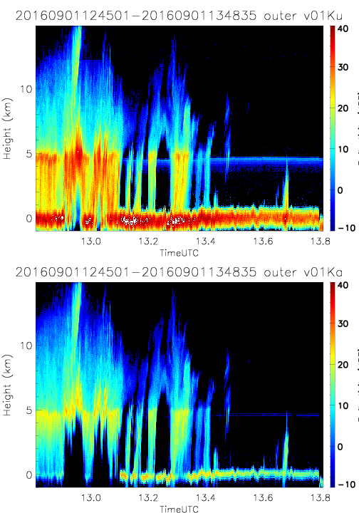
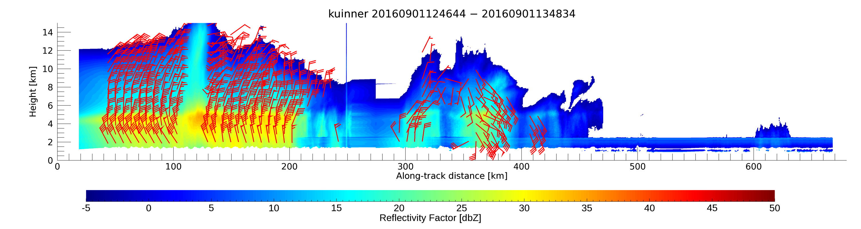
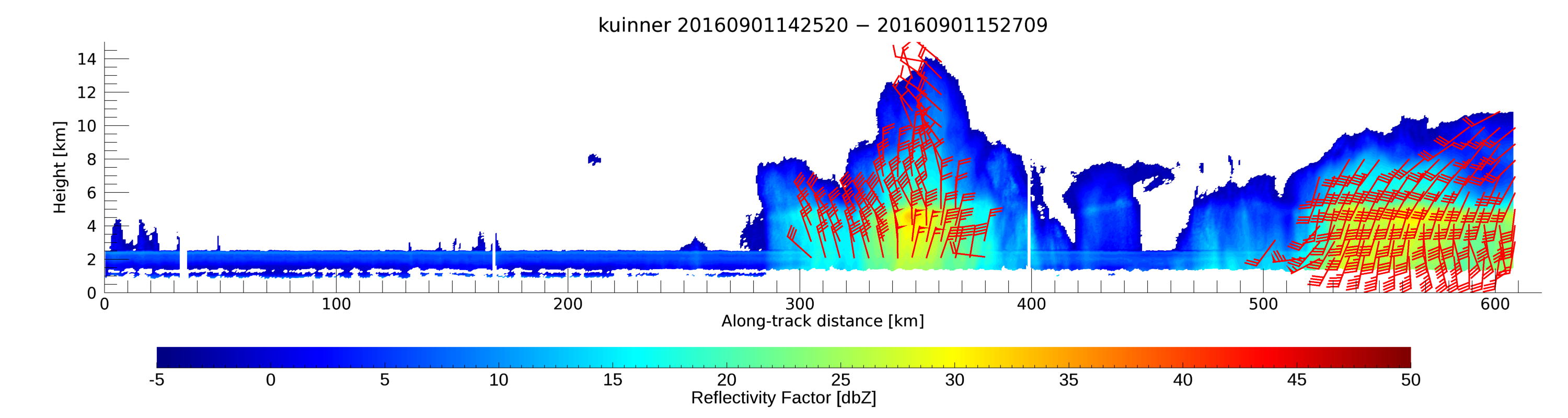
- SHOUTHRR_HIWRAP_L1B_20160901124501-20160901134835_inner_v01.h5
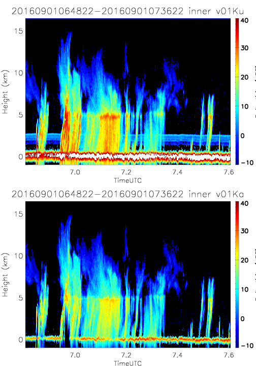
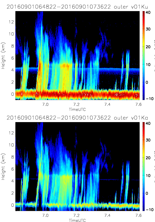
- SHOUTHRR_HIWRAP_L1B_20160901064822-20160901073622_inner_v01.h5
- SHOUTHRR_HIWRAP_L1B_20160901124501-20160901134835_outer_v01.h5
- SHOUTHRR_HIWRAP_L1B_20160901064822-20160901073622_outer_v01.h5
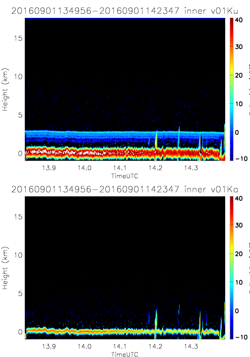
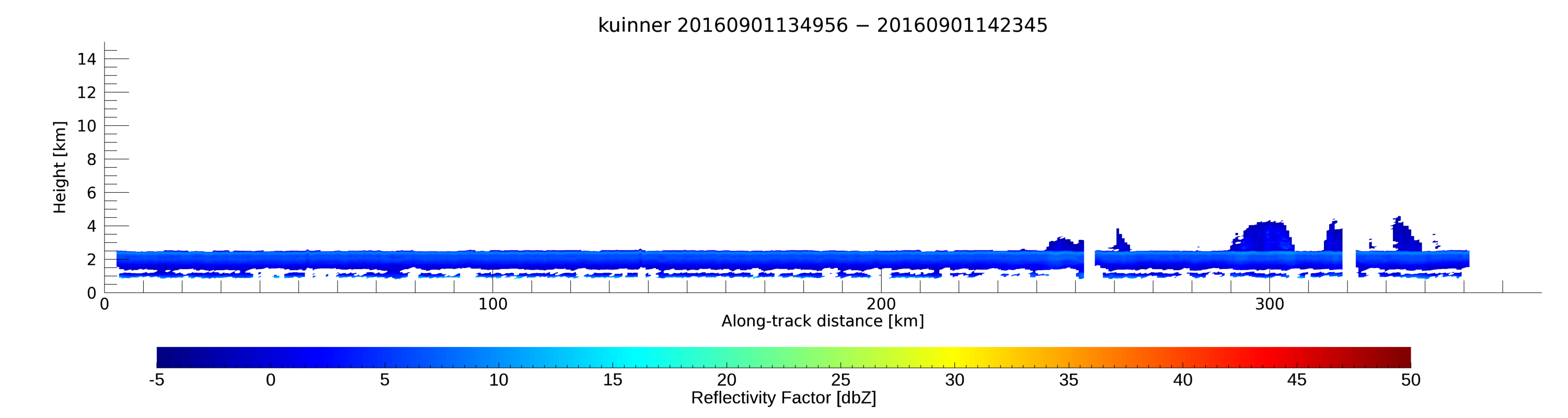
- SHOUTHRR_HIWRAP_L1B_20160901134956-20160901142347_inner_v01.h5
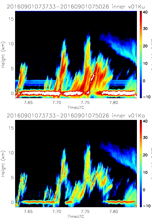
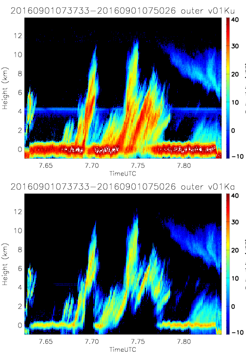
- SHOUTHRR_HIWRAP_L1B_20160901073733-20160901075026_inner_v01.h5
- SHOUTHRR_HIWRAP_L1B_20160901134956-20160901142347_outer_v01.h5
- SHOUTHRR_HIWRAP_L1B_20160901073733-20160901075026_outer_v01.h5
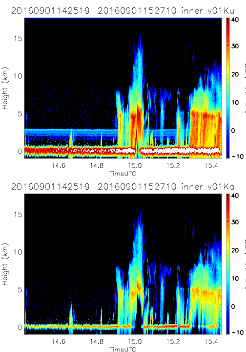
- SHOUTHRR_HIWRAP_L1B_20160901142519-20160901152710_inner_v01.h5
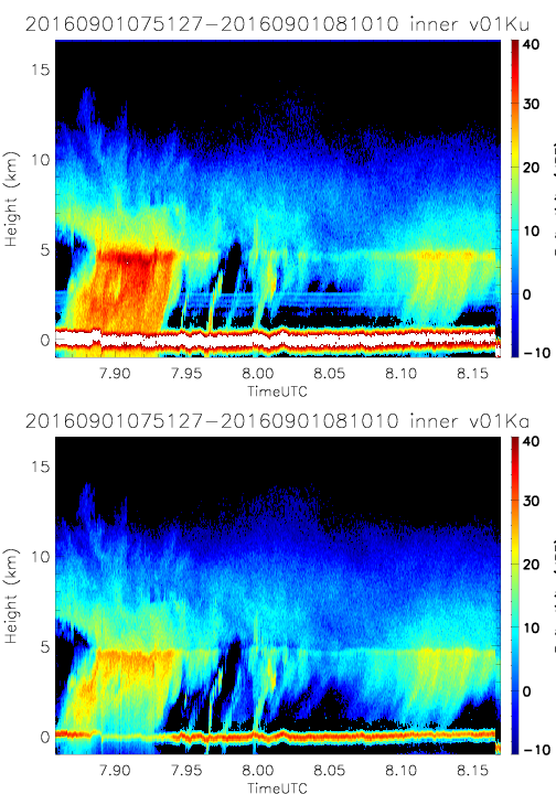
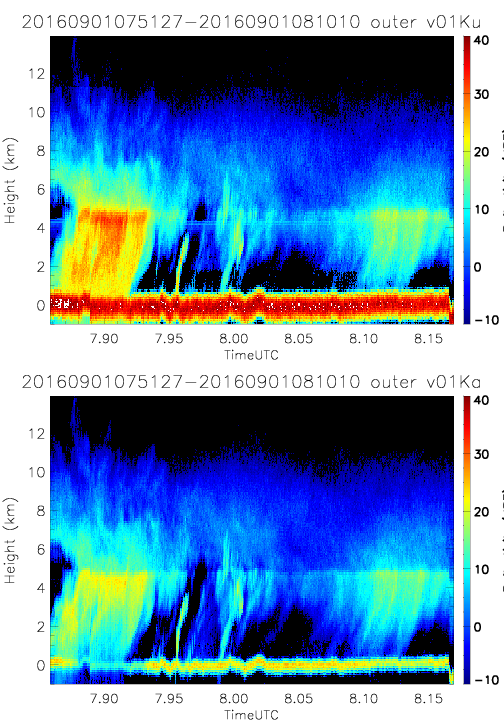
- SHOUTHRR_HIWRAP_L1B_20160901075127-20160901081010_inner_v01.h5
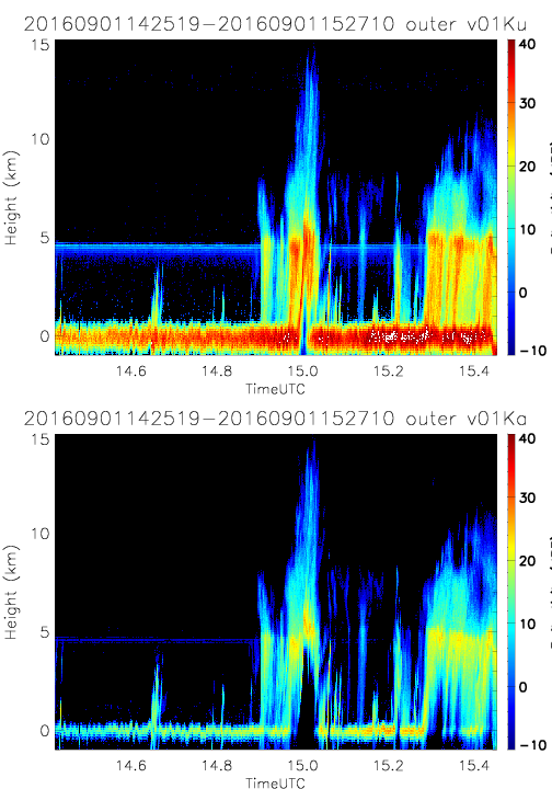
- SHOUTHRR_HIWRAP_L1B_20160901142519-20160901152710_outer_v01.h5
- SHOUTHRR_HIWRAP_L1B_20160901075127-20160901081010_outer_v01.h5
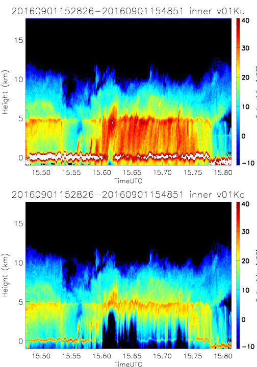
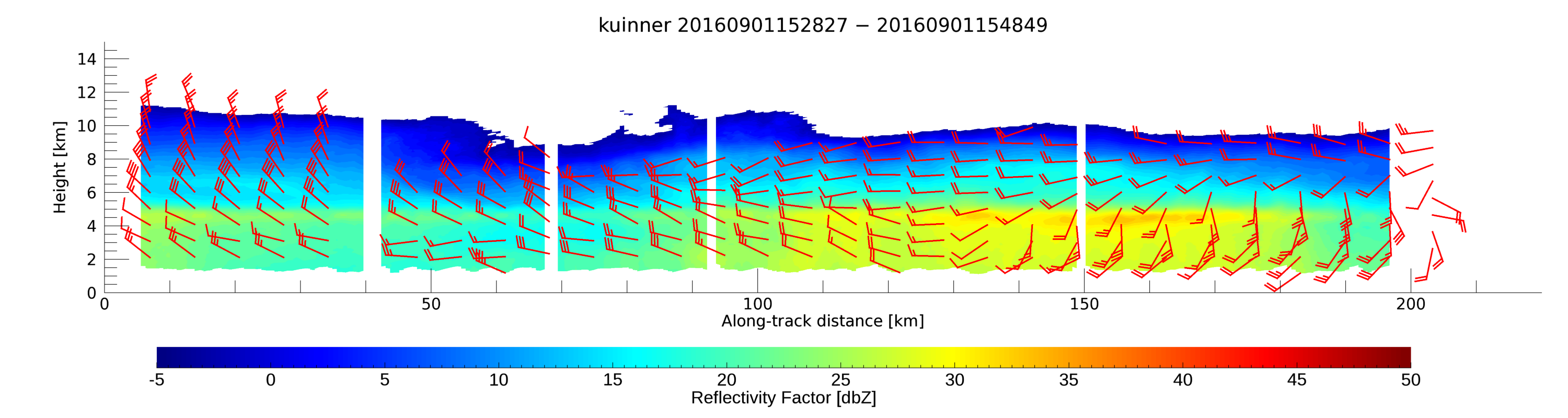
- SHOUTHRR_HIWRAP_L1B_20160901152826-20160901154851_inner_v01.h5
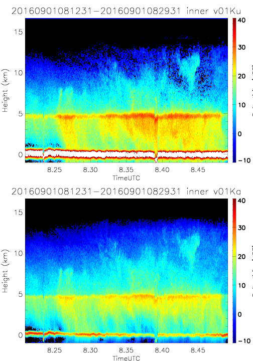
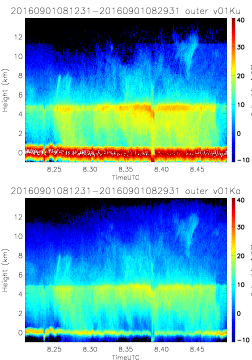
- SHOUTHRR_HIWRAP_L1B_20160901081231-20160901082931_inner_v01.h5
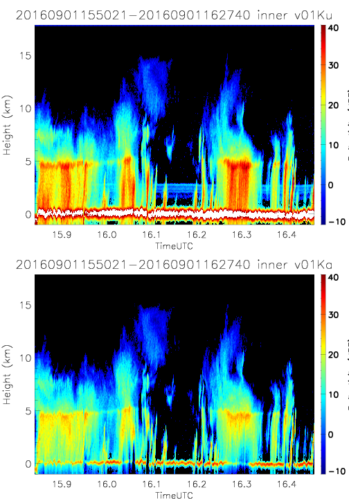
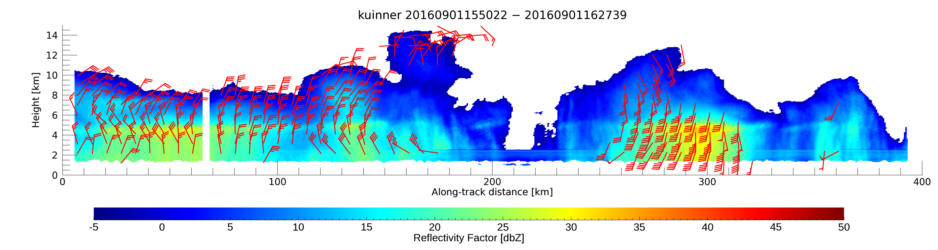
- SHOUTHRR_HIWRAP_L1B_20160901155021-20160901162740_inner_v01.h5
- SHOUTHRR_HIWRAP_L1B_20160901081231-20160901082931_outer_v01.h5
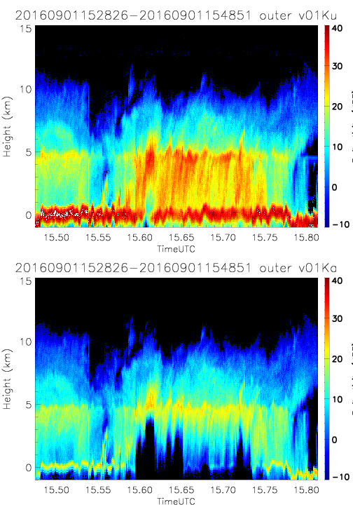
- SHOUTHRR_HIWRAP_L1B_20160901152826-20160901154851_outer_v01.h5
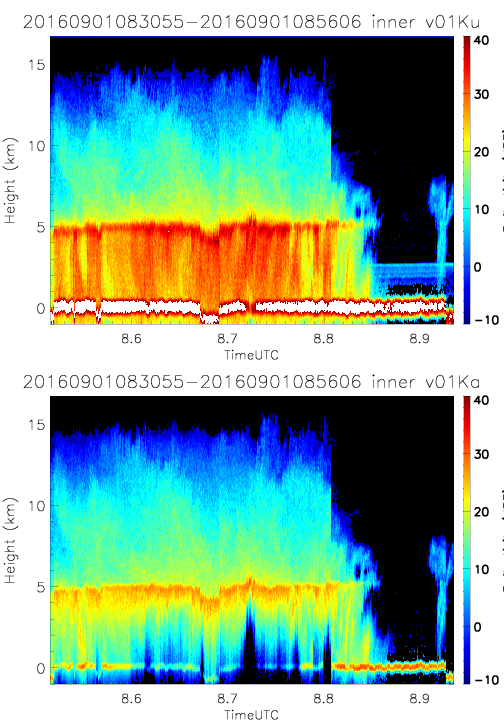
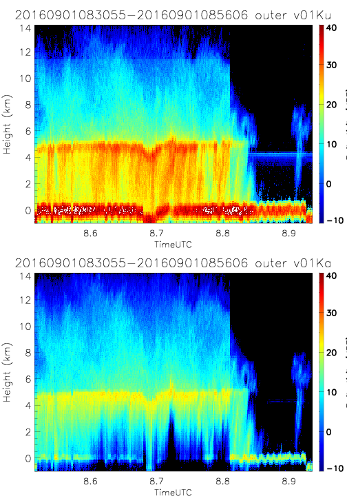
- SHOUTHRR_HIWRAP_L1B_20160901083055-20160901085606_inner_v01.h5
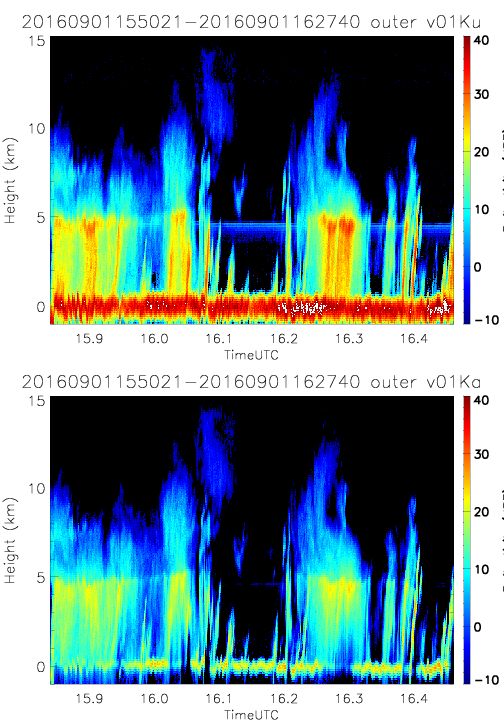
- SHOUTHRR_HIWRAP_L1B_20160901155021-20160901162740_outer_v01.h5
- SHOUTHRR_HIWRAP_L1B_20160901083055-20160901085606_outer_v01.h5
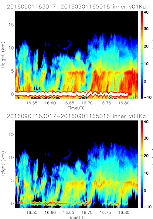
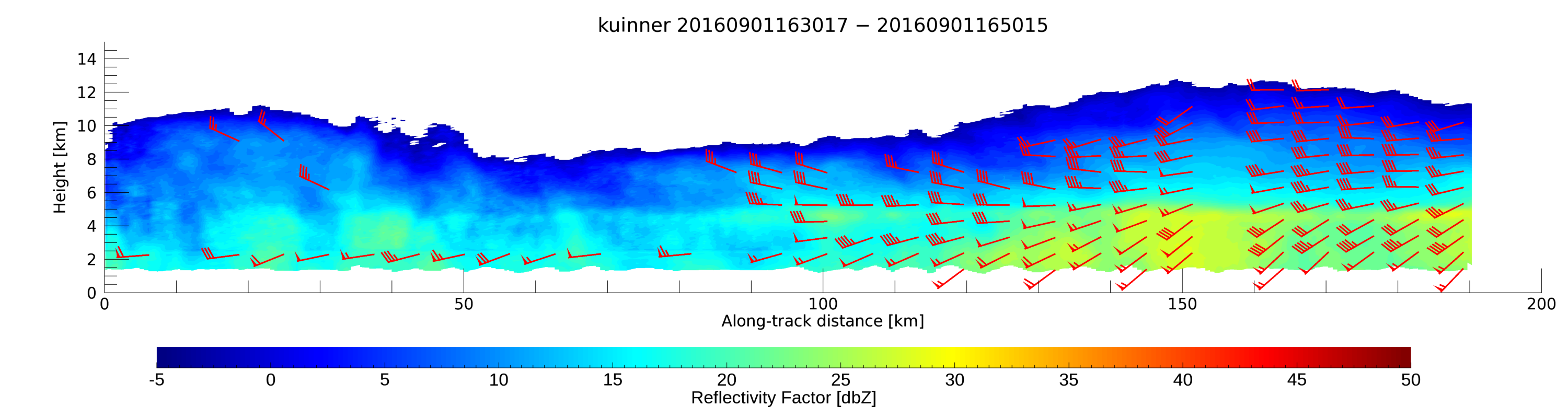
- SHOUTHRR_HIWRAP_L1B_20160901163017-20160901165016_inner_v01.h5
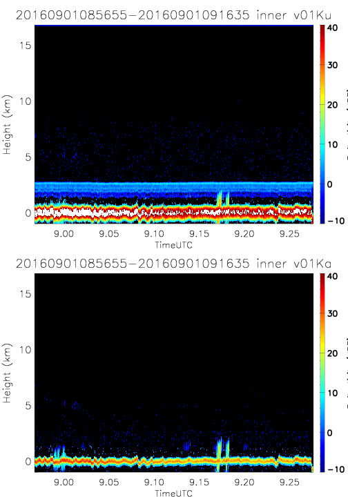
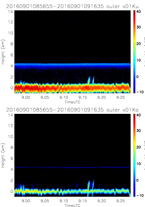
- SHOUTHRR_HIWRAP_L1B_20160901085655-20160901091635_inner_v01.h5
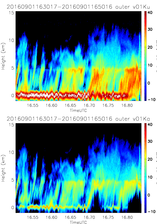
- SHOUTHRR_HIWRAP_L1B_20160901163017-20160901165016_outer_v01.h5
- SHOUTHRR_HIWRAP_L1B_20160901085655-20160901091635_outer_v01.h5
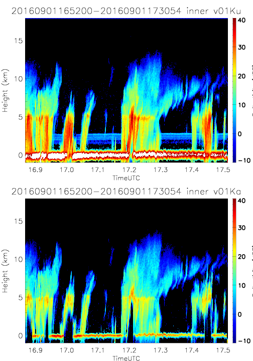
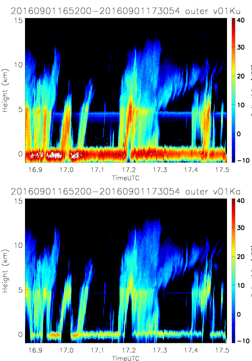
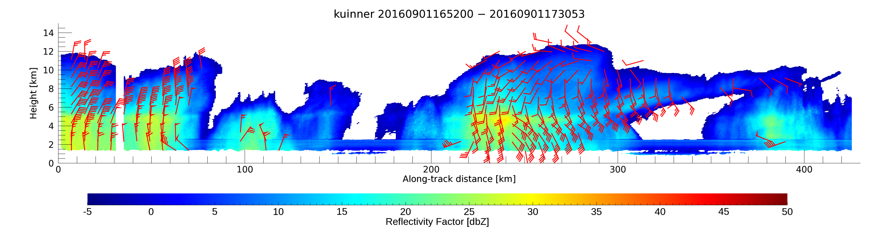
- SHOUTHRR_HIWRAP_L1B_20160901165200-20160901173054_inner_v01.h5
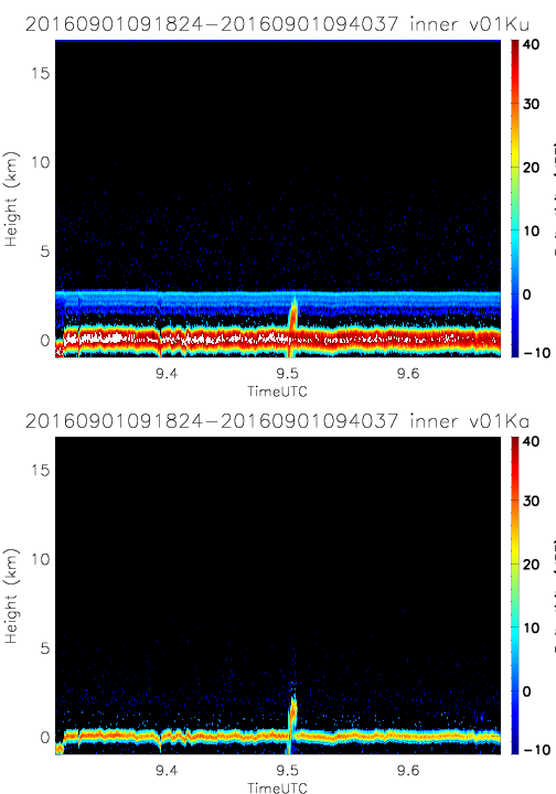
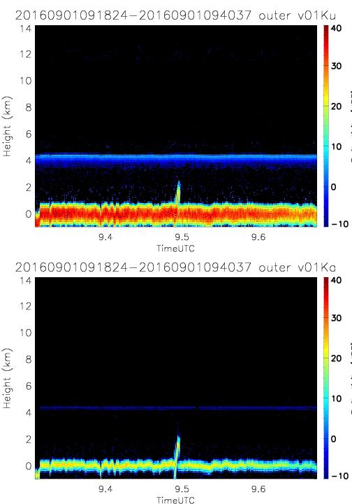
- SHOUTHRR_HIWRAP_L1B_20160901091824-20160901094037_inner_v01.h5
- SHOUTHRR_HIWRAP_L1B_20160901165200-20160901173054_outer_v01.h5
- SHOUTHRR_HIWRAP_L1B_20160901091824-20160901094037_outer_v01.h5
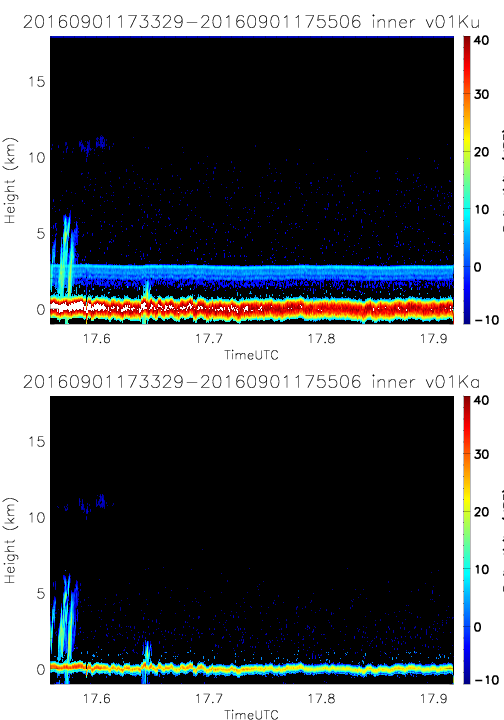
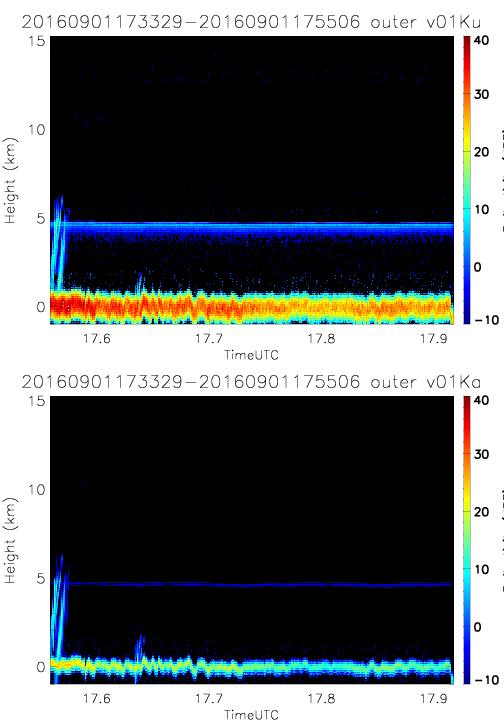
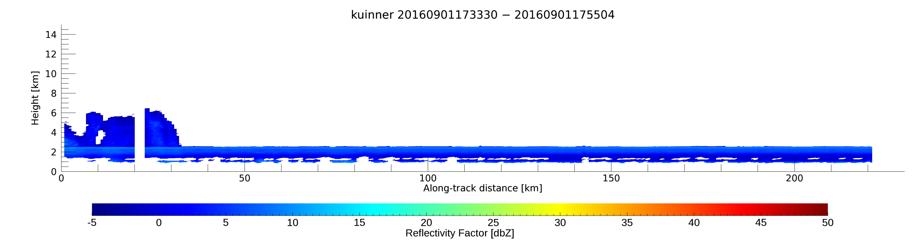
- SHOUTHRR_HIWRAP_L1B_20160901173329-20160901175506_inner_v01.h5
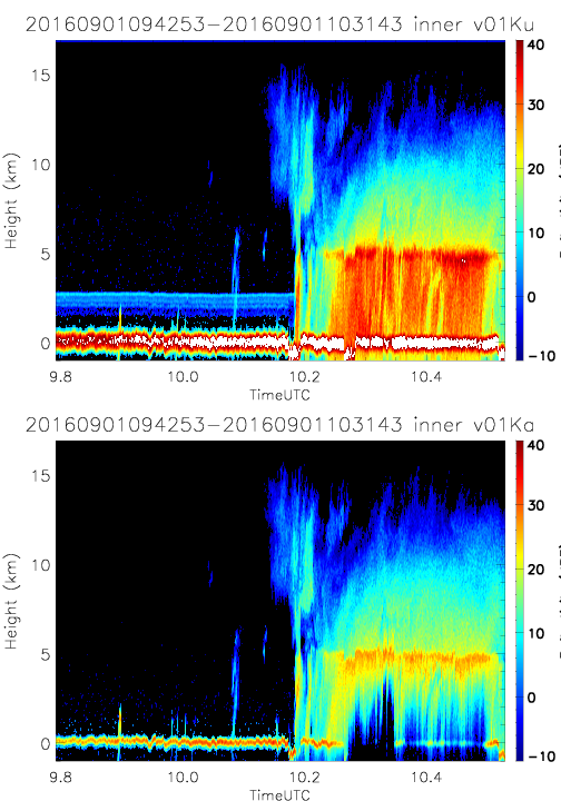
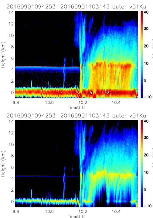
- SHOUTHRR_HIWRAP_L1B_20160901094253-20160901103143_inner_v01.h5
- SHOUTHRR_HIWRAP_L1B_20160901173329-20160901175506_outer_v01.h5
- SHOUTHRR_HIWRAP_L1B_20160901094253-20160901103143_outer_v01.h5
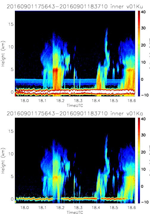
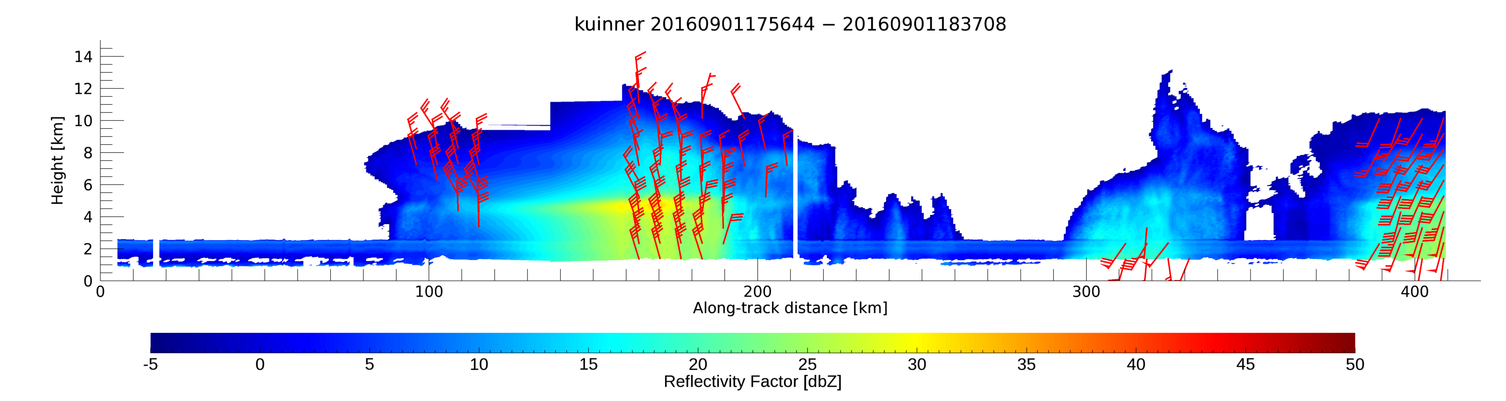
- SHOUTHRR_HIWRAP_L1B_20160901175643-20160901183710_inner_v01.h5
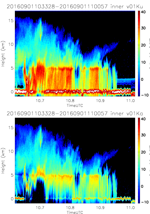
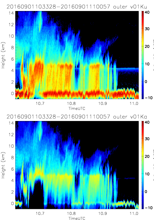
- SHOUTHRR_HIWRAP_L1B_20160901103328-20160901110057_inner_v01.h5
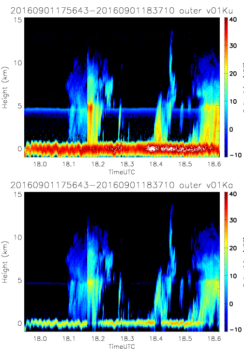
- SHOUTHRR_HIWRAP_L1B_20160901175643-20160901183710_outer_v01.h5
- SHOUTHRR_HIWRAP_L1B_20160901103328-20160901110057_outer_v01.h5
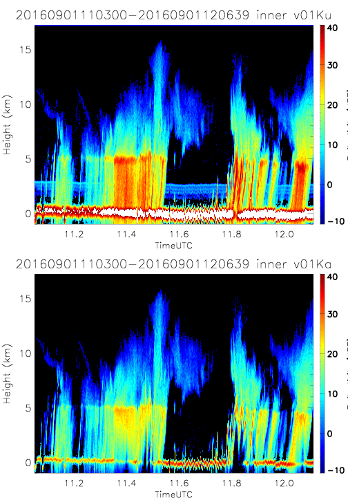
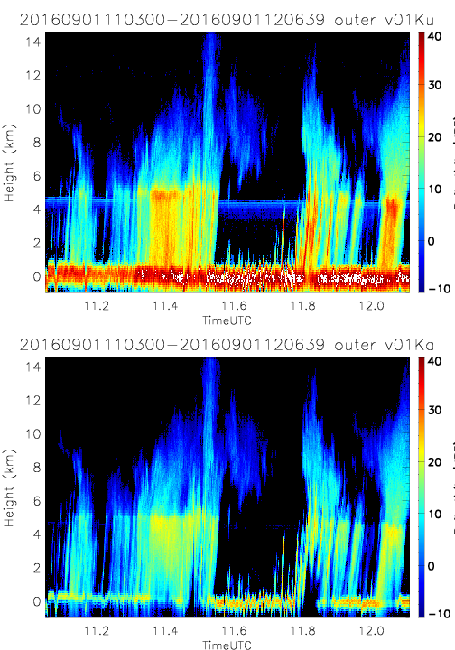
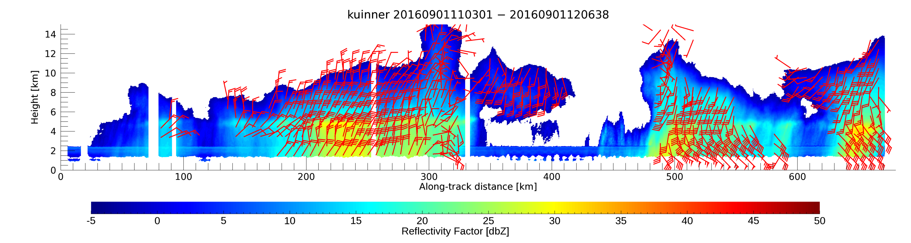
- SHOUTHRR_HIWRAP_L1B_20160901110300-20160901120639_inner_v01.h5
- SHOUTHRR_HIWRAP_L1B_20160901110300-20160901120639_outer_v01.h5
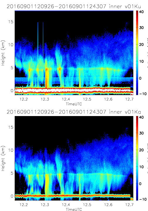
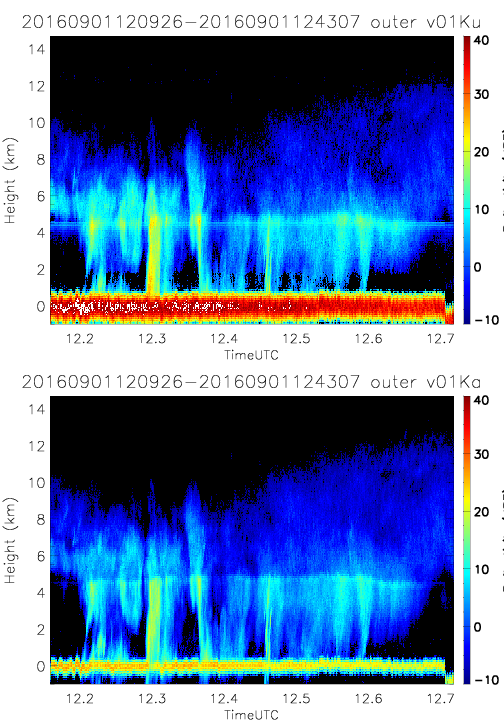
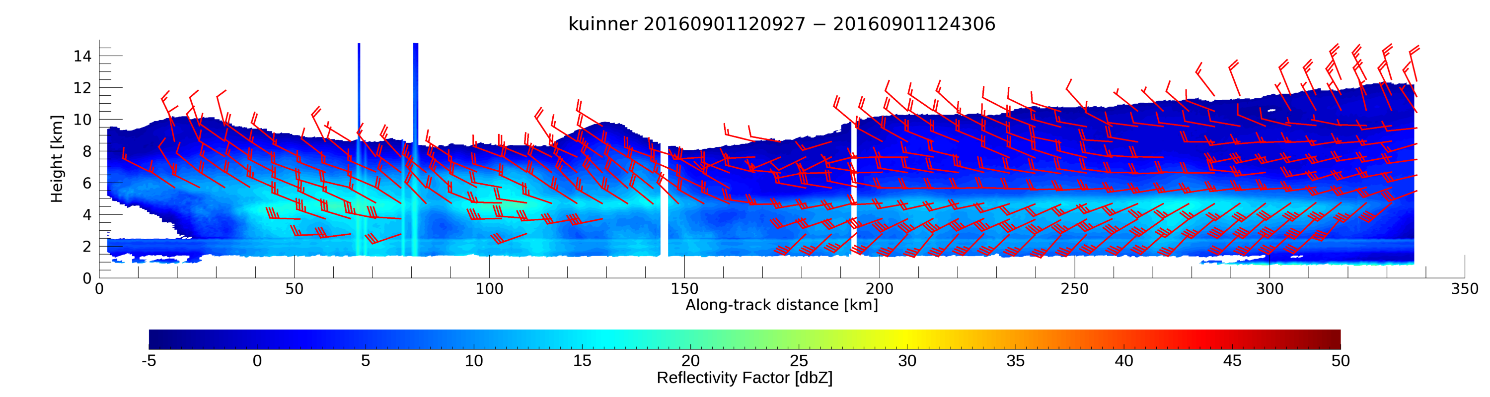
- SHOUTHRR_HIWRAP_L1B_20160901120926-20160901124307_inner_v01.h5
- SHOUTHRR_HIWRAP_L1B_20160901120926-20160901124307_outer_v01.h5
20160911
20161005
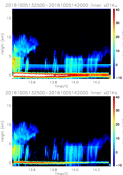
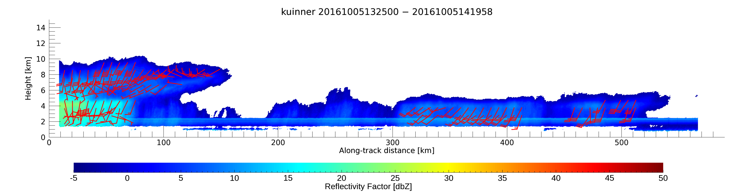
- SHOUTHRR_HIWRAP_L1B_20161005132500-20161005142000_inner_v01.h5
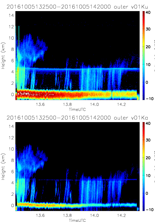
- SHOUTHRR_HIWRAP_L1B_20161005132500-20161005142000_outer_v01.h5
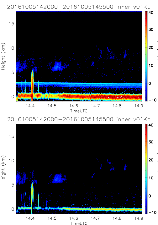
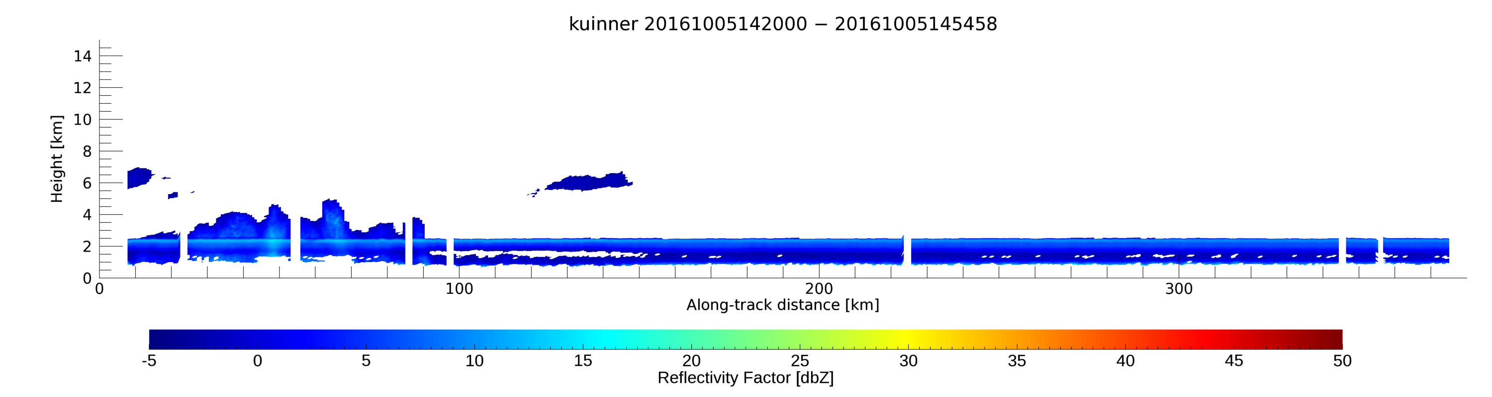
- SHOUTHRR_HIWRAP_L1B_20161005142000-20161005145500_inner_v01.h5
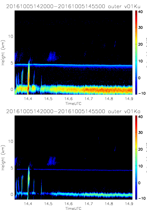
- SHOUTHRR_HIWRAP_L1B_20161005142000-20161005145500_outer_v01.h5
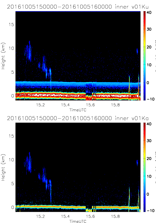
- SHOUTHRR_HIWRAP_L1B_20161005150000-20161005160000_inner_v01.h5
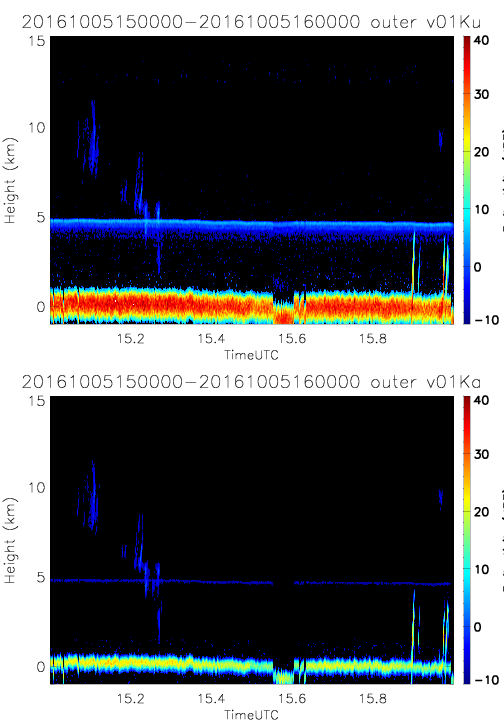
- SHOUTHRR_HIWRAP_L1B_20161005150000-20161005160000_outer_v01.h5
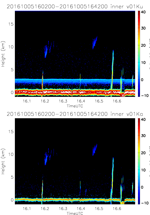
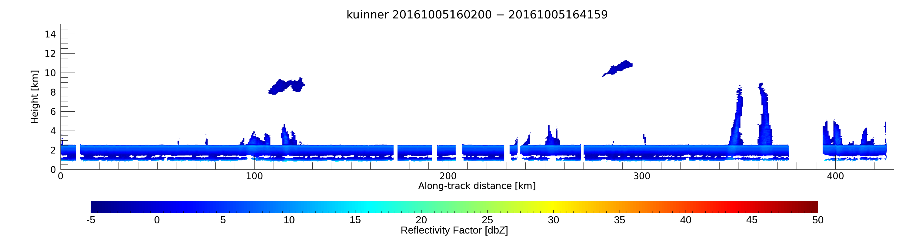
- SHOUTHRR_HIWRAP_L1B_20161005160200-20161005164200_inner_v01.h5
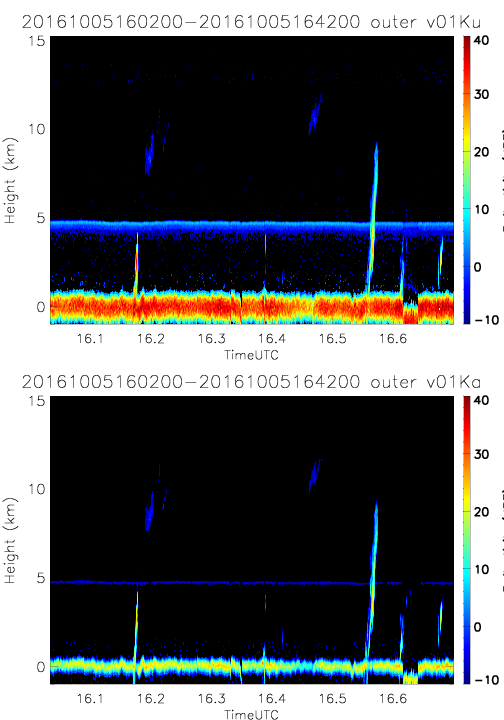
- SHOUTHRR_HIWRAP_L1B_20161005160200-20161005164200_outer_v01.h5
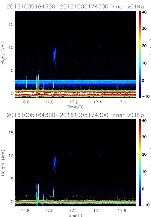
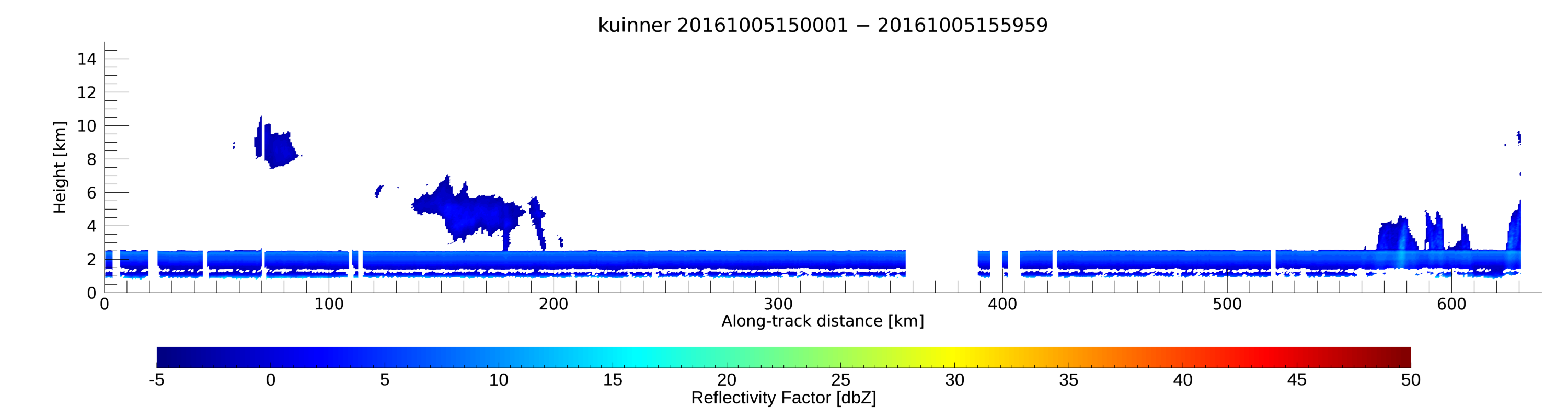
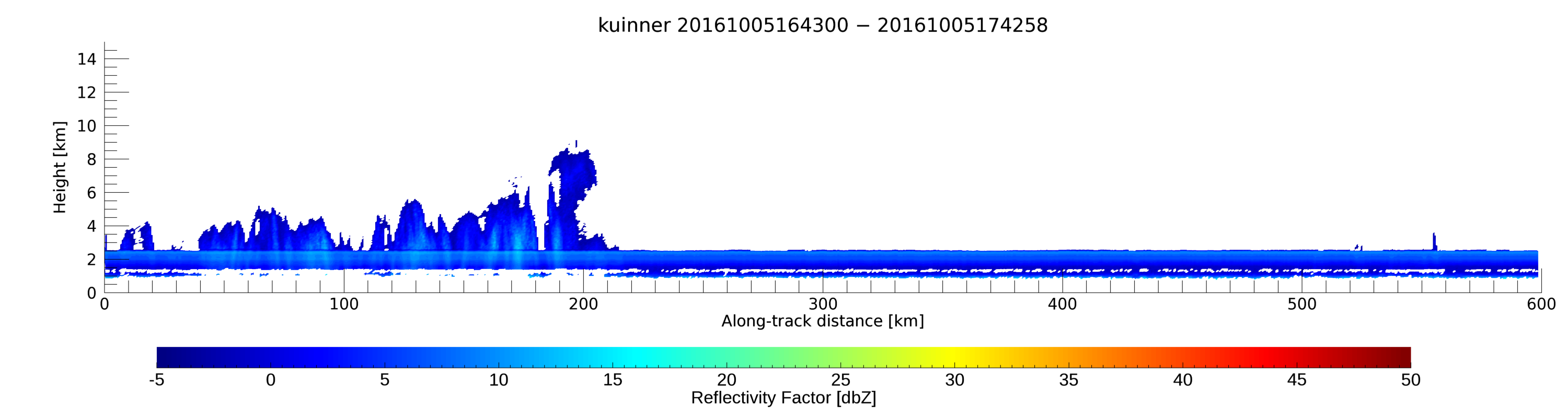
- SHOUTHRR_HIWRAP_L1B_20161005164300-20161005174300_inner_v01.h5
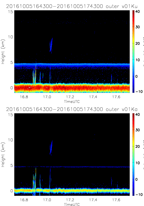
- SHOUTHRR_HIWRAP_L1B_20161005164300-20161005174300_outer_v01.h5
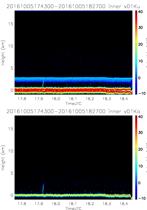
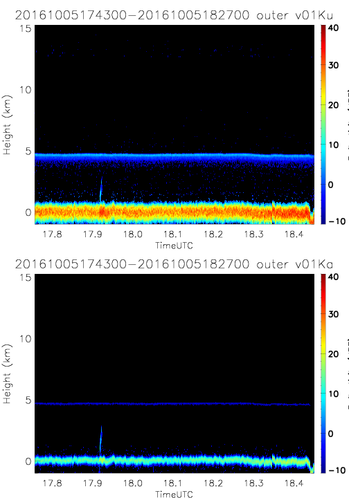
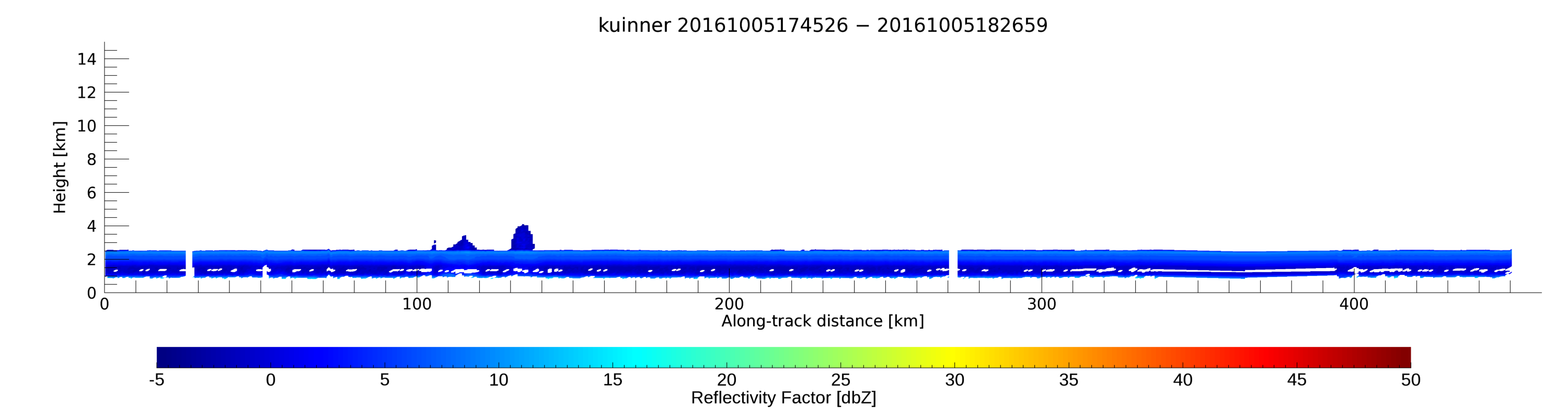
- SHOUTHRR_HIWRAP_L1B_20161005174300-20161005182700_inner_v01.h5
- SHOUTHRR_HIWRAP_L1B_20161005174300-20161005182700_outer_v01.h5
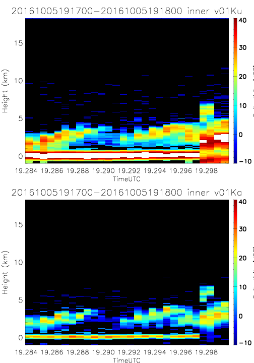
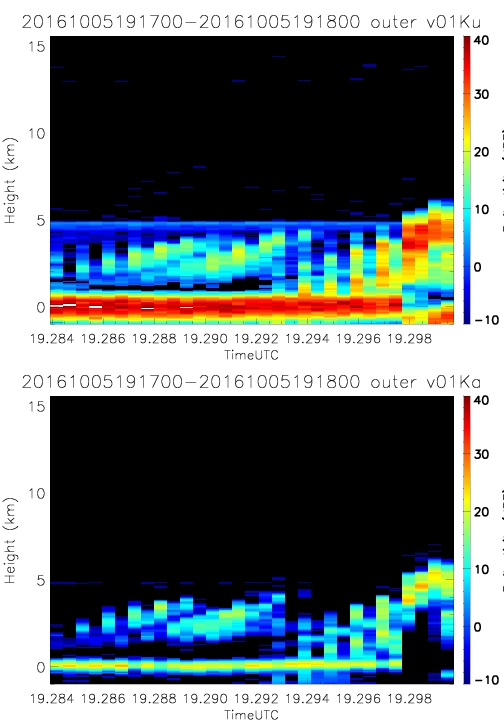
- SHOUTHRR_HIWRAP_L1B_20161005191700-20161005191800_inner_v01.h5
- SHOUTHRR_HIWRAP_L1B_20161005191700-20161005191800_outer_v01.h5
20160925
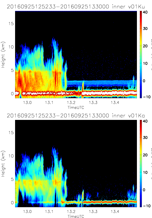
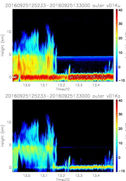
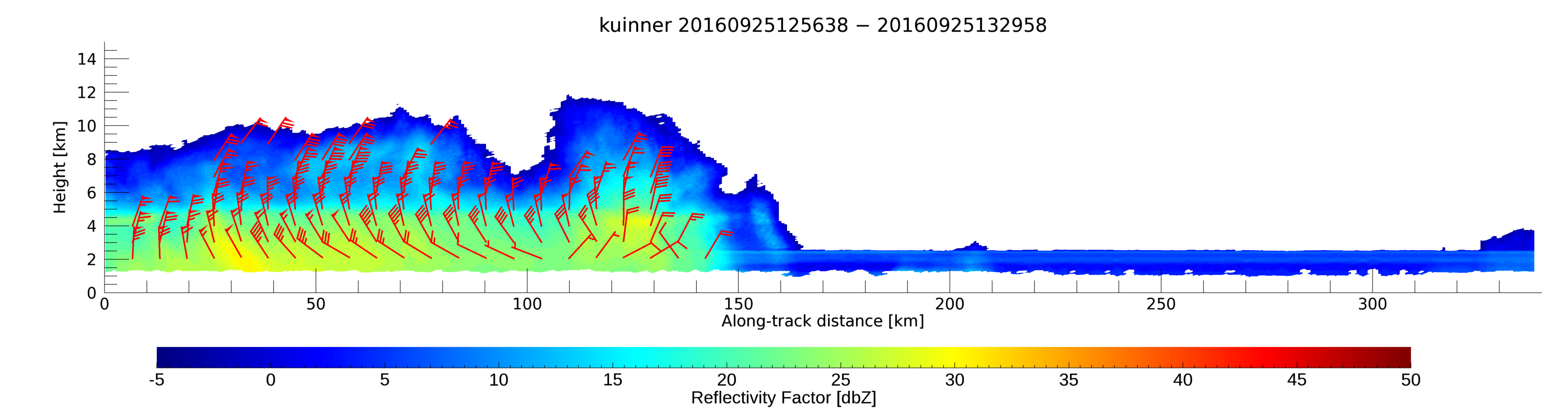
- SHOUTHRR_HIWRAP_L1B_20160925125233-20160925133000_inner_v01.h5
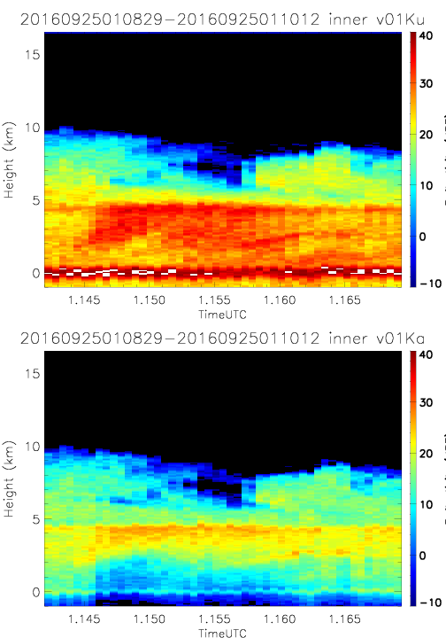
- SHOUTHRR_HIWRAP_L1B_20160925010829-20160925011012_inner_v01.h5
- SHOUTHRR_HIWRAP_L1B_20160925125233-20160925133000_outer_v01.h5
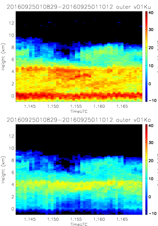
- SHOUTHRR_HIWRAP_L1B_20160925010829-20160925011012_outer_v01.h5
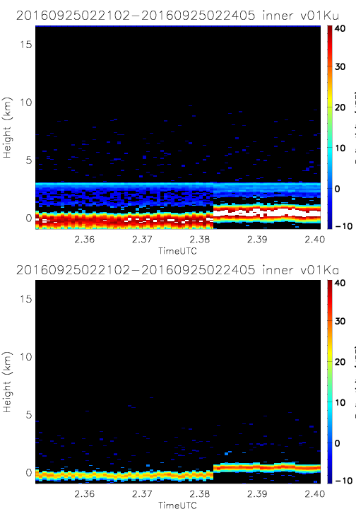
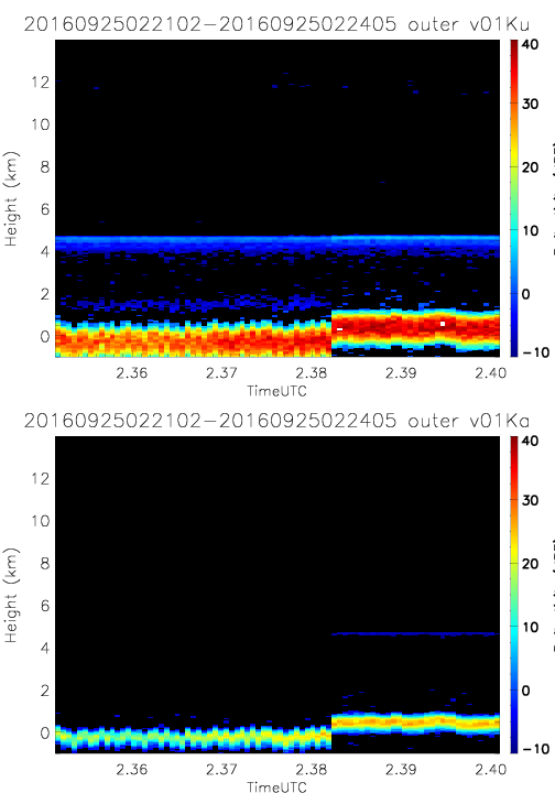
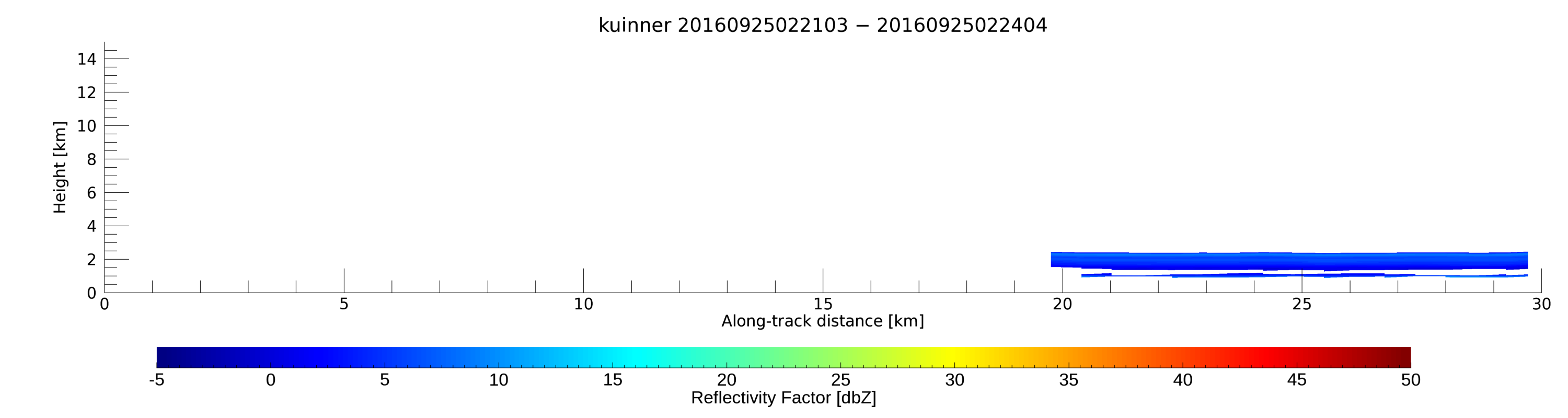
- SHOUTHRR_HIWRAP_L1B_20160925022102-20160925022405_inner_v01.h5
- SHOUTHRR_HIWRAP_L1B_20160925022102-20160925022405_outer_v01.h5
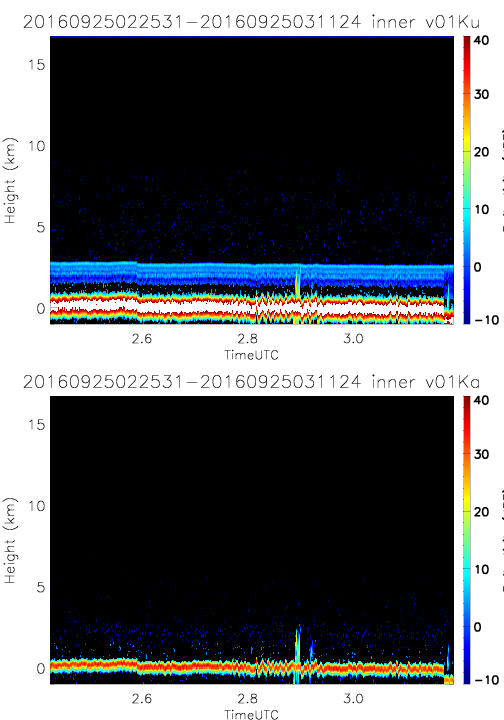
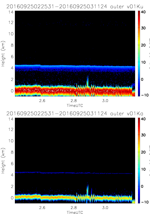
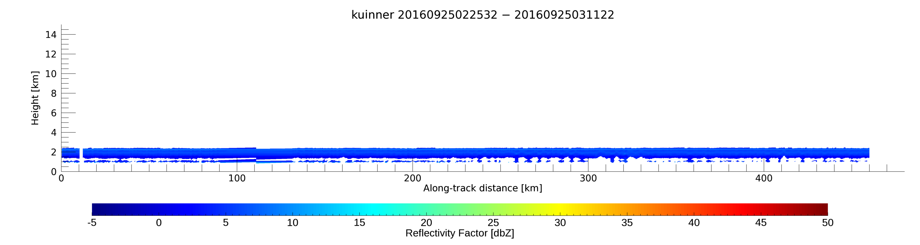
- SHOUTHRR_HIWRAP_L1B_20160925022531-20160925031124_inner_v01.h5
- SHOUTHRR_HIWRAP_L1B_20160925022531-20160925031124_outer_v01.h5
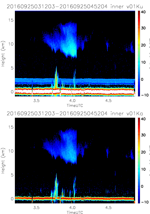
- SHOUTHRR_HIWRAP_L1B_20160925031203-20160925045204_inner_v01.h5
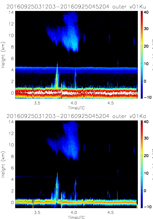
- SHOUTHRR_HIWRAP_L1B_20160925031203-20160925045204_outer_v01.h5
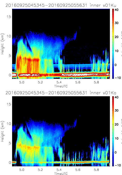
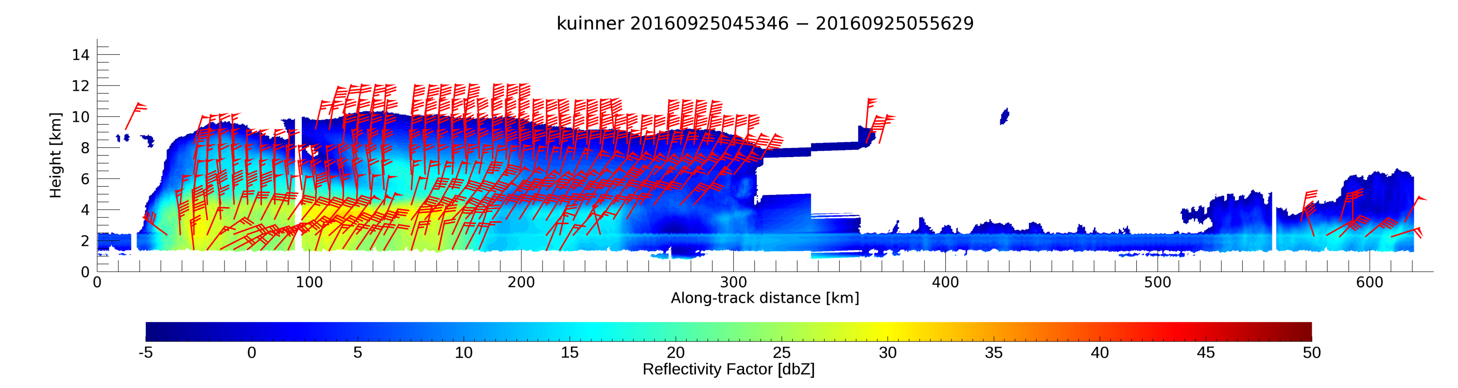
- SHOUTHRR_HIWRAP_L1B_20160925045345-20160925055631_inner_v01.h5
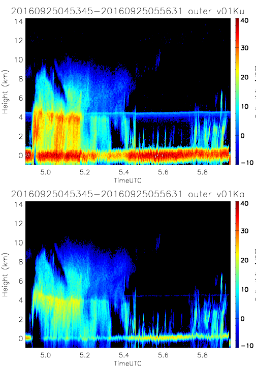
- SHOUTHRR_HIWRAP_L1B_20160925045345-20160925055631_outer_v01.h5
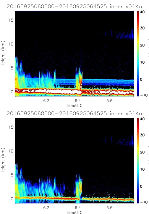
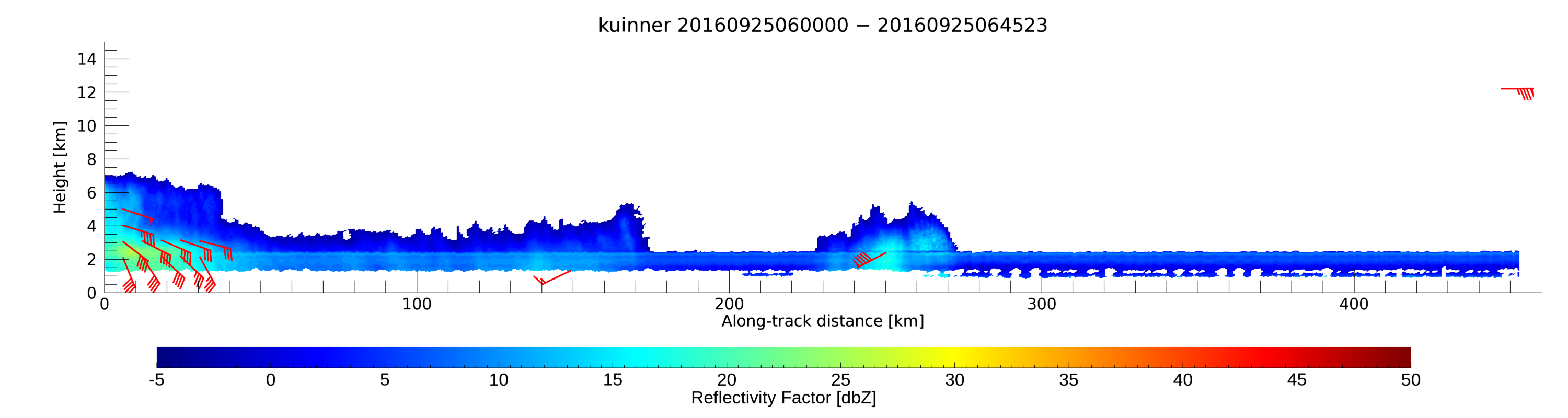
- SHOUTHRR_HIWRAP_L1B_20160925060000-20160925064525_inner_v01.h5
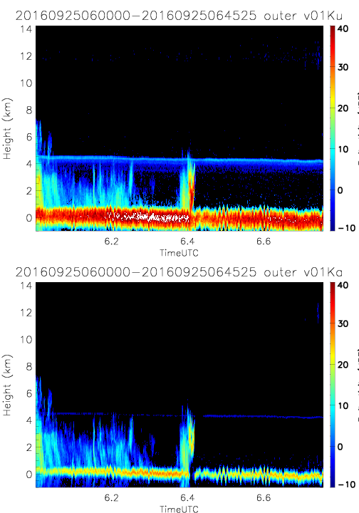
- SHOUTHRR_HIWRAP_L1B_20160925060000-20160925064525_outer_v01.h5
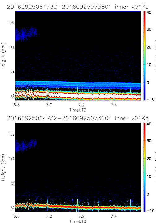
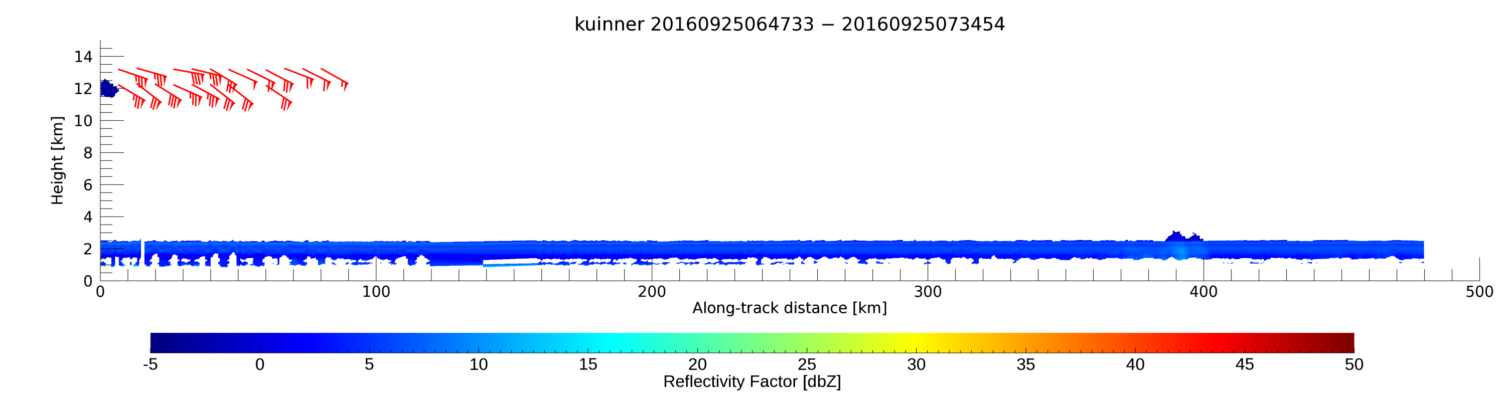
- SHOUTHRR_HIWRAP_L1B_20160925064732-20160925073601_inner_v01.h5
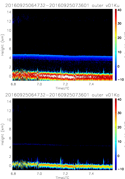
- SHOUTHRR_HIWRAP_L1B_20160925064732-20160925073601_outer_v01.h5
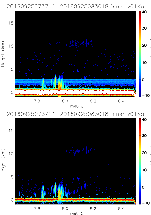
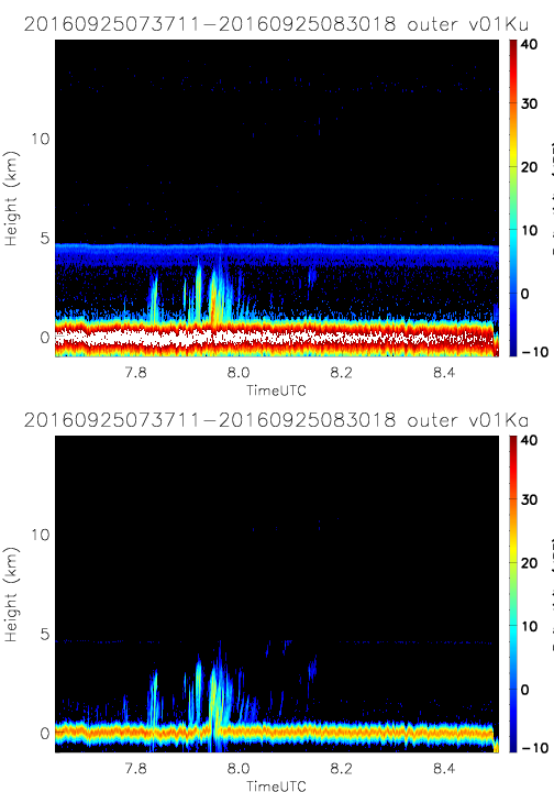
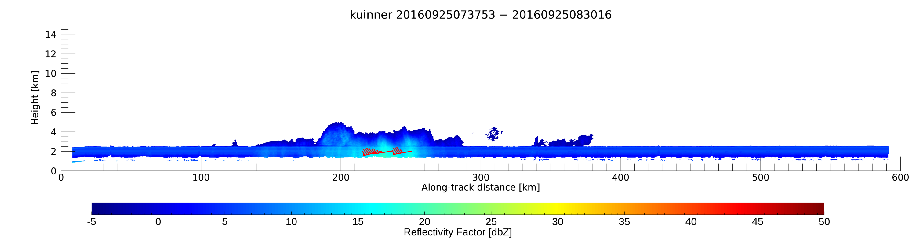
- SHOUTHRR_HIWRAP_L1B_20160925073711-20160925083018_inner_v01.h5
- SHOUTHRR_HIWRAP_L1B_20160925073711-20160925083018_outer_v01.h5
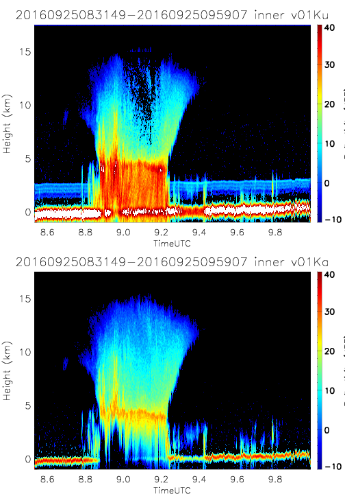
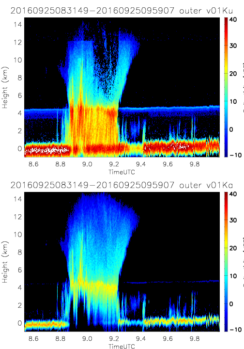
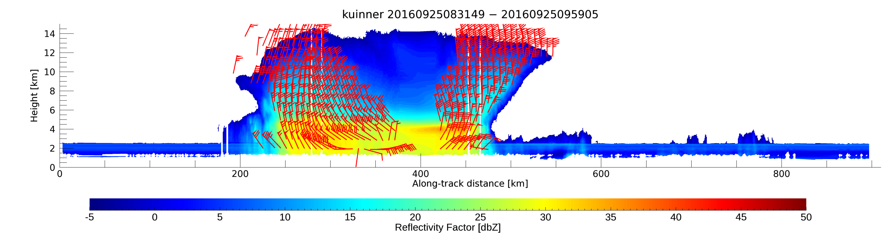
- SHOUTHRR_HIWRAP_L1B_20160925083149-20160925095907_inner_v01.h5
- SHOUTHRR_HIWRAP_L1B_20160925083149-20160925095907_outer_v01.h5
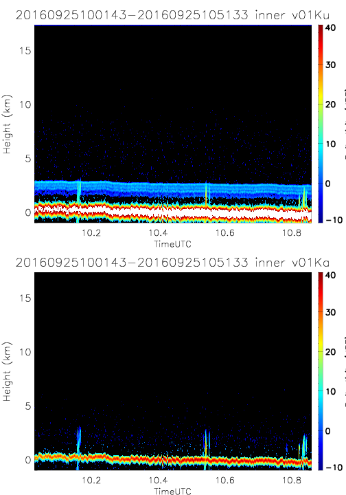
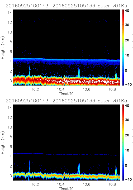
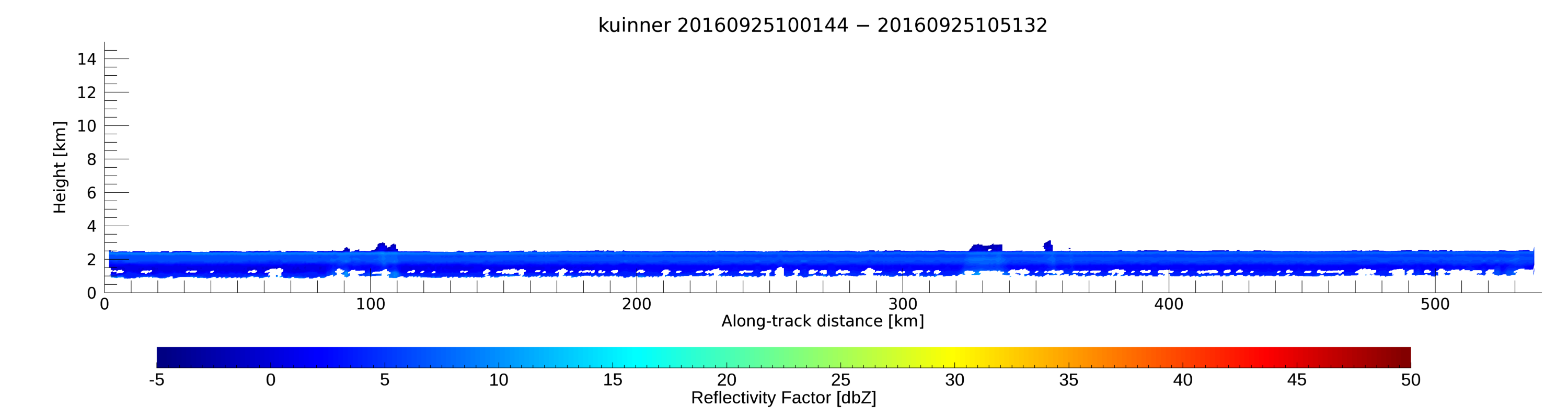
- SHOUTHRR_HIWRAP_L1B_20160925100143-20160925105133_inner_v01.h5
- SHOUTHRR_HIWRAP_L1B_20160925100143-20160925105133_outer_v01.h5
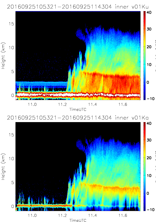
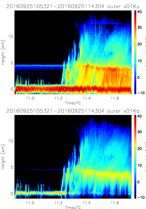
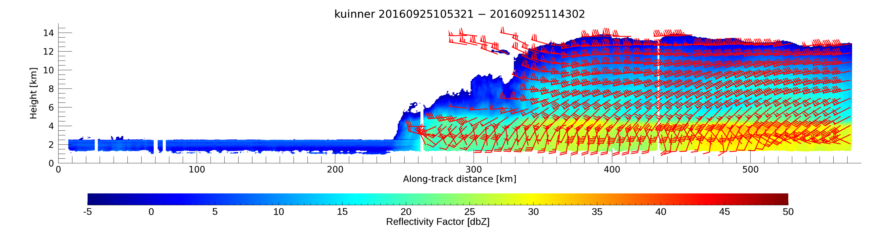
- SHOUTHRR_HIWRAP_L1B_20160925105321-20160925114304_inner_v01.h5
- SHOUTHRR_HIWRAP_L1B_20160925105321-20160925114304_outer_v01.h5
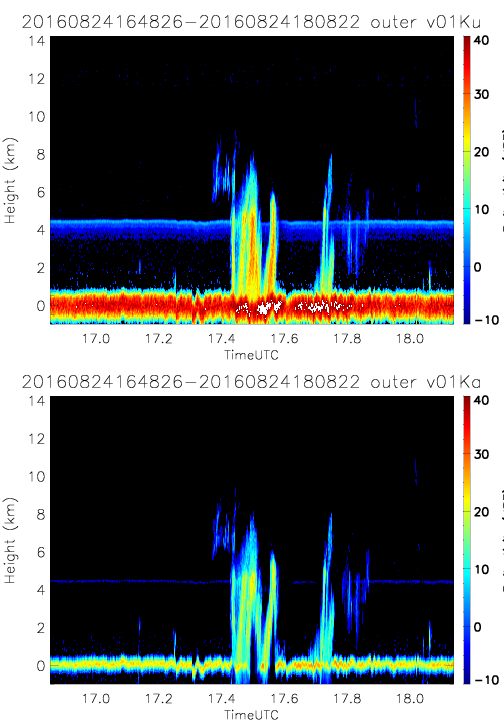
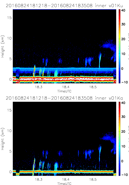
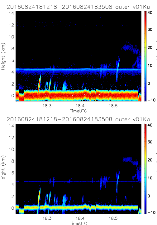
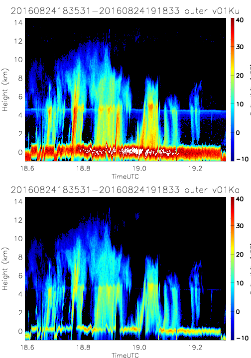
20160824
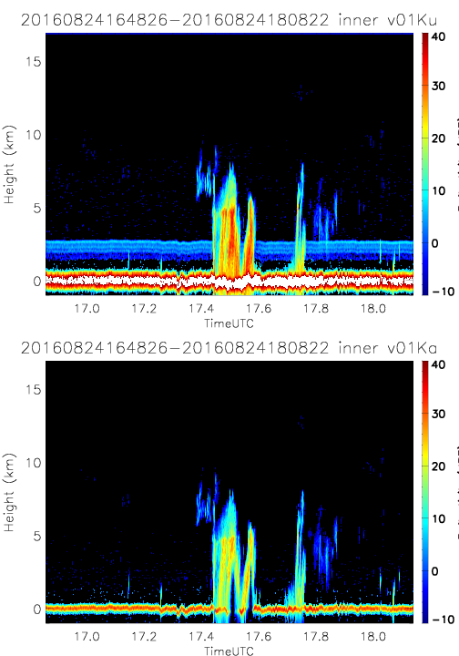
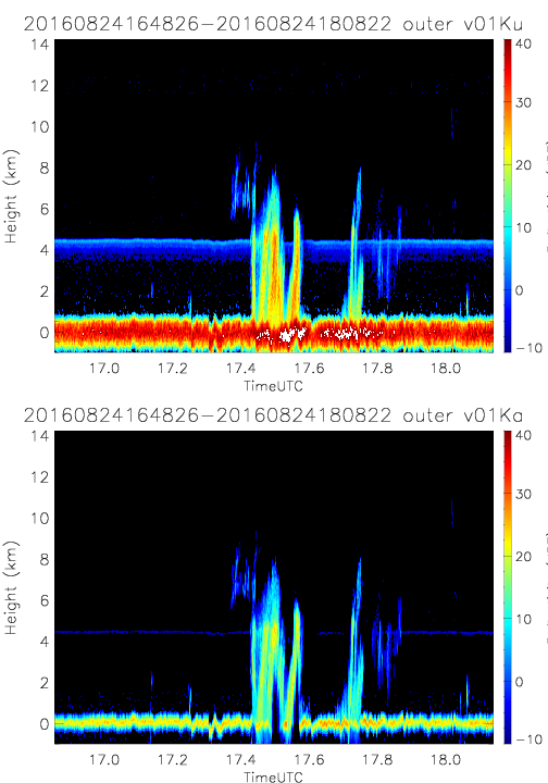
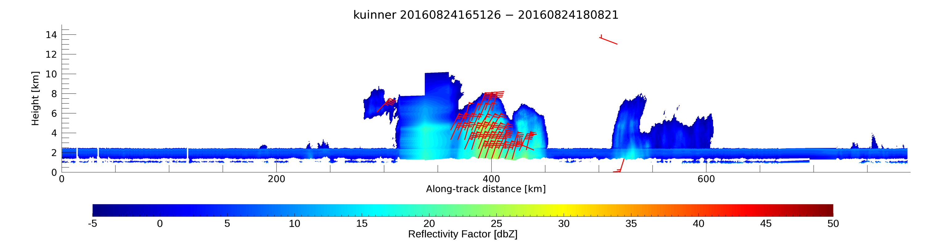
- SHOUTHRR_HIWRAP_L1B_20160824164826-20160824180822_inner_v01.h5
- SHOUTHRR_HIWRAP_L1B_20160824164826-20160824180822_outer_v01.h5
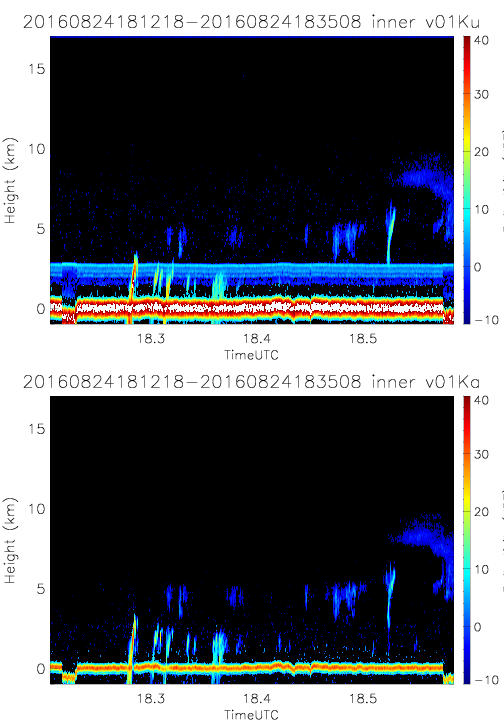
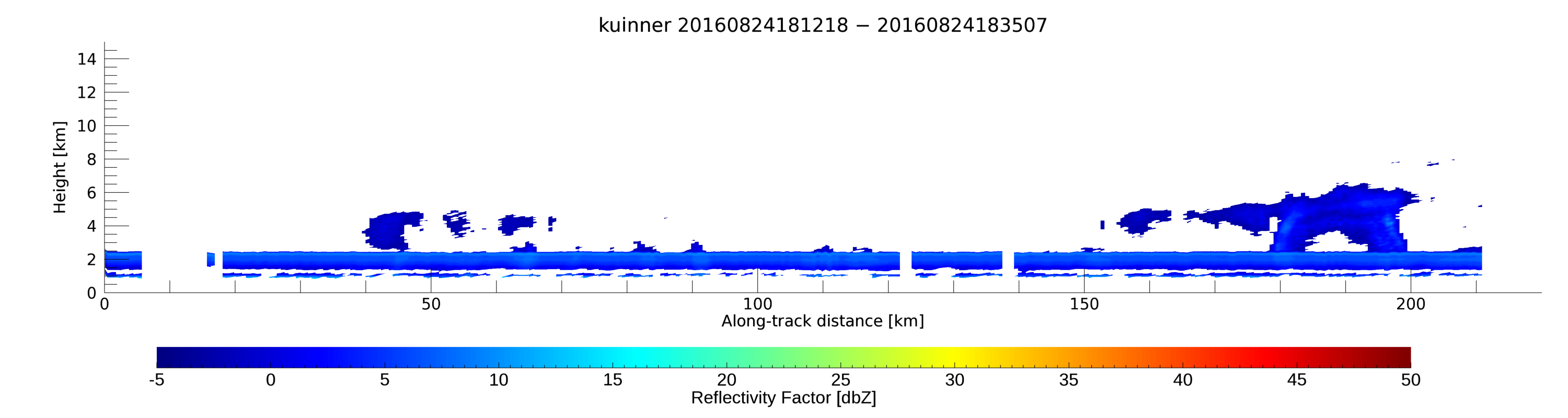
- SHOUTHRR_HIWRAP_L1B_20160824181218-20160824183508_inner_v01.h5
- SHOUTHRR_HIWRAP_L1B_20160824181218-20160824183508_outer_v01.h5
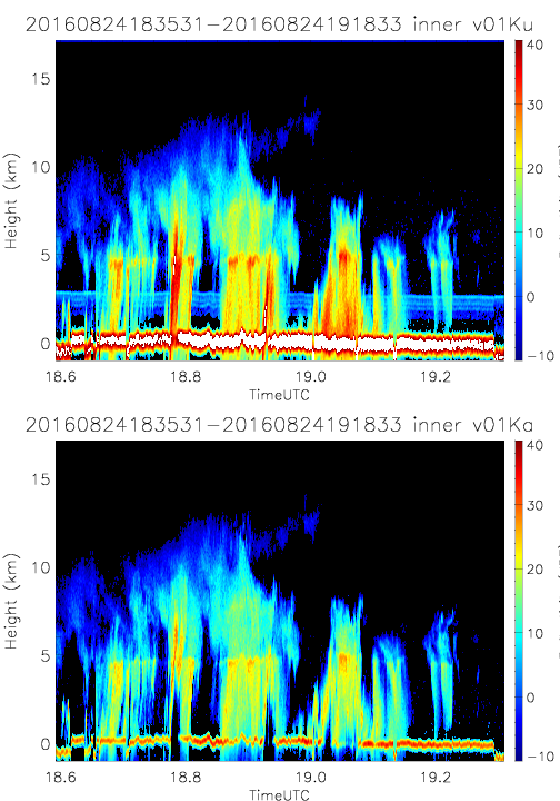
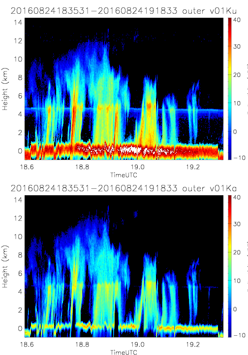
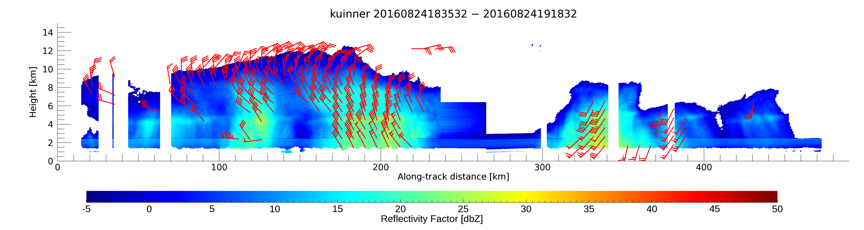
- SHOUTHRR_HIWRAP_L1B_20160824183531-20160824191833_inner_v01.h5
- SHOUTHRR_HIWRAP_L1B_20160824183531-20160824191833_outer_v01.h5
- SHOUTHRR_HIWRAP_L1B_20160824183531-20160824191833_outer_v02.h5
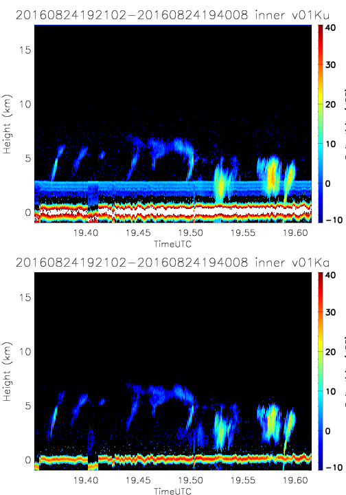
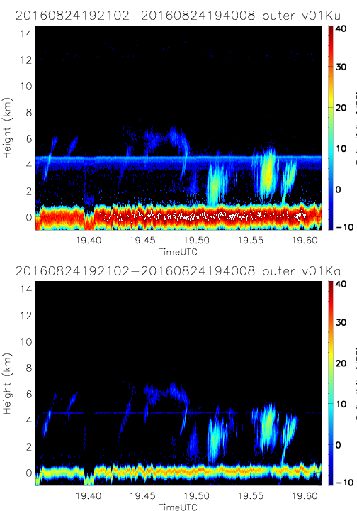
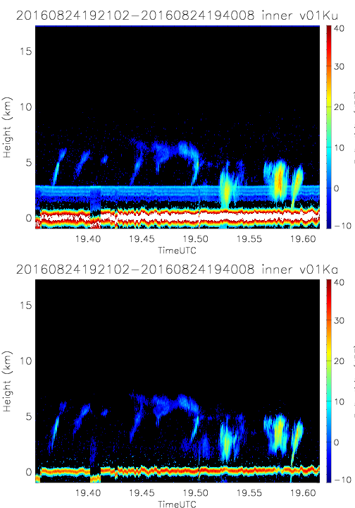
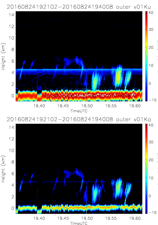
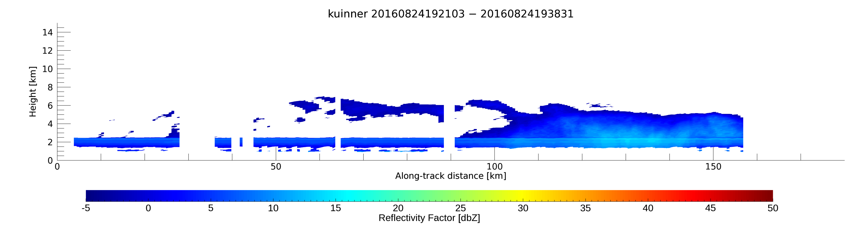
- SHOUTHRR_HIWRAP_L1B_20160824192102-20160824194008_inner_v01.h5
- SHOUTHRR_HIWRAP_L1B_20160824192102-20160824194008_outer_v01.h5
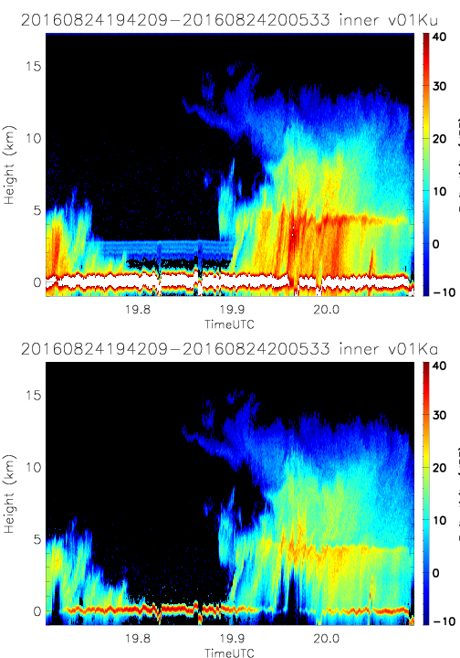
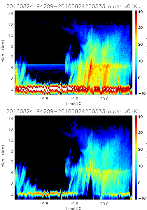
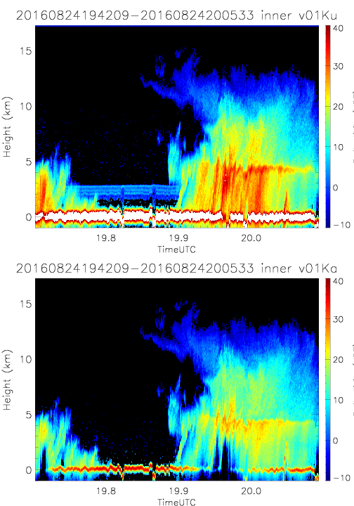
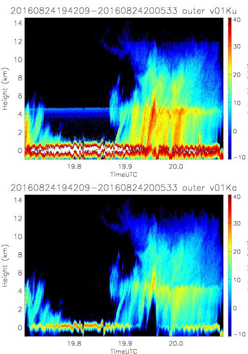
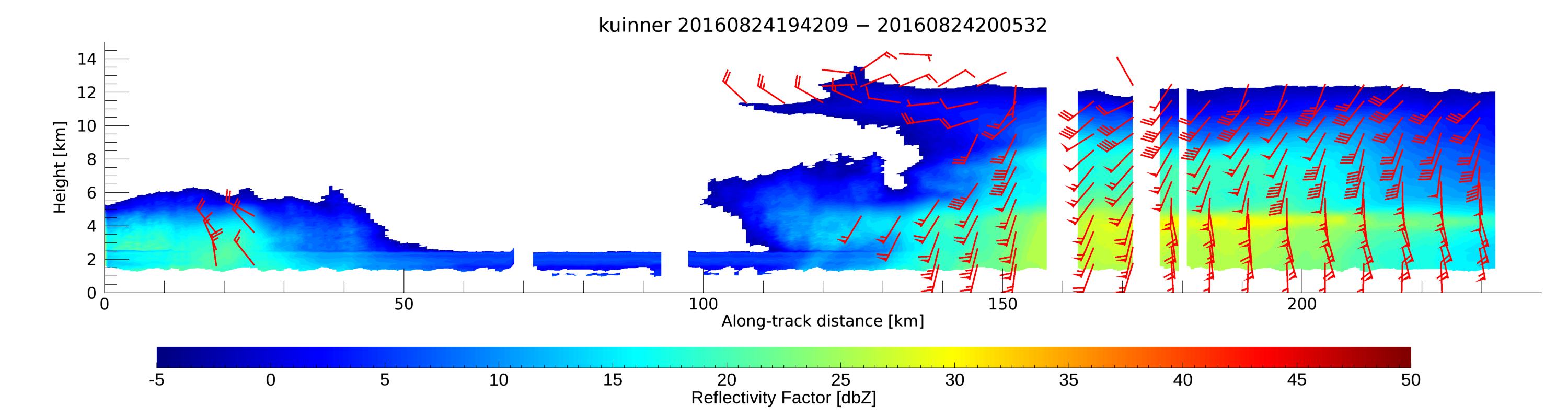
- SHOUTHRR_HIWRAP_L1B_20160824194209-20160824200533_inner_v01.h5
- SHOUTHRR_HIWRAP_L1B_20160824194209-20160824200533_outer_v01.h5
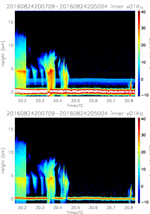
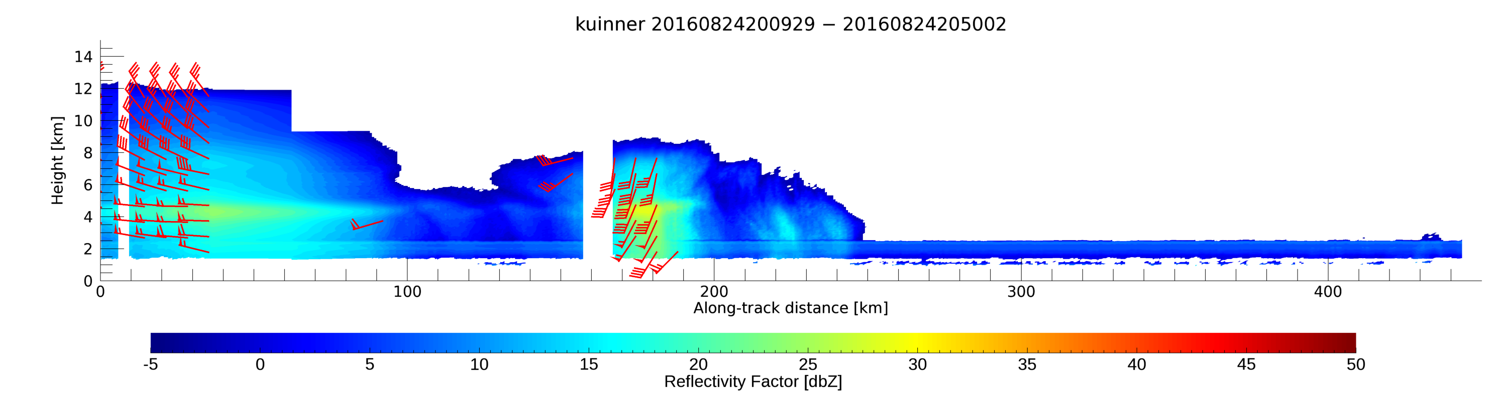
- SHOUTHRR_HIWRAP_L1B_20160824200709-20160824205004_inner_v01.h5
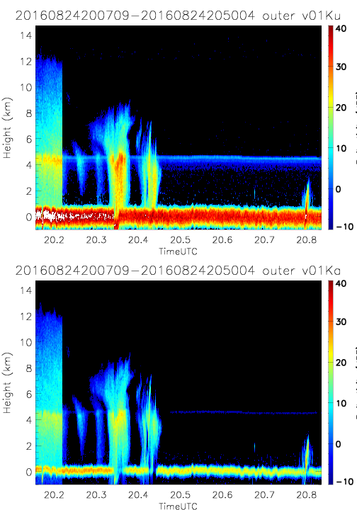
- SHOUTHRR_HIWRAP_L1B_20160824200709-20160824205004_outer_v01.h5
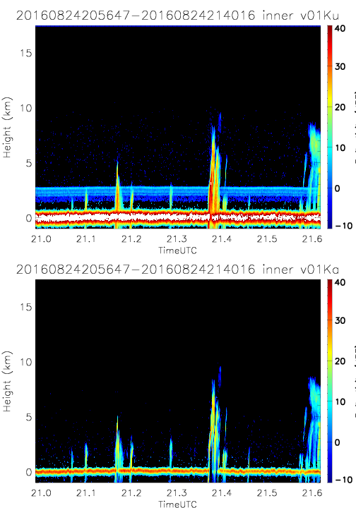
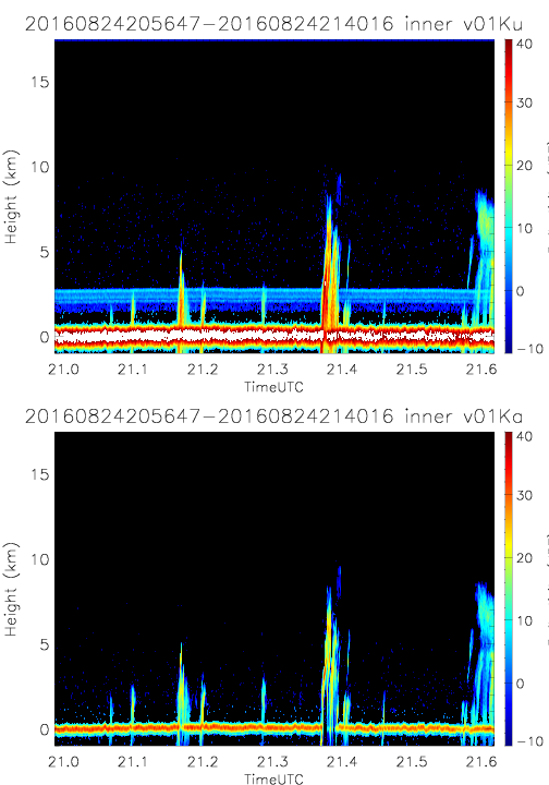
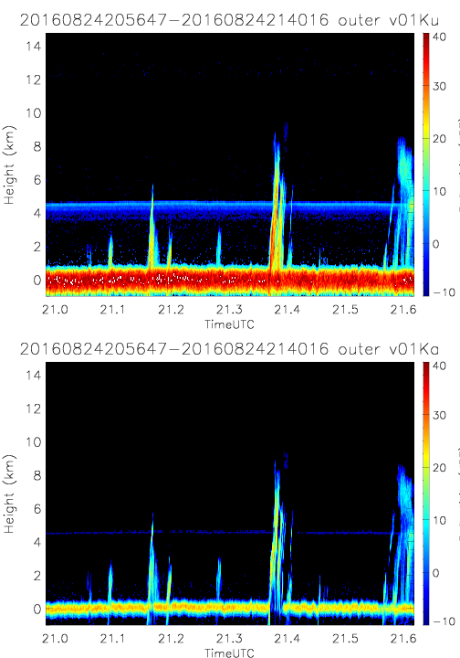
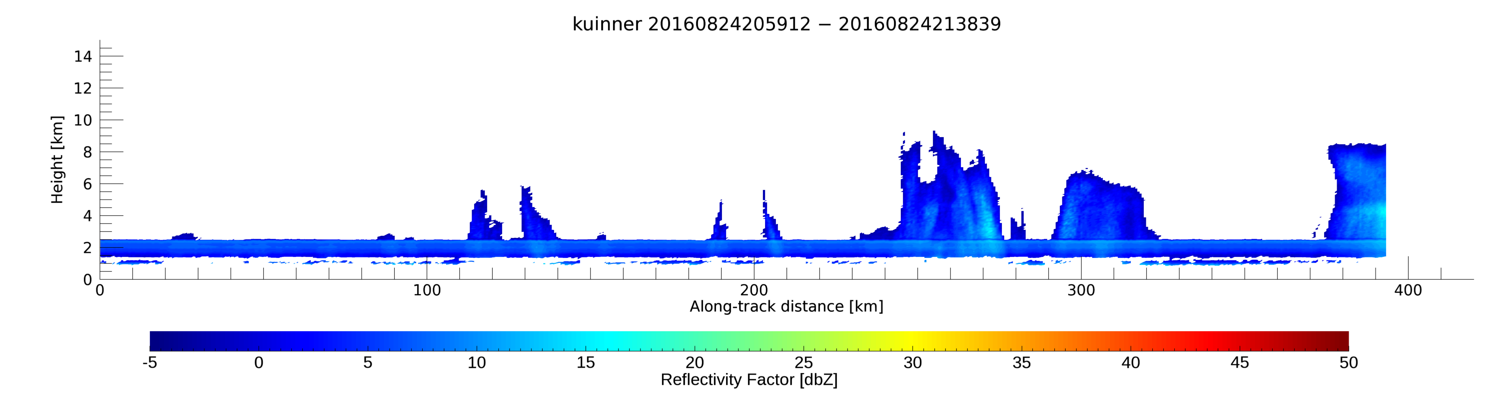
- SHOUTHRR_HIWRAP_L1B_20160824205647-20160824214016_inner_v01.h5
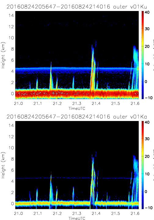
- SHOUTHRR_HIWRAP_L1B_20160824205647-20160824214016_outer_v01.h5
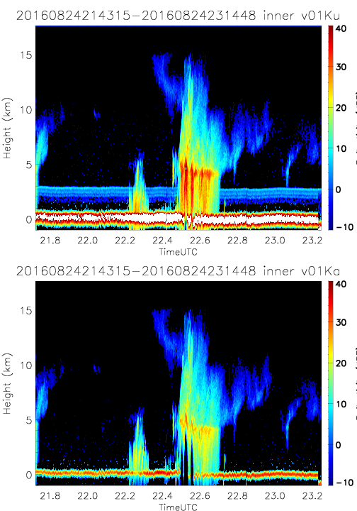
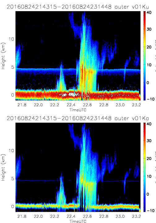
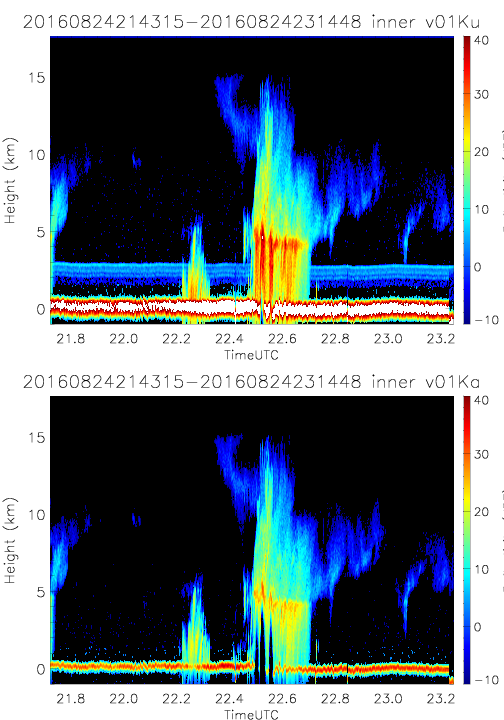
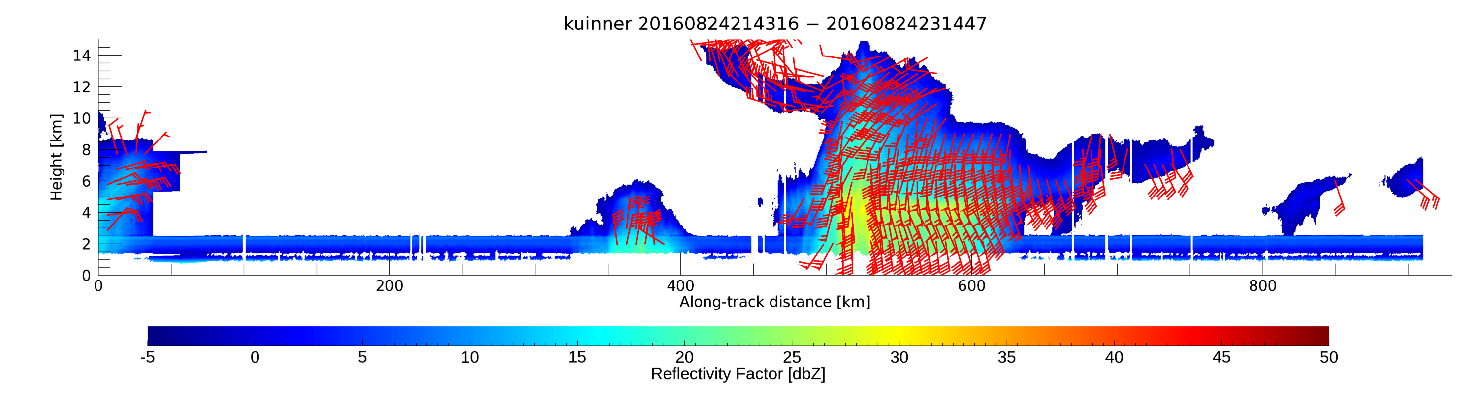
- SHOUTHRR_HIWRAP_L1B_20160824214315-20160824231448_inner_v01.h5
- SHOUTHRR_HIWRAP_L1B_20160824214315-20160824231448_outer_v01.h5
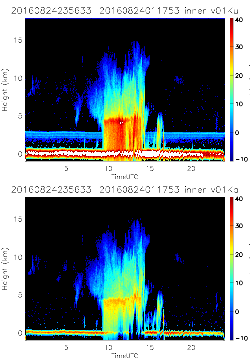
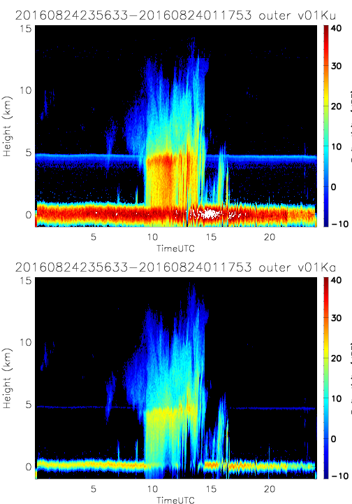
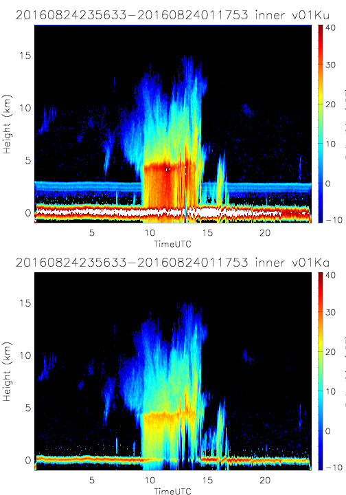
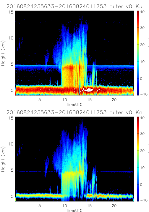
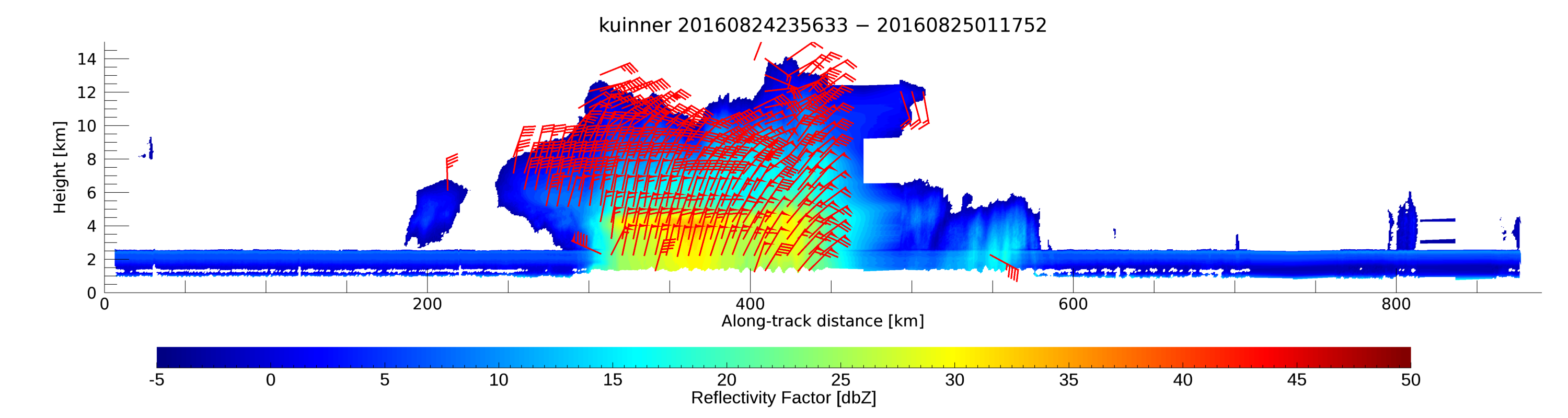
- SHOUTHRR_HIWRAP_L1B_20160824235633-20160824011753_inner_v01.h5
- SHOUTHRR_HIWRAP_L1B_20160824235633-20160824011753_outer_v01.h5
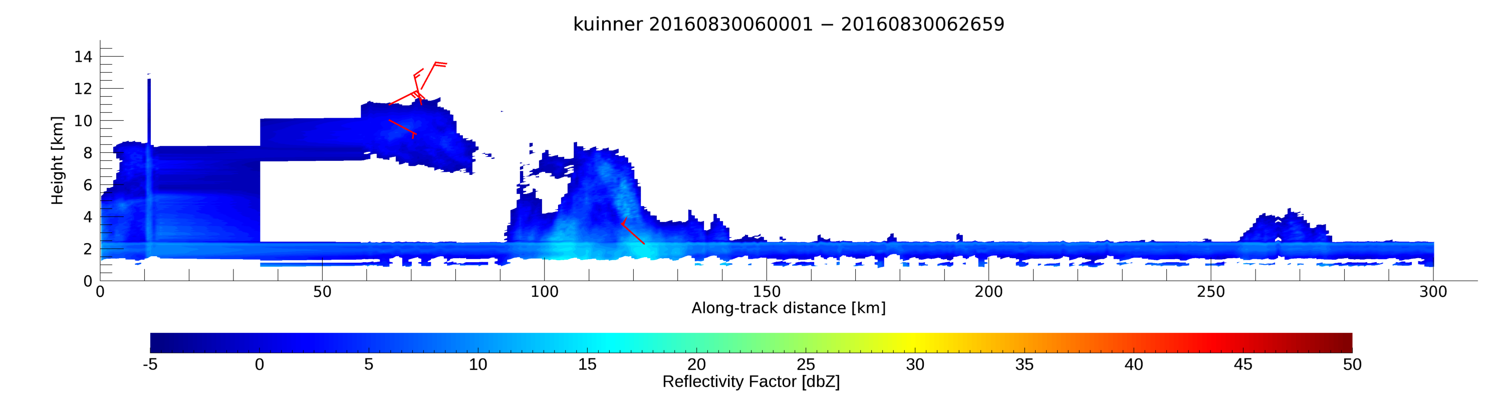
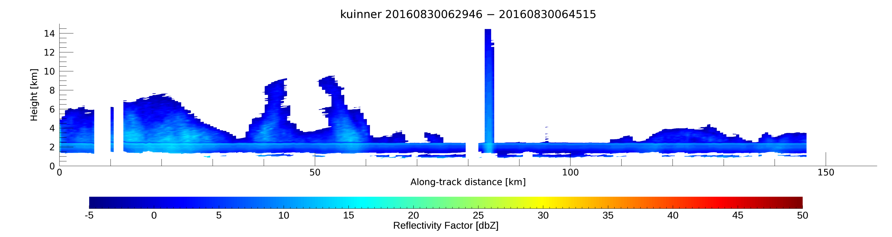
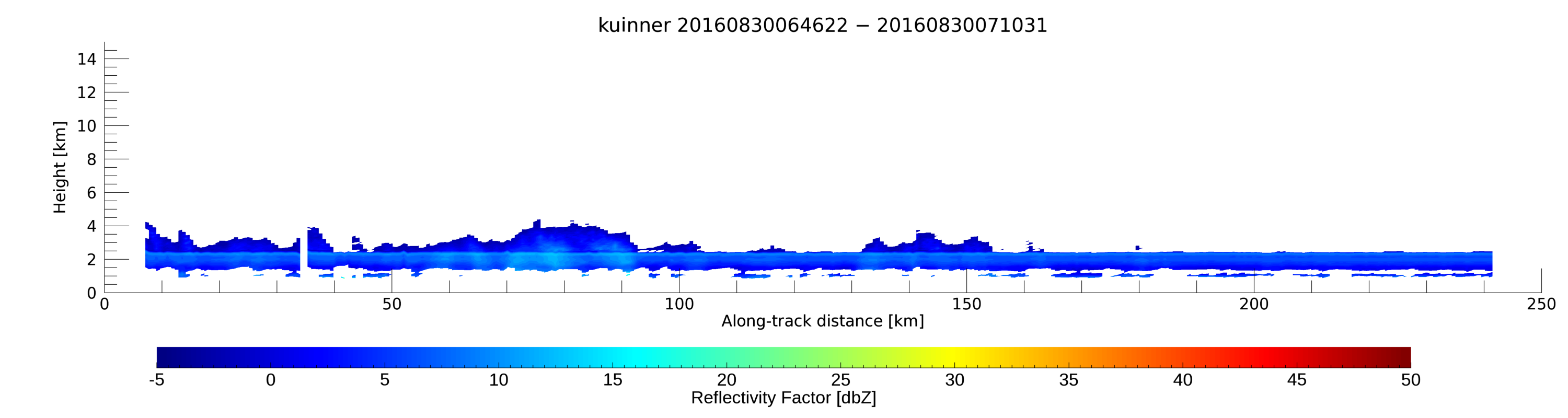
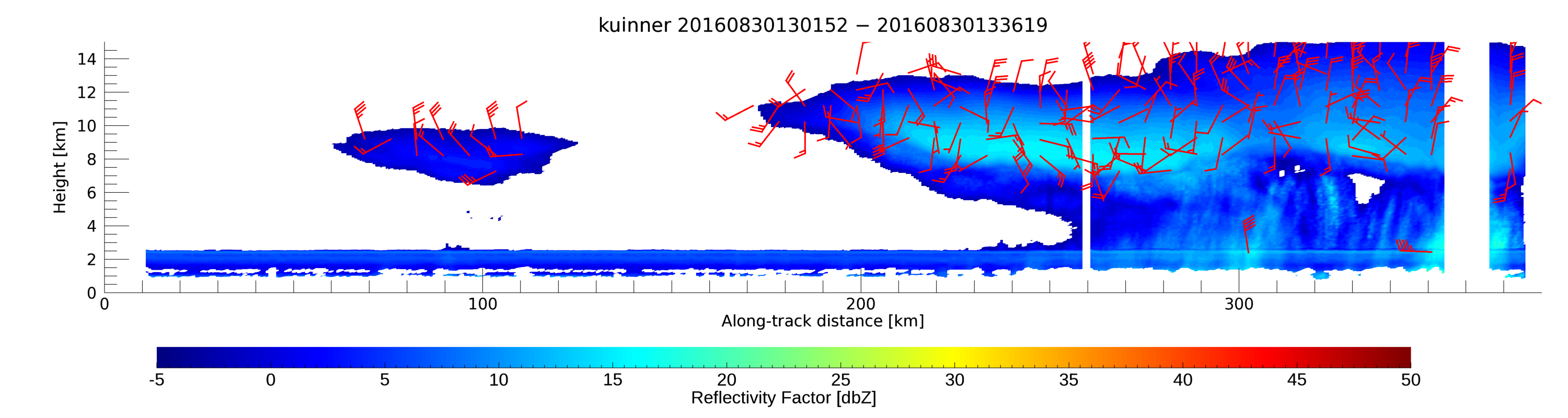
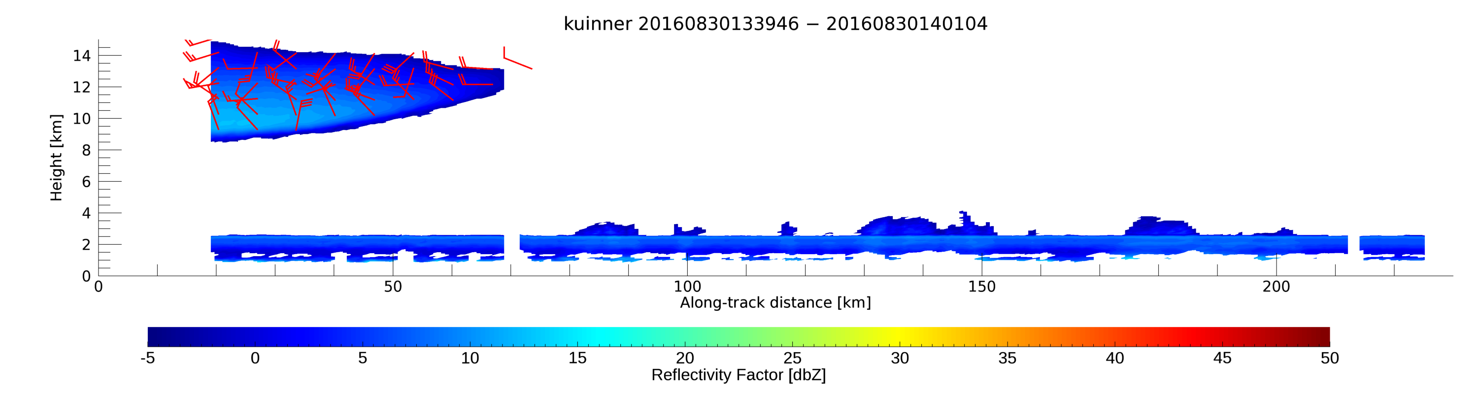
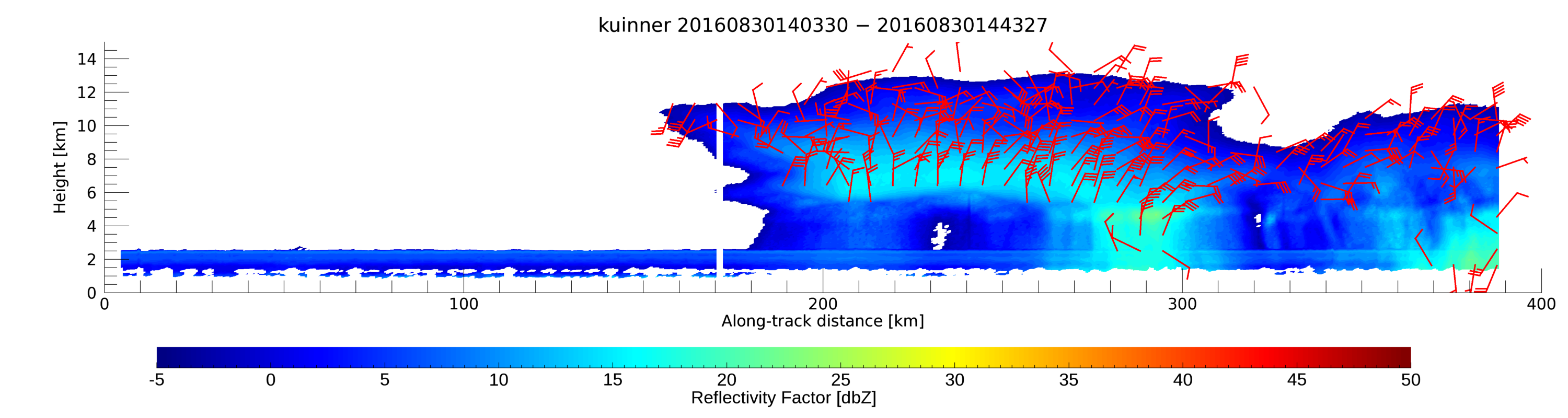
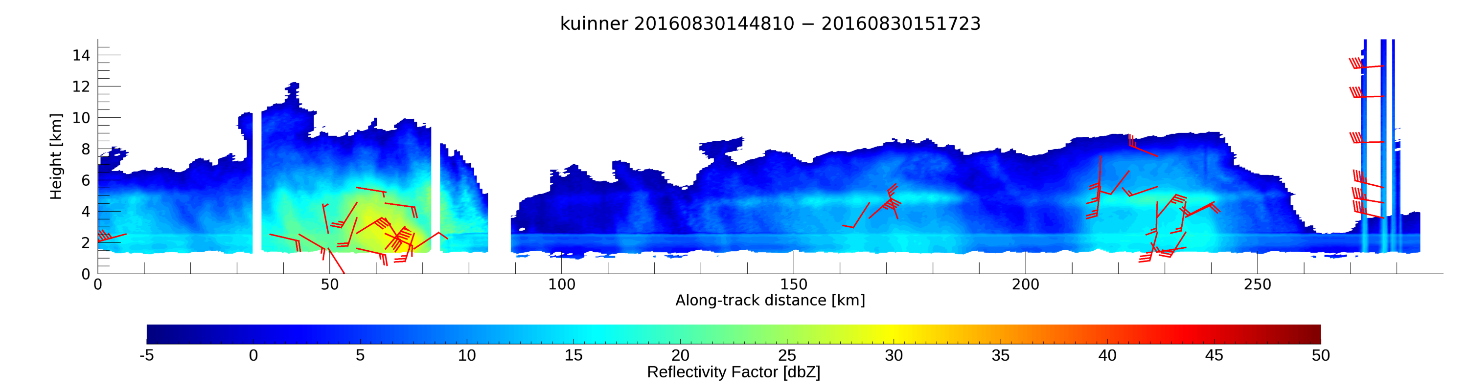
20160830
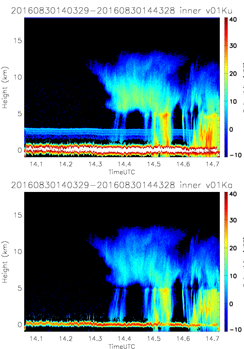
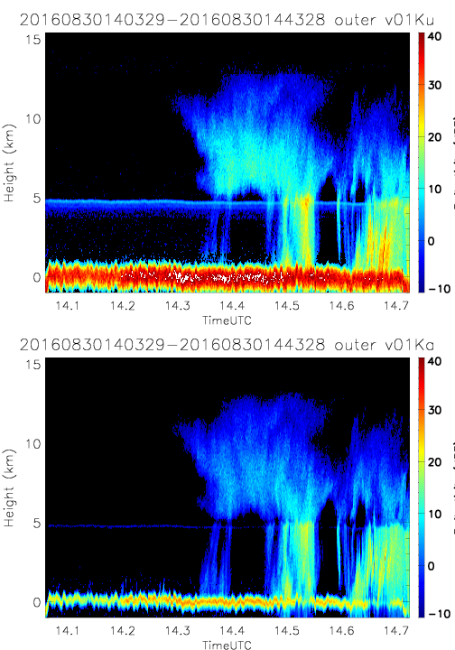
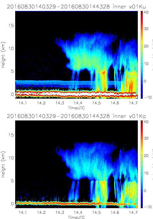
- SHOUTHRR_HIWRAP_L1B_20160830140329-20160830144328_outer_v01.h5
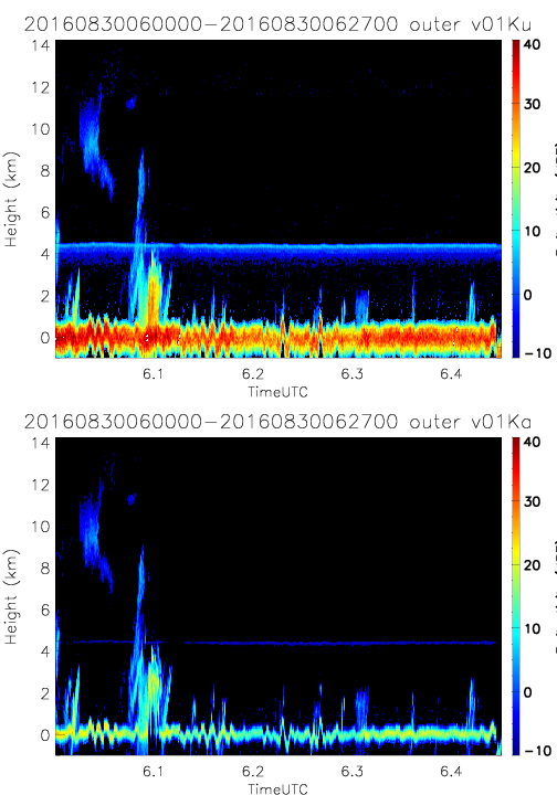
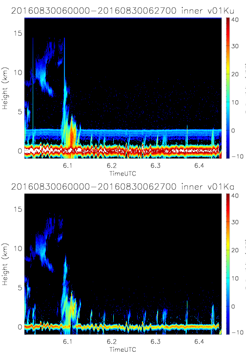
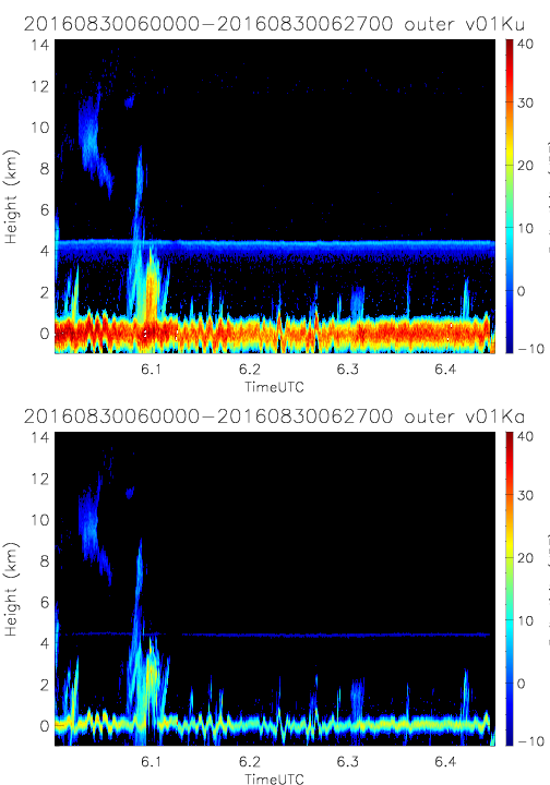
- SHOUTHRR_HIWRAP_L1B_20160830060000-20160830062700_inner_v01.h5
- SHOUTHRR_HIWRAP_L1B_20160830140329-20160830144328_outer_v02.h5
- SHOUTHRR_HIWRAP_L1B_20160830060000-20160830062700_inner_v02.h5
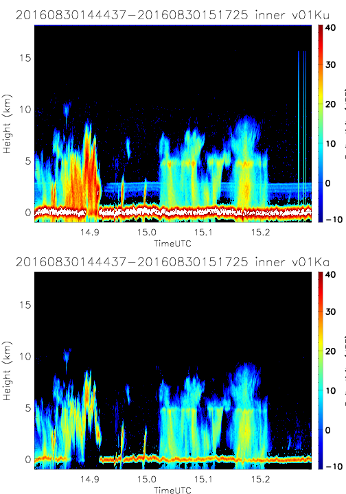
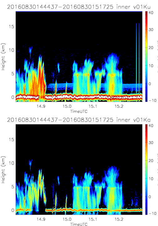
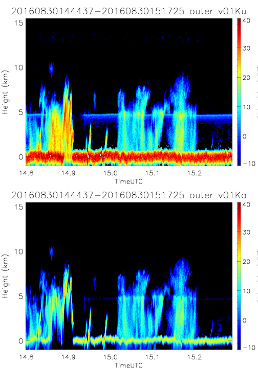
- SHOUTHRR_HIWRAP_L1B_20160830144437-20160830151725_inner_v01.h5
- SHOUTHRR_HIWRAP_L1B_20160830060000-20160830062700_outer_v01.h5
- SHOUTHRR_HIWRAP_L1B_20160830144437-20160830151725_inner_v02.h5
- SHOUTHRR_HIWRAP_L1B_20160830060000-20160830062700_outer_v02.h5
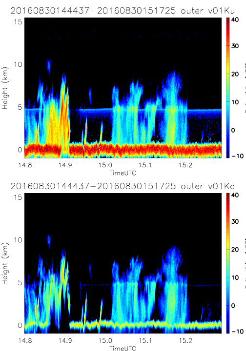
- SHOUTHRR_HIWRAP_L1B_20160830144437-20160830151725_outer_v01.h5
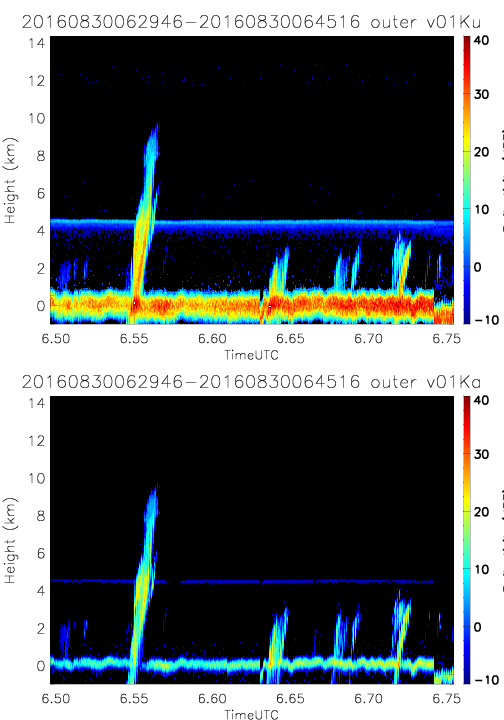
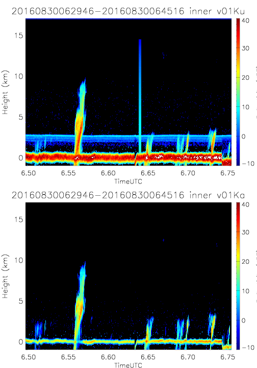
- SHOUTHRR_HIWRAP_L1B_20160830062946-20160830064516_inner_v01.h5
- SHOUTHRR_HIWRAP_L1B_20160830144437-20160830151725_outer_v02.h5
- SHOUTHRR_HIWRAP_L1B_20160830062946-20160830064516_inner_v02.h5
- SHOUTHRR_HIWRAP_L1B_20160901064755-20160901073713_inner_v02.h5
- SHOUTHRR_HIWRAP_L1B_20160830062946-20160830064516_outer_v01.h5
- SHOUTHRR_HIWRAP_L1B_20160901082929-20160901091620_inner_v02.h5
- SHOUTHRR_HIWRAP_L1B_20160830062946-20160830064516_outer_v02.h5
- SHOUTHRR_HIWRAP_L1B_20160901064755-20160901073713_outer_v02.h5
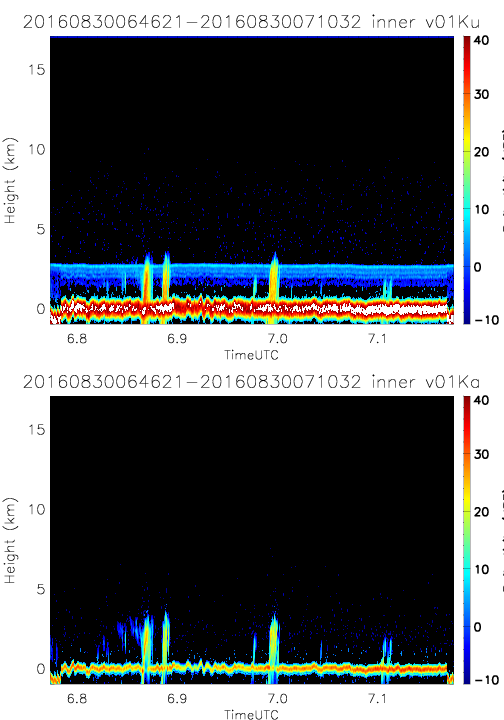
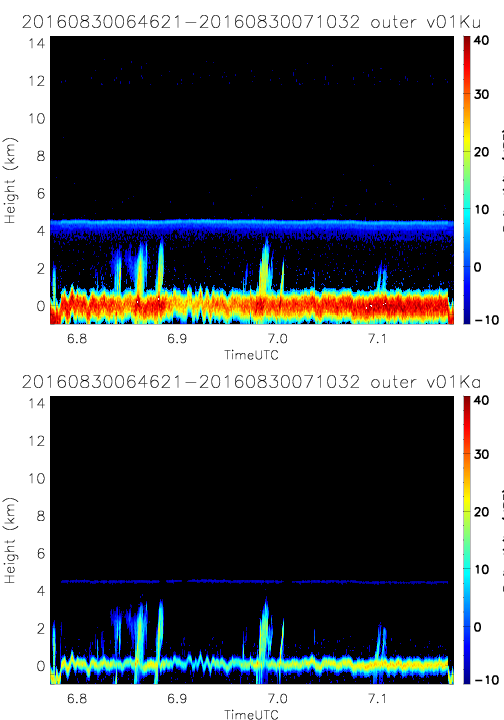
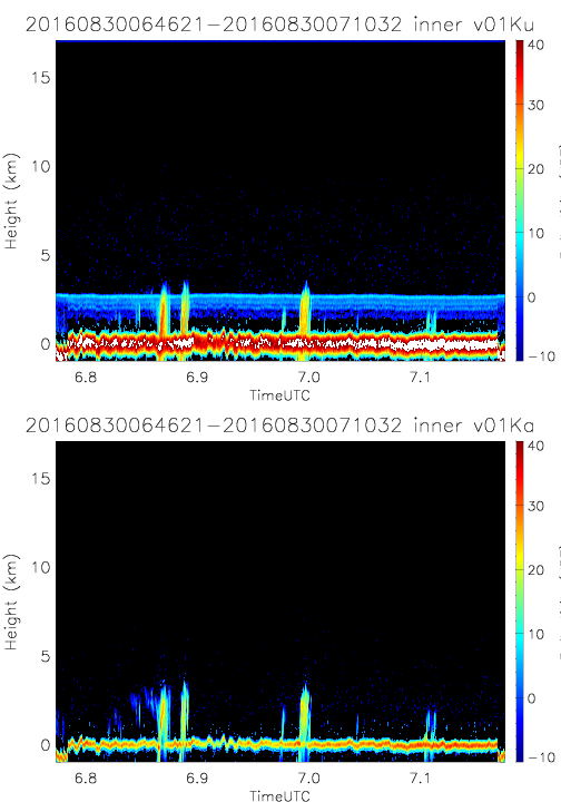
- SHOUTHRR_HIWRAP_L1B_20160830064621-20160830071032_inner_v01.h5
- SHOUTHRR_HIWRAP_L1B_20160901082929-20160901091620_outer_v02.h5
- SHOUTHRR_HIWRAP_L1B_20160830064621-20160830071032_inner_v02.h5
- SHOUTHRR_HIWRAP_L1B_20160901094253-20160901103145_inner_v02.h5
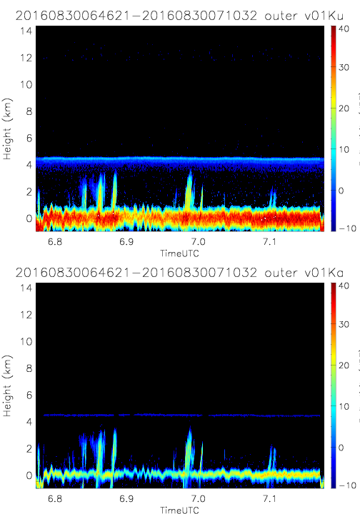
- SHOUTHRR_HIWRAP_L1B_20160830064621-20160830071032_outer_v01.h5
- SHOUTHRR_HIWRAP_L1B_20160901094253-20160901103145_outer_v02.h5
- SHOUTHRR_HIWRAP_L1B_20160830064621-20160830071032_outer_v02.h5
- SHOUTHRR_HIWRAP_L1B_20160901110331-20160901120736_inner_v02.h5
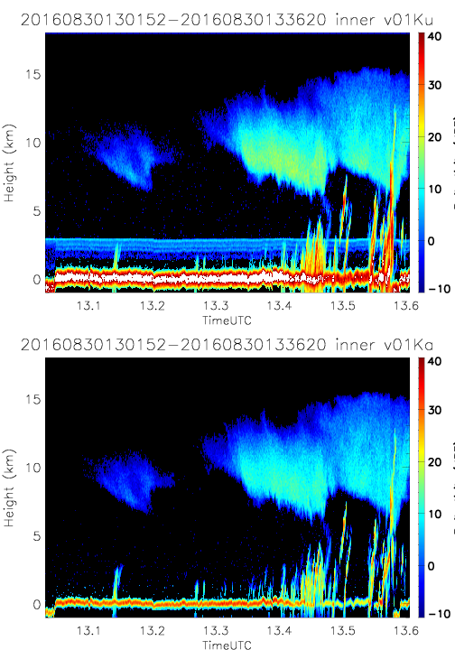
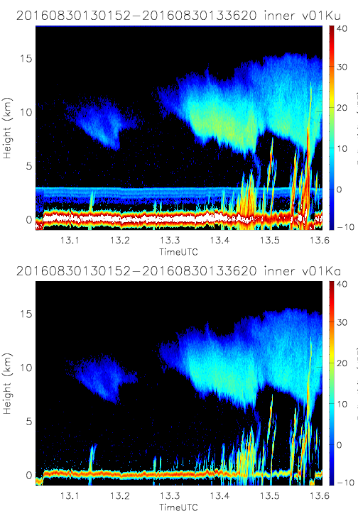
- SHOUTHRR_HIWRAP_L1B_20160830130152-20160830133620_inner_v01.h5
- SHOUTHRR_HIWRAP_L1B_20160901110331-20160901120736_outer_v02.h5
- SHOUTHRR_HIWRAP_L1B_20160830130152-20160830133620_inner_v02.h5
- SHOUTHRR_HIWRAP_L1B_20160901124338-20160901134756_inner_v02.h5
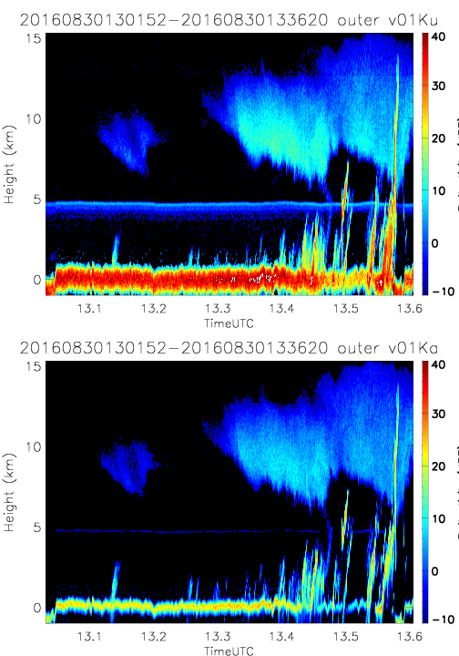
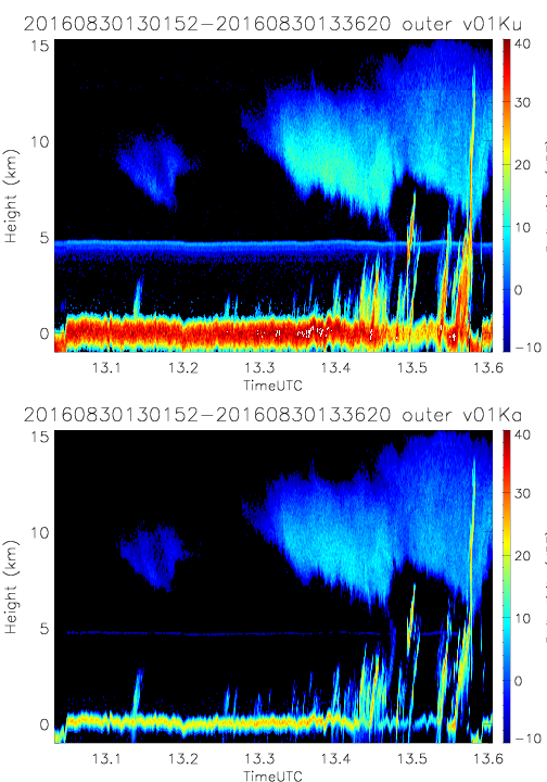
- SHOUTHRR_HIWRAP_L1B_20160830130152-20160830133620_outer_v01.h5
- SHOUTHRR_HIWRAP_L1B_20160901124338-20160901134756_outer_v02.h5
- SHOUTHRR_HIWRAP_L1B_20160830130152-20160830133620_outer_v02.h5
- SHOUTHRR_HIWRAP_L1B_20160901142428-20160901152704_inner_v02.h5
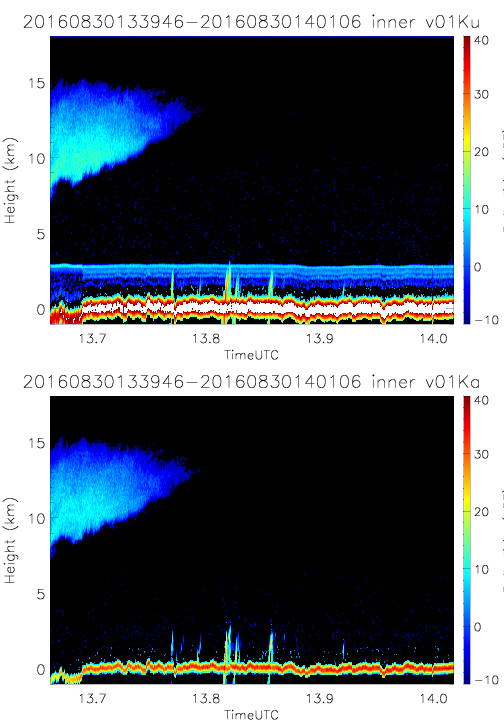
- SHOUTHRR_HIWRAP_L1B_20160830133946-20160830140106_inner_v01.h5
- SHOUTHRR_HIWRAP_L1B_20160901142428-20160901152704_outer_v02.h5
- SHOUTHRR_HIWRAP_L1B_20160830133946-20160830140106_inner_v02.h5
- SHOUTHRR_HIWRAP_L1B_20160901165035-20160901173031_inner_v02.h5
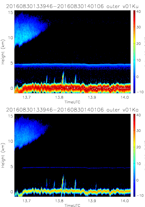
- SHOUTHRR_HIWRAP_L1B_20160830133946-20160830140106_outer_v01.h5
- SHOUTHRR_HIWRAP_L1B_20160901165035-20160901173031_outer_v02.h5
- SHOUTHRR_HIWRAP_L1B_20160830133946-20160830140106_outer_v02.h5
- SHOUTHRR_HIWRAP_L1B_20160901175708-20160901183719_inner_v02.h5
- SHOUTHRR_HIWRAP_L1B_20160830140329-20160830144328_inner_v01.h5
- SHOUTHRR_HIWRAP_L1B_20160901175708-20160901183719_outer_v02.h5
- SHOUTHRR_HIWRAP_L1B_20160830140329-20160830144328_inner_v02.h5
- SHOUTHRR_HIWRAP_L1B_20160901155045-20160901162840_inner_v02.h5
- SHOUTHRR_HIWRAP_L1B_20160901155045-20160901162840_outer_v02.h5