Welcome to HAR
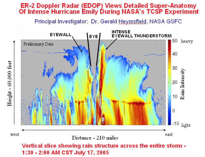
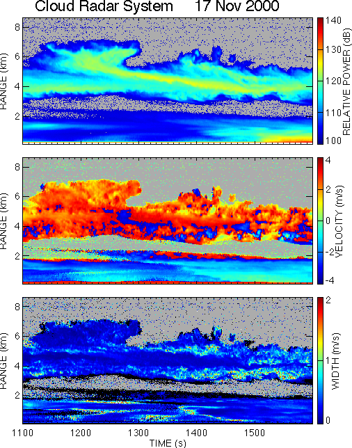
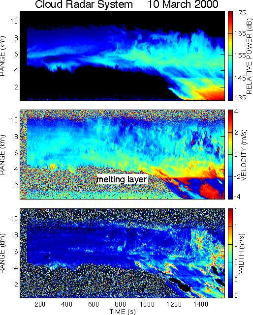
The high-altitude airborne radar group at NASA Goddard Space Flight Center covers all aspects of high-altitude airborne Doppler radars from hardware development, deployment, processing, and performing science studies with the data. They have participated in NASA field campaigns for over 20 years with focus on hurricanes and convection, TRMM, GPM, and CloudSat validation, and more recently snow storms. Several aircraft used for these studies including the NASA ER-2, WB-57, and Global Hawk. The group has developed 4 radars starting in the early 1990's with the 9.6 GHz ER-2 Doppler Radar (EDOP), and then the 94 GHz Cloud Radar system (CRS) in the early 2000's. Both radars have been involved in a number of field campaigns with EDOP flying on the ER-2, and CRS flying on the ER-2 and WB-57. EDOP was retired in 2007, and it's replacement called ER-2 X-band Radar (EXRAD) was first flown in 2013. EXRAD has flown on the ER-2 and Global Hawk. EXRAD provided new capability compared to EDOP with a conically scanning beam and a fixed nadir beam. Under technology funding from NASA around 2010, the High-altitude Imaging Wind and Rain Airborne Profiler (HIWRAP) at Ku- and Ka-band was developed for the unmanned Global Hawk, and it provided for the first time a conically scanning, dual-beam solid state radar. Currently, EXRAD, HIWRAP, and CRS are configured to fly on the ER-2 which provides nadir measurements at 4-frequencies that are valuable for both science studies and requirements for future spaceborne radars.
Please browse through our web site using the button-bar above, and contact us if you have any queries or comments.
Research
The high-altitude radar group focuses on several areas of atmospheric research including hurricanes, precipitation, clouds, and snowstorms. The data collected in field campaigns from these areas are used in algorithms to retrieve important geophysical variables such as winds, latent heat, precipitation and cloud variables. These data and retrievals allow for a detailed understanding of the dynamics of these phenomena with implications for the numerical modeling of weather and climate. Please see the "Research" side bar link above for details on HAR research.
Instruments
List of instruments related to HAR mission:
* This instrument has been retired as of 2007.

 EDOP
EDOP CRS
CRS HIWRAP
 EXRAD
EXRAD